The Best Views on St. Croix
Point Udall, Goat Hill, Ham's Bluff, and the Buck Island overlooks: where the island shows off, and when the light is best.
St. Croix hands out views faster than an island its size should. It runs about 22 miles east to west and 7 north to south, with a green spine that tops out at Mount Eagle, so a short drive keeps opening new ground: the length of the island, both coasts in a single turn, Buck Island a mile and a half offshore. The trick to using them is knowing that the views come in kinds. There are sunrise points and sunset points, ridge panoramas that hold two coasts at once, Buck Island overlooks strung along the East End, and town-and-harbor views over the old Danish ports. This page sorts every lookout worth the trip by type, says how you reach each one and when the light is right, and links the full guide wherever a deeper one exists.
How the island makes its views
Two facts of geography decide what you can see and from where. The first is shape. St. Croix is long and narrow, so its north shore faces the open Atlantic, its south shore faces the calmer Caribbean, and only a short western edge — the few miles from La Grange down past Frederiksted — looks straight west into the setting sun. That one western edge holds the island's over-the-water sunsets, just as the eastern tip holds its sunrises. Nothing you do changes which coast gets which end of the day.
The second fact is relief. The land climbs from sea level to about 1,165 feet at Mount Eagle in the western hills (some references round the summit to 1,160), and the whole island tilts and folds enough that a few high points see clear over the rest of it. Height plus position is what makes a panorama: Goat Hill is only about 672 feet but stands alone at the narrow eastern tip, so it reads two coasts, while the taller western summits sit buried in forest and give almost nothing back. The island also splits into two climates that change what a view looks like — a dry, open, cactus-scrub East End and a wet, green West End — a division the two landscapes guide explains in full. The short version for a viewpoint hunter: the East End lookouts are bare and windy with long clear sightlines, and the western ones are leafy, higher and often hazier.
Out of those two facts fall the categories this page uses: sunrise points at the east tip, ridge panoramas along the central and eastern spine, sunset vantages on the west edge, Buck Island overlooks down the northeast coast, town-and-harbor views over Christiansted and Frederiksted, the north-shore roadside pulloffs, and the handful of views you only get from a boat. Take them in that order.
Sunrise points
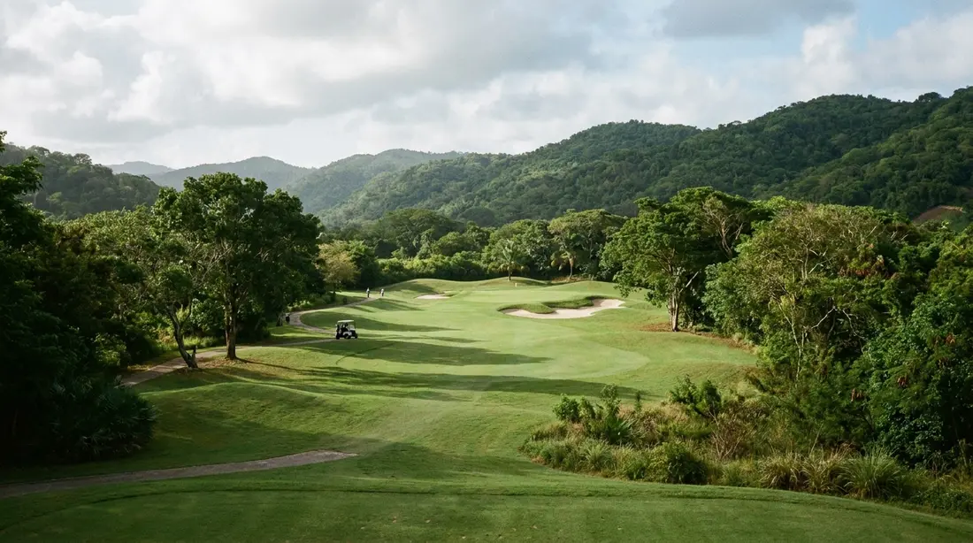
Sunrise is a one-address category on St. Croix, and the address is the east tip. Point Udall is the country's easternmost point, a headland you can drive to, marked by the Millennium Monument, a sundial raised for the country's first daylight of the year 2000. You park in a loop and walk a flat path to the terrace; no hike, no gate, no ticket at last check. Daylight reaches this ground before it reaches anywhere else Americans live, which is why so many visitors make the dark drive out before dawn a ritual of the trip. The full playbook — the sunrise clock month by month, the dark drive, where to stand, the New Year's-morning crowd — lives on its own page.
There is a private version of the same category. Because our homes sit on the side of the island the light hits first, an East End villa deck is a sunrise point in its own right, coffee in hand and no alarm-clock drive; the villa section at the foot of this page names the ones that face east. For the pairing that makes a morning of it, the trailhead down to Jack's and Isaac's Bays leaves from the lot just before the point, so a sunrise can roll straight into an empty-beach swim.
Ridge panoramas
The two-coasts view is the one people mean when they call St. Croix beautiful from above, and it comes from the spine.
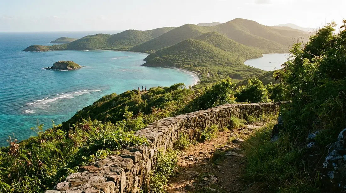
Goat Hill is the best of them and the one most visitors can reach. It climbs to roughly 672 feet at the island's narrow eastern end, and because the land drops to the sea on every side, one slow turn from the top takes in Buck Island to the north, Point Udall and the Atlantic to the east, the Caribbean and the south-shore bays below, and the island's own spine running west toward the central hills. It is a walk, not a drive — figure a two-mile round trip on a rough old track — so save it for early morning or the last hour of light, when the bare hill is cool and the low sun warms the ridges. Its neighbor to the west along the same spine, Sugarloaf Hill, stands a little higher and asks a longer walk for a similar reward, which is why Goat Hill is the one most visitors take. The trailhead sits opposite Cramer's Park, marked by an object you cannot miss: the white dish of the Very Long Baseline Array's St. Croix station, the easternmost of ten matching radio telescopes spread across the country. The dish itself is a roadside landmark rather than a lookout — the view is the climb above it.
The Beast, at the top of Route 69. The paved road that climbs from the north shore over the central ridge is steep enough that locals call it the Beast. Where it tops out and meets the Scenic Road, the saddle gives a ridge-crossing panorama down both sides of the island, and unlike most high ground here you reach it on pavement in an ordinary car. It works well as a stop on the island loop described in driving the island in a day; late afternoon, with the sun swinging west, is the flattering hour.
Mount Eagle and the Blue Mountain ridge. The island's rooftop — Mount Eagle and the Blue Mountain hills that run east of it — carries the highest ground on St. Croix, but the views up there are guarded. The only way along the crest is the unpaved Scenic Road, a backcountry track that needs high clearance in the dry and real four-wheel drive after rain. Treat this as an adventure-driver's panorama, not a casual pullover, and read the Scenic Road guide before you point anything uphill.
Sunset and the west end
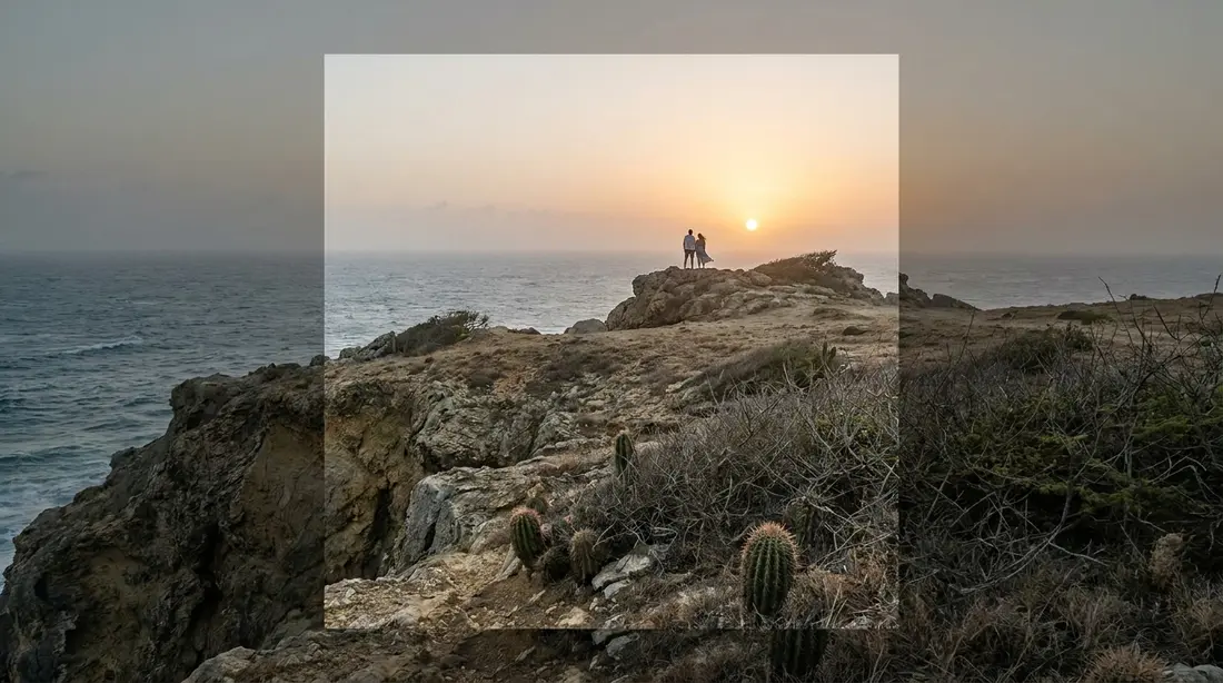
Every sunset-over-water view belongs to the short western shore, and the deep sunset beaches guide ranks them all with the times, the horizon math and the green-flash rules. In brief, sorted by what kind of evening you want:
- The social one. The Frederiksted waterfront runs due west end to end, and in winter the pier stretching offshore falls into black silhouette. Watch from the sand, the seawall, the fort walls or a table at any of the bars along the water.
- The serviced one. Rainbow Beach, a few minutes north of town, puts the same sky over a bar-and-chairs beach where the sun seems to drop right at the end of your own lounger row.
- The quiet one. Dorsch Beach, a short way down the shore road from town, is the low-volume seat for the identical show, backed by palms and sea grapes.
- The one with altitude. Ham's Bluff is the exception to a sea-level list: the 1915 Danish cast-iron lighthouse stands about 360 feet above the water on the northwest corner, reached by a half-hour uphill walk. Its face is northwest, so it is a summer-season sunset perch, and the descent through unlit forest is the catch — most guests take the bluff for its morning light and keep evenings at sea level.
- The one that closes first. Sandy Point, the island's grandest western sand, opens to visitors only on weekend days during its season and closes altogether from April into August while leatherbacks nest, so its gate is locked well before any sunset. It is a daytime pilgrimage, never an evening one.
Buck Island overlooks
Buck Island sits a mile and a half off the northeast coast, low and green with its reef around it, and a whole category of view is simply the act of looking at it. The East End road rides the north side of the island climbing and dropping, and the marine monument stays in the frame for much of the way; the guardrail pulloffs are where to stop. An elkhorn-coral barrier reef wraps two-thirds of the island, so on a calm day the overlook picks out a bright line of surf breaking over it well offshore. This is the everyday view of the northeast quarter, and the East End guide maps the roadside stretch.
The most comfortable Buck Island overlooks are private. Several of our homes are built to face this exact water — two of them, The Buck Island Overlook and the Ocean View Villa, take their names from it — and the villa section below lists the decks. There is also a view of the island from the island: the land trail on Buck Island itself climbs to an observation point around 300 feet up, looking back across the reef lagoon to St. Croix's whole north coast. That one is boat-and-boots, reached only on a tour with one of the National Park Service concessionaires or with a private-boat permit, and the Buck Island guide covers how to go.
Town and harbor views
The two Danish ports give a different kind of view — built, low and historic rather than wild.
Fort Christiansvaern's ramparts. From the yellow-brick walls of the fort in Christiansted you look over the working harbor, the boardwalk and Protestant Cay just offshore. The fort keeps regular daytime hours — open daily 8:30 a.m. to 4:30 p.m. at last check — so this is a walk-up view on a schedule, best in the morning before the light goes flat over the water.
The Frederiksted pier. The long pier on the west waterfront is a viewpoint two ways at once: back at the pastel town and Fort Frederik, and out over the open roadstead where the sun sets. Locals fish it at that hour, and it costs nothing to walk when a cruise-ship security zone is not closing part of it.
The Salt River overlook. Above the bay where Columbus's crew came ashore in 1493, the national park's visitor contact station sits on a hilltop looking down on the full sweep of mangroves and water at Columbus Landing. The building keeps limited hours; the view does not. Late afternoon is the softest light on the green bay, and the Salt River area guide has the rest.
The North Shore Road pulloffs
Some of the island's best views are taken from the driver's seat, and Route 80 is where. North Shore Road runs directly above the water for several miles between Salt River and Cane Bay, a run of hairpins and blind corners with green hills dropping to the sea and guardrail pulloffs placed where the view earns a stop. On a clear day the horizon holds St. Thomas and St. John; in the winter months, migrating humpback whales pass this coast, sometimes only a few hundred yards out, and the same pulloffs double as whale-watching posts. Two roadside landmarks break up the miles: the stone ruins of the Rust Op Twist sugar estate near La Vallee, a mill and great-house standing in plain view, and Cane Bay itself at the end of the run. Drive it east to west in the afternoon and the sun sits behind you, lighting the coast instead of glaring through the windshield — the ordering the island-loop guide recommends for exactly this reason. The steep green hills behind Cane Bay are the wettest, most dramatic slopes on the north coast, and the road threads right under them.
The Scenic Road ridge pulloffs
For drivers with the right vehicle and a dry forecast, the Scenic Road — Route 78, unpaved along the crest of the western mountains — is the island's richest string of overlooks. A resident who drove it for years catalogued what the gaps in the trees once served up: Salt River Bay, Buck Island, Christiansted, both shores at once, the Carambola valley, Sandy Point and Frederiksted, all from the ridgeline. The catch is the road, which has gone largely unmaintained and now demands high clearance in the dry and true four-wheel drive after rain; some rental contracts forbid unpaved driving outright. Treat this as a category for confident drivers only, verify conditions the same week, and read the Scenic Road guide first. Everyone else can reach the same panoramas the easy way, one at a time, from the drive-up and short-walk lookouts elsewhere on this page.
Views from the water
A few of the island's best angles only exist offshore. The observation point on Buck Island's land trail, noted above, looks back at the north coast in a way no road can. A day sail or a private charter turns the whole waterline into a moving overlook — the fort, the reef, the green ridges — and the day-sails guide and sunset-sails guide cover the boats that run them, including the evening trips that watch the sun go down from the water off Frederiksted. From a boat the island reads as what it is: a long green ridge dropped into two different seas.
The drive-to-the-view day
The categories link into a single day if you want them to. The east-first order does it cleanly: start with dawn at Point Udall, take the North Shore Road pulloffs while the morning is cool, stop at the Salt River overlook and the Beast on the ridge, then drift west through the afternoon to land at Ham's Bluff or the Frederiksted waterfront for the sunset. That is the loop the drive-around guide lays out leg by leg, with the road realities between stops. Few places let one relaxed day take in both an Atlantic sunrise and a Caribbean sunset, the two points roughly 28 road miles apart, and stringing the viewpoints together is the best argument for how much island fits into 84 square miles.
Photography by direction and hour
Which viewpoint you pick should follow the clock and the compass, because a great lookout at the wrong hour is a flat one. The rules are simple once you sort views by the way they face.
| The view faces | Best light | What to expect |
|---|---|---|
| East (Point Udall, East End decks) | First light, dawn | A shallow band of trade-wind cloud sitting on the horizon is the usual dawn picture; the color runs strongest just before the sun clears it |
| North (Buck Island overlooks, North Shore Road) | Morning through midday | Reef and lagoon blues switch on with the sun; afternoon puts warm side-light on the coast |
| West (Ham's Bluff, Frederiksted, Rainbow) | The last hour before sunset | Dusk lasts only about 20 minutes here, so be in place early |
| Both coasts (Goat Hill, the ridges) | Early morning or late afternoon | Midday light is flat and haze builds through the day; the long sightlines pay at the ends of the day |
Two conditions shape every shot on the island. The easterly trades run for most of the year, which is why the sunrise horizon so often carries a low cloud shelf while the leeward west stays clean at sunset. And haze thickens as the day heats up, so the sharpest long views — the two-coast panoramas especially — come in the first hours after sunrise. The weather guide covers the cloud seasons; for the fine detail of dawn and dusk color, the sunrise and sunset pages carry month-by-month tables.
Getting to each view: drive-up, walk-up, or 4WD
Access is the real dividing line, and it is worth being plain about which lookouts ask for effort.
Drive-up, no walking to speak of: Point Udall, the North Shore Road pulloffs, the Salt River overlook, the Frederiksted pier and waterfront, and Rainbow and Dorsch beaches. Any rental car reaches all of these on pavement.
Short walk from the car: Fort Christiansvaern's ramparts, a stroll from the Christiansted boardwalk within the fort's daytime hours.
Hike to earn it: Goat Hill is about a two-mile round trip up a rough track; Ham's Bluff is a steady half-hour, roughly 1.6 miles round trip through shaded forest. Both are moderate rather than hard, but both want closed shoes, water and an early start against the heat. For the full set of the island's walks, see the hiking guide.
Boat, then boots: the Buck Island observation point, reached only by concessionaire tour or private permit and then a climb from the beach.
Four-wheel drive only: the Scenic Road ridge and the Mount Eagle and Blue Mountain crest. High clearance in the dry, real four-wheel drive after rain, and a rental contract that permits it — the rental car guide covers what to book, and every road here is driven on the left, a habit worth reading up on in driving on the left before your first dawn or dusk run.
Viewpoints at a glance
The whole roundup in one table, sorted roughly east to west. Access and best time are the columns to plan around; hours and conditions are current at last check and worth reconfirming for your dates.
| Viewpoint | Type | Access | Best time |
|---|---|---|---|
| Point Udall | Sunrise | Drive-up | Dawn; biggest crowd Jan 1 |
| East End villa decks | Sunrise, Buck Island | Private, for guests | Dawn and all day |
| Goat Hill | Ridge panorama | Hike, ~2 mi round trip | Early morning or late afternoon |
| East End road pulloffs | Buck Island overlook | Drive-up | Any time; morning clearest |
| The Beast, top of Route 69 | Ridge panorama | Drive-up, paved but steep | Late afternoon |
| Mount Eagle / Blue Mountain ridge | Ridge panorama | 4WD only, Scenic Road | Dry mornings |
| Scenic Road pulloffs | Ridge panorama | 4WD only | Dry days |
| North Shore Road pulloffs | Roadside, whale-watch | Drive-up | Afternoon; winter for whales |
| Salt River overlook | Bay and harbor | Drive-up | Late afternoon |
| Fort Christiansvaern ramparts | Town and harbor | Walk-up, 8:30-4:30 | Morning |
| Buck Island observation point | Reef and island | Boat plus short hike | Midday tour |
| Ham's Bluff | Sunset, coast ridge | Hike, ~1.6 mi round trip | Morning light or summer sunset |
| Frederiksted pier and waterfront | Sunset, harbor | Drive-up | Sunset |
| Rainbow Beach | Sunset | Drive-up | Sunset |
| Dorsch Beach | Sunset, quiet | Drive-up | Sunset |
Safety and practicals
Views concentrate at the edges of the day, which is exactly when the island's roads ask for care. None of the rural roads are lit, so a dawn run to Point Udall or a dusk descent from Ham's Bluff happens in the dark; add time and slow down. The island's wild white-tailed deer step onto East End pavement most often at first and last light, so assume any deer you pass has company. Drive on the left, keep your speed down in the narrow bends, and remember that phone coverage fades near the east tip — load directions before you leave.
The exposed lookouts are windy and dry. The East End points in particular get the trade winds at full strength, and before six in the morning the wind makes it feel cooler than the thermometer claims, so pack a windbreaker or long sleeves and water even for a short walk. Hats leave without permission on Goat Hill and the bluff; keep a hand on loose gear near any edge.
One recurring problem deserves a plain warning: cars left at quiet trailheads and remote pulloffs get broken into. The defense is simple: leave the car with nothing worth taking — arrive with an empty cabin, no bags in view, nothing worth a smashed window in the trunk. The safety guide sets out the same rule island-wide alongside the rest of the level-headed basics.
Questions guests ask
What is the single best view on St. Croix?
For seeing both coasts at once, Goat Hill is the answer, and most regular walkers rate it the finest land view on the island's eastern half. For the least effort, Point Udall is unbeatable: it is a parking lot at the easternmost point in the country, with a flat walk to the terrace. For a sunset over open water, the Frederiksted waterfront and Rainbow Beach share the honors. There is no need to choose only one — the categories on this page exist so you can match a view to the hour you have free.
Which viewpoints can I reach without hiking?
Most of them. Point Udall, the North Shore Road pulloffs, the Salt River overlook, the Frederiksted pier, and Rainbow and Dorsch beaches are all drive-up. Fort Christiansvaern's ramparts are a short walk within the fort's daytime hours. The only lookouts that ask for a hike are Goat Hill and Ham's Bluff, and the only ones that need four-wheel drive are the Scenic Road ridge and the Mount Eagle crest.
When is the light best for photos?
At the ends of the day, and the direction the view faces decides which end. East-facing points want first light; west-facing ones want the last hour before sunset; two-coast panoramas read sharpest early, before the day's haze builds. Midday light is flat almost everywhere. The one wrinkle is the trade-wind cloud that often sits on the eastern horizon at dawn, which tends to delay a clean sunrise by a few minutes rather than cancel it.
Can I see the sunrise and the sunset in the same day?
Yes, and it ranks among the island's signature days. Sunrise reaches Point Udall at the east tip before anywhere else in the country, and the sun sets into the Caribbean off the west end about 28 road miles away. Run the day east to west — dawn at the point, the north coast and ridge through the middle, the west shore for the drop — and the driving guide maps the route. Winter holds the easiest clock — first light around 6:50 and the sun down near 5:45.
Are the viewpoints safe to visit at dawn and dusk?
Yes, with ordinary care. The paved roads carry almost no traffic at those hours; the real variables are the dark, the deer that cross East End roads at first and last light, and the fading cell signal near the east tip. Drive modestly on the left, use your high beams on the empty stretches, and travel with the car already emptied of anything worth stealing, since remote lots are the island's one persistent theft problem.
Do I need a four-wheel drive to see the best views?
No. Every view on this page except the Scenic Road ridge and the Mount Eagle crest is reachable in an ordinary rental, either by driving up or by a moderate walk. Four-wheel drive only comes into it if the high, unpaved central ridge is a specific goal, and even then the same panoramas — Salt River Bay, Buck Island, both shores — can be caught the easy way from the drive-up and short-walk lookouts. Rent the capable vehicle only if ridge driving itself is the plan, and check that your contract allows unpaved roads.
Where do the whales fit in?
In winter, and along the north shore. The humpbacks pass the island on their migration, most dependably in February and March, and the deep water hard against the north coast can put them within view from shore. The North Shore Road pulloffs above Cane Bay and the high ground at Ham's Bluff are the shore-side perches; bring binoculars and treat any sighting as a bonus rather than a schedule.
Viewpoints from our villas
The most comfortable lookout on the island is a deck with your name on it for the week. Because our homes cluster on the East End and around Christiansted, several of them turn a great view into the default setting of the trip. The Buck Island Overlook and the Ocean View Villa are named for the water they face; Moko Vista takes its name from the same view, and The Cerulean and Dragonfly Villa look out over the same stretch toward Buck Island and the sunrise. On the sunset side of the island, Sunset Sea-Clusion sits near Frederiksted where the day ends over the water. Browse the full East End collection to pick the deck, then use this page to plan the mornings and evenings you spend away from it.
Sources
Written from official and first-party sources, checked August 2026. Hours, prices and event dates change — confirm before you go.
In this guide
Stay nearby
On The Shoys beach: six bedrooms, six baths, pool and hot tub, room for twelve, and the beach through the back garden.
 Shoy's Beach House6 bd · 6 ba · sleeps 12 · Christiansted
More in Land & Adventure
Sources
12 references, listed in full at the end of this guide — official park, refuge, tourism-board and business sources, checked August 2026.