Creque Dam & the Rainforest
Walk or 4x4 the Scenic Road through St. Croix's western rainforest, past mahogany and kapok trees to the 1926 Creque Dam.
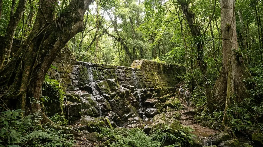
Creque Dam is a stone arch dam finished in 1926, standing in the wettest ground St. Croix has. Upward of 50 inches of rain falls on these northwestern hills in a typical year, while the East End collects 25 to 38, and the difference built the "Rain Forest" of mahogany, kapok and turpentine trees that has since grown back over the dam, its road, and the old Scenic Road network beyond it. This page is the reference for all three as a destination in their own right: the dam's history and present condition, Creque Dam Road and how to judge it, the forest walk, the ruins nearby, and the plain answer to the swimming question.
What Creque Dam is
The dam went up across a forest gut in 1926 to give Frederiksted a reliable water supply, in the years when the U.S. Navy administered the Virgin Islands. Its reservoir was engineered to bank as much as nine million gallons of potable water for the town below — serious infrastructure for a small island a century ago, raised with pick, barrow and muscle in a steep valley with no machinery worth the name. The Crucian historian Johnny Tranberg, whose family owned land in this valley, recorded that his father sold ground to the government for the project as early as 1903 — planning, in other words, ran two decades ahead of the concrete — and that the laborers who finally built the dam earned 40 cents a day.
Published dimensions deserve a hedge. The figure that recurs in the sources we trust puts the structure at about 45 feet high; at least one national guidebook prints a number three times larger, which says more about guidebooks than about the dam. Stand at the base and 45 feet reads right: a curved gray wall filling the ravine, tall enough to command the scene, small enough that the forest towers over it anyway.
The date places the dam in a particular chapter of island history. The United States bought the Virgin Islands from Denmark in 1917, and for the first fourteen years the territory was run by the U.S. Navy, with naval governors ordering public works across the islands. Creque Dam belongs to that era: an American military administration finishing a waterworks a Danish-era landowner had been asked to make room for, in a valley where the estate names, the road names and the labor were all Crucian. Few structures on St. Croix compress the island's layered history into one object so neatly.
The Creque name
The dam carries the surname of one of the old Virgin Islands merchant families. Henry O. Creque, descended from a mariner named James Crequi, moved from Anegada to St. Thomas in 1876, built a trading business there, and opened a store on St. Croix in August 1900; Creque's Alley off Main Street in Charlotte Amalie remembers the same family. How exactly the name attached to this valley — land ownership, the marine railway fortune, or simple association — is a detail we have found asserted in several directions and documented in none, so we will leave it at this: the family was prominent across the territory when the dam was planned, and the road, the dam and the surrounding estate maps all carry Creque today.
A century of service and silt
The dam's working life ran shorter than its builders hoped. By the late 1930s, silt and worsening seepage already threatened the structure, and New Deal crews were sent in to strengthen the footings and clear the reservoir basin; the Governor of the Virgin Islands reported the repairs to Washington in his annual report for fiscal 1939, barely thirteen years after completion. The pattern of a leaking basin and an emptying reservoir never fully reversed. Frederiksted's water long ago shifted to other sources, and the dam settled into retirement as the island's most atmospheric piece of abandoned engineering.
What remains is remarkably intact for a hundred-year-old structure in a wet forest. The arch stands square, the spillway line still reads clearly along the crest, and you can walk across the top from one side of the ravine to the other. Do it carefully: the downstream face drops steeply away, there is no railing to speak of, and wet stone in permanent shade stays slick. Keep children in hand and cameras on straps.
The dam today
Expect a ruin in the best sense. Ferns sprout from the joints of the masonry, moss films the shaded faces, and the forest has closed back over the reservoir site so completely that first-time visitors sometimes drive past without registering what the gray wall was for. Most of the year the basin behind the dam holds little or no water — a visitor report from early 2024 found the reservoir floor wearing a green quilt of plants rather than a lake — because the old leak still drains what the rains deliver. Come in a wet stretch and the picture changes: water sheets down the gut that feeds the basin, the masonry darkens, and for a few days the dam almost looks employed again. A seasonal cascade even appears across the road from the structure after real rain, a bonus that lasts exactly as long as the runoff does.
There is no gate, no fee, no ticket booth and no crowd. The dam sits directly beside Creque Dam Road; you park on the verge and you are there.
Swimming
People arrive with pictures in their heads of a jungle plunge pool, so here is the truth of it. The reservoir behind Creque Dam is dry or nearly dry most of the year and is nobody's swimming hole; even after rain, what collects is shallow, silty and brief. The pool at the foot of the wall follows the same weather. Nothing about the site is set up for bathing, and the respectful move — this is a historic structure in a working watershed, on an island that treats its guts as drinking-water infrastructure — is to look, photograph and move on, packing out whatever you carried in.
The freshwater swimming the northwest forest does offer lives in the Caledonia Valley, one drainage over, where St. Croix keeps its only natural waterfall. That waterfall is rain-fed: at its best in the two or three days following a soaking, then dwindling toward quiet pools and finally bare damp rock as the ground dries. Reaching it means walking up a gut — the local word for a steep seasonal streambed — and the St. Croix Hiking Association grades the route between moderate and difficult: figure roughly 60 minutes of climbing to the falls and about two and a half hours for the full round trip, with wading to the knees when the stream is up and some scrambling where trunks have come down. Go with the association or a local guide rather than alone, aim for the days just after rain, and obey the one absolute rule of every gut on this island: stay out while heavy rain is falling or forecast upstream, because these ravines flood fast enough to trap people. The hiking guide ranks this walk against the island's others.
Creque Dam Road
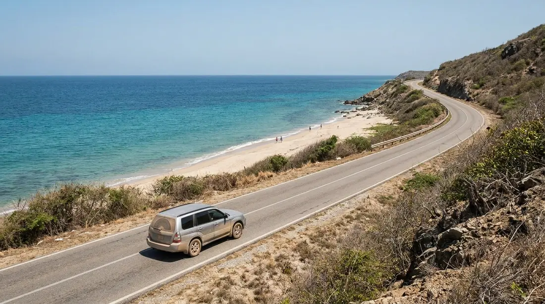
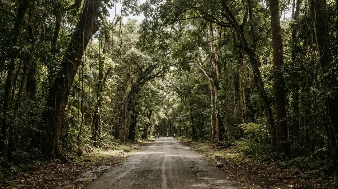
The road is half the destination. Creque Dam Road — Route 58 on most maps, though route numbering in this forest is famously loose, as the Scenic Road guide explains — leaves the Route 63 coast road north of Frederiksted and climbs east into the forest, passing the dam partway up and continuing toward the high junctions with the ridge routes. For long stretches the trees close over the roadbed in a tunnel of leaves, the light goes green, and the temperature drops enough to notice from an open window.
Surface condition is the practical question, and the answer splits by end and by season. The lower, western approach from Route 63 is the tame half: narrow and winding, patched in places, and manageable in an ordinary car in dry weather driven at forest speeds. The upper, eastern reaches toward the ridge junctions are a different proposition — rougher, rockier, cut by the guts the road crosses, and best left to high-clearance vehicles. Rain rewrites all of it. The clay greases over, the crossings run water, and a stretch that a sedan idled through last week can hold that same sedan hostage today. In a wet spell, treat the whole road above the dam as 4WD ground, read your rental contract's unpaved-road clause before testing it, and get a same-week condition report from someone local — a villa host, a guide, anyone who drives the west end — because no agency publishes one.
Two features of the driving deserve their own sentences. The guts that cross the road are dips, not bridges; take them slowly even when dry, because the far lip arrives abruptly. And the road is single-lane in effect wherever the vegetation leans in, so use the pull-offs, yield to anyone coming downhill, and remember the island drives on the left — the driving guide covers the habits, and the rental car guide covers the vehicle question.
Why people walk it instead
Ask around the west end and you will find that locals mostly experience this road on foot, and they are onto something. Walking removes every vehicle worry at a stroke — no clearance, no contract clause, no stuck — and the road itself is the trail: graded, shaded nearly the whole way, and quiet enough that birdsong carries over your own footsteps. At three miles an hour the forest resolves into details a windshield erases. This is the easiest self-guided rainforest walking on St. Croix, and it needs no permit, no gate and no fee.
The standard outing parks near the bottom of the road off Route 63 and walks up to the dam at a stroll, which makes a comfortable morning with time built in to linger at the wall. Stronger walkers continue past the dam, where the forest deepens within the next mile and the road keeps climbing toward the ridge; turn around whenever the day says so. The ambitious version is a loop the St. Croix Hiking Association has run for years: start near Sprat Hall on the coast, climb Creque Dam Road past the dam and Mount Victory, cross to Mahogany Road and descend it back toward the coast — seven to eight miles and roughly three hours at the association's moderate pace. Sturdy shoes, water, snacks and repellent cover the equipment list for any version.
The forest along the road
The big three of the west-end canopy — mahogany, kapok, turpentine — all stand along this road, and the two-landscapes guide tells their botanical story properly. What gives Creque Dam Road its own flavor is the layer underneath and between them. Samaan trees spread wide crowns over the openings. Ferns and vines pack every level below the canopy, thickening visibly as the road gains height and rainfall. And threaded all through the forest grow the escapees of the plantation kitchen: sweet lime, mango, hog plum and breadfruit, all planted in estate days and gone happily feral since. In season, mangoes drop onto the roadbed and hikers eat them warm — the hiking association's own outing notes promise late mangoes as a trailside snack. Guided walks in this valley also point out cocoa plants and royal palms among the understory, species you will not spot from a moving car.
The wetness explains all of it. This drainage sits in the band of hills that wrings the most rain out of the trade winds, and the vegetation responds like a paid endorsement. Crucians call the result the Rain Forest, capital letters included; the strict term is moist tropical forest, and the difference matters to ecologists and to nobody standing under the kapoks.
Birds along the road
Walkers with binoculars rate this road among the island's best land birding, because the moist forest concentrates species the dry side rarely shows. The prize is the bridled quail-dove, a shy, ground-walking dove of deep Caribbean forest that survives on St. Croix mainly in this northwestern corner; it is scarce across its whole range — mongoose predation has pushed it hard — and birders treat any sighting as a mark of intact forest. Scaly-naped pigeons work the canopy in heavy, clattering flights. Lower down, yellow warblers move through the tangles, zenaida doves feed along the road edges, pearly-eyed thrashers police the fruit trees, and both of the island's hummingbirds — the Antillean crested and the green-throated carib — hold territories wherever anything flowers. Early morning is the productive window, and the walking pace is the whole trick: stop often, listen first, and let the road's quiet do the finding. The wider island list lives in the wildlife guide.
Mount Victory
Partway up the road stands the area's history lesson: Estate Mount Victory, a sugar estate about 2.6 miles northeast of Frederiksted that has been on the National Register of Historic Places since 1978. The seven-acre listing covers the ruins of a factory built around 1849, an animal mill, a steam mill chimney, a windmill and outbuildings — the full anatomy of a west-end sugar operation, being slowly reclaimed by the same forest that once fed its boilers. Most of the island's mill remains stand on private ground and get admired through a car window — the mill ruins guide covers that etiquette — so a cluster this complete, this close to a public road, is a rarity, and it comes with a rarer bonus still.
The bonus is the schoolhouse. The Mount Victory School, built in 1841, was one of eight architecturally identical country schools erected across St. Croix to a design by the Danish architect Albert Lovmand, part of Governor-General Peter von Scholten's program to school the children of the enslaved — seven years before emancipation came to the Danish West Indies. Its walls still stand because they found a second life: Mount Victory Camp, the low-key eco-lodge that has operated on the estate grounds for years, folded the old masonry into a guest apartment and keeps the ruins as part of the property. At last check the camp was taking bookings for its timber lodges, the schoolhouse apartment and a pair of tent pitches, and offering walks around the ruins; its longtime web address has lapsed, so reach it through its current site or by phone rather than old links, and treat any visit to the grounds as a guest courtesy rather than a right.
Guided options
Two organizations put expert eyes on this valley. VI Eco Tours builds its rainforest discovery outing around Creque Dam and the coastal viewpoints above the west end, with a naturalist naming the trees, the birds and the history as the group walks; at last check the trip ran about three hours on morning departures, cost $159 per adult with a four-person minimum, included pickup at the Frederiksted pier, and finished with beach time and a freshwater rinse — which is where the swimming on a Creque Dam day actually happens. The St. Croix Hiking Association is the community alternative: scheduled group hikes at member prices, decades of institutional knowledge of these roads, and the only sensible way into the Caledonia waterfall gut. Its calendar, and the rest of the island's guided walking, are in the hiking guide.
When to come
The valley runs two calendars, and the right visit depends on which Creque Dam you want. For water — the cascading gut, the darkened masonry, the seasonal fall across the road, the best odds of a running Caledonia waterfall — come during or just after the island's wetter months, September through November above all, and time your walk for the second or third dry day after a system passes, when the runoff still moves and the roads have begun to drain. For walking and driving — firm surfaces, reliable footing on the upper road, easy access for ordinary cars on the lower — the dry season from roughly January through April is the friendly window, at the price of a quieter gut and an empty basin. The two goals conflict, which is worth knowing before you promise anyone a waterfall in March.
Time of day matters less here than elsewhere on St. Croix because the canopy shades the whole outing, but mornings still win: birds active, air cooler, and the full daylight margin banked against the forest's early dusk. The island-wide picture of rain months and travel seasons is in the weather guide.
Pairing the dam with the rest of the west
The dam slots naturally into a west-island day, and its neighbors each have their own pages. Mahogany Road, the paved canopy drive one valley south, connects through the forest road network and supplies lunch at the Mt. Pellier Domino Club. Ridge to Reef Farm, the territory's certified-organic farm at Estate Little La Grange off this very road, sells from its farm stand on posted days — worth timing if fresh produce sounds better than a granola bar. Drivers with clearance and a dry week can continue up to the Scenic Road ridge network; walkers can angle toward Ham's Bluff Lighthouse and the Maroon Ridge country beyond it. And the classic finish drops back to the coast for salt water and sunset: Rainbow Beach or any of the beaches near Frederiksted, with dinner in Frederiksted itself.
Practical notes
- Getting there: from Frederiksted, take Route 63 north along the coast and turn right onto Creque Dam Road; the dam is partway up on the roadside. Allow 15 to 20 minutes of driving from town.
- Parking: unpaved pull-offs on the verge near the dam. Get the car fully clear of the roadway, keep the interior empty of anything worth a window, and carry valuables on your person — west-end trailhead break-ins are a documented pattern.
- Facilities: none. No restrooms, no water, no food, no trash cans between the coast road and Centerline. Carry in, carry out.
- Phone signal: patchy to absent in the valley on several networks. Save offline maps ahead of time, and tell someone your plan if you are walking far.
- Daylight: the canopy brings dusk early. Start forest walks in the morning and be back at the car with light to spare; no lights exist anywhere on these roads.
- Bugs: pack repellent and use it. The damp shade of this valley breeds mosquitoes like nowhere else on St. Croix.
- Footwear and water: real shoes, not flip-flops, even for the short dam stop — the verges are uneven and the stone is slick. Carry more water than the distance suggests; the humidity taxes walkers who cruise through drier hikes.
- Weather sense: a shower is atmosphere; a downpour is a schedule change. Give the road a day to drain before driving the upper stretches, and stay out of every gut while rain is moving through.
Walks at a glance
| Outing | Distance and time | Effort | Conditions that govern it |
|---|---|---|---|
| Dam stop (drive and look) | Minutes, plus the drive | None | Lower road fine for cars in dry weather |
| Road walk to the dam | 1–2 hours at a stroll, as parked | Easy | Any dry day; shaded nearly throughout |
| Road walk past the dam | 2–3 hours, turn around at will | Easy to moderate | Rougher surface above; daylight rule applies |
| Sprat Hall–Mahogany Road loop | 7–8 miles, about 3 hours | Moderate | Group outing pace; water and repellent mandatory |
| Caledonia waterfall gut | About 2.5 hours round trip | Moderate to difficult, wet | Days after rain only; guided; never during rain |
| Mount Victory grounds | Under an hour | Easy | Courtesy visit around an operating eco-lodge |
The dam in numbers
| Fact | Figure |
|---|---|
| Completed | 1926, under the U.S. Naval administration |
| Purpose | Potable water storage for Frederiksted |
| Design capacity | Up to nine million gallons |
| Height | About 45 feet (published figures vary) |
| Type | Stone arch dam across a forest gut |
| Builders' wage | 40 cents a day, per historian Johnny Tranberg |
| Major repairs | Late 1930s New Deal work on footings and basin |
| Water held today | Little to none in most seasons |
| Access | Roadside on Creque Dam Road (Rt 58), off Rt 63; free |
Questions guests ask
Can you swim at Creque Dam?
No, in every practical sense. The reservoir leaks and sits dry or nearly dry most of the year, whatever collects after rain is shallow and short-lived, and the site is a historic structure in a drinking-watershed rather than a swimming spot. The freshwater experience in this forest is the Caledonia waterfall gut one drainage over — rain-dependent, guided and rewarding in the days after a wet spell — and the salt-water swim belongs to the west-coast beaches 15 minutes downhill. Plan the dam as a look-and-walk stop and you will leave happy.
Do I need four-wheel drive to reach the dam?
In dry weather, no. The lower road up from Route 63 is passable to ordinary cars driven slowly, and the dam sits within that tame stretch. The calculation changes above the dam, where the surface roughens toward the ridge junctions, and it changes everywhere after rain, when the clay slicks over and the gut crossings run water. If the week has been wet, or your plans continue past the dam, you want clearance, a dry forecast and a rental contract that permits unpaved roads — or a pair of walking shoes, which beat all three.
How do I get there from Frederiksted?
Drive north out of town on Route 63 with the sea on your left. Watch for the signed right turn onto Creque Dam Road once the houses thin, then climb inland; the dam appears beside the road partway up. The drive runs 15 to 20 minutes at island speeds. Walkers can park respectfully near the lower end of Creque Dam Road and make the climb on foot, which is the version this page recommends when the weather cooperates.
Is the dam still in use?
Not as water supply. Silting and seepage plagued the structure almost from the start — federal crews were shoring up the footings by the late 1930s — and Frederiksted's water has come from other sources for generations. The masonry itself still stands sound enough to walk across, which makes Creque Dam that rare ruin you can experience with your feet as well as your camera. Treat the crest with respect: steep drop, slick stone, no railing.
Is there a waterfall at the dam?
Sometimes, briefly. After real rain, the gut that feeds the reservoir cascades hard enough to earn photographs, and a second seasonal fall appears across the road from the structure. Both dry to a trickle within days. The island's named waterfall — the one people mean when they say St. Croix has a waterfall — is in the Caledonia Valley nearby, reached by a guided gut walk covered in our hiking guide, and it obeys the same weather: go in the days after rain or see damp rock.
How much time should I give it?
A drive-up look at the dam fits inside 30 minutes plus the driving. The walk up the road and back makes a half-morning. The hiking association's Sprat Hall loop, or a guided VI Eco Tours outing with its beach finish, fills most of a day when you add lunch at the Domino Club and a swim on the west coast. The forest rewards the slower versions; this is the corner of St. Croix least improved by hurrying.
Is Creque Dam Road part of the Scenic Road?
They connect, and maps blur them, so here is the untangling. Creque Dam Road is Route 58, the cross-valley road that climbs past the dam from Route 63 up toward the ridge junctions. Route 78 — the Scenic Road — is the unpaved crest route along the island's western spine, and the two meet mid-forest. Some guidebooks print combined labels like 58/78, which is where the confusion starts. Navigate by names and landmarks up here rather than numbers; our Scenic Road guide covers the ridge network and the vehicle it demands.
Does visiting cost anything?
Nothing. No entry fee, no parking fee, no permits — the dam and the road are simply there, which is part of the charm. The costs are indirect: repellent, water, decent shoes, and a vehicle appropriate to the season. Guided trips price separately, with VI Eco Tours at $159 per adult and hiking association outings at modest member and guest rates at last check.
Staying within reach of the forest
The dam sits in Frederiksted's back hills, so a west-end base turns the whole valley into a before-breakfast option. Sunset Sea-Clusion, our Frederiksted home, puts the Route 63 turn minutes away — close enough to walk the road at first light, when the quail-doves are moving, and still make the beach by ten. The rest of our west-end homes share that geography. From our Christiansted and East End villas and condos, the forest works as the island's best half-day trip: under an hour's drive to the greenest ground on St. Croix, with the return leg passing every good dinner on the west coast.
Sources
Written from official and first-party sources, checked August 2026. Hours, prices and event dates change — confirm before you go.
In this guide
Stay nearby
On The Shoys beach: six bedrooms, six baths, pool and hot tub, room for twelve, and the beach through the back garden.
 Shoy's Beach House6 bd · 6 ba · sleeps 12 · Christiansted
More in Land & Adventure
Sources
13 references, listed in full at the end of this guide — official park, refuge, tourism-board and business sources, checked August 2026.