Salt River
A national park, a marina, a bio bay, and a submarine canyon share one bay on the north shore. How to spend a Salt River day and night.
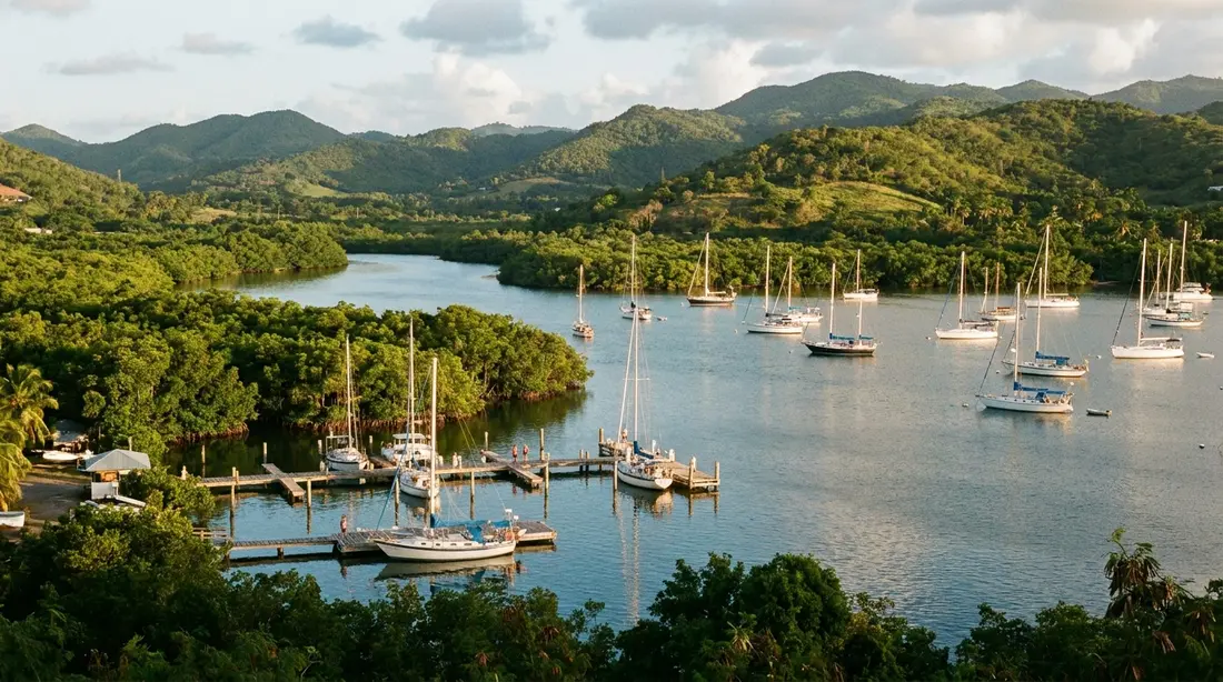
Salt River Bay is the one stretch of St. Croix where the island's oldest history, its rarest after-dark spectacle, and a good share of its water sports crowd onto a single shoreline. A national park, a small marina, a lagoon that glows all year, a mangrove estuary, and the mouth of a submarine canyon all wrap the same north-coast inlet, a twenty-to-twenty-five-minute drive down the coast road from Christiansted. This page is the map to the whole bay: what it is, how the pieces fit together, where to point the car, and which of our deeper guides to open for each thing you decide to do.
Where Salt River Bay sits
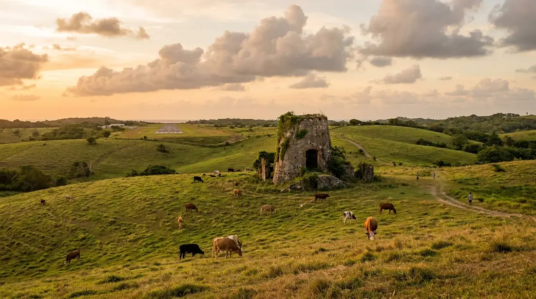
The bay notches the north coast about halfway between Christiansted and the island's northwest corner. The shape is worth fixing in your head before you go, because it decides where you park. Think of a keyhole: a narrow, reef-guarded mouth on the open Caribbean, widening inward to a sheltered estuary that collects the rain off the largest watershed on the north coast. Two low fingers of land frame the water. The western finger, below the rise called Salt River Point, holds the swimming beach, the grassy earthworks of the old colonial fort, and the hilltop where the shuttered park building looks down the inlet. The eastern finger holds the marina and the boats. The estuary and its wall of mangroves fill the space between the two, and past the reef at the mouth, invisible from any towel, the sea floor falls away into the canyon that brings divers out by boat.
All of it falls inside Salt River Bay National Historical Park — the federal unit that also carries the label ecological preserve, jointly administered by the Park Service and the U.S. Virgin Islands government across roughly 1,015 acres of water, wetland, and hill. The two-part name is the bay in miniature. It is a historical park because a shore party from Columbus's second fleet landed on the western beach in November 1493; it is an ecological preserve because the same basin shelters one of the largest mangrove forests left in the territory, a living reef, and a canyon head that drops toward the three-mile-deep Virgin Islands Trough. The landing, the archaeology beneath the point, and the fort are told in full on our Salt River, 1493 guide. This page stays above ground, with the working layout of the place.
Why one bay carries so much
Five different reasons to visit St. Croix converge here, and it is fair to ask why. Geography did most of the work. The deep water that lets a canyon wall start a few hundred yards offshore is the reason ships have always anchored off this mouth, which is why Columbus's fleet stopped here and why a marina sits here now. The sheltered, slow-flushing estuary that traps warm water long enough for a glowing plankton to multiply is the same nursery that raises the reef fish, and the mangroves that feed the glow are the mangroves that armor the shore. At Salt River, history, ecology, and recreation are five faces of one unusual piece of coastline. Here is each in a sentence, with the page that covers it properly:
- The 1493 landfall. The western beach is the one identified place on United States ground where a Columbus crew stepped ashore, and the fight that followed is the earliest Native armed resistance to European arrival that anyone wrote down. Full story: Salt River, 1493.
- The year-round glow. The inner lagoon sparks blue-green around anything that moves it, on every night of the year, a trait only a few bays on earth hold. Full story: bio-bay kayak tours.
- The mangrove nursery. Some of the territory's largest surviving mangrove stands ring the estuary and raise the juvenile fish that later populate the reefs. Full story: the mangroves of Salt River.
- The dive canyon. Offshore, the sea floor cracks open into two moored wall dives that fall past sponges and black coral into deep blue. Full story: diving Salt River Canyon.
- The marina. A single small harbor launches the kayaks, the dive boats, and a sportfishing charter, which is why so much happens within sight of one dock. More below.
Salt River Marina
The marina is the operational center of the bay, and for most visitors it is the address that matters, because nearly every guided activity meets there. It is a small harbor on the eastern arm, reached off Route 80, with a boat launch, a parking lot, and a working-waterfront feel rather than a resort one; the posted contact number was 340-778-9650 at last check. Do not expect a marina village of shops and restaurants. What the harbor offers a visitor is a place to put a boat in the water and a set of outfitters who stage from it. The public boat launch here is the same ramp some dive operators use to load, so on a busy morning you may share it with trailers and tour groups.
Based at or launching from the marina, verified operating at last check:
- Anchor Dive Center — the one dive operation set within the park itself, running the shortest boat ride to the canyon walls. See Salt River Canyon and the island-wide scuba guide.
- Sea Thru Kayaks VI — the see-through-kayak outfit whose night trips launch from the marina dock.
- Virgin Kayak Tours — pedal-drive kayaks, running both the after-dark glow trip and the daytime park paddle.
- BushTribe Eco Adventures — the eco-outfitter whose after-sundown run works the bay's eastern shore.
- Gone Ketchin' Charters — the sportfishing boat working out of the harbor for marlin, wahoo, mahi, king mackerel, and tuna; the offshore picture is in our deep-sea fishing guide.
The three kayak companies and the dive shop each run their own booking, meeting time, and check-in, all sent in a confirmation when you reserve, so the marina works as a rendezvous rather than a single ticket desk. Reserve ahead in winter; the operators are small, and the darkest nights fill first. One name you may find in older write-ups, Caribbean Adventure Tours, could not be confirmed as still running and is left off deliberately. If a booking gives "Salt River Marina" as the meeting place, this eastern-arm harbor is where to go, not the beach across the water, which is a separate drive covered next.
Getting there and getting your bearings
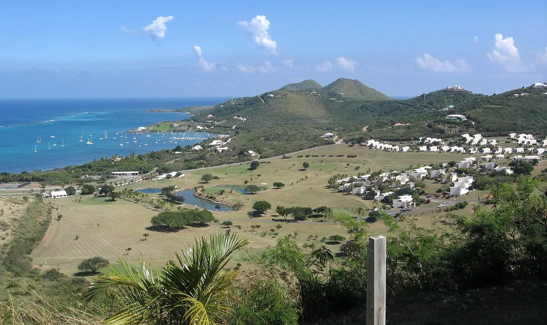
Salt River sits on Route 80, the North Shore Road, and the drive from Christiansted runs about twenty to twenty-five minutes; from the west end, allow longer for the cross-island roads. There is no single "Salt River" turnoff that serves everything, and this is where visitors lose time. The bay's two arms have separate approaches, and reaching one from the other means driving back out to the highway and around the inlet.
For the marina and every guided tour, follow your operator's directions to the harbor on the eastern arm; the kayak and dive boats leave from here, and the lot is the place to park for a paddle, a dive, or a fishing charter.
For the beach, the fort, and the overlook, the western arm comes off the north-shore road on a rough dirt spur; expect ruts and holes, and take it at a crawl in a normal rental car. That one track climbs past the hilltop overlook and the closed park building, then drops to Columbus Landing Beach, where you park free on the unmarked ground by the sand. From the rise, the shape of the 1493 landing is easy to pick out, so the overlook earns its two minutes even when the beach is not the plan.
| You are here for | Which arm | How you reach it | Parking |
|---|---|---|---|
| Kayak, dive, or fishing tour | Eastern (marina) | Operator's directions to Salt River Marina off Route 80 | Marina lot |
| Swim, picnic, own-board launch | Western (beach) | Unpaved spur to Columbus Landing Beach | Informal, free, near the sand |
| Overlook, fort banks, the view | Western (hill) | Same dirt track, up past the old visitor building | Pull-off by the overlook |
A word on names, because they trip up a map app. The area shows up under several labels — the estate names Judith's Fancy and Salt River, the park, the marina, and the beach — and a search for "Salt River" on its own may pin the general district rather than your actual destination. Navigate to "Salt River Marina" for a tour and to "Columbus Landing Beach" for the sand and the fort; if the app offers only one Salt River pin, use the operator's written directions, which are the reliable ones. The road narrows and turns to dirt near the water on the western side, so trust the directions over the smooth line on the screen.
One practical note that catches people out: the park's visitor contact station, the building on the western hill, has stayed closed since Hurricane Maria struck in 2017, with no reopening date at last check, so there is usually no ranger, no desk, and no exhibit on site. For maps, the passport stamp, and staffed information, the Park Service sends visitors to the Fort Christiansvaern visitor center in town, or by phone to the park office at 340-773-1460. Cell coverage at the bay is ordinary rather than absent; the roads keep left, as everywhere on St. Croix, which the driving guide covers if it is new to you. The fuller park-visit detail lives on the history page.
How to spend your time here
Salt River flexes from a ten-minute photo stop to a full day capped by a night on the water. Here is the menu, each item with the guide that runs it in depth. Pick by what your group wants and, for two of these, by the calendar.
- Walk the history — the overlook, the grassy banks of Fort Salé, and the 1493 beach are self-guided, free, and open through daylight hours. Read Salt River, 1493 first, and the beach detail in Columbus Landing Beach.
- Paddle the mangroves by day — a calm, roughly two-hour guided paddle from the marina, easiest in the morning before the trades fill in, and a good fit for families. See daytime kayaking at Salt River.
- Kayak the glow after dark — the headline night trip, run only on the darker half of each month; you choose the date off the moon, not the other way around. See bio-bay kayak tours.
- Dive the canyon — two moored wall dives by boat from the marina, weather-permitting on the north shore, for certified divers with a guide. See diving Salt River Canyon.
- Swim, picnic, or launch a board — the calm beach on the western arm has restrooms, grills, and picnic tables, and it doubles as the simplest place on the north shore to put in your own kayak or paddleboard; rental gear is at the marina desks. See Columbus Landing Beach and the paddleboard guide.
- Watch the birds — herons, egrets, pelicans, and frigatebirds work the mangrove edge, best at first and last light from the beach or a drifting boat. See St. Croix wildlife.
- Fish offshore — a sportfishing charter runs from the marina out to the blue water beyond the shelf. See deep-sea fishing.
Two of these are calendar-driven. The night kayak needs a dark sky, so it tracks the moon; the canyon dive needs a settled sea, so it tracks the north-shore swell. Everything else runs on ordinary daylight and your own schedule.
Planning the visit by trip type
The bay suits very different visits, and the trick is to match the plan to your group rather than trying to do everything. A few shapes that work:
- The quick history stop. Thirty to forty-five minutes on the western arm — the overlook, a walk on the fort banks, a few minutes on the sand. No booking, no gear, and a strong add-on to a north-shore drive. Read the history guide first and it stops being a plain grassy field.
- The easy half-day. A morning guided paddle from the marina, then lunch fifteen minutes west at Cane Bay; or a slow beach morning at Columbus Landing if you would rather book nothing at all. Low effort, flat water, and kind to families.
- The full day and night. The bay's best use, described above: a morning activity, a Cane Bay afternoon, and the glow kayak after dark. It only lines up when the moon is right, so settle that before anything else.
- The diver's day. A two-tank trip on the canyon walls with the in-park shop, then the bioluminescent kayak that evening from the same harbor, weather and moon permitting. Keep your final day out of the water for the flight home.
- The nature morning. First light for the birds along the mangrove edge, a quiet paddle while the water is still glass, and the beach nearly to yourself before the trades come up. The mangrove and wildlife guides set up what you are looking at.
The bay as an ecosystem
The "ecological preserve" half of the park's job rests on a chain that starts with fresh water. Rain off the hills runs down the guts into the estuary, where it meets the sea and slows; the red mangroves ringing the shoreline shed leaf litter that feeds the whole food web, their tangled roots hold the sediment that would otherwise choke the reef, and those same roots shelter juvenile fish through the seasons when they are easiest to eat. The reef at the mouth, the seagrass on the bottom, and the mangroves at the edge are one connected system, and the canyon just offshore adds the deep-water link. The nursery here is a fair thing to remember while paddling past the roots, because the reefs elsewhere on the north shore hold fish partly thanks to it: do not grab or climb the mangroves. The trees themselves, and what lives in and over them, get their own pages in the mangroves of Salt River and the island-wide wildlife guide. The nighttime chapter of the same ecology, the glowing plankton the mangroves feed, is the bio-bay story.
Reading the conditions
Because the bay does several different things, several different variables decide your day, and none of them is temperature — the water is swimmable year-round. Learn the three that matter and you can time a visit well.
The moon rules the glow. The plankton light every night, but a bright moon washes the faint blue out of the water, so tours run on the dark half of the month and stand down near the full moon; check a moon calendar before you lock the date, and read the bio-bay guide for the specifics.
The north-shore swell rules the dive and the outer bay. From roughly mid-December through mid-March, long-period Atlantic swell can send surge across the canyon walls and chop into the mouth even under a clear sky, and shops shift boats to sheltered coasts on those days. Book the dive early in your stay so a rough morning postpones it rather than cancels it; the scuba guide has the seasonal picture.
The rain rules the water clarity. The estuary drains a big watershed, so after a real downpour the shallows turn cloudy for a day or two while the guts empty; give the beach and any snorkeling a fair-weather buffer, and spend a wet day on the west coast instead. The month-by-month version is in the weather guide.
The one constant is the morning calm. Trade winds usually build after midday, so the flattest water for paddling and the clearest light for the mangroves come early. Whatever the season, an early start is the reliable Salt River move.
What Salt River offers
The bay's activities at a glance, with the arm to aim for, the timing that suits each, and the full guide.
| What you want | Where in the bay | Best timing | Full guide |
|---|---|---|---|
| History, fort, overlook | Western arm | Any daylight; late light for photos | Salt River, 1493 |
| Calm swim and picnic | Columbus Landing Beach, western arm | Weekday morning; dry spell | Columbus Landing Beach |
| Daytime mangrove kayak | Marina, eastern arm | Morning, before the trades | daytime kayaking |
| Bioluminescent night kayak | Marina, eastern arm | Dark half of the month, after sunset | bio-bay tours |
| Canyon wall diving | Boat from the marina | Calm north-shore days | Salt River Canyon |
| Offshore sportfishing | Marina, by charter | By appointment | deep-sea fishing |
| Birding the mangroves | Beach or a quiet boat | First and last light | St. Croix wildlife |
Practical notes
Salt River rewards a self-sufficient visitor and tests an unprepared one, because the bay sells you nothing. There is no shop, no snack bar, no drinking-water tap, and no fuel at the beach, and the marina is a working harbor rather than a services hub. The one real amenity on the public side is the block of restrooms, grills, and picnic tables at the beach. Everything else, you bring.
- Pack in, pack out. Stock a cooler and carry more water than you expect to drink, buying it in Christiansted on the way out, and take every scrap of trash home with you.
- Sun and bugs. Shade on the sand is thin, so bring an umbrella and reef-safe sunscreen; the still, mangrove-lined water breeds mosquitoes and no-see-ums when the breeze drops, most reliably at dawn and dusk, so keep repellent in the bag. On a night kayak, cover up instead of spraying, because the operators ask you to keep chemicals off the lagoon.
- Day-use hours. The park keeps daylight hours only. Clear the beach and trails once the light goes, unless you hold a reservation for an after-dark kayak, which meets on the marina side under its own arrangements.
- No lifeguard. As on every St. Croix beach, no one watches the water; the inner bay is calm, but swim to your own ability and mind small children on the soft, seagrassy bottom.
- Dress to get wet on any of the boat or paddle trips, and pack a dry change for the drive back to the villa.
Combining Salt River with the north shore
Salt River is the anchor of the island's best half-day of driving, because Route 80 strings the north-shore highlights along one road. The natural run heads west from the bay: about fifteen minutes along the coast brings you to Cane Bay, where the beach bars and the wall snorkeling sit steps apart and lunch is easy; a little farther are Cane Bay's beach and, beyond Carambola, the Annaly Bay tide pools for the ambitious, walkable only at low tide and calm seas. The full loop, with the timing and the road notes, is in our island driving guide.
The strongest single day on this coast uses the bay twice. Spend the morning on the water or in the history, break for the afternoon at Cane Bay, then come back to the marina after dark for the glowing-water kayak — five centuries of the island by day and the plankton by night, from one inlet. Divers can run the same trick, the canyon walls in the afternoon and the kayak that evening, since the dive boat and the kayak share the one harbor; just confirm the moon suits the night trip before planning around it. History-first travelers should tie the bay to Christiansted, where the town's forts and museums carry the Danish half of the island's past and the park runs its one staffed information desk, at the national historic site; the local kitchens also cover a pre-tour dinner, and the Christiansted dining guide flags the ones that get you out the door on time. First-time visitors fitting Salt River into a wider plan will find the island's rhythm in our first-timer guide.
Questions guests ask
Which side of the bay do I drive to?
It depends on your plan, and the two sides are a separate drive apart. For any guided tour — kayak, dive, or fishing — go to Salt River Marina on the eastern arm, following your operator's directions. For a swim, a picnic, the fort, or launching your own board, go to Columbus Landing Beach on the western arm, down the unpaved spur that also passes the overlook. The bay has no single entrance that serves both, so choose the side that matches the day, and if you want both, expect to drive back out to the road and around. When a confirmation says "the marina," it means the eastern harbor, not the beach.
How long should we set aside?
Anywhere from ten minutes to a full day and evening. A focused history stop — the overlook, the fort banks, and a short spell on the sand — takes about half an hour. Add the daytime paddle or a dive and you have filled a morning; add the beach for lunch and the bio-bay kayak after dark and Salt River fills a day and a night. Most visitors give it a morning, and the keenest give it the whole cycle, from noon history to a ten-o'clock glow.
Is there an entrance fee or a gate?
No. The park charges nothing, has no gate, and keeps no staffed entrance; it works as a day-use site, sunrise to sunset. The trade-off for the open access is the missing services: with the visitor building closed since 2017, there is usually no ranger present, so bring what you need and treat the Fort Christiansvaern visitor center in Christiansted as the place for maps, the passport stamp, and questions. Guided tours set their own prices, paid to the operator.
Can we do the daytime and the nighttime activities in one trip?
Yes, and it is the bay's signature move, with one caveat each. You will head home or to dinner in between, because the beach and trails close at sunset and the night tour meets later from the marina. The night kayak depends on a dark sky, so it pairs cleanly with a day visit only when the moon cooperates; the daytime activities carry no such limit. Book the night trip by the moon first, then build the daytime around it.
Are there restrooms, food, or gas at the bay?
Restrooms, yes, at Columbus Landing Beach, along with grills and picnic tables. Food, water, and fuel, no — nothing is sold at the beach or the marina, and there is no store within walking distance. Buy groceries and fill the tank in Christiansted on the way, carry plenty of water, and pack your trash out. The nearest beach with a bar and food on the sand is Cane Bay, about fifteen minutes west.
What time of year is best?
There is no bad season, only different trade-offs, since the water stays warm year-round. Winter brings the driest air and the fullest calendar, along with the north-shore swell that can scrub a canyon dive and the dark-moon nights that fill the kayak boats first. Late summer and fall bring the calmest, clearest diving and easier bookings, offset by the wetter weather that clouds the beach and the hurricane-season watch. For the glow, the moon matters more than the month; for everything else, an early start beats a late one. The weather guide has the month-by-month detail.
Is Salt River worth it if we don't dive or kayak?
Yes. The history stands on its own — the overlook, the fort earthworks, and the beach where the 1493 landing happened make a satisfying stop with no gear and no booking, and the reading on our history page turns twenty minutes on a quiet hill into something memorable. The calm beach is one of the gentler swims on the north shore, and the mangrove edge is the easiest birding on the island. Plenty of non-paddlers pair a Salt River history stop with a Cane Bay beach afternoon and never touch a boat.
Where to stay near Salt River
Our homes sit mostly around Christiansted, roughly a half-hour from the bay, which is what makes the daylight-and-dark double so simple to arrange from a villa base. From our East End villas or the beachfront collection, the drive follows the waterfront out of town and up Route 80; a few of these houses stock kayaks or paddleboards that carry nicely to the Columbus Landing put-in. The west-end houses sit farther from Salt River but nearer the sheltered diving off Frederiksted for the balance of the week. Because the glow night is the one outing that turns on the moon, share your travel dates with us at booking and we will slot it into the right window. See the full roster on the villas page.
Sources
Written from official and first-party sources, checked August 2026. Hours, prices and event dates change — confirm before you go.
In this guide
Stay nearby
On The Shoys beach: six bedrooms, six baths, pool and hot tub, room for twelve, and the beach through the back garden.
 Shoy's Beach House6 bd · 6 ba · sleeps 12 · Christiansted
More in Towns & Areas
Sources
9 references, listed in full at the end of this guide — official park, refuge, tourism-board and business sources, checked August 2026.