Driving the Island in a Day
An 84-square-mile island, two towns, one rainforest, and the easternmost point in the U.S. — a full-loop driving day, timed out.
St. Croix is 84 square miles — about 22 miles end to end, two towns, one rainforest, a national park and the easternmost point in the United States — and a single long day in a rental car can show you nearly all of it. This page maps that day as a route: the classic full-island loop, leg by leg, with route numbers, distances, stops, fuel and food logistics, and the road reality between them. Every mile and minute below is approximate. Small enough to lap in a day, the island still holds enough that you will want to come back for half of what you pass.
The loop in one view
The circuit is built from a handful of numbered roads, and learning their names is most of the navigation. From Christiansted, Northside Road (Route 75) runs west to meet North Shore Road (Route 80), which traces the coast past Salt River Bay and Cane Bay until the pavement quits near Davis Bay. Route 69 climbs over the ridge from there, drops you onto Centerline Road (Route 70), and Centerline carries you west into Frederiksted. North of Frederiksted, Route 63 runs the wild west coast toward Ham's Bluff. The return east goes one of two ways: Mahogany Road (Route 76) through the rainforest to Grove Place, or Centerline straight down the island's spine. Add the East End spur — Route 82 out to Point Udall, Route 60 back along the south shore — and you have circled everything the island has.
Counting both spurs, the full day covers roughly 60 to 65 miles of driving. That number surprises people in both directions: small enough that no leg feels long, large enough that the day needs structure. Traffic runs on the left the whole way, in ordinary left-hand-drive cars; the habits and rules live in driving on the left, and this page assumes you have read it. An ordinary rental handles every paved mile below — the car question itself is covered in renting a car.
Which direction to drive it
The loop works in either direction, and the choice comes down to where you want the sun.
East first, west last is the classic order and the one this page follows. It opens with dawn at Point Udall, the first light to touch U.S. soil each morning, runs the north coast while the day is still cool, crosses the rainforest in the afternoon, and lands you in Frederiksted or at Rainbow Beach exactly when the sun drops into the sea in front of you. Sunrise and sunset both happen where you are standing. The price is an early alarm and a long day.
West first, east last — Centerline out to Frederiksted at breakfast, then the coast roads in reverse — earns its keep in two situations. When a cruise ship is docked at Frederiksted's pier, an early westbound run gets you through town before the midday crowd peaks; the ship-day rhythm is laid out in cruise day on St. Croix. And photographers sometimes prefer it, because driving North Shore Road eastbound in late afternoon puts the westering sun behind the car and warm side-light on the coast instead of glare through the windshield.
There is no wrong answer. If you have only one shot at the loop and no ship is in port, take the east-first order and let the day end facing the water.
Total time
Pure wheel time for the whole circuit, both spurs included, runs about three hours at island speeds. Nobody should drive it that way. The loop earns a full day — figure nine to ten hours door to door with a swim, a fort, a long lunch, a rainforest stop and a sunset in it, and treat even that as a sampler rather than a checklist. Two shorter framings hold up too: the western circle alone (north shore out, rainforest back) fills a comfortable half day plus lunch, and the East End spur is a half morning. Both stand alone below under half-day versions.
All times on this page assume dry roads and daylight. Rain slows the coastal and rainforest legs noticeably, and none of these roads are lit at night, so build the day to finish before dark or on a stretch you have already driven. Speed limits are low everywhere — 35 mph is the ceiling on most of the loop, less through the curves — and the arithmetic works out fine anyway, because nothing on this island is far from anything else.
Christiansted to Salt River
Leave Christiansted on Northside Road, Route 75, heading west. If the day starts here rather than out east, give the town its hour first: coffee near the wharf, a walk through Fort Christiansvaern — doors open 8:30 a.m. until 4:30 p.m. every day, as of our last check — and the shaded arcades of the old Danish streets. The National Park Service pegs the drive from the town's historic site to Salt River Bay at about five miles: Route 75 out, then a signed connection onto Route 80 toward the water.
Salt River Bay National Historical Park, with its ecological preserve, is the loop's first landmark and its heaviest piece of history: Columbus's crew came ashore in this bay on November 14, 1493 — no other known spot on present-day American ground was walked by men from his fleet — and the bay also saw the earliest documented armed fight between Europeans and Native people anywhere in the hemisphere. From the road this reads as a quiet green bay with a small marina, which is part of its power. The bluff by the park's visitor contact station overlooks the full sweep of mangroves and water; the building keeps limited hours, the view does not. Kayak outfitters work out of the marina, and the bay's night side — it glows with bioluminescence in every season, a rarity among the world's bio bays — belongs to a different evening. The full picture is in the Salt River area guide; for the loop, fifteen minutes at the overlook does the job.
North Shore Road to Cane Bay
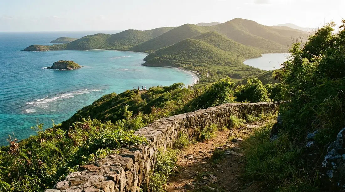
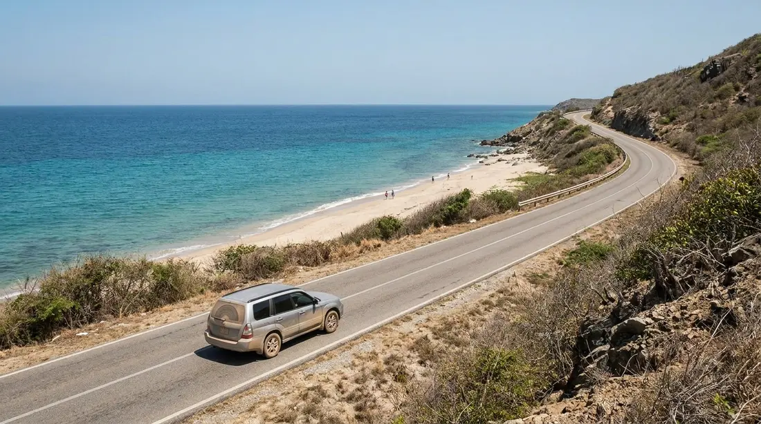
West of Salt River, Route 80 becomes the drive people mean when they call St. Croix a driving island. North Shore Road runs directly above the water for several miles, and the road itself is the attraction: hairpin turns, blind corners, green hills rolling down to the sea on your right, and guardrail pull-offs placed where the views justify a stop. On clear days the horizon holds St. Thomas and St. John; in winter, humpback whales migrate past this coast, sometimes only a few hundred yards offshore, and the pull-offs above Cane Bay double as whale-watching posts.
Two stops mark the miles. The ruins of the Rust Op Twist sugar estate stand near La Vallee — mill and great-house remains from the plantation centuries, visible from the road and one of the loop's easiest photographs. Then comes Cane Bay itself, the north shore's hub: a strip of tan sand with the famous wall reef beginning a short swim out, dive shops at the roadside, and lunch a few steps off the sand — The Landing beach bar and the restaurant AMA, at last check. If the loop includes one swim, most guests take it here; mask and fins in the trunk turn a leg stretch into the best half hour of the day. Walkers and sometimes horses share the shoulder through this stretch, so drive it gently.
Past Cane Bay the road runs another couple of miles to a three-way stop. Straight ahead lies the dead-end finish at Davis Bay and the Carambola resort — a worthwhile five-minute detour to one of the island's most dramatic beaches. The left turn is the way onward, and it has a name.
Over the Beast to Frederiksted
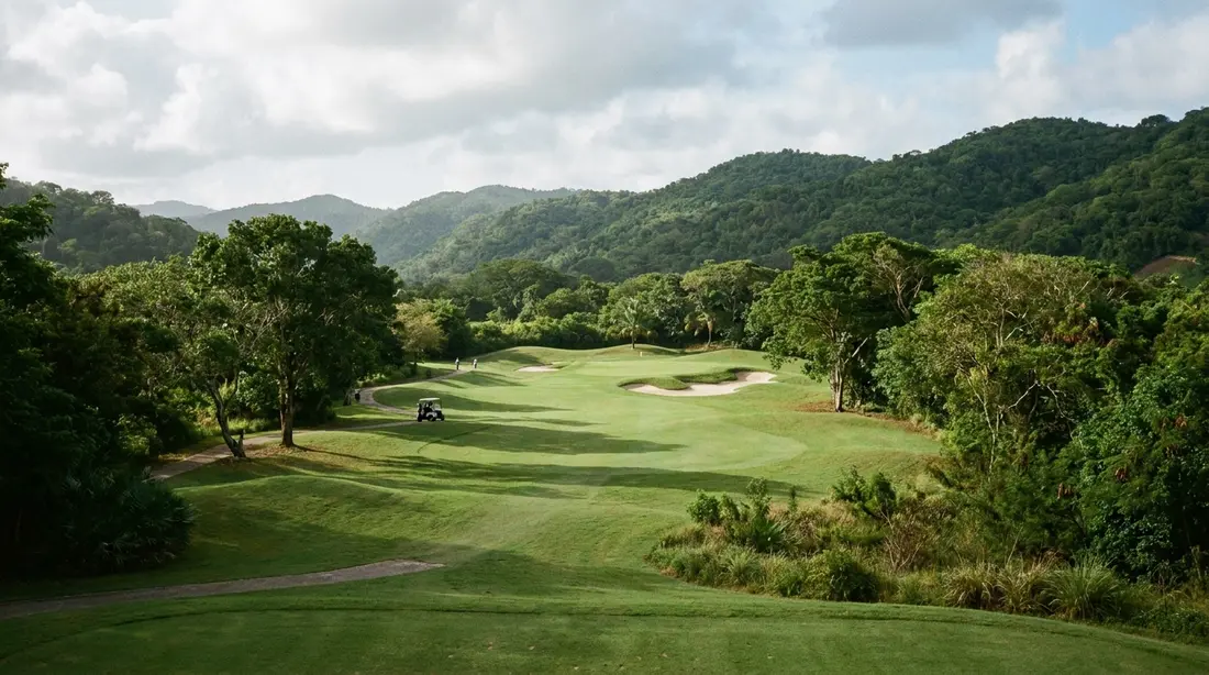
Route 69 climbs off the coast in one sustained pull that the island's triathlon made famous: the Beast, roughly 600 feet of gain in about three quarters of a mile, with an average grade near 14 percent and pitches above 20, by the numbers race organizers publish. In a car it is five minutes of low gear and switchbacks rather than an ordeal, and the reward comes fast — openings near the top look back over the whole coast you just drove. The Carambola Golf Club, a Robert Trent Jones Sr. design from 1966 and the territory's only championship-length course, spreads across the valley by the road.
From the ridge, Route 69 descends to Centerline Road, Route 70. Turn right and the island changes character: the tight coastal geometry opens into the flat agricultural middle, cattle land and old estate names, and the driving gets easy. Frederiksted arrives in about fifteen minutes. Count the Cane Bay-to-Frederiksted leg as nine or so miles and 25 minutes, all of it paved and none of it difficult when taken at the posted pace. Going downhill on the Beast in the reverse direction, use engine braking rather than riding the pedal.
The Route 63 spur
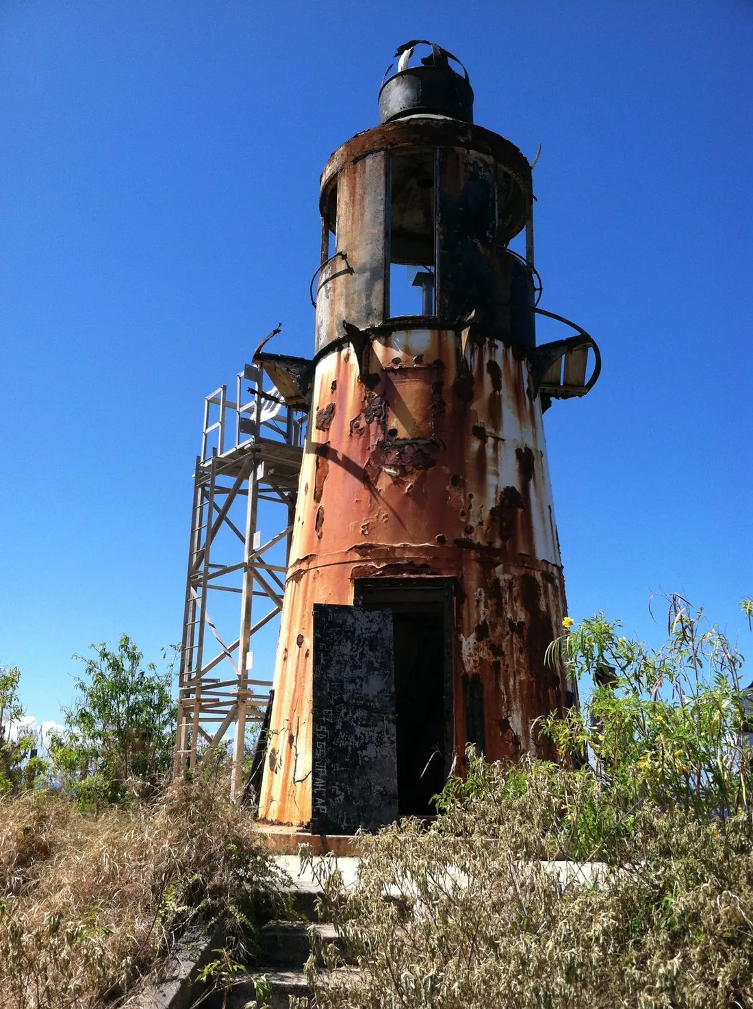
Before or after the town stop, the west coast north of Frederiksted deserves its out-and-back. Route 63 runs due north from the edge of town, pinched between the sea and the steep green shoulder of the northwest hills. The paved miles pass Sprat Hall and the turn for Creque Dam Road, then Butler Bay — about 2.7 miles north of town, the shore opposite the island's famous wreck-diving grounds — before the road deteriorates toward its end near Hams Bay. From the road's last reaches, a roughly 30-minute uphill walk gains the 1915 Danish cast-iron lighthouse on the cliffs; the walk, and the ridge beyond it, have their own page at Ham's Bluff Lighthouse.
Treat the spur as roughly seven miles round trip and half an hour of driving, more if the final unpaved stretch is rough that season — turn around whenever the surface outvotes the rental agreement. This is the emptiest coastline a paved road reaches on St. Croix, and even without the lighthouse walk the turnaround views justify the detour. The inland turn at Creque Dam Road leads to the 1926 dam and the wet heart of the forest, covered in the Creque Dam guide; it is a rough, narrow track best saved for its own outing.
The stop in Frederiksted
The loop's western anchor asks for at least an hour. Frederiksted is the island's second town, laid out on a grid beside a long open roadstead, and its essentials sit within three blocks of each other: Fort Frederik, built 1752 to 1760, from whose ramparts emancipation was proclaimed to the Danish West Indies on July 3, 1848; the long pier, which serves cruise ships by day and divers by night; and the Strand with its cafes and galleries facing straight west over the water. Depth on all of it — the history, the restaurants, the rhythm — lives in the Frederiksted guide.
For the drive, the practical notes are these. On ship days the blocks near the pier fill from mid-morning to late afternoon, and the town is at its liveliest; on quiet days it can feel half asleep at noon and comes back to life at sunset. Beaches bracket the town — Frederiksted Beach at its north edge, Dorsch Beach south of it, Rainbow Beach a few minutes up Route 63 with a rental shack and a long-running beach bar. If the day is running on schedule, sunset belongs here: the west end faces the drop squarely, and dinner on this coast closes the loop's daylight in the right direction.
Mahogany Road or Centerline
Two roads lead back east from Frederiksted, and the choice defines the second half of the day.
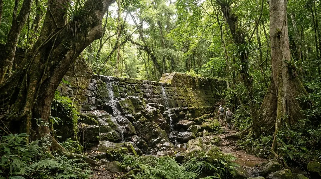
Mahogany Road, Route 76, is the scenic vote. It leaves the coast road just north of town and climbs into the only true rainforest under the U.S. flag outside the Pacific: mahogany, kapok and turpentine trees closing into a canopy that turns the road into a green tunnel. Two institutions mark the miles — St. Croix LEAP, the roadside workshop where furniture and boards are milled from fallen local hardwoods, and the Mt. Pellier Domino Club, the open-air forest bar pouring since 1971, known island-wide for its beer-drinking pigs and its house infusion called MamaWanna. The road is paved, narrow, patched in places, and slow; count its crossing as five to six winding miles and 25 minutes, and take the whole thing in second and third gear. It emerges at Grove Place in the island's middle, a short link from Centerline Road. The full treatment, including the unpaved Scenic Road that shadows it along the ridge, is in the Mahogany Road guide.
Centerline Road, Route 70, is the direct vote — the island's spine, two easy lanes through the farm flats, with the day's remaining history lined up beside it as described in the next section. Town to town it measures about 15 miles and 30 to 45 minutes, more in the weekday rush around Kingshill. There is also a third, plainest option: the Melvin H. Evans Highway, Route 66, a 9.3-mile divided road along the south shore past the airport, the territory's only 55-mph stretch. It sees nothing and gets you home fastest, which at the end of a ten-hour day is sometimes exactly the sight you want.
The strong play: cross on Mahogany Road while there is still full daylight — the canopy makes it dark early — and let Centerline or the highway carry the final flat miles.
Mid-island on Centerline Road
Whichever way you crossed the forest, the run east along Route 70 passes more of the island's story per mile than any other leg, and each stop can absorb an hour you may no longer have. Choose one and note the rest for another day.
- Estate Whim, just east of Frederiksted, is the restored sugar plantation museum with its round great house and mill; the interior of the great house has stayed shut since 2017, and the grounds, mill and outbuildings carry the visit — details on our Estate Whim page.
- St. George Village Botanical Garden grows its collections in and around the ruins of a plantation village mid-island; see the garden guide.
- The rum stops — Cruzan's distillery at Estate Diamond, in Nelthropp family hands with a tradition dating to 1760, and the Captain Morgan visitor center near the highway — sit a few minutes south of Centerline. Tour times are limited and reservations matter; our Cruzan distillery guide has current details.
- La Reine Chicken Shack, the spit-roast institution, feeds the mid-island stretch, and Leatherback Brewing pours at Kingshill, daily 11:30 to 8 at last check — both fuller entries in the mid-island guide.
From Grove Place back to Christiansted is roughly ten miles and 25 minutes. Weekday afternoons stack traffic near Sunny Isle and Kingshill; on the clock at day's end, the highway bypass earns its existence here.
The East End spur
The eastern third of the island hangs off the loop as a spur rather than a link — Route 82 runs out to the point and Route 60 offers a different shore for the return, and together they add roughly 22 miles round trip from Christiansted, about 70 minutes of driving without stops. In the east-first order this is the day's opening act, driven in the dark toward first light.
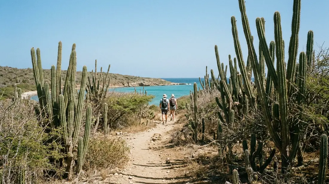
Route 82, the East End Road, leaves town past the harbor and follows the north coast of the dry east — cactus country, an entirely different landscape from the rainforest you will cross that afternoon — with Buck Island holding position offshore the whole way. The pavement runs all the way to the parking loop below Point Udall, where the Millennium Monument sundial marks the easternmost ground in the United States and the compass bearing of the nation's first sunrise of 2000. Coming back, bear onto Route 60, South Shore Road, for the windward side: Grapetree Bay, the Divi resort strip, and the mangrove flats of Great Pond before the road rejoins the island's road net. A morning swim slots in easily at Cramer's Park — pavilions, restrooms and gentle water right on Route 82 — or at Chenay Bay closer to town.
This page deliberately keeps the spur short, because the whole quarter — its beaches, its marine park, its restaurants, the hike-in bays at the tip — has a dedicated reference in the East End guide. For the loop, the spur's job is the monument, one swim, and the two-shore contrast, all before most of the island has finished coffee.
The loop leg by leg
Distances and times below are approximate, measured for a normal driving pace without stops. Add stop time generously; the legs are short so the pauses can be long.
| Leg | Roads | Miles (approx.) | Driving time (approx.) | Along the way |
|---|---|---|---|---|
| Christiansted to Point Udall and back via the south shore | Rt 82 out, Rt 60 back | 22 round trip | 70 min | Buck Island views, Cramer's Park, Millennium Monument, Grapetree, Great Pond |
| Christiansted to Salt River | Rt 75 to Rt 80 | 5 | 15 min | Northside Road, Salt River marina, 1493 landing overlook |
| Salt River to Cane Bay | Rt 80 | 4 | 10–15 min | Hairpins over the water, Rust Op Twist ruins, coastal pull-offs |
| Cane Bay to Davis Bay dead end and back | Rt 80 | 4 round trip | 10 min | Carambola resort, Davis Bay beach |
| Cane Bay to Frederiksted | Rt 69 to Rt 70 | 9 | 25 min | The Beast climb, ridge views, Carambola Golf Club, mid-island flats |
| Frederiksted west-coast spur | Rt 63 out and back | 7 round trip | 30 min | Sprat Hall, Butler Bay, Ham's Bluff trailhead |
| Frederiksted to Grove Place | Rt 76 | 6 | 25 min | Rainforest canopy, St. Croix LEAP, Domino Club |
| Grove Place to Christiansted | Rt 70 | 10 | 25 min | Kingshill, Sunny Isle, distillery and brewery turns |
Grand total with every spur: on the order of 60 to 65 miles and roughly three hours at the wheel. The alternate return on the Melvin Evans Highway (Rt 66) trades the Grove Place and Centerline rows for 9.3 fast, viewless miles.
Fuel, food, and bathrooms
Fuel first, because the loop's geography is unforgiving about it: the gas stations concentrate in and around Christiansted, along Centerline Road mid-island, and around Frederiksted. At last check there were none on North Shore Road, none in the rainforest, none on Route 63 north of town, and none on the East End roads. Start the day full and the whole question disappears; a full tank covers the loop three times over.
Food falls naturally into thirds. The east spur runs too early for restaurants — pack coffee, or catch breakfast in Christiansted between the spur and the north shore leg. Midday belongs to Cane Bay, where lunch sits steps from the water, or holds out for Frederiksted's cafes an hour later. The rainforest offers the Domino Club for a drink and a pig visit rather than a meal, and the Centerline leg adds La Reine's roast chicken and the Kingshill brewery for the last stretch. Sunset dinner on the west coast is the classic finish; Christiansted's fuller restaurant row works when the day ends early. Roadside fruit and food stands appear along Centerline and near the towns — cash-friendly, worth a stop when one turns up, never certain to be there.
Bathrooms are the thinnest resource on the route. The reliable public ones sit at Cramer's Park on the east spur and at Columbus Landing Beach inside Salt River park; the forts cover the towns during opening hours, and any restaurant stop solves the problem for its hour. Plan around those and prompt the back seat accordingly.
Half-day versions
The full loop is one option among three, and plenty of guests split it across two days rather than force it into one.
The west circle — Christiansted, Salt River, Cane Bay, over the Beast, Frederiksted, back through the rainforest or down Centerline — is the loop's heart: roughly 35 to 40 miles, and a 9 a.m. start with a swim and lunch delivers you home by mid-afternoon, or stretches to sunset on the west coast if the day is going well. If you drive only one half, drive this one; it holds the hairpins, the forest and both towns.
The east spur alone — Route 82 out, Route 60 back — fits before lunch with time left over, and pairs naturally with a lazy beach afternoon at Cramer's Park, Chenay Bay or The Shoys. East End villa guests barely count it as a drive; from Christiansted it is a half morning.
The rainforest-only run — up Mahogany Road, a Domino Club stop, back over 63 or Centerline — makes a fine rainy-afternoon plan from the west, since the canopy is the one landscape on the island that improves in a shower.
Photo stops
The loop's dependable frames, in driving order for the east-first day. A longer list, with directions to each, is in best viewpoints.
- The Millennium Monument at first light — the sundial's slot lines up with the dawn bearing; arrive 20 minutes before sunrise for the color.
- The Salt River overlook — the bay, the mangroves and the historical marker in one frame from the visitor-station bluff.
- The Route 80 pull-offs — the coastal hairpins photograph best from the marked guardrail pull-offs; in winter, watch the water for whale blows.
- Rust Op Twist — sugar-mill ruins against the sea near La Vallee, shot from the roadside.
- The top of the Beast — openings near the crest of Route 69 look back down the entire north coast.
- The Frederiksted pier at golden hour — the long straight line into a low sun, from the sand at the town beach.
- The Mahogany Road canopy — stop only where the shoulder allows; the green-tunnel shot needs ten safe feet, never a blind bend.
Questions guests ask
Can you really drive around St. Croix in one day?
Yes, with margin. The full circuit including the East End and west-coast spurs is on the order of 60 to 65 miles, which at island speeds means about three hours of actual driving spread across a nine-to-ten-hour day. The constraint is never the road; it is the stops, each of which could swallow the schedule. The workable formula is one swim, one town hour, one forest stop and one sunset, with everything else noted for later in the week. Guests staying seven nights usually lap the island once early on, then spend the rest of the stay returning to the two or three places that grabbed them.
Do I need four-wheel drive for the loop?
No. Every leg in the table — Routes 75, 80, 69, 70, 63's maintained miles, 76, 82 and 60 — is paved, and an ordinary compact handles all of it, the Beast included. The exceptions are deliberate add-ons this page does not require: the unpaved Scenic Road along the western ridge, Creque Dam Road's rough stretches, and Route 63's deteriorating final reach toward Hams Bay. Those want clearance, dry weather and a rental agreement that tolerates dirt, which is worth confirming before you add them. When the pavement ends, so does the loop's obligation; turning around costs five minutes.
Which way around is better?
East first for most days: sunrise at Point Udall, the north shore in morning cool, the rainforest after lunch, and the sunset dead ahead on the west coast, so both ends of the light happen where you stand. Drive it west-first when a cruise ship is at the Frederiksted pier and you want the town before the midday crowd, or when you care about photographing North Shore Road in warm afternoon side-light, which favors the eastbound direction. The mileage is identical either way; only the sun and the crowds move.
Is the Beast difficult in a regular car?
It is steep — around 600 feet of climb in under a mile, with grades the island's triathlon made famous — and completely routine in any rental with an automatic transmission. Going up, hold a low gear and let the engine work; going down, select low gear again and use engine braking instead of riding the brake pedal through the switchbacks. Give cyclists the full lane when you meet them; this hill is a pilgrimage ride. If a passenger is prone to car-sickness, the Centerline-only return skips the grades entirely at the cost of the ridge views.
Where can we get gas on the north shore?
Nowhere, at last check — the coastal and rainforest legs run station-free, and so do the East End roads past the edge of Christiansted. The stations sit in and around the two towns and along the Centerline corridor mid-island. In practice this is a non-problem solved the night before: fill the tank in town, and the entire loop uses a fraction of it. The same forward planning applies to cash for roadside stands and water for the car, since the scenic legs sell nothing at all between their endpoints.
What changes on a cruise-ship day?
Frederiksted transforms. Ships dock at the town pier, and from mid-morning to late afternoon the waterfront blocks, the nearby beaches and the west-end taxi fleet all run at full tide; Rainbow Beach and the rainforest bar pick up tour traffic too. The rest of the loop barely notices. If your drive falls on a ship day, either reach Frederiksted before 10 a.m. by running the loop west-first, or arrive after the ship's all-aboard when the town exhales and the sunset crowd is back to locals and villa guests. Schedules are public; the cruise-day guide linked above shows where to check them.
Is the drive safe after dark?
The roads are the same at night; the margins are not. Outside the towns there is essentially no street lighting, and the loop's character stops — hairpins, deer near the roads at dusk, the odd pothole — all get harder to read by headlight. The sensible builds: finish the circuit before dark, or arrange the day so the after-dark miles are Centerline or the highway, the two straightest roads on the island, ideally ones you have already driven in daylight. The full night-driving playbook lives in the driving-on-the-left guide linked at the top of this page.
Starting the loop from your villa
Where you wake decides the loop's order. Guests at our East End homes — The Cerulean and its neighbors — hold the best opening move on the island: Point Udall is minutes away, so the spur happens at dawn from bed, and the rest of the circuit unrolls westward with the day. Christiansted-based guests run the classic order exactly as written above. And from Sunset Sea-Clusion in Frederiksted the loop flips: east on Centerline in the morning, the far spur at midday, the north shore westbound in the afternoon, and the final miles delivering you home precisely as the sun lands in front of the house. Browse all our villas — every one of them assumes a car, and every one of them sits somewhere on this loop.
Sources
Written from official and first-party sources, checked August 2026. Hours, prices and event dates change — confirm before you go.
In this guide
Stay nearby
On The Shoys beach: six bedrooms, six baths, pool and hot tub, room for twelve, and the beach through the back garden.
 Shoy's Beach House6 bd · 6 ba · sleeps 12 · Christiansted
More in Land & Adventure
Sources
10 references, listed in full at the end of this guide — official park, refuge, tourism-board and business sources, checked August 2026.