Buck Island Reef National Monument
A 19,015-acre no-take marine reserve protecting one of the Caribbean's finest marine gardens, 1.5 miles off St. Croix. Here's how it works.
Buck Island Reef National Monument protects a 176-acre island and 18,839 acres of surrounding sea about 1.5 miles off St. Croix's north-east coast, 19,015 acres in all, as a no-take marine reserve run by the National Park Service. President Kennedy created it on December 28, 1961, to preserve a reef his proclamation ranked among the finest marine gardens in the Caribbean; President Clinton expanded it to its present size in 2001. This page is the full reference: what the monument is, what lives in it, the rules that apply inside it, its history, and how a visit actually works.
The monument at a glance
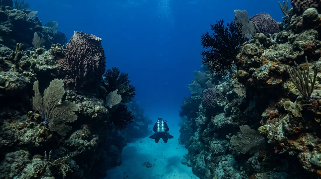
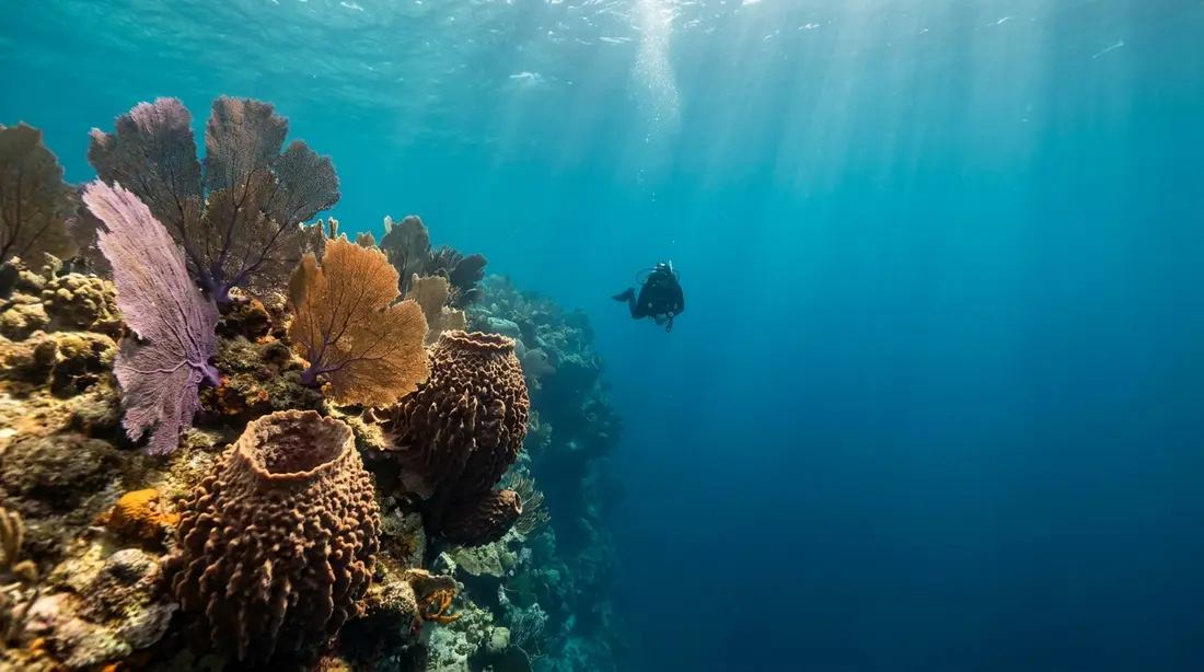
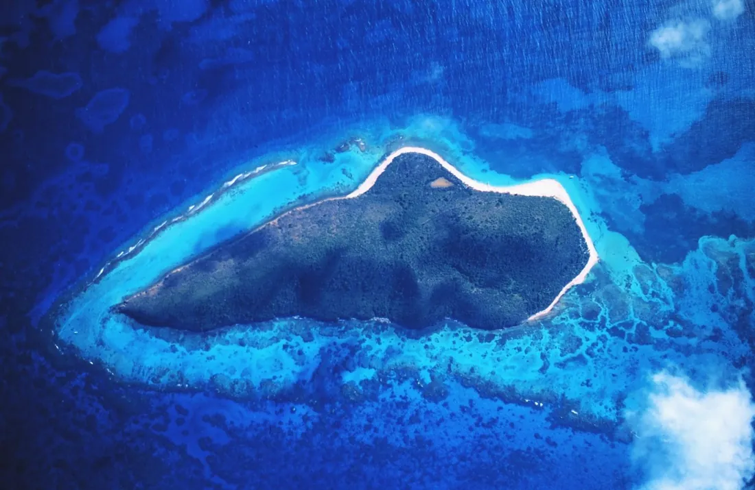
The numbers first, because they explain everything else about the place. The land is small: one uninhabited island of 176 acres, with a ridge that carries an observation point roughly 300 feet above the sea. The water is anything but small: 18,839 submerged acres, about 99 percent of the monument. That ratio is the point. Buck Island Reef exists for what is under the surface, and the Park Service describes its elkhorn coral barrier reef as unique in U.S. waters and the reef system as one of the most intact in the Caribbean.
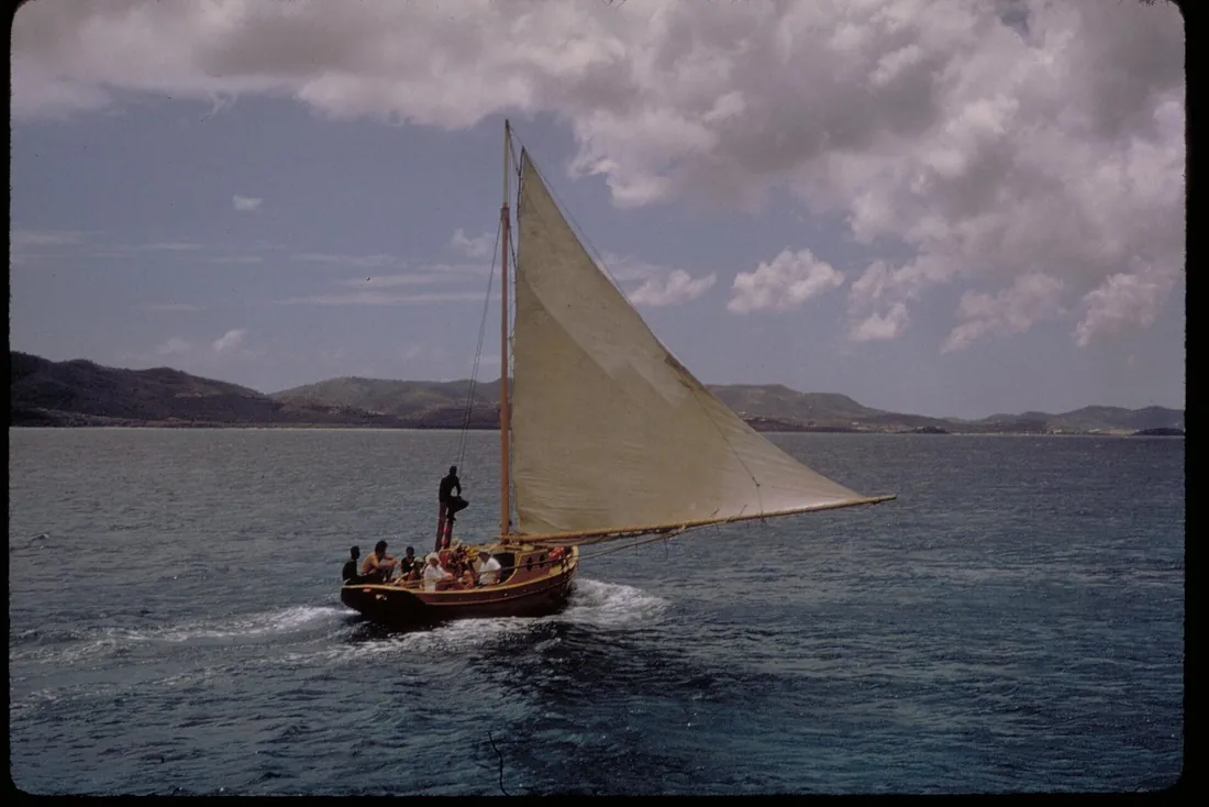
Three practical facts frame every visit. First, access is by boat only, either with a Park Service concessionaire or in a private vessel under the park's rules. Second, the whole monument is no-take: no fishing of any kind, no collecting of anything, on land or in the water, not a shell. Third, the island is day-use only, open 7 a.m. to 5 p.m. and closed at night year-round to protect nesting sea turtles. There is no entrance fee. The crossing from Christiansted is about 5.5 miles of water; boats take 40 minutes to an hour and a half depending on whether they motor or sail, and on the day's sea.
The 1961 proclamation and the 2001 expansion
The Virgin Islands government moved first: in 1948 it set aside Buck Island and its surrounding reefs as a territorial park. Federal protection came on December 28, 1961, when President Kennedy signed Proclamation 3443 establishing Buck Island Reef National Monument, an area of roughly 880 acres taking in the island and the reef around it. The proclamation's language did the reef a favor that lasted: its "marine garden" praise stuck as the lagoon's enduring name, the Marine Garden, which still appears on Park Service maps and in the regulations.
The second act came forty years later. On January 17, 2001, President Clinton expanded the monument by 18,135 acres, bringing it to 19,015 acres, and the expanded monument was placed under the strictest protection in the region: all extractive uses prohibited. That is the legal foundation of the no-take rules below, and it is why the fish inside the boundary are noticeably larger and calmer around swimmers than fish anywhere else off St. Croix. Nothing here has had a reason to fear a person holding a spear or a line for a generation.
The island
Buck Island is a dry, green ridge rising from the sea, with its sand concentrated at the west end. Nobody lives on it and nothing is sold on it; the only structures are Park Service facilities. The vegetation is subtropical dry forest in recovery. The hardwood forest that covered the island, like the forest that covered St. Croix, was largely cut beginning in the 1760s, when ironwood, the lignum vitae that gave the island its early Danish-era names, was a valuable export timber, and residents cut trees for charcoal and grazed sheep and goats on what grew back. Grazing leases continued until the 1920s, which kept the forest suppressed long after the plantations were gone.
A century on, the forest is coming back. Botanists have recorded over 228 plant species on the island, about 180 of them native, and the Park Service describes the dry forest as recovering, with much of the island in shrub thickets working through natural succession. Nineteen of the recorded species are invasive non-natives, six of them, including guinea grass, tan-tan and wild pineapple, listed as immediate concerns that the park manages against. The walk across the island passes through low beach forest, over hillsides of turpentine and pigeon-berry trees to the crest, then down the south side through switchbacks lined with frangipani, organ pipe cactus and bromeliads. The Park Service calls the crossing fairly strenuous and figures it at about 45 minutes at a walking pace; a side trail leads to the observation point over the reef, where the water below shades from lagoon pale to open-ocean dark in one view. A second, easier path near West Beach runs through a manchineel forest to a stand of giant tamarind trees. Manchineel sap and fruit are toxic, so stay on the trail and do not shelter under the trees in rain, the same caution that applies on St. Croix's own south shore.
The barrier reef and the lagoon
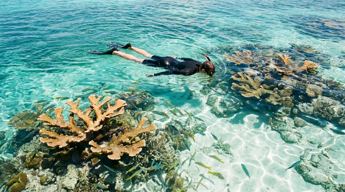
An elkhorn coral barrier reef wraps around two-thirds of the island, standing off the shore and enclosing a lagoon on the island's north and east sides. Elkhorn is the big branching reef-builder of the Caribbean, and Buck Island's barrier formation of it is the reason the monument exists: the Park Service describes this elkhorn barrier reef as unique within United States waters. Inside the barrier, the lagoon is calm on most days even when the open channel is not, which is what makes the snorkeling here workable for almost anyone a boat can carry.
At the island's eastern end the reef forms coral grottoes, and the water inside them is shallow; the Park Service puts the maximum depth in the grottoes at 12 feet. That shallowness matters. A first-time snorkeler in the east lagoon looks down at living coral from close range in protected water, with a guide nearby and a boat a short swim away. The reef has taken its blows over the decades, from storms, bleaching years and disease, as reefs across the Caribbean have, and the Park Service and its research partners monitor it continuously; what a visitor sees today is a protected, studied reef inside the strongest legal protection available, with fish life the open coast cannot match. For where Buck Island fits among the island's other snorkel water, see snorkeling St. Croix.
The underwater trail
The marked underwater trail through the east lagoon is the monument's signature, and only two other underwater trails exist anywhere in the United States. It works like an interpreted footpath, submerged: a marked route through the coral grottoes with signs on the bottom that identify what you are swimming over. Concessionaire guides lead it in small groups, six visitors at a time under the park's rules, at an unhurried pace, and the 12-foot maximum depth means everything on the signs is close enough to read and close enough to see. The trail is closed to scuba diving, closed like the rest of the island from 5 p.m. to 7 a.m., and snorkeled in practice on nearly every concessionaire trip that runs to the island.
This page keeps to what the trail is; the swim itself, who it suits, and how the guided pass actually feels are covered in the underwater trail guide. The short version: if one water hour defines a St. Croix trip, it is this one.
West Beach and Turtle Beach
The island's west end carries its sand and its day-use life. West Beach is the anchoring and mooring area for visiting boats and the trailhead side of the island, with the monument's modest facilities: picnic tables, charcoal grills and vault toilets, the only amenities on the island. Snorkeling is allowed at the West Beach anchoring area as well as in the lagoon, so a beach stop here usually includes easy swimming off the sand.
Turtle Beach, the powder-sand strand at the west end, is regularly named among the most beautiful beaches in the Caribbean and has its own page covering the beach day itself. Two sentences here do it justice: it is the sand every boat builds its day around, and it belongs to nesting turtles at night, which is why the island closes at 5 p.m. sharp.
Rules inside the monument
Buck Island's rules are stricter than any other place a St. Croix visitor will swim, and they are the reason the place looks the way it does. The ones that shape a normal visit:
- No-take, absolutely. All extractive uses are prohibited: fish, lobster, conch, whelk, hermit crabs, seashells, corals living or dead, sea fans, sponges, plants, fruits and seeds, firewood, driftwood, rocks and sand. Possessing fishing gear inside the boundary is itself prohibited.
- No fishing of any kind: spear, rod and reel, hand-line, net, trap, snare or hook. Chumming is prohibited too.
- Day use only. The island and its facilities are closed 5 p.m. to 7 a.m. year-round, and so are the underwater trail and the Marine Garden. Artificial lights on the beach are prohibited during closed hours, for the turtles' sake.
- No drones. Launching, landing or operating an unmanned aircraft anywhere in the monument is prohibited without written approval from the superintendent.
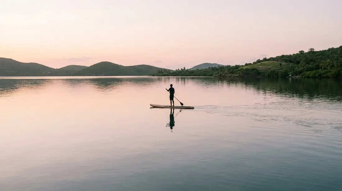
- No personal watercraft, and no towed anything: jet skis, parasailing, kite surfing, wind surfing, wake boarding, water skiing and pulled tubes are all prohibited. Paddleboards, boogie boards and kayaks are allowed.
- Scuba only where designated: recreational diving is limited to the lagoon at the moorings called Boat Cut and SCUBA Cut. The underwater trail is snorkel-only.
- Beach manners are regulated: no glass containers, no staking poles or umbrellas into the sand, no pets on the island or in the water (attended pets may stay on vessels), and alcohol stays on the boats, it is prohibited on the island itself.
- Private vessels: anchoring is allowed only in the designated area off West Beach, overnight anchoring is prohibited, vessels of 91 feet or more may not anchor at all, and the lagoon is closed to vessels 42 feet and larger. Boats on Park Service moorings must leave them when winds of 40 mph or more are forecast. At last check the Park Service had put the anchoring-permit requirement on hold for the designated West Beach area (announced January 2025) while it revises its permitting procedures, with mooring and lagoon permits handled through the park office at Fort Christiansvaern in Christiansted, so private skippers should confirm current requirements with the park before going.
None of this burdens a normal concessionaire trip. The operators hold the permits, know the mooring rules and brief the rest, which for a guest reduces to: reef-safe sunscreen, touch nothing, take nothing, follow the guide's route on the trail.
Sea turtles
Three sea turtle species nest on Buck Island: hawksbill, green and leatherback. The beaches here are among the most closely studied turtle nesting grounds in the hemisphere. The Park Service's Buck Island Sea Turtle Research Program has run every nesting season since 1988, patrolling the beaches at night and tagging every female encountered, one of the longest continuous saturation-tagging studies of hawksbills anywhere. Across the program's first 29 seasons, researchers encountered on average around 43 hawksbill females and about 154 hawksbill nests a year, and the park's species pages report 342 leatherbacks tagged over the program's history, with nesting female counts that have ranged from 18 to 55 in a season, alongside a smaller number of green turtle nests. The Park Service credits the recovery, from a population that poaching and invasive predators had pushed to a remnant by the 1980s, to three things done in sequence: eliminating poaching through patrols, eradicating the island's introduced predators, and closing the beaches at night. By the Park Service's own account the protected beaches now send over 20,000 hatchlings a year out to sea.
Visitors see turtles most often in the water, grazing or surfacing in the lagoon and off West Beach. Give them room, never chase or touch, and remember the wider context: greens and hawksbills also nest on St. Croix's own East End bays, and the largest leatherback nesting beach under U.S. jurisdiction sits at the island's other corner, at Sandy Point National Wildlife Refuge.
Birds and land animals
The bird list for the Virgin Islands and Buck Island runs to about 210 known species, roughly 60 of them native breeders and 129 non-breeding migrants, and the island earns its share of that list because it is a predator-free offshore refuge two protected miles from the nearest road. Brown pelicans, long listed as endangered in the region, nest on the island from June through March; least terns, a threatened species, arrive to nest on the open sand from May to August, which is one more reason the beach rules read the way they do. Magnificent frigatebirds work the air over the channel, and the resident cast includes bananaquits, gray kingbirds, green-throated caribs, kestrels, ospreys, pearly-eyed thrashers and zenaida doves.
The land animal story is headlined by a lizard. The St. Croix ground lizard, an endangered species that vanished from St. Croix itself after the mongoose arrived, survived only on a couple of tiny cays until 2008, when biologists moved 57 of them from Green Cay to a cleared, predator-free Buck Island. The translocation took: the lizards bred within months, and the island now holds an established population of one of the rarest reptiles in U.S. territory. It shares the ground with the St. Croix anole and a dwarf gecko. Watch your feet on the trail and you may see the reintroduction running around in front of you.
Removing the goats, rats and mongoose
Buck Island as it looks today is restoration work, decades of it. When the monument was created, the island carried the standard Caribbean set of introduced animals: goats from the grazing-lease era, mongoose brought to the region in the plantation years, and roof rats. Each did its own damage. Goats kept the dry forest from regrowing; mongoose ate turtle eggs, hatchlings, lizards and ground-nesting birds; rats ate seeds, seedlings and eggs, and were documented hampering the park's efforts to restore native trees, including the lignum vitae the island was once named for.
The park took them out in order. The goats went as the leases ended and the Park Service took over management. The mongoose were trapped out in the 1980s. The rats took a campaign: from 1998 to 2000 the Park Service and USDA Wildlife Services ran an island-wide grid of elevated bait stations with a diphacinone rodenticide, and six years of follow-up trapping produced no rats. Every recovery on this page sits downstream of that work. The turtle rebound, the ground lizard translocation, the tern colonies and the regrowing forest all required an island where nothing introduced was waiting to eat the results.
History before the monument
People have been going to Buck Island for a very long time, almost always for the day, almost always for what the water holds. Archaeology on the island shows Amerindian people from St. Croix visiting from around A.D. 400 to fish, hunt lobsters and large land crabs, gather conch and collect eggs, leaving pottery and hearths in the beach forest, day-trippers seventeen centuries before the catamarans.
Under Denmark the island appears on records as Pocken Island and similar names, after the pockwood or ironwood, the lignum vitae, that grew on it, the timber that would eventually be cut off it. From 1754 a manager named Johann Deidrich ran the island as a small estate worked by six to twelve enslaved Africans. In 1789 the Danish government built a signal station on the island's highest point to warn Fort Christiansvaern of approaching ships, using the same sightline to Christiansted harbor that the observation point serves today. Through the nineteenth and early twentieth centuries the island was cut for charcoal and grazed by sheep and goats under leases that lasted until the 1920s.
Protection then arrived in three steps: the Virgin Islands territorial park of 1948, Kennedy's monument of 1961, and Clinton's expansion of 2001. The dates line up into a neat table:
| Year | What happened |
|---|---|
| ca. A.D. 400 | Amerindian people from St. Croix begin visiting to fish and gather |
| 1754 | Johann Deidrich manages the island as a small Danish-era estate |
| 1760s | Hardwood clearing accelerates; ironwood exported, forest cut for charcoal |
| 1789 | Danish signal station built on the summit to alert Fort Christiansvaern |
| 1920s | Last goat-grazing leases end |
| 1948 | V.I. government protects Buck Island and its reefs as a territorial park |
| 1961 | President Kennedy signs Proclamation 3443; the national monument is born |
| 1980s | Mongoose trapped out; turtle research program begins (1988) |
| 1998–2000 | Roof rats eradicated island-wide |
| 2001 | President Clinton expands the monument to 19,015 acres; all extraction banned |
| 2008 | St. Croix ground lizards translocated from Green Cay |
For the Danish-colonial world the signal station served, walk Christiansted itself with our Christiansted National Historic Site guide; the fort the station signaled still stands on the harbor.
The authorized boats
Visitors reach the monument with Park Service concessionaires, the only companies authorized to carry passengers there. At last check the park listed five companies, six boats as the Park Service counts them, since one operation runs two vessels. Departure points and contacts, from the park's own directions page:
| Concessionaire | Departs from |
|---|---|
| Big Beard's Adventure Tours | Queen Cross Street, Christiansted (boardwalk) |
| Caribbean Sea Adventures | King's Wharf, Christiansted (boardwalk) |
| Jolly Roger Charters | Christiansted Harbor mooring |
| Llewellyn's Charters | St. Croix Yacht Club (East End) |
| Teroro II and Dragonfly (Buck Island Charters) | Green Cay Marina (East End) |
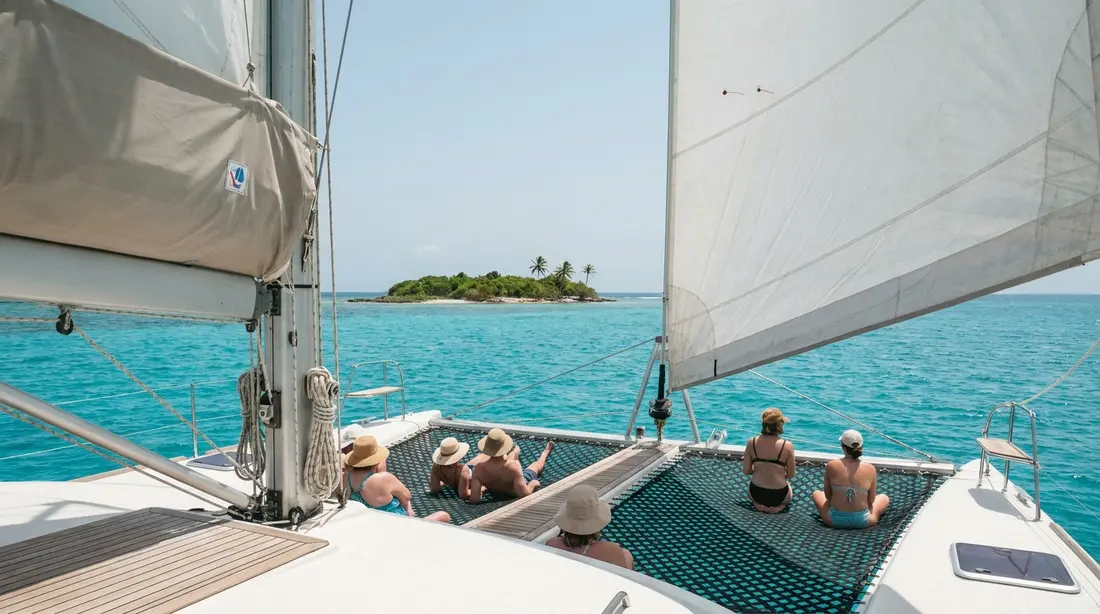
The pattern: most visitors board on the Christiansted boardwalk, and East End guests can board closer to home at Green Cay Marina or the yacht club, a few minutes from our villas on that side. Buck Island Charters has been sailing the run since 1968. Crossings take 40 minutes to an hour and a half, sail slower than motor, and half-day trips generally center on the underwater trail with a Turtle Beach stop while full-day trips add lunch and long beach hours. Which boat suits which group, what each provides and how to book are the subject of the Buck Island boat tours guide; this page stays out of that business except to say all five companies operate under the same park rules, so the reef gets the same protection whichever deck you stand on.
How a trip day runs
Two shapes cover nearly every Buck Island day. The half-day shape is water-first: cross, moor in the east lagoon, swim the trail with a guide, then a shorter stop at the west end sand before the run home; morning departures get the calmest lagoon and the best light on the coral. The full-day shape adds the middle of the day at the beach, usually with lunch, and leaves room for the land trail, the 45-minute crossing to the crest and the observation point, which most half-day passengers never see. If the hike matters to you, book the full day and say so on board, since the trailhead stop depends on the day's plan.
Either way, the practical kit is the same: reef-safe sunscreen (regular formulas harm the coral the trip exists to see), a hat, water, a dry layer for the ride back, and shoes with soles if the hike is in play. Leave the beach umbrella; staking anything into the sand is against the rules, and the boats carry what shade there is. Book early in your stay rather than late, so a windy day can push the trip instead of canceling it. Guests planning the wider week can slot the boat day using our experiences page and the weather guide.
Conditions by season
The monument is open year-round, and there is no month when a Buck Island trip is a bad idea; what changes is the crossing and the surface of the lagoon. Air temperatures run warm and narrow, with average highs between 84°F and 89°F and lows in the 70s, and the water is swimmable in every month.
| Season | On the crossing and the reef |
|---|---|
| Mid-December to mid-March | Christmas Winds: brisk trades, livelier channel, afternoon chop. Morning departures are the calm ones. Peak demand, book ahead. |
| April to June | Winds ease, water clears, boats quieter. A favorite window. |
| July to October | Typically the flattest, clearest lagoon of the year. Hurricane season runs June 1 to November 30, peaking August to October: watch forecasts calmly, book flexibly. Occasional Saharan dust hazes the horizon. |
| November to mid-December | Green, quiet shoulder; conditions usually settled before the winter trades fill in. |
Operators make the weather calls, and a postponed trip is common enough in winter that the standing advice is to aim the boat at the front half of your week. The island closes at 5 p.m. in every season, so there is no sunset version of this trip; the sunset views of Buck Island belong to the East End shore and the villa decks that face it.
Questions guests ask
Can you visit Buck Island on your own boat?
Yes, under the park's rules. Anchoring is limited to the designated area off West Beach, overnight anchoring is prohibited, the lagoon is closed to vessels 42 feet and larger, and boats 91 feet and up may not anchor at all. At last check the park had set the anchoring-permit requirement aside for the designated area while it revises procedures, announced in January 2025, with mooring and lagoon permits handled through the park office at Fort Christiansvaern; applications there take about five business days to process at last check. Rules change; confirm with the park before you sail. Most visitors find the concessionaire trip simpler.
Does it cost anything to enter the monument?
No. The Park Service charges no entrance fee at Buck Island Reef National Monument. What you pay is the boat: concessionaire trips are priced by the operator and vary by boat and trip length, so check current rates when you book. There are no vendors, no rentals and nothing for sale on the island itself, which is part of why it looks the way it does. Bring what you need and carry out what you bring.
How far is Buck Island from St. Croix?
About 1.5 miles off the north-east coast at the nearest point, and about a 5.5-mile run from Christiansted harbor, where most trips start. Crossings take 40 minutes to an hour and a half depending on the boat and the day; power catamarans are fastest, sailing trips slower and quieter. From the East End the island sits close enough that several of our villas look straight at it across the channel, and East End departures from Green Cay Marina shorten the ride.
Can you snorkel Buck Island without a guide?
On a concessionaire trip, the underwater trail is swum with the crew leading small groups, and that is how nearly everyone sees it. Snorkeling is also allowed in the lagoon and at the West Beach anchoring area generally, so private-boat visitors swim under the same rules without a formal guide. The trail is closed to scuba; divers use the designated lagoon moorings, Boat Cut and SCUBA Cut. Wherever you swim, the law is uniform: touch nothing, stand on nothing, take nothing.
Are drones allowed at Buck Island?
No. Launching, landing or operating an unmanned aircraft on or over the monument's lands and waters is prohibited without written approval from the superintendent, and the same rule covers Christiansted National Historic Site and Salt River Bay. Leave the drone at the villa. The legal photo spots are the observation point on the island's ridge and the deck of the boat, and the reef photographs best from underneath anyway, with a simple waterproof camera along the trail.
What is the best time of year for the trip?
Summer through early fall usually offers the flattest crossing and the clearest lagoon, with hurricane-season forecasts as the trade-off to watch. Winter brings the Christmas Winds, which make afternoons choppy; winter visitors should book morning departures and put the trip early in the week so weather can reschedule it. Spring splits the difference. There is no closed season and the water is warm year-round, so the real answer is: whichever month you are here, with a morning boat.
Do sea turtles interrupt visits during nesting season?
No, because the park designed the visit around them. Nesting happens at night, and the island closes to everyone from 5 p.m. to 7 a.m. year-round, with beach lights prohibited after hours, so day visitors and nesting turtles never meet on the sand. What visitors do get is turtles in the water, grazing and surfacing in the lagoon, plus tracks on the beach some mornings in season. The nighttime research patrols that tag the females are Park Service science work, separate from any public tour.
Villas facing the monument
From the East End of St. Croix, Buck Island is the view itself. The Cerulean and the Buck Island Overlook face the monument across the channel, close enough to watch the day boats cross to it, and Moko Vista and Dragonfly put Green Cay Marina's East End departures a few minutes from the door. Guests on that side of the island tend to book the boat for early in the week and spend the rest of it looking at where they swam. The full set is on our East End villas page, and our on-island team books the trip as a matter of routine.
Sources
Written from official and first-party sources, checked August 2026. Hours, prices and event dates change — confirm before you go.
In this guide
Stay nearby
Private oceanfront on the East End with a sandy, swimmable beach, pool, outdoor kitchen and a separate guest cottage. Sleeps twelve.
 The Cerulean5 bd · 5 ba · sleeps 12 · Christiansted
More in On the Water
Sources
12 references, listed in full at the end of this guide — official park, refuge, tourism-board and business sources, checked August 2026.