Two Landscapes, One Island
Fifty inches of rain in the western rainforest, twenty-five on the cactus East End: how one 22-mile island grew two different worlds.
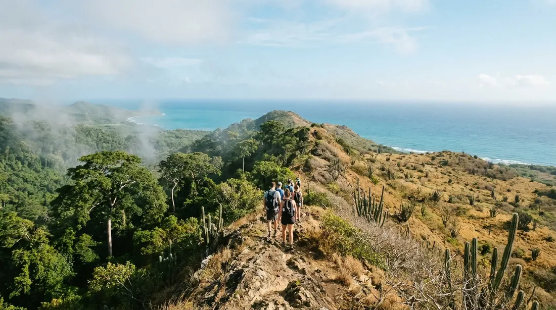
St. Croix runs about 22 miles end to end, and across that distance the annual rainfall nearly doubles. A U.S. Geological Survey water study mapped the gradient at roughly 30 inches a year near the eastern tip and roughly 55 inches in the northwestern mountains. The result is an island with a forest canopy at one end, cactus and thorn scrub at the other, and a farmed plain, a network of seasonal streams, and a chain of salt ponds and mangroves stitched between them. This page is the island's natural-science reference: the mechanism behind the split, what actually grows and lives in each zone, and where to stand to see it all.
How the rain gradient works
Start with the wind. The trade winds blow out of the east across St. Croix nearly every day of the year, and they arrive carrying moisture picked up over a few thousand miles of warm Atlantic water. What happens to that moisture depends entirely on what the air hits first.
The island's shape decides it. The USGS describes St. Croix's northwestern and eastern sections as low mountains and rugged hills, with the central and southwestern sections low-lying to gently rolling. The northwestern range is the tall part: Mount Eagle, the island's high point, reaches 1,165 feet there. When the moist trade-wind air reaches that high ground it has nowhere to go except up. Rising air cools, cool air holds less water, and the surplus condenses into cloud and falls as rain on the hills. Meteorologists call the process orographic lift, and on St. Croix the USGS found it works almost like a dial: average annual rainfall on the island tracks elevation nearly in direct proportion, adjusted for which way the wind blows.
The eastern end gets the opposite treatment. Its hills are lower, the air passing over them barely rises, and much of the moisture that might have fallen there ends up traveling on to the taller ground downwind or staying in the sky altogether. Air that has already dropped its water and then descends warms as it sinks, which dries it further. The East End sits in that regime year-round, which is why its slopes carry cactus while slopes 20 miles away carry ferns. The same physics explains a bonus fact swimmers figure out fast: the west coast is the leeward, sheltered side, and its water is usually the calmest on the island.
None of this requires a continent. The whole demonstration fits inside 84 square miles, which is what makes St. Croix unusual. Plenty of islands are wet and plenty are dry; few let you drive from one climate to the other in well under an hour.
The rainfall numbers
The figures worth keeping are these. The USGS survey of the island's water resources put the spread at about 30 inches a year in eastern St. Croix and about 55 inches in the northwestern mountains. Commonly cited figures for the East End as a whole run 25 to 38 inches a year, and the forested northwest is generally credited with more than 50. Mid-island and the Christiansted area fall in between, which suits the pasture and dry woodland that covers them.
Numbers like these average out a lot of year-to-year drama. A wet fall can green the East End until it looks like ranch country after rain; a dry spring can brown the edges of the forest itself. The gradient holds through all of it. However much rain a given year delivers, the northwest hills take the largest share and the eastern tip takes the smallest, because the mechanism never changes. For how the rainfall spreads across the calendar, see the weather guide.
Rainforest as a local term
Crucians call the forested northwest the Rain Forest, capital letters and all, and the name is worth a footnote. By the textbook definition it does not qualify: true rainforests receive on the order of 100 inches of rain a year or more and have no real dry season, and the wettest corner of St. Croix reaches roughly half that. What the island actually has is a moist tropical forest, the kind ecologists file under the moist forest life zones, standing next to one of the Caribbean's better examples of the dry forest life zone. The label matters less than the experience. Under the canopy along Mahogany Road the light drops, the air goes damp and green, and the vegetation closes overhead exactly the way visitors expect a rainforest to behave. The name fits the feel, if loosely the definition, and nobody on the island is going to stop using it.
What grows in the western forest
The canopy trees carry most of the character. Mahogany is the signature: a wide-spreading shade tree whose dense reddish wood was cut for furniture and boats for centuries, and which now arches over the western roads. Kapok, also called the silk-cotton tree, is the giant of the group; Crucians know it as the jumbie tree, a name tied to old beliefs about spirits living in its buttressed trunk. Its seed pods split open into a fluff that once stuffed pillows and life preservers, and its light wood was carved into dugout canoes. The turpentine tree fills out the trio. Islanders and field guides both call it the tourist tree for its coppery bark, which peels the way a first-week visitor's shoulders do. Rain trees, locally samaan, spread their crowns over the clearings, and the understory runs to ferns, vines, and the damp-loving plants that vanish entirely from the landscape a few miles east.
One more tree is everywhere, and its story says a lot about the island. Tan-tan, a fast-growing small tree botanists know as Leucaena leucocephala, was introduced and has since spread across almost the whole of St. Croix. U.S. Forest Service surveys of the territory's woodlands rank it among the most dominant small trees in the islands, a signature of land that was once cleared and then let go. It fixes nitrogen and rebuilds tired soil, and it also crowds out native plants, which makes it both nurse and pest in the same trunk.
That mix of planted, introduced, and regrown is the forest's real history. When the sugar economy peaked, St. Croix had been stripped almost bare; one territorial forest assessment estimates about 96 percent of the island stood deforested in the 1830s. What covers the hills today is mostly second growth that returned as agriculture retreated, and the recovery is substantial: the Forest Service's 2014 inventory measured 29,610 acres of forest on St. Croix, 56.1 percent of the island. The green northwest, in other words, is a landscape that came back.
Exploring it is covered elsewhere on this site, so this page will point rather than repeat: the paved canopy route is the Mahogany Road drive, the 1926 dam and the island's one seasonal waterfall are in the Creque Dam guide, the unpaved ridge route is the Scenic Road, and the whole western circuit is assembled in the rainforest and west end guide.
Birds of the green side
The moist side concentrates the island's birdlife wherever flowers and fruit concentrate. The bananaquit, the official bird of the U.S. Virgin Islands, works every garden and flowering tree on the island, yellow-chested and constant. Two hummingbirds share the territory, the green-throated carib and the Antillean crested hummingbird, and birders at St. George Village Botanical Garden report the pair sparring over feeding rights among the plantings; the garden has recorded more than a hundred species across its grounds. Pearly-eyed thrashers patrol the fruit trees. Scaly-naped pigeons, big and slate-colored, move through the canopy, though observers report their numbers declining. The secretive mangrove cuckoo turns up in scrub and coastal thickets, and a possible first island nesting record was logged at the Southgate reserve east of Christiansted. Egrets and kestrels split the open country between them, the egrets shadowing cattle in the pastures and the kestrels hovering over the grass from the wires.
The East End thorn scrub
Drive east past Christiansted and the vegetation shortens, stiffens, and grows spines. This is the dry forest and thorn scrub of the East End, and it is as distinct a plant community as the western canopy.
The cactus family supplies the landmarks. The pipe organ cactus stands tall and narrow across the eastern hills, armed with woody needles that reach a couple of inches long; it is the plant most responsible for the desert first impression. The Turk's cap cactus grows low among the rocks, a barrel topped with a reddish fez-like cap that pushes out small pink blooms, and it is abundant toward the island's tip. Century plants send up their tall flowering stalks from rosettes of blade-shaped leaves, and one of them is a scientific treasure: Eggers' century plant, Agave eggersiana, grows naturally nowhere on earth except St. Croix. The U.S. Fish and Wildlife Service lists it as endangered and finds it confined to coastal cliffs and dry shrubland on the island. The thorny backbone of the scrub is casha, the local name for acacia: long paired spines, small yellow puffball flowers, a tree that tolerates drought, salt, and wind, and that tends to grow alone in rocky ground with only cactus for company.
The result reads as desert to most eyes, and the reading is fair even though the rainfall says semi-arid. Between the cactus and casha the ground shows through, the hills go tawny outside the wet months, and the wind is constant. The visual jolt arrives at the coast, where the dry brown hills drop straight into water of a blue that seems imported from a different climate.
The places to walk it: the cactus-lined trail into Jack's and Isaac's Bays inside the Nature Conservancy's roughly 300-acre preserve, the short scramble up Goat Hill, and the sunrise pilgrimage to Point Udall. The full region, radio telescope and all, is in the East End guide.
Drought adaptations
Everything on the dry side is built around the same problem: months can pass with little rain, and the wind steals water from every leaf. The solutions are visible once you know to look. Cactus skip leaves altogether and bank water in their stems, with pleats that let the plant swell after rain and shrink through the dry stretch. Agaves store water in thick leaves coated with wax and edged with teeth. Casha and its thorn-scrub companions shrink their leaves to tiny leaflets that spend less water, and many drop foliage entirely in a hard dry season, standing gray and apparently dead until the next rain flushes them green within days. Spines do double duty, discouraging browsers in a landscape where every mouthful of moisture matters. The East End after a wet October and the East End in a dry April are two different color schemes on the same bones, and both are worth seeing.
The mid-island plain
Between the wet hills and the dry tip lies the landscape most visitors cross without registering it as one: the central plain. It is the transition zone in every sense, catching middling rainfall and carrying vegetation that splits the difference, grassland and pasture studded with tamarind, tan-tan thickets, and big lone shade trees.
Its openness is historical. The plain holds the island's deepest soils, which is why the Danish sugar estates concentrated there and why the island once carried more than 150 windmills grinding cane. Two centuries of cultivation erased the original forest so thoroughly that today's plain is less a natural community and more a long-running afterimage of agriculture: former cane fields gone to grass, estate boundaries still visible as tree lines, cattle where the cane was. The stone mill towers still standing in pastures are the plain's fossil record. Under it all lies the Kingshill aquifer, the island's main groundwater body, fed by the modest rain the plain receives and by the streams that cross it.
One tree on the plain outranks every other in historical weight. At Grove Place stands a baobab, an African species that reached St. Croix around 1750; historians of the island recount that enslaved Africans carried baobab seeds through the Middle Passage in their hair and jewelry. The Grove Place tree is estimated at more than 250 years old, stands on the National Register of Historic Trees, and served for generations as the community's gathering place, including for the meetings that launched the Caribbean's first organized labor movement. A tree from the Sahel, rooted in a Danish sugar plain, at the center of Crucian political history: the mid-island in one organism.
The plain's human landmarks have their own pages: Estate Whim for the estate system itself, and St. George Village Botanical Garden, which grows more than 1,500 plant species through the ruins of a plantation village and functions as the island's best side-by-side display of wet-side and dry-side flora.
The guts
St. Croix has a stream system, and almost nobody arrives knowing it. The islands call their watercourses guts, a Virgin Islands word with a long paper trail; researchers trace it through the older Caribbean spelling ghaut, possibly back to the Indian term ghat, and territorial law defines a gut broadly as any natural or built waterway, permanent or intermittent. The word is on the map everywhere once you start looking: Bethlehem Gut, River Gut, Caledonia Gut.
The USGS counts four principal streams on the island, every one rising in the wet Northside Range, with River Gut the largest, running south across the Kingshill aquifer to the sea. The rest of the island's guts are short and steep. What none of them are is permanent. The major streams flow intermittently and the minor ones only after real rain, so the island's rivers spend most of the year as dry, boulder-lined green corridors threading down through the hills. They matter anyway: guts recharge the aquifer, feed the coastal ponds and mangroves, and hold a ribbon of moist-forest vegetation even where they cross dry country, which makes them wildlife corridors across the whole gradient.
Respect them in wet weather. A gut that has been dry for months can run violently within minutes when a storm cell parks over the hills, and hikers should never be in one with heavy rain falling or forecast. The island's single natural waterfall, in the Caledonia Valley, is a gut in action and runs only after rain; the Creque Dam guide linked above covers how to see it safely.
The coasts
Where the land meets the sea, St. Croix keeps a third set of habitats that belongs to neither the wet end nor the dry.
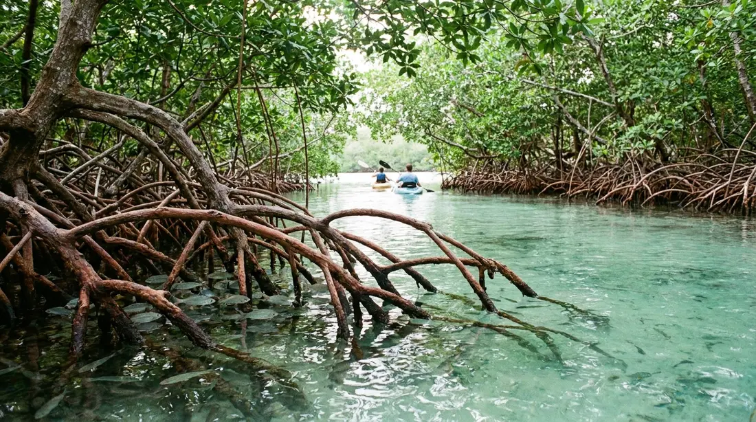
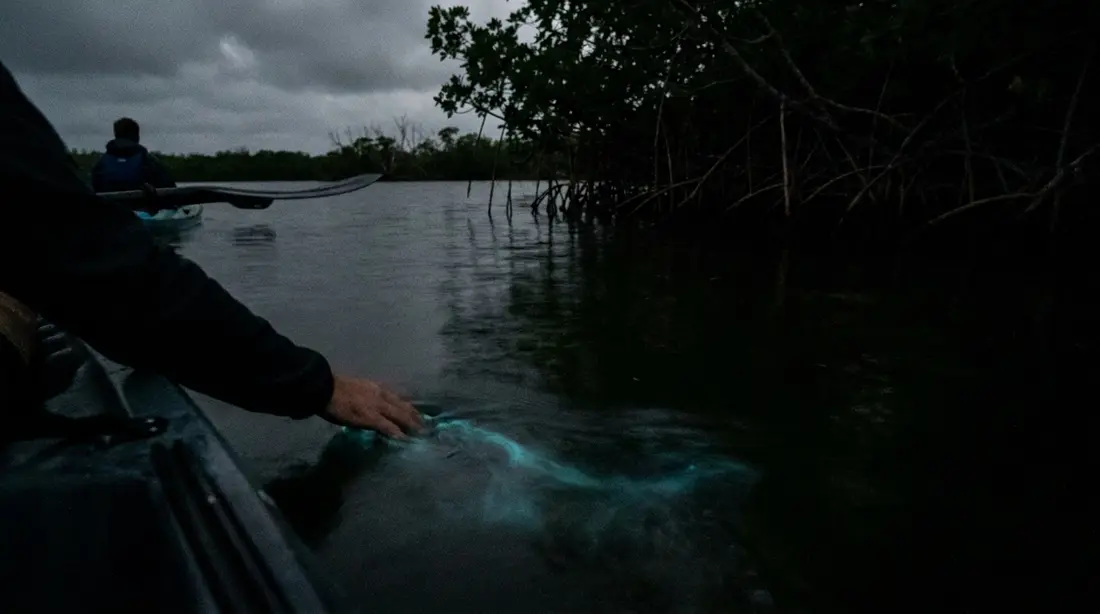
The mangroves are the headline. Salt River Bay, on the north shore where the Columbus expedition touched in 1493, shelters some of the largest mangrove stands left in the Virgin Islands inside its 1,015-acre national park, red mangroves on stilt roots nursing juvenile reef fish and holding the shoreline together. The full story is in the Salt River mangrove guide, and the same bay hosts one of the island's two glowing bays, covered in the bio bay guide.
The salt ponds are the quieter treasure. These shallow coastal lagoons, cut off from the sea by berms of sand and coral rubble, concentrate salt and brine life and feed extraordinary numbers of birds. Southgate Pond, in the St. Croix Environmental Association's 101.5-acre Southgate Coastal Reserve just east of Christiansted, records more than 100 resident and migrant species, and least terns hide their nests around its flats. Great Pond on the southeastern shore is the territory's second-largest salt pond and one of St. Croix's largest remaining mangrove tracts; BirdLife International flags it as an Important Bird Area for its white-crowned pigeons, green-throated caribs, Antillean crested hummingbirds, and Caribbean elaenias, plus a least tern breeding colony that in one surveyed year held 134 pairs. Around the ponds grows beach forest, the salt-tolerant fringe of sea grape and maho that once lined most Caribbean shores.
The coasts also hold the island's most famous wildlife event, the sea turtle nesting beaches at Sandy Point and the East End bays, which have their own reference in the turtle guide.
Wildlife by landscape
The animals sort themselves along the same gradient as the plants, with one big historical asterisk: much of what a visitor sees moving was brought here.
The white-tailed deer came first. A Danish ship log records five deer released on St. Croix in or before 1790, almost certainly for hunting, and by 1840 they were described as living in the island's mountainous parts. Their descendants, noticeably smaller than mainland deer, graze the pastures and forest edges island-wide and cross the roads at dawn and dusk.
The mongoose came second, and its story deserves telling straight. The small Indian mongoose was released on St. Croix in 1884 to kill the rats eating the sugarcane. It largely failed at that job; when researchers later examined mongoose stomachs on the island, lizards outnumbered rats among the contents by a wide margin. Visitors sometimes hear that the mongoose rid the island of snakes, and it is true St. Croix has no venomous snakes, but the animal's documented legacy is grimmer: it hunted the St. Croix ground lizard, found nowhere else on earth, completely off the main island. None has been seen on St. Croix proper since 1968.
The ground lizard survived on the mongoose-free cays, and its slow comeback is one of the better conservation stories in the Caribbean. Small populations held on at Protestant Cay, the islet in Christiansted harbor, and Green Cay just offshore; a created population thrives on Ruth Cay. In 2008 biologists moved 57 lizards from Green Cay to Buck Island after a rat and mongoose eradication there, and that population has grown past 1,000, the largest anywhere. In 2022 the territory began releases back on the main island itself, at Sandy Point and a university wetland reserve. A sharp-eyed visitor on a Buck Island trip has a real chance of seeing a striped, foot-long lizard that nearly vanished from the planet.
The rest of the cast: green iguanas sun themselves in the trees and mangroves, with Salt River and the Tamarind Reef shoreline among the reliable places to find them. Hermit crabs by the hundreds work the beach forest and trail edges, hauling borrowed shells uphill. Bats come off the rooftops and out of the old sugar-mill towers at dusk. Full watching notes are in the island wildlife guide.
| Animal | Status on St. Croix | Best odds of seeing it |
|---|---|---|
| White-tailed deer | Introduced by 1790, island-wide | Pastures and road edges, dawn and dusk |
| Small Indian mongoose | Introduced 1884, island-wide | Darting across any road, midday |
| St. Croix ground lizard | Endemic, endangered; cays only plus new releases | Buck Island trips; Protestant Cay |
| Green iguana | Established, common | Salt River, Tamarind Reef, hotel grounds |
| Bananaquit | Native; official territorial bird | Every flowering garden on the island |
| Least tern | Native; nests at salt ponds | Southgate and Great Pond in nesting season |
| Hermit crab | Native, abundant | East End trails and beach forest |
The landscapes at a glance
| Zone | Yearly rain | Signature plants | Where to stand in it |
|---|---|---|---|
| Northwest hills, moist forest | 50 inches and up | Mahogany, kapok, turpentine tree, ferns | Mahogany Road; Creque Dam; Scenic Road |
| Central plain | Middle of the range | Pasture grass, tamarind, tan-tan, lone baobab | Centerline Road; Estate Whim; the botanical garden |
| East End dry scrub | Roughly 25 to 38 inches; about 30 at the tip | Pipe organ and Turk's cap cactus, century plants, casha | Point Udall road; Goat Hill; Jack's and Isaac's trail |
| Coastal fringe | Follows its shore | Red mangrove, sea grape, salt-pond flats | Salt River Bay; Southgate reserve; Great Pond |
Seeing both in one day
The two-climates day is the single best free thing St. Croix offers, and it needs no planning beyond a fuel stop. The classic order runs with the sun: first light among the cactus at Point Udall, the morning working west, midday under the canopy on Mahogany Road with a stop in the forest, and the last hour on the calm leeward water at Frederiksted, where the sunset lands. Run it in reverse and you trade sunrise in the desert for sunrise over the forest, which is the lesser deal. The full route, with times, road numbers, and where the gas stations are, is the drive-around-the-island guide; the walking versions are in the hiking guide on this site. However you sequence it, watch for the transition itself, a stretch of a few minutes around mid-island where the roadside vegetation visibly changes teams.
Dry years and drought
The gradient describes an average, and some years fall hard below it. In 2015 a regional drought dried ponds and pastures across the territory and hit St. Croix's livestock farmers badly. In mid-2026, federal drought monitoring again showed extreme drought conditions across the U.S. Virgin Islands, with ponds low and cistern deliveries in demand; conditions like these come and go with the larger Caribbean rainfall cycle, so check the current status rather than assuming either extreme. Climate researchers working on the region expect drought episodes to grow more frequent as temperatures rise, though projections for a single small island carry real uncertainty. For a visitor the practical effects are mostly visual: in a drought year the East End browns deeply, the guts stay silent, and even the western forest dulls; after a wet fall the whole island greens from tip to tip. The sea, for what it matters, does not care, and neither do the beaches.
Questions guests ask
Is the St. Croix rainforest a real rainforest?
By strict definition, no. True rainforests take on the order of 100 or more inches of rain a year with no marked dry season, and the wettest part of St. Croix receives roughly 55. Ecologists class the northwest hills as moist tropical forest. In practice the distinction dissolves under the canopy: closed shade, damp air, ferns, vines, and hundred-foot trees deliver the full rainforest experience, and the local name has stuck for generations, capital R and capital F.
Why is one end of the island a desert?
Rain shadow. Trade winds push moist ocean air onto the island from the east. The low eastern hills barely lift the air, so little rain falls there; the tall northwestern range forces the air high enough to cool and drop its moisture, so the rain concentrates on that end. The eastern tip gets around 30 inches a year, semi-arid territory, and its plants respond with spines, wax, and water storage. It looks like a desert, functions much like one, and sits 40 minutes from a fern gully.
Can it be raining on one part of the island and sunny on another?
Routinely, and locals plan around it. A shower soaking the north shore hills often leaves the East End dry, since most rain cells ride the trade winds west and the dry side simply sees fewer of them. Any radar app shows which parts of the island a cell will cross. If weather interferes with a beach morning, driving out from under it is a legitimate and frequently successful move, usually toward the east.
What is a gut?
The Virgin Islands word for a stream or the steep ravine that carries one, from the older Caribbean spelling ghaut. St. Croix's guts rise mostly in the wet northwestern hills, and none of them flow year-round in a normal year: they run after real rain and stand dry otherwise. They recharge the island's groundwater and act as green wildlife corridors. The safety rule is absolute: stay out of guts during and right after heavy rain, because they flood fast.
Are there dangerous animals in either landscape?
Nothing that should change your plans. St. Croix has no venomous snakes, no large predators, and nothing in the scrub worse than the plants themselves; the cactus spines and casha thorns are the real hazard on dry-side trails, so wear closed shoes. Mosquitoes concentrate in the shady, wet west, which is the one corner of the island where repellent earns its space. In the water, standard reef rules apply, and they are covered in the snorkeling guides.
When is the island at its greenest?
Late fall. The September-to-November stretch delivers the biggest share of the year's rain, and by November even the East End can look upholstered, with the cactus standing in fresh grass. The deep dry season, February through April, browns the eastern half and thins the plain, while the northwest forest stays green on its larger water budget. Both versions are photogenic; they are simply different islands to the camera.
Where can I see the cactus landscape without a hike?
Drive the East End road to Point Udall. The pavement runs the whole way through pipe organ cactus and thorn scrub to the easternmost parking lot in the United States, with the landscape in full view from the car and at the overlook. The botanical garden's cactus collection mid-island is the even easier version, with labels. For the full on-foot immersion, the trail to Jack's and Isaac's Bays crosses the scrub for about twenty minutes each way.
Villas on both sides of the island
Our homes sit on the dry, sunny side of the gradient, which is where St. Croix's beach weather lives. The Cerulean faces Buck Island from the East End itself, cactus country at the door and the island's best rainfall odds overhead. Shoy's Beach House sits on a calm beach just east of Christiansted, at the green edge of the dry zone. From either, the wet side works as a day trip in the best direction: you keep the sun at home and drive to the forest, then come back to dinner on the leeward coast. The rest of the beachfront collection spans the island end to end.
Sources
Written from official and first-party sources, checked August 2026. Hours, prices and event dates change — confirm before you go.
- U.S. Geological Survey
- U.S. Geological Survey
- U.S. Geological Survey
- research.fs.usda.gov
- geographicconsulting.com
- vinow.com
- GoToStCroix
- GoToStCroix
- U.S. Fish & Wildlife Service
- U.S. Fish & Wildlife Service
- U.S. Fish & Wildlife Service
- Government of the U.S. Virgin Islands
- researchgate.net
- Wikipedia
- stxenvironmental.org
- laaudubon.org
- stjohnsource.com
- drought.gov
In this guide
Stay nearby
Private oceanfront on the East End with a sandy, swimmable beach, pool, outdoor kitchen and a separate guest cottage. Sleeps twelve.
 The Cerulean5 bd · 5 ba · sleeps 12 · Christiansted
More in Nature & Wildlife
Sources
18 references, listed in full at the end of this guide — official park, refuge, tourism-board and business sources, checked August 2026.