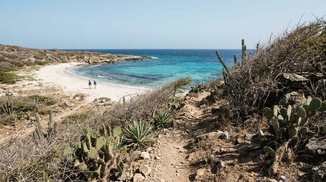
Jack's & Isaac's Bays
Two undeveloped hike-in beaches inside a 301-acre Nature Conservancy preserve at the island's east tip, with reef snorkeling and turtle nesting.
Jack's Bay and Isaac's Bay are the last two beaches on St. Croix that you cannot drive to. They sit at the island's far eastern tip inside a Nature Conservancy preserve of roughly 300 acres, they have no road, no shade, no water and no lifeguard, and the fifteen-to-twenty-minute walk that guards them is the entire reason they are usually empty. This page is the full reference: what the preserve is, how the two bays differ, both routes in, the snorkeling, the turtle rules, and when to go.
The preserve
The land behind and between the two bays belongs to The Nature Conservancy, which bought it in 1999 and manages it as the Jack and Isaac Bay Preserve. The Conservancy's own materials describe it as 300 acres of rolling hills running down to white sand; the trail maps round it to 301. Either way, the boundary takes in the two named bays, the dry upland forest above them, and the scrubby ridge that walls them off from the nearest pavement.
The protection story explains why the beaches look the way they do. Before the purchase, this corner of the island was slated for residential development, the standard fate of Caribbean shoreline with sand this good. The sale took the tip of the island off the market permanently, and the Conservancy's only additions since have been a set of low-impact walking trails. Nothing else has been built. That single decision in 1999 is why a visitor in 2026 can stand on a swimmable white-sand beach in the United States Virgin Islands and see no structure of any kind.
The water in front of the preserve is protected too. The bays sit against the St. Croix East End Marine Park, the territory's first marine protected area, and the water off Jack's, Isaac's and East End Bay carries the park's strictest designation, a turtle wildlife preserve extending well over a mile offshore where fishing and collecting of any kind are prohibited. Land and sea are covered by complementary rules; the practical version for a swimmer is simple, and appears below. The wider park is mapped in the East End guide.
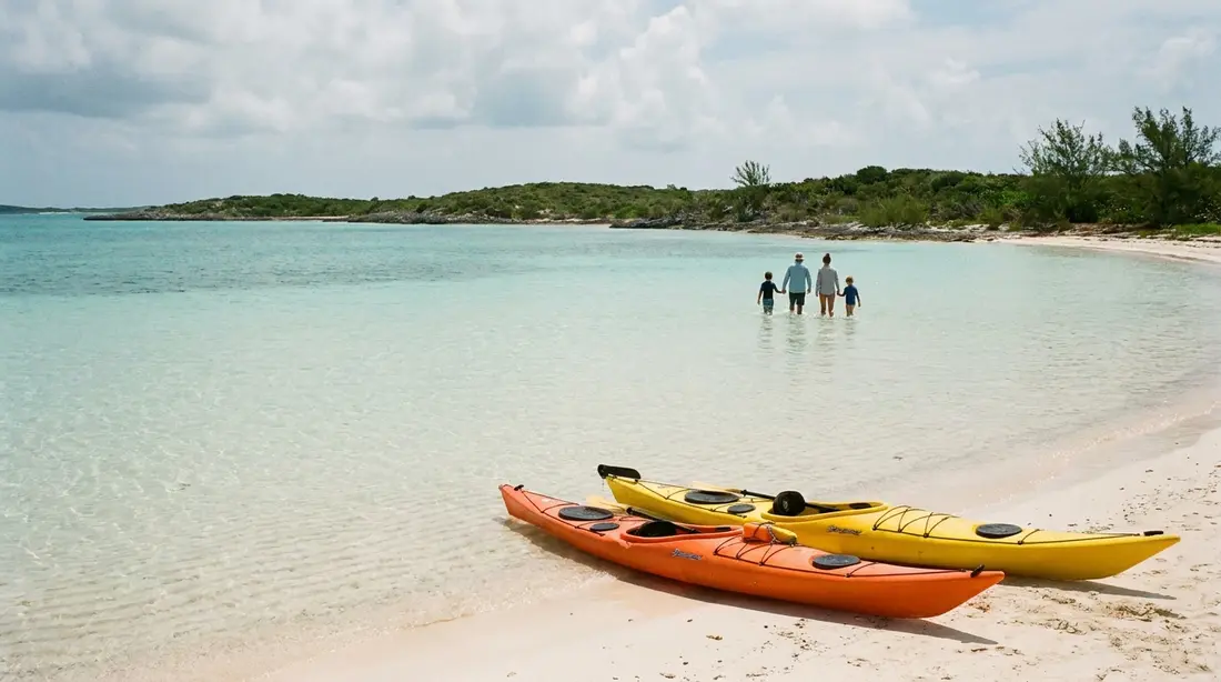
Jack's Bay and Isaac's Bay, told apart
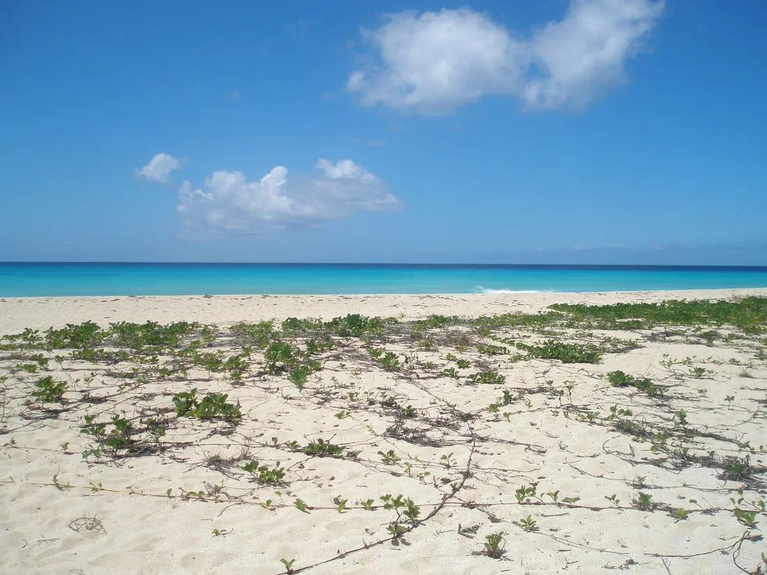
Walkers arriving from the Point Udall side meet the bays in a fixed order, and the order is the easiest way to keep the names straight. Isaac's Bay comes first. It is the closer, slightly busier and more swimmable of the two: a curve of white sand with deeper water close in, fewer rocks in the shallows, and less seaweed on the bottom, which is why nearly every snorkeling write-up names Isaac's as the better of the pair for time in the water.
Jack's Bay lies farther west, past a low headland, and reaching it takes one more push on a connecting path of about seven-tenths of a mile. It faces the sea from the south side of the island's eastern end. Because it costs extra effort beyond a beach that already satisfies most people, Jack's is routinely deserted even when Isaac's has a handful of towels on it. Hikers' reports mention picnic tables at Jack's; treat anything you find out there as a bonus rather than a plan. Beyond Jack's, a short spur of roughly three-tenths of a mile continues to Hughes Point, the rocky corner past the sand, for walkers who want the coastline rather than another swim.
One more piece of shoreline belongs in the picture. Coming down from Point Udall, the first water you actually see is East End Bay, a stonier, more exposed cove short of Isaac's. It is part of the same protected coast and the same turtle-nesting shoreline, and some walkers mistake it for their destination and stop early. If the beach you have reached is rocky and rough, you have not arrived; carry on over the rise.
Getting to the trailheads
Both doors into the preserve hang off the same road. Route 82, East End Road, leaves Christiansted along the north shore and runs the length of the East End; the drive to its far end takes 25 to 30 minutes from town, 10 to 15 from most of our East End houses, on pavement the whole way. No four-wheel drive is needed for either trailhead, and no St. Croix rental plan should skip the car entirely, since nothing else reaches this end of the island; the rental car guide covers the practicalities, including the left-side driving.
For the main approach, follow Route 82 until it begins the final climb toward the Millennium Monument and watch for the small signed lot on the right before the monument loop. For the Jack Bay track, the landmark is impossible to miss: the giant white dish of the radio observatory on East End Road across from Cramer's Park, with the gravel track taking off nearby. A two-car party can stage one vehicle at each end and walk the preserve through in a single direction, which turns the trail system into a point-to-point coastal hike instead of an out-and-back, with the swim placed wherever the group wants it.
Two timing notes shape the drive. Deer cross East End Road at dawn and dusk, exactly the hours this outing favors, so drive the early miles gently. And the road dead-ends at the point, so there is no through-traffic; the only other people out this far are sunrise-watchers, hikers and the odd runner, and on a weekday morning the trailhead lot is often empty.
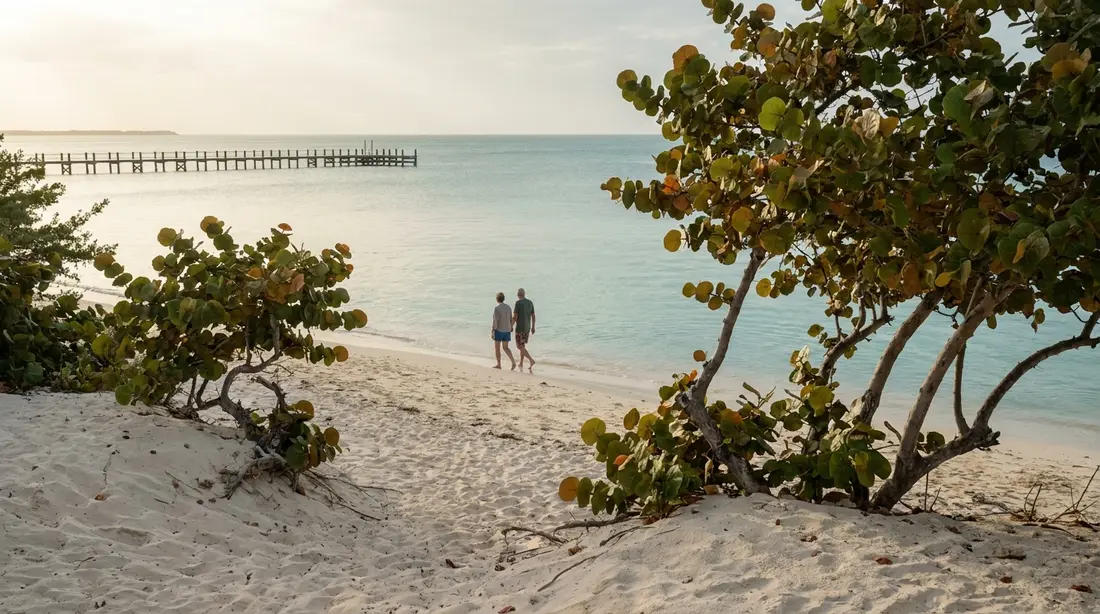
The walk in from Point Udall
The standard approach starts at the eastern end of Route 82. Driving up toward the Millennium Monument at Point Udall, a small parking area with a trail sign sits on the right shortly before the monument loop. From it, the marked path drops through cactus and dry scrub toward the water, touching East End Bay and then climbing over a knob to come down on Isaac's. Plan on fifteen to twenty minutes of walking to reach Isaac's sand, longer coming back up, since the return is the uphill half and usually happens in stronger heat.
The trail is short, but it is not casual. Every step is open to the sun. The footing is dry gravel and rock through low thorny growth, the kind of ground that punishes flip-flops, and the East End's air is the driest on St. Croix. Closed shoes or solid trail sandals, a hat, and more drinking water than the distance seems to justify are the real minimum. The pleasant version of this walk happens before about nine in the morning or in the last two hours of daylight; the miserable version happens at one in the afternoon in August.
The Jack Bay track from East End Road
There is a second way in, less known and useful in a different way. On the north side of the East End, a gravel track leaves East End Road near the big white radio-telescope dish across from Cramer's Park and crosses the ridge to come down at Jack's Bay, about 1.2 miles from road to sand. Running write-ups that use it as a workout clock the opening kilometer at close to 600 feet of climb with grades up to 17 percent, so the front half is a genuine hill; the reward is that it delivers you straight onto the emptier of the two beaches without passing anything else first.
For most beach visitors, the Point Udall side remains the better door: shorter, gentler, and starting from a landmark you were going to visit anyway. The Jack Bay track earns its keep for strong walkers who want Jack's Bay specifically, for anyone making a loop, and for a party with two cars that wants to walk the preserve end to end without doubling back.
Walking the whole preserve
Linked together, the trail system adds up to a real East End outing. The full network, from the East End Road side over the ridge to Jack's, along the connector to Isaac's, out past East End Bay to the Point Udall lot, with the Hughes Point spur included, measures about 3.6 miles, and the trail apps rate the circuit moderate. Walked as a hike with a swim in the middle, it is one of the island's best half days, and it appears as a route entry in the St. Croix hiking guide. Treat the mileage with respect: there is no shade at any point, no water source anywhere, and the grades on the northern half are steeper than anything a beach day normally includes. Two liters of water per person is the working figure, and the deep-heat hours in the middle of the day are the wrong time to be on the ridge.
Swimming and snorkeling
The reefs fronting the preserve are the healthy, close-in kind that St. Croix's East End is known for. The Conservancy's survey of its own water lists elkhorn, staghorn and brain corals with at least 400 fish species over them, parrotfish, blue tangs, sergeant majors and four-eyed butterflyfish among the regulars, plus seagrass beds inshore holding conch and starfish, with turtles and the occasional nurse shark passing through. Because the offshore zone bans all fishing, the fish population behaves the way protected populations do: bigger, denser and less skittish than at beaches where lines and traps work the same water.
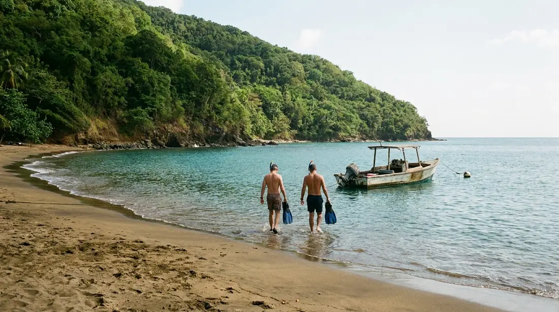
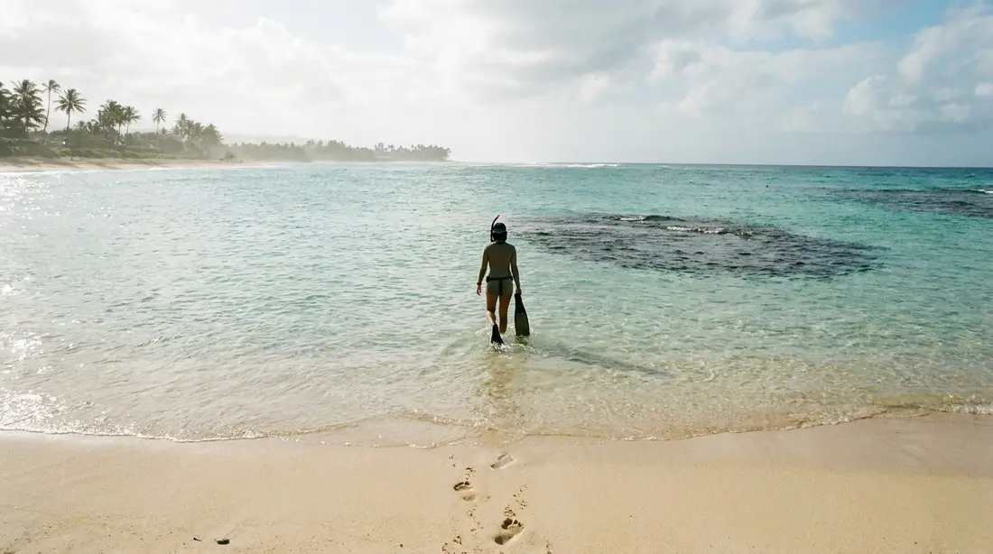
Isaac's is where to put the mask on. Enter over the sandy middle of the beach rather than the rockier edges, swim out over grass and patch reef, and work toward the reef lines at the sides of the bay where the coral structure is. Reef shoes help at every entry that is not clearly bare sand. Jack's can also be snorkeled, with more rock and weed to negotiate near shore, and swimmers there should stay well inside the bay.
The conditions rule is absolute at both: this is a calm-day activity only. The bays are usually swimmable, but they face open water at the windward tip of the island, and on windy days chop builds and currents strengthen quickly. There is no lifeguard, no other swimmer to flag, and no quick way to summon help, so the margin you would accept at Cane Bay does not exist here. Read the water from the sand before anyone gets wet, and if it looks rough, walk the beach instead. Where these bays rank against the island's other entry points is covered in the snorkeling beaches guide and the wider snorkeling overview.
A beach with no services
Everything a normal beach provides, this one does not. No restrooms, no fresh water, no vendor, no trash cans, no rental chairs, no phone reliability, and functionally no natural shade on the sand. Entry is free and the preserve is open to the public, at last check with no gate and no posted hours; what regulates the place is the walk and the rules below.
- Carry in all the water, food and sun protection you will use, and shade if you want any, since the sand offers none worth planning around.
- Carry out every item you brought, and leave with nothing you found: no shells, no coral fragments, no sand souvenirs. Both the preserve and the marine park prohibit collecting.
- Mineral sunscreen only. The USVI restricts oxybenzone products, and the reef under your fins is alive.
- No fires, no camping, no drones over nesting beaches, and dogs are better left at the villa during nesting months.
- At the trailhead, leave nothing visible in the car. This advice attaches to every remote trailhead on St. Croix and this one is as remote as they come.
What to carry
The packing for these bays is short, specific and non-negotiable, because forgetting an item means walking back for it. Water leads the list: a liter per person for the basic there-and-back visit, two liters each for the full circuit or any stay past mid-morning, and none of it is available anywhere past the car. Footwear is the second decision that makes or breaks the day, closed shoes or genuine trail sandals for the gravel and thorn scrub, plus reef shoes in the bag for the water entries. After those two, the rest assembles quickly:
- Mask, snorkel and fins carried in, since no rental exists within miles; the dive shops in Christiansted rent sets for the week.
- Mineral sunscreen applied before the walk, a hat, and a sun shirt for the swim, which spares your back at the one beach where shade cannot be bought.
- Food that survives heat, and a bag for carrying out every wrapper.
- A dry bag for phone, keys and wallet, both for the swim and for leaving the car empty at the trailhead.
- A basic first-aid minimum: cactus country plus bare feet plus distance from help argues for tweezers and a few bandages.
What can stay behind: the umbrella, unless someone is willing to haul it, the cooler, ditto, and anything valuable. The lighter the pack, the better the climb out feels; the full island-wide checklist lives in the packing guide.
The turtle beaches
Jack's and Isaac's are not casually turtle-adjacent; they hold the largest nesting populations of green and hawksbill sea turtles on St. Croix, and turtle recovery is the core reason the Conservancy bought the land. Monitoring teams have worked these beaches every season since 2001, patrolling during the July-to-December window that covers green and hawksbill nesting, and the results are one of the territory's quiet conservation successes: by the Conservancy's count, nesting green turtle females here grew from around eight in the early years to nearly 300.
The wider Virgin Islands nesting calendar runs from roughly March through December across species, with hawksbills peaking August through November, which means a summer or fall beach day here overlaps the season. The preserve does not close for it, at last check, in contrast to Sandy Point's hard seasonal shutdown for leatherbacks. What the season asks of a visitor instead is conduct:
- Stay off the dry upper sand where possible and give a wide berth to any tracks, depressions, stakes or marked areas; a nest is invisible from above.
- Never dig, and fill any hole a child digs before leaving; open pits trap hatchlings.
- After dark, the beach belongs to the turtles. No flashlights or phone lights on the sand at night; artificial light disorients both nesting females and hatchlings.
- If you encounter a turtle on the beach, keep your distance, stay behind her, stay quiet, and let the encounter cost her nothing.
Guests who want a sanctioned nighttime nesting experience should book a guided watch program rather than improvising one here: the St. Croix Sea Turtle Project and the St. Croix Environmental Association both run organized turtle watches in season. Species, seasons and every reliable daytime sighting spot on the island are gathered in the sea turtle guide.
Why the bays stay empty
The arithmetic of these beaches is worth stating, because it is the product being bought with every drop of sweat on the trail. St. Croix's drive-up beaches are already uncrowded by mainland standards. Add a shadeless walk, subtract every facility, and the visitor count falls to a level that beachfront elsewhere in the Caribbean cannot reach at any price: on an ordinary weekday morning, the odds are good that the first person onto Isaac's sand owns it outright until midday, and Jack's runs emptier still. The trail is a filter, and it filters in your favor exactly as long as you are willing to carry your own water. Guests deciding whether the trade suits them can compare the alternatives in the island beach rundown; Grapetree offers seclusion without the walk, and The Shoys offers calm without the sun exposure.
Remote-beach safety
Emptiness is the appeal and also the risk profile. Help at Jack's or Isaac's is a hike plus a drive away, and phone coverage at the island's tip is spotty, so the safety practices are the self-reliant kind. Swim as a pair, always; a solo visitor should treat the water as scenery. Tell someone at the villa which bay you are walking to and when you expect to be back, since a twisted ankle on the trail is a very different event when somebody knows to come looking. Swim conservatively, inside the bay and inside your ability, because the nearest assistance is your own group. Watch the heat on the climb out, the most demanding stretch of the day, and turn the outing into a morning rather than a full day if anyone in the party is marginal on water or footwear. None of this is exotic; it is the same short list that governs every unattended shoreline, applied to a beach where it actually matters. The island-wide version lives in the safety guide.
The photograph
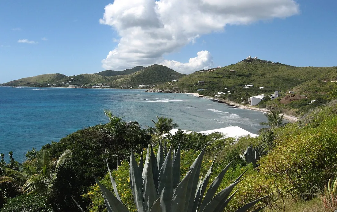
The image that sells these bays, white crescents below dry green hills with reef color offshore, is taken from above, and there are two reliable places to stand. The first is the high ground on the Point Udall approach, where the path crests between East End Bay and Isaac's and the near bay opens up beneath you; morning light, with the sun behind your shoulder from the east, is the flattering hour. The second is the ridge on the Jack Bay track, which looks down the length of Jack's from the north. Photographers wanting the widest version of the view, both coasts and Buck Island in one frame, should climb Goat Hill instead, whose summit covers the entire East End from 672 feet.
A bays morning, hour by hour
The outing has a best version, and it runs on the clock. Check the sunrise time the night before and leave the villa in the dark; from the East End houses that means roughly a quarter hour of driving, from Christiansted about half an hour. Watch the sun come up from the Millennium Monument terrace, the first light to touch United States soil that day, then walk back to the lot, swap into trail shoes, and start down the path while the air is still cool and the shadows still reach across it. By the time most of the island is pouring coffee, you are drifting over the reef at Isaac's with the water at its calmest and the sand entirely yours.
Swim early, then use the middle of the morning for the walk to Jack's, when warmth is building but not yet punishing. Aim to be climbing back out no later than ten thirty, because the return is the uphill half and the East End sun stops being funny before noon. The recovery stops are already positioned on the drive home: Cramer's Park for restrooms and a rinse, minutes back down Route 82, then a late breakfast in Christiansted or at the villa. The whole program, sunrise included, fits inside five hours and leaves the afternoon for the pool. Slot-by-slot versions of the wider trip live in the seven-day itinerary, which reserves a morning for exactly this.
Season by season
The bays open toward the south and east at the island's windward extremity, so the variable that runs their year is wind more than crowds. In winter, the trades blow strongest, and the stretches locals call the Christmas winds can put chop and current into the bays for days at a time; winter visitors should hold the snorkel plan loosely and be ready to swap in a west-coast day, exactly the flexibility the weather guide recommends island-wide. Spring and early summer bring the year's most dependable calm, when the bays go glassy in the morning and the snorkeling is at its best. From August into October, distant storms can send swell even on cloudless days, and the heat on the trail peaks; this is also the heart of nesting season, when the sand rules deserve their fullest observance. Every month of the year, the first two hours after sunrise are the premium window: coolest trail, calmest water, emptiest sand, and the option of pairing the walk with dawn at Point Udall.
The bays at a glance
| Shoreline | Access | Water | Best use |
|---|---|---|---|
| East End Bay | First water on the Point Udall path | Stony, exposed | Passing through; nesting shore, not a swim stop |
| Isaac's Bay | 15 to 20 min from the Point Udall lot | Deeper close in, sandier bottom, reef at the edges | The swim and the snorkel |
| Jack's Bay | 0.7 mi past Isaac's, or 1.2 mi over the ridge from East End Road | More rock and weed near shore | Maximum solitude, long beach sits |
| Hughes Point | 0.3 mi spur beyond Jack's | Rocky point, no swimming | Coastline walking, the turnaround |
Conditions caveat for every row: calm days only in the water, and no facilities anywhere in the preserve.
Questions guests ask
Can you drive to Jack's Bay or Isaac's Bay?
No. There is no vehicle access to either beach, and that is by design; the preserve's trails are the only way in. The nearest parking is the small lot on Route 82 just below the Point Udall monument, with the walk to Isaac's running fifteen to twenty minutes, or the roadside start of the Jack Bay track near the radio-telescope dish on East End Road for the longer, steeper route. Anyone in your party who cannot manage a shadeless mile on rough ground should be pointed at Cramer's Park or Chenay Bay instead, both minutes away by car with real facilities.
Which of the two bays is better?
For time in the water, Isaac's: deeper water near shore, less rock and seaweed underfoot, and the easier reef access, which is why it takes the snorkeling vote in nearly every account. For emptiness, Jack's: the extra connector walk past Isaac's, or the hill on the northern track, keeps its visitor count near zero. The sensible itinerary treats them as one destination, swims at Isaac's, and walks to Jack's for the stretch of sand with nobody on it.
How hard is the hike, really?
From the Point Udall side, short but hot: fifteen to twenty minutes down on gravel and rock through cactus scrub, with the climb saved for the return leg. Sturdy school-age kids handle it fine with their own water and closed shoes. The Jack Bay track from East End Road is a different animal, roughly 600 feet of climbing in its first kilometer, and the full preserve circuit of about 3.6 miles is a legitimate moderate hike. Heat is the limiter in every version; early starts fix it.
Is the preserve open during turtle nesting season?
Yes, at last check the beaches stay open year-round with no seasonal closure, unlike Sandy Point on the island's other end. What changes in season, roughly summer through early winter for the greens and hawksbills that nest here, is your obligation on the sand: keep clear of tracks and any marked or disturbed areas, dig nothing, and keep all artificial light off the beach after dark. Monitoring teams may be working the beaches; give them room and follow any instruction they post or give.
Is it safe to leave a car at the trailhead?
The standing local advice for the Point Udall lot, as for every remote trailhead on the island, is to leave nothing of value in the vehicle and nothing visible at all. Break-ins are opportunistic and rare rather than systematic, and an empty car with an empty cabin makes a poor target. Take your phone and wallet down the trail in a dry bag, which you will want at the beach anyway since there is nowhere to secure anything.
Does it cost anything, and are there hours?
Entry is free, and at last check the preserve posts no gate hours; access runs on daylight in practice, since the trail is no place to be after dark and beach lighting is prohibited in nesting season anyway. There is no permit, no reservation and no capacity limit. The only booking-style constraint on a visit is the weather, which decides whether the day is a swim day or a walk day.
Staying near the bays
The trailhead sits at the end of Route 82, which makes the East End villas the natural base for this outing. Guests at The Cerulean are only a few minutes' drive from the Point Udall lot, close enough to walk down for a swim before breakfast and be back while the day is still cool, and the wider East End collection puts the whole preserve, Cramer's Park and the Point Udall sunrise inside a fifteen-minute radius. From the Christiansted-side homes, count on about half an hour each way, still an easy morning. See the full villa portfolio for current availability across the island.
Sources
Written from official and first-party sources, checked August 2026. Hours, prices and event dates change — confirm before you go.
In this guide
Stay nearby
Private oceanfront on the East End with a sandy, swimmable beach, pool, outdoor kitchen and a separate guest cottage. Sleeps twelve.
 The Cerulean5 bd · 5 ba · sleeps 12 · Christiansted
More in Beaches
Sources
8 references, listed in full at the end of this guide — official park, refuge, tourism-board and business sources, checked August 2026.