Weather & When to Visit
83°F winters, 88°F summers, a dry season and a green season: the climate month by month, with the numbers.
St. Croix runs one of the steadiest climates in the hemisphere: days near 83°F in winter and near 88°F in summer, a sea that never cools out of swimming range, and a trade wind that shows up for work almost every day of the year. This page explains how that machine operates, hour by hour and season by season, so you can read a forecast here the way residents do. If what you want is help choosing a month, that decision has its own essay in our best-time-to-visit journal post, and each month has its own page.
The short calendar answer
The year splits into a dry season and a green season. January through April is the dry stretch, with March the driest month of all on the long-term record, and it doubles as peak visitor season because the brisk winter trades, called the Christmas Winds, blow from roughly mid-December until mid-March. May opens the green season, which runs to December: warmer, quieter, showerier, with a drier pause across June and July and the heaviest rain from September into November. Hurricane season occupies June 1 to November 30 on the calendar and mainly August and September in the statistics; the hurricane season guide covers all of it. For the driest days, book February or March. For value with strong weather odds, look at late April and May. For the turn back toward winter with the island still empty, November works. The month-by-month guides take each of the twelve in detail; everything below is about how the weather itself behaves once you are here.
The trade winds
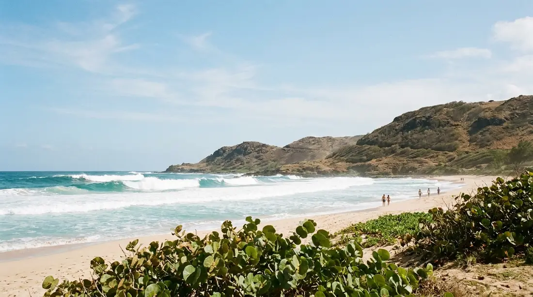
One wind runs this island. NOAA's Coast Pilot, the federal government's mariner's reference for these waters, calls the steadiness of the trade winds one of the outstanding features of the Virgin Islands climate: they blow from an easterly direction almost without exception, wandering only between north-northeast and south-southeast. That is the trade wind belt doing what it has done for centuries, air flowing out of the high-pressure zone parked over the central Atlantic and streaming west across thousands of miles of warm ocean before it reaches this coast.
The wind's character shifts with the calendar even though its direction barely does. In winter it leans northeast and blows hardest; sailing references put the cool-season trades around 15 to 20 knots, and NOAA's records show the highest average maximum wind speeds falling between late December and the end of January. By early summer the flow backs toward the southeast and softens into the 10-to-15-knot range. Late summer and fall bring the lightest, most fitful wind of the year, which is part of why the sea goes glassy in September and October.
For a visitor, the trade wind is mostly a gift. It is the reason an 88-degree afternoon on the East End feels comfortable while the same temperature in a mainland city feels punishing, and the reason so many villas here were designed around cross-breeze and covered galleries. It also sorts the coasts into a windward side and a lee: the east and north shores take the wind and its chop head-on, while the west coast around Frederiksted sits in the island's wind shadow with the calmest water on St. Croix. That single fact drives half the daily decisions on this site, from where to snorkel to where to watch the sun go down.
The daily rhythm
The wind here keeps office hours, and once you notice the schedule you can plan a whole trip around it. The Coast Pilot lays out the cycle: nights run lighter than days, the breeze starts building around daybreak, reaches its peak in the late morning or early afternoon, and begins easing back toward the quiet nighttime regime around 4 p.m. On days when the trade wind is weak to begin with, St. Croix commonly goes dead calm after dark; the island has no regular nightly land breeze of its own, so a soft day simply fades to stillness.
The reason is sunshine. Over the open ocean the trade wind blows harder a few hundred feet up than it does at the surface. When the morning sun heats the island, the warmed air starts churning vertically, and that churning drags the faster wind aloft down to ground level. More sun, more mixing, more breeze; the wind peaks with the heat of the day. After sunset the mixing shuts off, the surface decouples from the flow above it, and the evening goes quiet.
What this means in practice is worth spelling out, because it repeats nearly every day of the year:
- Dawn to mid-morning is the calm window. The sea is at its flattest and clearest, which is why boat captains, divers, and photographers all start early here. If a snorkel session at Cane Bay matters to you, take the morning slot.
- Early afternoon is the breezy peak. Exposed windward beaches pick up chop and blowing sand; the lee side barely notices. This is a fine time to be under sail, on a shaded gallery, or over on the calm west coast.
- Evening glasses off. The wind stands down through the late afternoon, and the water off Frederiksted at sunset can look like poured metal. Sunset sails are scheduled into exactly this window.
Temperature, and the small print
The temperature numbers on St. Croix are almost boring, which is the point of coming. NOAA's Coast Pilot puts the island's average temperature at 80.2°F, with an average daily maximum of 86.3°F and an average minimum of 73.6°F. August is the warmest month, averaging 82.5°F around the clock; January is the coolest at 77.2°F. The whole annual swing between them is 5.3 degrees. For daytime planning, the NOAA climate normals for the airport put winter highs around 84 to 85°F and late-summer highs around 89 to 90°F, with nights in the low 70s in winter and upper 70s in summer.
The extremes are nearly as tame as the averages. Readings above 90°F have occurred in every month except January and February, the all-time island maximum stands at 93°F, and the coldest temperature ever recorded on St. Croix is 61°F, from a January night in 1955. In seventy-plus years of records, the island has never seen 100 degrees and never come within thirty degrees of frost. Pack for the mid-80s, add one light layer for breezy winter evenings and boat rides, and you have covered every scenario the record supports; the packing list has the rest.
The small print is that what changes through the year is only partly on the thermometer. A January afternoon and a September afternoon may read four or five degrees apart while feeling much further apart than that, and the gap is moisture, which gets its own section next. Guests who arrive in winter sometimes expect tropical swelter and find breezy, dry warmth instead; guests who arrive in September expecting January's crispness find the air noticeably thicker. Same island, same narrow numbers, different feel.
Humidity and how the heat actually feels
The moisture calendar moves more than the temperature calendar. Climate summaries for St. Croix put the average dew point, which is the cleanest measure of how sticky air feels, around 68°F in the winter months and up near 75°F in late summer and fall, with the muggiest run of the year lasting from roughly May through November. A dew point of 68 reads as pleasantly tropical; 75 reads as thick, the kind of air where a walk uphill earns a shirt change.
Heat index, the feels-like number, comes out of that combination. In winter the feels-like temperature and the actual temperature sit close together, one more reason the Christmas Winds season is peak season. On humid late-summer afternoons the feel can run several degrees above the reading, and a still, hazy 89-degree day in September asks for shade, water, and a swim in a way a windy 85-degree day in February never does. The island's own remedies are built in: the trade breeze, the sea, and the habit of scheduling exertion for morning. Hikers should take the hint most seriously; the exposed East End trails are morning work in the humid months.
Nights deserve one line of their own. Even in the warmest stretch, lows settle into the upper 70s, and most of our homes carry air conditioning in the bedrooms, so sleeping weather is a solved problem year-round.
The sea temperature
The ocean around St. Croix moves through about a five-degree annual cycle, and it lags the air by a couple of months the way large bodies of water always do. Satellite and station records for the island put the coolest water in late winter, around 79 to 80°F in February and March, and the warmest at the end of the heating season, peaking near 85°F in September and holding close to that through October. January water still carries summer's leftovers at around 80; June sits near 83 on the way up.
Every number in that range is comfortable for swimming, which is why the island has no off-season for the water. The differences show at the margins. At the September peak you can float indefinitely and the water asks nothing of you. In the 79-degree late-winter trough, most swimmers are still perfectly happy, while divers doing long, still bottom time often prefer a thin wetsuit for the second tank; the shops covered in the diving guide will steer you at the counter. Snorkelers rarely notice the season at all.
Warm water cuts one other way, and it belongs in the same paragraph: that late-summer 85-degree sea is also the fuel supply the tropical Atlantic draws on in its active months, which is one of the mechanical reasons August and September lead the storm statistics. The trade-offs are handled in the hurricane season guide.
How rain works here
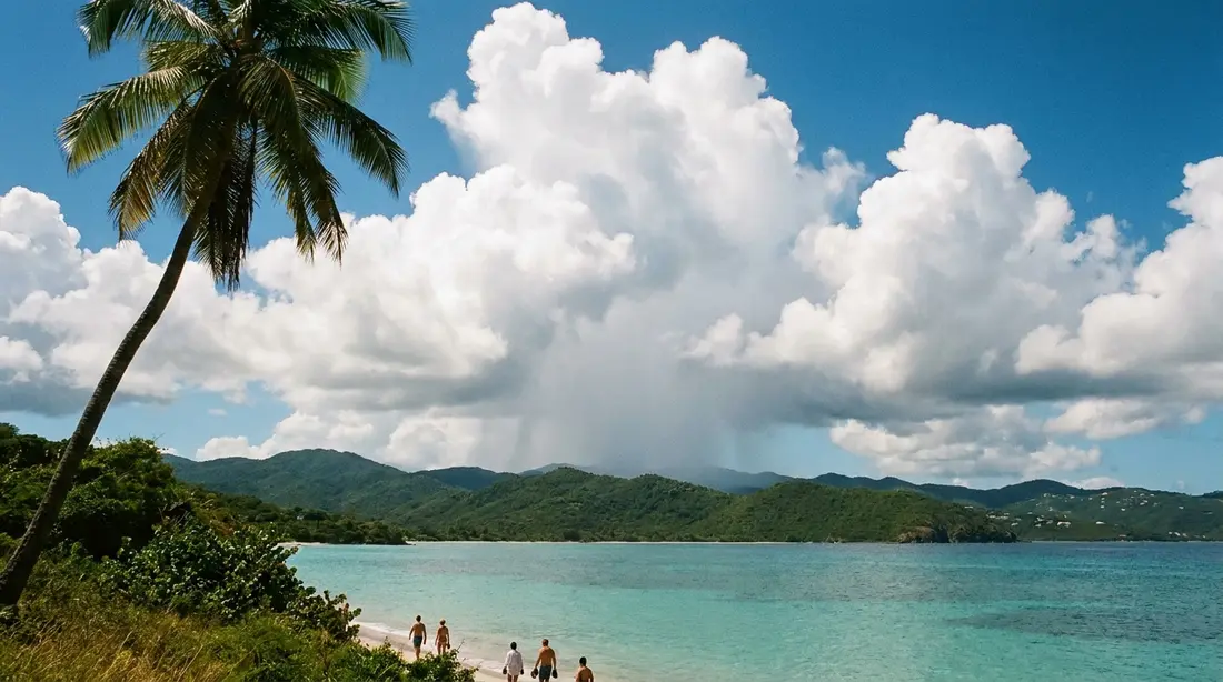
Most St. Croix rain arrives as cells: compact showers a mile or a few miles wide that ride in on the trade wind, drop their load in ten or twenty minutes, and move on west. You can usually watch the whole life of one from a beach chair, a gray column over the water upwind, a burst of fat drops, sun again before the pavement dries. The Coast Pilot's climatology says it directly: showers provide most of the rain in these islands, and the heavier totals have usually come from tropical systems, from the disturbances mariners call east waves, or from old frontal boundaries that sag down from the north and stall, mostly in winter. Those bigger events are the exception. The default rain experience on this island is an interruption measured in minutes.
The totals stay modest by tropical standards. St. Croix averages 41.24 inches of rain a year in the federal record, about what Kansas City gets, and a quarter of that annual total falls in just the two peak months of August and September. The seasonal shape follows the calendar laid out at the top of this page: the January-to-April dry season, a wetter May, the June-July lull, then the September-through-November peak, when roughly 40 percent of the year's rain arrives.
Where the rain falls is as lopsided as when. The trade wind piles its moisture onto the island's high northwest corner, which catches 50-plus inches a year and wears a forest, while the low East End gets by on roughly half that and grows cactus; the full mechanism, and everything it does to the landscape, is the subject of the two-landscapes guide. The practical corollary: if a shower is soaking one end of the island, the other end is very often dry, and driving out from under weather is a legitimate tactic here.
What a rainy spell cannot usually do is take your whole day, and it takes even fewer plans if the villa has a gallery to watch it from. When the sky does settle in properly, the island's indoor bench is deeper than people expect; that inventory is the rainy day plan.
What an 80 percent rain chance means
The most common weather-app disappointment on St. Croix runs the other direction from most places: the phone promises rain and the day delivers sunshine. The explanation lives in how the number is built. The National Weather Service defines the probability of precipitation as the forecaster's confidence that rain will occur somewhere in the forecast area, multiplied by the fraction of that area expected to get wet. The result is the chance that measurable rain, one hundredth of an inch or more, touches any single point, such as your beach, during the period.
Now put that formula over a 22-mile island in a shower-cell climate. On a typical green-season day, forecasters can be near-certain that scattered cells will pop somewhere over the island and its waters, while each cell wets only a small patch for a few minutes. The arithmetic turns that into a headline number that sounds like a washout and describes a day that is 85 degrees and mostly sunny with two brief interruptions. The percentage says nothing about duration, timing, or intensity; a 70 percent day here routinely out-sunshines a 30 percent day on the mainland.
Two habits fix the misreading. First, look past the icon to the wording: "scattered showers" riding a normal trade-wind day is business as usual, while a forecast talking about an approaching tropical wave or a stalled front describes organized weather worth actual attention. Second, use radar rather than probability once you are on island; the loop shows exactly which cells are riding the wind toward which coast, and twenty minutes of patience or fifteen minutes of driving beats a canceled plan almost every time.
Wind seasons
The trade wind never really leaves, but it has seasons, and each one rearranges the island's water.
The Christmas Winds, mid-December to mid-March. Winter's reinforced trades are strong enough to have earned a proper name across the Caribbean. They blow out of the east-northeast for days at a stretch, and the strongest periods commonly run 20 to 25 knots by the standard sailing references, with NOAA's records placing the year's highest average maximum winds between late December and late January. They are also the dry season's engine, which is why the breeziest weeks and the sunniest weeks are the same weeks. Effects: whitecaps and chop on the exposed east and north coasts, morning-only windows for the most exposed snorkel spots, brisk and beautiful conditions under sail, and evenings cool enough that a long-sleeve at dinner earns its packing space.
Spring, April into May. The winter reinforcement relaxes, the wind stays easterly but drops a gear, and the windward coasts flatten out. Many long-time visitors consider this the island's finest all-around water window: winter clarity, softening seas, thinning crowds.
Summer, June through August. The flow backs southeast and runs 10 to 15 knots on the typical day. Seas ease further, and boat schedules run at their most reliable. The Coast Pilot notes one summer wrinkle worth knowing: between June and September, when the trades go slack, the island occasionally takes a day of strong southwest wind with heavy rain, briefly reversing the usual calm-side logic and putting slop on the west coast instead. It passes, and the normal pattern reasserts itself.
Late summer and fall, September through November. The lightest and least reliable wind of the year. Glassy mornings stack up back to back, which divers and paddlers treasure; this is prime season for flat-water paddling and for mirror-calm days over the reef. The same slack in the atmosphere belongs to hurricane season's active weeks, so fall boat plans carry a weather-eye asterisk: operators here watch the marine forecast closely and reshuffle around anything organized, an arrangement covered in the Buck Island tour guide.
Saharan dust
Several times each summer the sky over St. Croix turns milky, the horizon goes soft, and the sunsets shift from pink to deep burnt orange. The cause is a river of desert air called the Saharan Air Layer, and NOAA studies it closely enough to publish a running explainer. The SAL is a mass of hot, dusty, extremely dry air, carrying about half the moisture of the normal tropical atmosphere, that lifts off the Sahara and rides the upper winds west across the Atlantic. It travels as a distinct layer starting about a mile above the surface and running two to two and a half miles thick, and fresh outbreaks push off the African coast every three to five days in season. Activity ramps up in mid-June, peaks from late June to mid-August, and fades quickly after mid-August.
On the ground, a dust event looks like haze. NOAA's description matches what you see from a villa gallery exactly: a hazy white sky, softened visibility, and sunsets with an orange cast, because the airborne mineral dust scatters light differently than clean marine air. Heavy episodes measurably lower air quality across the Caribbean, and people with asthma or other respiratory sensitivities should treat a thick dust day the way they would a poor-air-quality day at home, easing off outdoor exertion until it thins. Most visitors register nothing beyond the light show, and a typical episode moves through in a few days.
The SAL carries one genuine consolation for summer travelers: all that dry, fast-moving air is hostile to developing storms. NOAA credits the layer with suppressing tropical cyclone formation and strengthening, which is a working part of why the early summer, when dust traffic peaks, tends to stay quiet in the tropics even as the ocean warms. When the dust season shuts down in late August, the deep tropics wake up; the two calendars are connected.
Swell and water clarity
The waves on a St. Croix beach on any given day come from two different sources, and telling them apart makes you a better beach picker. The first is local wind chop, made by the trade wind blowing across nearby water; it follows the daily and seasonal wind patterns above, roughs up the windward coasts, and leaves the lee alone. The second is ground swell: long, organized waves generated by distant weather that arrive independent of the local breeze. In winter, storms far out in the North Atlantic send southbound swell that mariners here call the northers' swell, and the Coast Pilot flags it as especially heavy along stretches of the north coast. A north-swell day can put genuine surf on north-facing sand under a cloudless, windless sky, which confuses newcomers every winter. In late summer, a distant tropical system hundreds of miles away can do the same thing at long range, sending waves without weather.
Swell is the reason a few island rules exist. The tide-pool hike at Annaly Bay is a calm-seas-only outing, full stop. North-shore snorkeling is best judged by looking at the water, and on a big-swell day the correct answer is the west coast, where the same ocean is usually lying flat.
Clarity follows from all of it. The water is clearest when two conditions line up: little recent swell, since waves stir sand off the bottom along shorelines, and little recent heavy rain, since runoff from the island's guts clouds the nearshore band after real downpours. Calm, dry stretches in any season produce the glassiest, farthest-seeing water; the days after a big blow or a soaking are when divers head for deeper, more protected sites and beach snorkelers wait a day. Operators check conditions every morning, and their judgment, plus the marine forecast in the next section, beats any rule of thumb.
Reading the forecast from here
The forecasts most phone apps show for St. Croix are automated and generic; the products professionals here actually read are free, and knowing which is which upgrades a trip.
- The NWS San Juan forecast office owns the official forecast for Puerto Rico and the U.S. Virgin Islands. Its zone forecast and daily discussion explain what the atmosphere is doing rather than reducing the day to one icon; when a forecast matters, read the words, at weather.gov.
- The coastal waters forecast is the single most useful product for a beach-and-boat trip. NWS San Juan issues it several times daily, with wind in knots and seas in feet for named zones; St. Croix's water sits in the zone titled "Caribbean waters of Puerto Rico from 10 NM to 17N, including the coastal waters of Saint Croix." A line like "east winds 10 to 15 knots, seas 3 to 4 feet" tells you more about tomorrow's snorkeling than any weather app ever will. Seas under about 4 feet mean comfortable boating for most people; when the forecast reads 6 and up, expect operators to start adjusting.
- Live observations come from NOAA's National Data Buoy Center. Station CHSV3 sits in Christiansted Harbor and LTBV3 at Lime Tree Bay on the south shore, both reporting wind and water conditions in near-real time, and offshore buoys such as 41052 south of St. John report the open-water wave heights headed this way. Checking a buoy before an early boat departure is a five-second habit worth forming.
- Radar and satellite answer the only question a shower-cell climate really poses: is anything riding the wind toward my beach in the next hour? Any radar app works; look upwind, meaning east.
- In hurricane season, the National Hurricane Center's tropical outlook is the once-a-day glance that covers you, and the territory's emergency agency runs its own alert system; both, plus every booking rule that goes with them, are laid out in the hurricane season guide.
One calibration note: trust length matters. A two-day forecast here is solid, a five-day forecast is a sketch, and a ten-day icon row is entertainment. The climate's steadiness works in your favor, since the default forecast, warm with a passing shower and an east breeze, verifies more often than almost anywhere else on earth.
Microclimates in one table
An island 22 miles long should not have this much weather variety, and yet a single afternoon drive crosses all of it. The quick reference:
| Area | Rain habit | Wind exposure | Typical water |
|---|---|---|---|
| East End | Driest on the island; showers often miss it | Full trade wind, first to feel every breeze | Chop on exposed shores; protected bays like Chenay stay swimmable |
| Christiansted and mid-island | Moderate; brief cells passing through | Breezy, softened by terrain | Harbor and reef-sheltered water, generally friendly |
| North Shore (Cane Bay, Davis Bay) | More cloud and shower activity against the hills | Open to the trades and to winter north swell | Calm mornings; swell events bring real surf |
| Northwest hills and rainforest | Wettest zone, 50-plus inches a year | Ridge-top wind, still air under canopy | Inland; guts run after heavy rain |
| Frederiksted and the west coast | Between the extremes | The lee; lightest wind on the island | Flattest, calmest sea; the default rough-day refuge |
The pattern to remember is diagonal: rain increases toward the northwest, wind and dryness increase toward the east, and calm water lives in the west. Whatever the day is doing, some part of the island is having better weather than the part you are standing in.
The seasons at a glance
| Season | Wind | Sea state | Rain character | Sea temp |
|---|---|---|---|---|
| Mid-Dec to mid-Mar (Christmas Winds) | ENE, strongest of the year; brisk stretches near 20–25 kt | Choppy windward, winter north swell episodes; west coast calm | Fewest and briefest showers; March driest | Cooling to ~79–80°F by late winter |
| April–May | East, easing | Flattening everywhere | Dry April; showers return in May | ~80–82°F, warming |
| June–August | SE, 10–15 kt typical; rare SW blow-through days | Gentle; most reliable boating | June–July lull, then climbing; SAL haze episodes | ~83–84°F |
| September–November | Lightest and least steady | Glassy calms; watch for distant-storm swell | Wettest stretch of the year, still mostly cell showers | Peak, ~85°F in September–October |
What the weather does to your plans
Every activity on the island has a weather lever, and most of them are the same lever:
- Beach choice: wind and swell pick the coast for you. Breezy or swell-laden day, go west; calm day, everything is open. The beach guide sorts them by exposure.
- Boat days: captains decide on the marine forecast, and cancellations cluster in strong Christmas Winds stretches and around organized fall weather, with the caveat that most weeks in both seasons run normally. Book boat trips early in your stay so a blown day can be rescheduled.
- Snorkeling and diving: morning beats afternoon nearly year-round, and the west coast is the backup plan whenever the north and east are working. Frederiksted Pier is the classic any-conditions site.
- Hiking: rain turns the rainforest routes greasy and fills the guts, so give trails a drying day after a soaker and never walk a gut with heavy rain around. Dry-side trails ask the opposite: start early before the heat. Details in the hiking guide.
- Photography: the light is best in the first and last hour, dust-season sunsets go dramatic, and the clarity after a shower passes is the sharpest the island ever looks.
Questions guests ask
Does it rain all day on St. Croix?
Almost never. The standard rain event is a trade-wind shower cell that wets one part of the island for ten or twenty minutes and moves on; the federal climatology for these islands states that showers provide most of the rain. All-day rain requires organized weather, a tropical system, an old front, a stalled disturbance, and those are occasional visitors rather than regulars, concentrated in the fall. Even in November, the wettest month on average, the common experience is a green island with interrupted sunshine rather than a washed-out one.
How hot does it really get?
The all-time recorded maximum on St. Croix is 93°F, and the island has never touched 100 in the modern record. Typical daytime highs run from about 84°F in winter to about 89°F in late summer. What varies more is the humidity: winter air is dry enough that the heat feels light, while a still September afternoon feels heavier than its number. The trade breeze does the moderating almost every day, and nights settle into the 70s in every month of the year.
Why does the forecast always say scattered showers?
Because that is the climate. On most days, small showers form somewhere over or around the island and drift west on the trade wind, so a forecast covering the whole island correctly reports a chance of one crossing your spot. The National Weather Service builds its rain percentage by multiplying confidence that rain occurs by the fraction of the area that gets wet, which means high numbers routinely describe days that are sunny at your beach for all but a few minutes. Read the wording, and use radar once you are here.
When is the wind strongest?
Two answers, one for the clock and one for the calendar. Daily: the breeze is lightest around dawn, builds to a peak in the late morning and early afternoon, and eases from about 4 p.m., a cycle documented in NOAA's Coast Pilot. Seasonally: the Christmas Winds, from roughly mid-December to mid-March, are the year's strongest stretch, with the very windiest average weeks falling from late December through January. September and October sit at the other extreme, with the lightest and glassiest conditions of the year.
What is the haze I sometimes see in summer?
Saharan dust. From roughly mid-June to mid-August, pulses of dry, dusty air from the Sahara cross the Atlantic every few days in a layer that starts about a mile up, and heavy pulses turn the sky milky and the sunsets orange over the Caribbean. NOAA tracks the phenomenon because it also suppresses tropical storm development. Episodes typically last a few days; travelers with respiratory conditions should take dense dust days gently, and everyone else mostly just gets different sunsets.
Can I trust a 10-day forecast for my trip?
Trust the climate, not the icons. Ten days out, the reliable information is what the season always says: warm, breezy, a shower somewhere. Specific rain icons at that range flip daily and mean little in a shower-cell climate. Inside two or three days, the NWS San Juan forecast and its marine products become dependable, and in hurricane season the National Hurricane Center outlook is the one long-range product worth a daily glance. Plan activities off the two-day forecast, not the ten-day row.
Which side of the island has the calmest water?
The west, around Frederiksted, nearly all the time. The trade wind comes out of the east, so the west coast sits in the island's lee with the flattest sea and the gentlest beach entries, and it doubles as the refuge when winter swell puts surf on the north shore. The main exceptions are the occasional summer southwest-wind days, which briefly roughen the west while calming the east, and those are infrequent and short-lived.
Weather and the villas
The daily wind map is also a villa map. Our East End homes, The Cerulean and its neighbors facing Buck Island, sit on the island's driest, breeziest corner, first in line for the trade wind that keeps afternoons comfortable. The Christiansted-side homes, including beachfront Shoy's Beach House, pair reef-sheltered swimming with that same reliable breeze. On the opposite shore, Sunset Sea-Clusion holds the leeward west coast, closest to the calmest water and the sunset. Whichever end of the weather you want to live on for a week, the beachfront collection covers both, and we answer questions about any week's typical conditions from the island itself.
Sources
Written from official and first-party sources, checked August 2026. Hours, prices and event dates change — confirm before you go.
In this guide
Stay nearby
On The Shoys beach: six bedrooms, six baths, pool and hot tub, room for twelve, and the beach through the back garden.
 Shoy's Beach House6 bd · 6 ba · sleeps 12 · Christiansted
More in Plan Your Trip
Sources
12 references, listed in full at the end of this guide — official park, refuge, tourism-board and business sources, checked August 2026.