The Scenic Road by 4x4
The unpaved ridge road across the island's forested spine: what it takes, when to skip it, and what you'll see from the top.
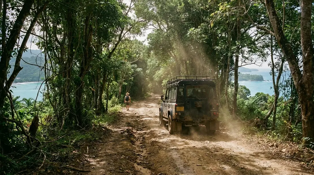
The Scenic Road is Route 78, the unpaved track that rides the crest of St. Croix's western mountains. On a dry day, in the right vehicle, it is the island's best adventure drive: forest closing over the roadbed, then a gap in the trees with the sea on both sides of you at once. On a wet day it is a place to get a rental stuck. What follows covers the whole corridor: where it runs, where the pavement stops, what each stretch demands and pays, and the sensible alternatives when conditions vote no.
What the Scenic Road is
Start with the name, because maps handle it badly. Route 78 traces the spine of the island's high country from the Salt River area in the northeast to Ham's Bay on the far northwest coast, staying on or near the ridgeline most of the way. Islanders split it in two at the saddle where Route 69 crosses the ridge: Scenic Road East runs from that crossing toward Salt River, and Scenic Road West runs from the crossing out past Mount Eagle and the Annaly forest to the sea near Ham's Bluff. The St. Croix Hiking Association literally uses that junction — the top of Route 69's famous climb — as a meeting point, described as the spot between Scenic West and Scenic East.
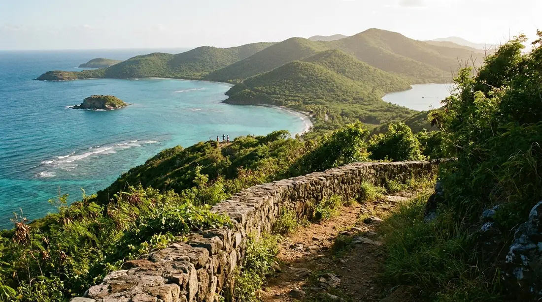
What the road is today is a rougher question. A 2016 opinion piece in the Virgin Islands Daily News, written by a resident who had driven it for years, described a route that once served up overlooks of Salt River Bay, Buck Island, Christiansted, both shores, the Carambola valley, Sandy Point and Frederiksted — and that had gone essentially unmaintained for so long that most of its length demanded a sturdy four-wheel drive. The author called what remained "a wild, dangerous, bumpy Jeep ride." The same piece recorded the repair pattern that explains the surface you will meet: occasional cosmetic work on the paved Salt River mile that washed out within a year or two, a patch at one subdivision access, and nothing at all on the miles between. A decade on, nothing we can find suggests a rebuild happened. Treat the Scenic Road as a backcountry track wearing a road number, and plan accordingly.
One more mapping note. Guidebooks and map apps disagree about where 78 begins and ends, and some print combined labels — Frommer's, for instance, refers to Creque Dam Road as Route 58/78 and to a Western Scenic Road as Route 63/78. Do not navigate the forest by route number. Navigate by the named anchors this page uses: the Ham's Bay end, the Annaly forest, the Creque Dam Road junction, Mount Eagle, the Route 69 crossing, and the Salt River end.
Where the pavement actually stops
The 2016 account reported a paved mile or so at the Salt River end before the surface failed, and named the stretch beyond Clairmont Hill as the point where ordinary cars give up; it also flagged the Blue Mountain area and the approach near the Bodkin's Mill subdivision as trouble spots. On the western half, the practical pavement boundary is simpler: there is none. From the Route 69 crossing west to Ham's Bay, expect dirt, rock, ruts and mud in whatever mix the last storm left. The short access roads that touch the route — the rutted lane along Ham's Bay to the lighthouse trailhead, the driveable stub near the Mount Eagle trail — are unpaved too, just shorter.
Because no agency publishes current conditions for any of this, every plan needs a same-week local check. Ask your villa host, a dive shop, a jeep-tour operator, or the crew at any west-end bar who look like they drive trucks. Conditions swing hard: a stretch that a careful SUV managed in March can be axle-deep in October. When we say "at last check" anywhere on this page, read it as exactly that — a snapshot, no promise.
Clearance, traction, and what 4WD really means here
"4WD recommended" gets stamped on a lot of easy roads. Here it means two separate things, and you need both.
The first is clearance. The Scenic Road's dry-weather problem is shape: rain gullies cut across the roadbed, rock ledges stand proud of the dirt, and the crown between wheel ruts rises high enough to drag a low car's underside. A compact sedan fails on geometry alone, in perfect weather, with a skilled driver. High clearance — a true SUV or pickup stance — solves most dry-day problems by itself.
The second is traction, and it only matters when the surface is wet, which under this canopy is more often than the coast suggests. The hills above the west end pull down more rain than anywhere else on the island, shade keeps the roadbed damp for days after the sky clears, and wet clay over rock behaves like grease. This is where all-wheel-drive crossovers with street tires get into trouble: enough clearance to enter, insufficient bite to climb back out. Real four-wheel drive with low range and decent tires handles damp ground; nothing rentable handles the road right after heavy rain, and nobody should try. If water is still running in the wheel ruts, the answer is no for every vehicle, full stop.
The rental-contract problem
Before the terrain question comes a paperwork question. Rental agreements in the U.S. Virgin Islands commonly exclude unpaved-road driving, and damage done off pavement can land entirely on you regardless of the insurance boxes you ticked. Policies differ by company and even by vehicle class, so this is a read-your-contract situation, verbatim, before you point anything uphill. Some island agencies do rent Jeeps and SUVs with the west end in mind — several advertise exactly that — so if ridge driving is a trip goal, say so when you book and get the permission in writing. The broader car question, including which class to rent for ordinary island driving, lives in the rental car guide; the left-side habits you'll need on every road, paved or otherwise, are in driving on the left.
If the contract says no and you still want the ridge, skip ahead to the guided section. Paying a tour operator is cheaper than buying a rental company a new suspension.
Scenic Road West, stage by stage
The western half is the half worth planning around, and it reads best as four stages, described here west to east.
The Ham's Bay end
Route 78 leaves the coast where Route 63 runs out of ambition north of Frederiksted. The first landmark is the turn along Ham's Bay toward the old National Guard site, which doubles as the parking area for the Ham's Bluff Lighthouse walk; that lane is rutted and often muddy, and it is the one piece of this corridor that patient drivers in ordinary cars regularly manage in dry spells, at walking speed. Beyond it, the road turns uphill in earnest and the casual options end.
Ham's Bay to the Annaly forest
The climb from the coast into the high forest is the wildest driving on St. Croix. The canopy closes, the light goes green, and the roadbed alternates between rock ledge and clay. Up here the road threads the estate lands around Annaly, and a branch track drops toward the coast at the bay itself — the route the jeep tours use to reach the tide pools without the 3.6-mile hike. Through the gaps you get the views that named the road: down onto the north shore's coves, back along the cliffs toward Maroon Ridge, and out over open water that, on clear days, holds the other Virgin Islands on the horizon.
The Creque Dam Road junction
Mid-forest, the Scenic Road meets Creque Dam Road, Route 58, the rough cross-link that falls away toward the 1926 stone dam and eventually the coast road. The junction matters for two reasons: it is your mid-route bailout — a way down off the ridge without finishing the crossing — and it is the connection to the dam and to Ridge to Reef Farm. Track names blur out here and signage is close to nonexistent, so keep an offline map open and confirm turns against the compass rather than the labels.
Mount Eagle and the Route 69 crossing
East of the junction the forest thins toward the island's rooftop. Mount Eagle, the highest point on St. Croix at about 1,165 feet — some references round it to 1,160 — rises just off the road, and the final stretch runs on to the saddle where Route 69 crosses the ridge. This stretch is a bumpy single lane rather than a technical crawl, and drivers with high clearance report reaching the small parking area near the Mount Eagle trail without drama in dry weather. From the Route 69 crossing you can descend north toward Cane Bay or south toward Centerline and call the adventure complete at half size.
Scenic Road East
The eastern half, from the Route 69 crossing toward Salt River, gets less traffic and less coverage, and we hedge it accordingly. The 2016 report described a short paved section at the Salt River end, deteriorating fast as the road climbs west into the Blue Mountain hills, with conditions past Clairmont Hill fit only for serious four-wheel drives. The payoff pattern mirrors the west: ridge-top openings with Salt River Bay, Buck Island and Christiansted arranged below you. If you only have one dry morning and one capable vehicle, we would still spend it on the western half — the forest is deeper, the destinations are better, and the bailout options are clearer. Save the east for a second trip, or see its best views the easy way from the overlooks listed in best viewpoints.
What the road serves
Four destinations hang off the Scenic Road corridor. Each has its own page; here is what the road contributes to each.
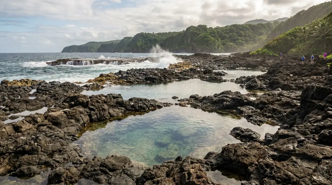
- Annaly Bay tide pools. The branch track off Scenic West is the driving route to the north shore's volcanic rock pools, the alternative to the hike from Carambola. Conditions in the pools rule everything — calm seas only — and the full checklist is in the tide pools guide.
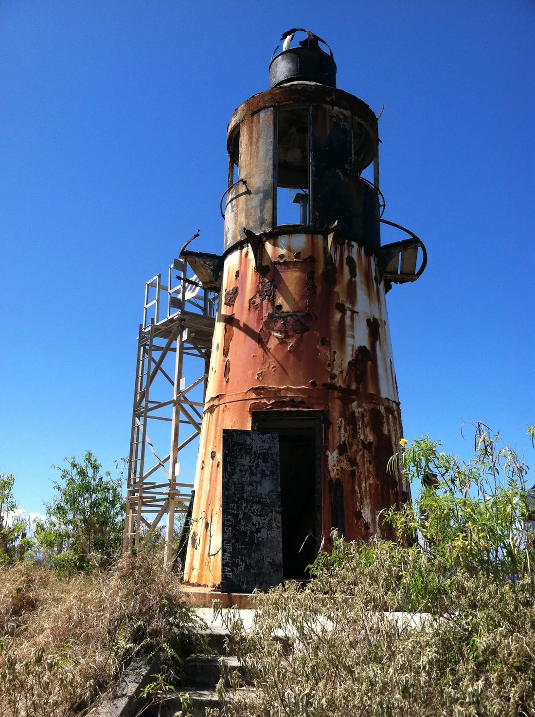
- Ham's Bluff Lighthouse. The Danish cast-iron tower of 1913 to 1915 stands about 360 feet over the sea at the road's western end — deactivated since the mid-1990s, with a plain truss tower now carrying the working light beside it — and is reached by a short, steep walk from the Ham's Bay lane. The route notes, and the reason you admire the tower from outside, are in the lighthouse guide; strong walkers can continue toward Maroon Ridge.
- Creque Dam. The mossy 1926 dam sits down Route 58 from the mid-route junction, with the island's one seasonal waterfall deeper in the same valley. Both, plus the safety rules for the guts that feed them, are in the Creque Dam guide.
- Mount Eagle. The island's high point is a walk off Scenic West rather than a drive-up: from the small parking area, hikers describe roughly 25 minutes on a wide, partly shaded path to the summit cairn, with an overlook about a hundred yards past it that opens onto Cane Bay and the whole north shore. There is no better view-per-effort ratio on St. Croix.
One naming trap serves as a footnote to the list. The bay reached by the walking route from Carambola is Wills Bay, which visitors routinely call Annaly Bay; the St. Croix Hiking Association points out that Annaly Bay and its larger pools lie farther west along the coast, over harder ground. The distinction rarely changes anyone's plans — the Wills Bay pools are the ones in the photos — but it explains why maps, tour operators and trip reports seem to disagree about where the trail ends.
The road on foot
Locals treat the Scenic Road as a trail with a route number, and that is the cheapest way to experience it. The St. Croix Hiking Association runs group outings here — its Mount Eagle hikes meet at the Route 69 crossing and cover about 5.5 miles round trip along Scenic West to the summit and back, often led by the ecologist Olasee Davis, whose commentary on the forest is worth the early alarm by itself. The association's events are open to visitors; its calendar, plus the island's full trail lineup, is in the hiking guide.
Walking solves every problem the road poses to vehicles. No contract clause, no clearance, no stuck. What it does require: a dawn start before the heat, more water than feels necessary, real shoes, bug spray for the shaded stretches, and a turnaround time you actually obey. Trail runners and mountain bikers use the ridge too — the surface suits fat tires far better than rental sedans — though anyone on two wheels should assume zero traffic one minute and a jeep tour around a blind bend the next.
Guided instead of driving
If the contract, the vehicle, or the nerve says no, the ridge is still reachable. These operators were running at last check; confirm details when you book, because prices and schedules move.
- Tan Tan Tours runs open-air 4WD trips out of Christiansted (33 Queen Cross Street) and has made the Scenic Road corridor its business for years. As published in August 2026: a 2.5-hour tide pools run at $200 per person, a 4.5-hour half day at $280, and a 7.5-hour full day at $350, each with a three-person minimum or a two-person option for an extra $100 private fee. The driving down to Annaly Bay is half the show.
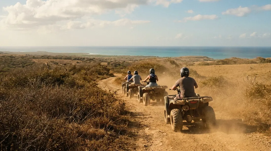
- Gecko's Island Adventures covers the west-end hills on ATVs and a guide-driven five-seat UTV from downtown Frederiksted, with two-hour tours over roughly 16 miles of mountain track, a stop at the Mt. Stewart summit and a descent through the forest. At last check: $175 per ATV driver, $75 per passenger, with the UTV seats at $100 (and $75 for kids five to ten).
- Ridge to Reef Farm is the forest's standing institution rather than a tour: the U.S. Virgin Islands' only USDA-certified organic farm, founded in 2010 on about 100 acres at Estate Little La Grange, at No. 1 Creque Dam Farm Road. It hosts farm tours, farm-to-table dinners and overnight farm stays by arrangement, and has sold from an on-site stand on a published weekly schedule — arrange any visit ahead rather than dropping in, and treat posted days and hours as changeable.
A jeep tour also functions as reconnaissance: ride the road once with someone who drives it weekly, then decide whether your own rental adventure still sounds necessary.
Conditions, storms, and closures
The Scenic Road has no maintenance schedule anyone publishes, no grader on retainer, and no closure notices. What it has is weather. Heavy rain cuts new gullies across the roadbed and greases the clay; tropical systems drop trees and trigger washouts that can sever a stretch for months or years; and the canopy hides damage until you are on top of it. The pattern since at least the mid-2010s has been damage first, repair eventually or never — which is why every year's conditions differ from the last, and why the only current information is local information.
Build your timing around the island's rain calendar. The driest window runs roughly January through April, and it is the best season for ridge driving; September through November is the wettest stretch and the worst. The two-landscapes guide explains why these particular hills catch the island's rain — upward of 50 inches a year against half that on the East End — and that arithmetic is the whole story of this road's surface. After any storm, give the ridge days to drain, and after a named storm, assume nothing until someone who has driven it tells you otherwise.
Safety and practicals
- Tell someone. Leave your route and a return time with your villa host or a friend. This is the one road on St. Croix where that habit earns its keep.
- Daylight only. Start in the morning. Every recovery scenario — digging, walking out, flagging help — gets dramatically worse at dusk, and there is no lighting of any kind up here.
- No fuel, no facilities. There is nothing to buy between the coast and Centerline: no gas, no water, no restrooms. Fill the tank in town and carry more water than the drive seems to justify.
- Assume no signal. Coverage in the high forest is patchy at best. Download offline maps before you climb, and do not build your safety plan around a phone call.
- Respect gates and yards. The ridge threads private estate land, working farms and the odd subdivision access. A gate, a chain or a No Trespassing sign ends that spur of the adventure; turn around without debate.
- Getting unstuck is on you. There is no roadside service up here in any practical sense. Recovery means self-rescue, a passing local with a strap, or an expensive conversation with your rental company — a fourth reason the guided option keeps winning arguments.
- Two vehicles beat one. If your group rented two SUVs, run the ridge together. It converts most stuck-car scenarios from a crisis into a story.
Segment guide
Conditions shift with every wet season; this table describes the stable pattern, not this week's mud. Verify locally before driving anything below.
| Segment | Surface | Vehicle, in dry weather | Payoff |
|---|---|---|---|
| Ham's Bay lane (Rt 63 to lighthouse trailhead) | Rutted dirt, mud holes | High clearance best; careful ordinary cars manage at walking speed | Ham's Bluff Lighthouse walk, Maroon Ridge access |
| Scenic West: Ham's Bay climb to Annaly forest | Rock ledge, clay, deep ruts | True 4WD with clearance; experienced driver | Deepest canopy, north-shore overlooks, tide pools branch track |
| Scenic West: Creque Dam Rd junction to Rt 69 crossing | Bumpy unpaved single lane | High-clearance SUV; hikers often walk it instead | Mount Eagle summit walk, both-coast ridge views |
| Scenic East: Rt 69 crossing toward Salt River | Unpaved and degraded; short paved stretch at the Salt River end (2016 report) | Serious 4WD only beyond the paved end | Blue Mountain hills, Salt River Bay and Buck Island views |
| Any segment after heavy rain | Grease, standing water, fresh washouts | None — no rental vehicle, no exceptions | None; drive Mahogany Road and come back in a dry spell |
If the answer is no
Most visitors, most weeks, should skip the drive — and lose surprisingly little. Mahogany Road, Route 76, crosses the same forest on pavement, with the Domino Club's pigs partway along; it is the right call for every ordinary car and every wet day, and the Domino Club guide covers the famous stop. North Shore Road serves up the coast's drama with guardrails, as part of the loop in the drive-around guide. The rainforest and west end guide pulls the full western day — forest roads, dam, coast, beaches — into one plan, and none of it needs a millimeter more clearance than a compact rental has. The Scenic Road rewards exactly one profile: a dry week, a capable vehicle, written permission to drive it, and a driver who thinks the road is the destination. If that is you, it delivers. If it is only three of the four, book the jeep tour.
Questions guests ask
Do I need real 4WD, or is an all-wheel-drive crossover enough?
For the core of Scenic West in dry weather, you want genuine four-wheel drive with high clearance — the problem is as much geometry as grip, and crossovers sit too low for the ledges and ruts even before traction enters it. The gentler pieces, like the lane to the lighthouse trailhead or the stretch near the Mount Eagle parking area, forgive a high-riding SUV driven slowly in a dry spell. Wet ground moves every segment up a difficulty class, and fresh rain removes all of them from the menu regardless of what you are driving.
Can a regular rental car do any of it?
Two pieces, cautiously, in dry weather: the rutted Ham's Bay lane to the lighthouse walk, taken at walking speed, and the paved tail at the Salt River end as reported in 2016. Treat both as maybes that a wet month can cancel, and turn around the moment the surface outclasses the car. Everything between those ends is off the table for a sedan in any season — high crowns and rock ledges will stop you before mud gets the chance.
Will my rental agreement allow it?
Read it — this is the clause that matters most on St. Croix. Many island rental contracts exclude unpaved roads entirely, which can void your damage coverage the moment you leave asphalt, even in a Jeep. Some companies rent 4x4s specifically for this kind of driving and say so; if the ridge is on your list, raise it at booking and keep the answer in writing. When the contract is silent or ambiguous, ask directly rather than assuming, and when the answer is no, take a tour instead.
How long does the Scenic Road take to drive?
Budget a half day for the western half alone. The distances are small — the whole corridor is on the order of ten-plus miles end to end — but dry-day speeds run at a crawl over the rough stretches, and the stops are the point: the lighthouse walk, the Mount Eagle summit, the overlooks. Add the descent to Annaly Bay or a Creque Dam detour and you have filled the day. Nobody should schedule this road; it decides its own pace.
Is the Scenic Road the same as Mahogany Road?
No, and mixing them up matters. Mahogany Road is Route 76, paved end to end, driveable in any car, and home to the Domino Club — the forest drive for everyone. The Scenic Road is Route 78, the unpaved ridge route above it, and it needs the vehicle, the weather and the contract permission this page describes. They connect through the forest road network, so plenty of visitors drive 76 and taste the canopy without ever touching 78.
How do people reach the Annaly Bay tide pools by vehicle?
Via the branch track off Scenic Road West — and for nearly everyone, that means a guided trip rather than a rental. Tan Tan Tours has run that descent for years, with the 2.5-hour tide pools outing listed at $200 per person and a three-person minimum as of August 2026. Self-driving it requires everything this page warns about, plus familiarity with the unsigned turns. The hike from Carambola remains the free route; the tide pools guide compares both and carries the calm-seas rule that governs any visit.
Is there gas, water, or cell service on the ridge?
No, no, and unreliable. Stations cluster in the towns and along Centerline; nothing sells anything between the coast and the mid-island roads. Carry your own water, start with a full tank, download offline maps, and assume the phone will show no bars exactly where you would want them. The old backcountry rules apply in full: tell someone your plan, start in the morning, and carry out your own mistakes.
Can I walk or bike the Scenic Road instead of driving it?
Yes, and locals do exactly that. The hiking association's outings use Scenic West as a footpath — its standard hikes run three to five miles over three to five hours at a moderate pace, and the Mount Eagle round trip from the Route 69 crossing fits that pattern — while mountain bikers find the surface friendlier to knobby tires than to any rental car. Go at dawn for the cool air, carry water and bug spray, and listen for tour jeeps on the blind bends; the ridge is quiet, never certain empty.
What time of year is best?
The dry season, roughly January through April, gives the road its longest stable spells and is the window we would pick for any self-drive attempt. June and July often bring a drier lull worth watching. September through November is the wet heart of the year, when clay stays greasy for days and washouts appear between one week and the next — tour operators still run then, on their own judgment, which is one more argument for letting them do the driving in that season.
Staying near the western forest
Ridge days start easiest from the west. Sunset Sea-Clusion, our home in Frederiksted, puts the Route 63 coast road — and every western gateway to the Scenic Road corridor — within about ten minutes, close enough to check conditions with a morning drive and still salvage a beach day if the ridge says no. From our Christiansted and East End homes, the forest sits under an hour away, an easy morning launch for a Tan Tan departure from Queen Cross Street. Either way, plan the ridge early in the stay: if the weather cooperates, you will want the option of going back.
Sources
Written from official and first-party sources, checked August 2026. Hours, prices and event dates change — confirm before you go.
In this guide
Stay nearby
On The Shoys beach: six bedrooms, six baths, pool and hot tub, room for twelve, and the beach through the back garden.
 Shoy's Beach House6 bd · 6 ba · sleeps 12 · Christiansted
More in Land & Adventure
Sources
11 references, listed in full at the end of this guide — official park, refuge, tourism-board and business sources, checked August 2026.