Hiking Goat Hill
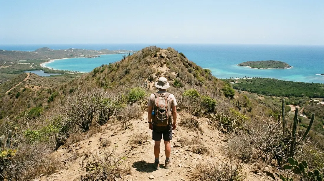
A roughly 672-foot East End summit with 360-degree views down the island's spine, over both coasts, to Buck Island and Point Udall.
Goat Hill is the high point of St. Croix's far East End, a bare ridge that climbs to about 672 feet above the sea at the island's eastern tip. From the crest you can see water on both sides at once, Buck Island to the north and Point Udall to the east, which is why regular walkers rate it the finest land view on this half of the island.
Where Goat Hill sits
St. Croix carries two climates on one small island. The west end is wet and green; the East End is dry, breezy and covered in cactus and low scrub, taking only 25 to 38 inches of rain a year. Goat Hill belongs entirely to that dry country. It rises at the narrow eastern tip of the island, part of a ridge that runs from the land above Point Udall down to the low neck between Knight Bay and Grapetree Bay on the south shore. Its neighbor to the west along the same spine is Sugarloaf Hill, a little higher and a longer walk.
At roughly 672 feet, Goat Hill is nowhere near the island's true summit; that title goes to Mount Eagle, 1,165 feet, over in the western hills. What makes this the view people talk about is not height. It is position. The hill stands alone at the end of a tapering point, so nothing blocks the sightlines. The land falls away on every side to the sea, and the whole eastern quarter of St. Croix lies below you. The blue water spread below belongs to a protected zone, the St. Croix East End Marine Park, which was the first marine reserve the U.S. Virgin Islands set up for itself, and its reefs run out past the hike-in bays. More on that further down.

Getting to the trailhead
Goat Hill sits at the eastern tip of the island, so every trip to it runs east along Route 82, the main East End road. From Christiansted and the homes around it, the trailhead opposite Cramer's Park is roughly 25 to 30 minutes away; from Frederiksted in the west, allow closer to three-quarters of an hour. No bus serves it and there is no ride-share on St. Croix, so you need a rental car, or a taxi willing to wait, which is one more reason most guests rent for a dawn start.
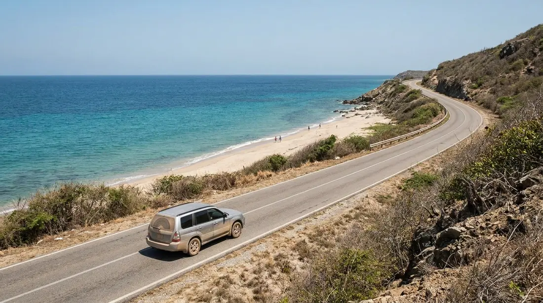
Two local habits are worth a reminder. Traffic here keeps to the left, in cars with the wheel on the left as well, so ease into the narrow East End bends rather than rushing them. And fill the tank before you head east, because filling stations thin out past Christiansted. The road is paved the whole way to Cramer's Park and on to the Point Udall loop; the only unpaved stretch is the dirt track up the hill, and you cover that on foot.
Finding the trailhead
The walk starts from the roadside opposite Cramer's Park, the public beach near the end of the East End road, Route 82. There is no sign for Goat Hill and no gate. The landmark to aim for is the large white dish antenna that stands beside the road just before the park. A dirt track leaves the pavement on the east side of that dish and heads up into the scrub. That track is the trail.
The dish is not decoration. The dish belongs to the Very Long Baseline Array, and this is its St. Croix station, a 25-meter (82-foot) radio telescope that ranks as the easternmost of ten matching antennas spread across the country, reaching from here to Mauna Kea in Hawaii some 5,000 miles off. Astronomers run it remotely to fix the positions of distant objects and measure the slow drift of the continents. For hikers it does one plain job: it is impossible to miss, so it is the surest way to find the start. The East End guide tells the antenna's full story.
Park sensibly. Most people leave the car in or beside the Cramer's Park lot and walk across the road. Do not block the dirt track or the antenna's service gate. See the safety section below for the usual note about valuables in a car left at a quiet trailhead.
The climb, bottom to top
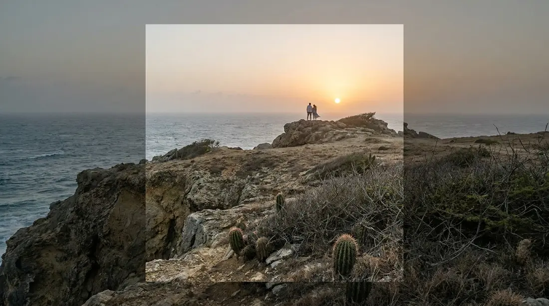
The route is a former four-wheel-drive road that years of rain have cut down to a walking path. It is wide, rough and rutted, which makes it easy to follow and hard on the ankles at the same time. From the bottom the grade is gentle, then it tips up and stays up. You gain most of the hill's 672 feet in a single mile, so the second half is a steady climb rather than a scramble.
There is a first crest partway up where the ground briefly levels and the view opens. It gives a preview of the summit panorama and a natural place to judge whether the heat is winning. Many people pause here, and it is a fair turnaround for anyone already feeling the heat. The summit proper is a little farther, past a last steep pitch. Round trip from the road is about two miles, a bit more if you carry on along the ridge. Most parties are up and back in ninety minutes to two hours, plus whatever time you spend at the top, which tends to run longer than planned.
Route-finding is easy in the sense that the old road is obvious, but there are places where goat and cattle paths branch off it. Keep to the widest, most worn line, keep climbing, and you will reach the top. On the way down, loose gravel over hard stone is the real concern; take it slowly, especially where the grade is steepest. Trekking poles help knees that object to steep, rocky descents.
The view from the summit
The top is open on all sides, with nothing tall enough to stand in the way. Look west and the island runs away from you down its own spine toward the central hills. Turn north and Buck Island sits offshore with its reef; turn east and the land narrows to Point Udall and the Millennium Monument, with open Atlantic beyond. To the south lie Grapetree and Knight Bays and the south coast. Almost straight below, on the northeast side, the twin crescents of Jack's and Isaac's Bays curve against the reef. Seeing both coasts of St. Croix in a single turn is the thing that puts Goat Hill near the front of any list of island viewpoints.
| Look | What you see |
|---|---|
| North | Buck Island, its reef and the north coast |
| East | Point Udall, the Millennium Monument, open Atlantic |
| South | Grapetree and Knight Bays, the south shore |
| West | the island's spine toward the central hills |
| Below, northeast | Jack's and Isaac's Bays and their reef |
Photographers get the widest single frame of the East End from here, coast to coast in one shot. Morning light favors the eastern half toward the point; late afternoon warms the hills to the west. Wind is constant on the summit, so keep a hand on hats and loose gear.
Heat and water
The one fact that governs this hike is that there is no shade. Not a tree, not an overhang, not a single step of relief from the sun between the road and the summit. On the dry East End the midday sun and the heat thrown back off pale rock make the climb dangerous in the hot months, and people have turned back sunstruck who would have been fine two hours earlier.
Carry more water than feels necessary: at least two liters per person for the round trip, and more in summer or if you plan to linger up top. Drink before you are thirsty. Wear a hat and sunglasses, cover your shoulders or use strong sunscreen, and reapply. There is no water source on the hill and nowhere to buy any at the trailhead, so whatever you need, you bring.
The timing rule follows from all of this: climb at first light or in the last cool hour before sunset. For most of the year the middle of the day is simply too hot to attempt safely on a slope with no cover. Our island hiking guide collects the same heat-and-water discipline for every exposed trail on St. Croix.
Footing and terrain
Underfoot, Goat Hill is loose gravel scattered over fixed stone, with ruts and small ledges where the old road washed out. It is not technical. It does roll and slide, though, and the steeper it gets, the more it wants to send you down on the descent. Closed shoes are not optional. Flip-flops and thin sandals fail here on the first slope, and the real hazard at the edges is the cactus and casha thorns waiting for a bare toe.
You do not need boots. Trail runners or trainers with proper tread handle the hill well. What matters is a closed toe, a sole thick enough to shrug off sharp gravel, and grip you trust on a loose downhill. Longer shorts or light trousers save your shins from the scrub where the path narrows. The hiking overview has the full footwear breakdown by terrain if you are choosing one pair for the whole trip.
Riding the track
The same rutted road that carries hikers is also ridden. Mountain bikers treat the Goat Hill track as one of the island's few genuine climbs, grinding up the loose gravel to earn the descent back down. It is a lungs-and-brakes effort rather than a technical trail, and everything said here about heat, water and sun counts double when you are working that hard on an open slope. If you did not travel with a bike, ask an island rental shop what they carry and what shape the track is in; loose surface and zero shade make this an early-morning ride only.
Guided or on your own
Goat Hill is one of the East End walks most people do without a guide. The old road is clear, the distance is short, and as long as you start from the dish and keep to the widest track uphill, you will not get lost. The St. Croix Hiking Association, the island's volunteer walking club, counts it among its regular outings, sometimes as a full-moon evening climb, which tells you it is a well-trodden, established route rather than a bushwhack.
Going with someone still has its reasons. A guide or a group adds a margin of safety on a hot, exposed hill where a twisted ankle a mile from the road becomes a serious problem, and a naturalist can name the plants and point out the goats and birds you would otherwise walk past. If you would rather not sort the logistics, several island operators run guided East End and Goat Hill hikes; treat their schedules and prices as changeable and confirm when you book. Whichever way you go, do not climb it alone in the heat, and tell someone your plan. Our hiking guide lays out which St. Croix trails are fine solo and which really want a guide.
When to go
Time of day matters more than time of year. A dawn start is the best version of this hike in any season: the air is coolest, the light is low and kind, and you can be back at the villa for breakfast before the sun has any real force. The last hour before sunset is the other good window, with the western hills going gold as you come down.
By season, the sweet stretch runs through the dry, breezy period from roughly December to April, when the Christmas Winds keep the East End cool into the middle of March. Summer and early fall are hot enough that the dawn-or-dusk rule stops being advice and becomes the plan. The East End's dryness gives one advantage: unlike the western rainforest trails, this ground drains and dries fast, so a passing shower rarely leaves it muddy for long. Rain on the gravel can make the steep sections slick for an hour, but the heat dictates when you climb, more than the mud ever does.
The dry forest around you
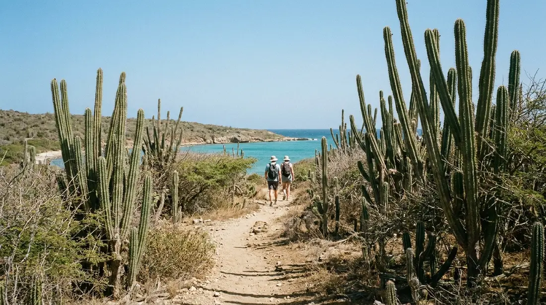
The scrub on Goat Hill is a working habitat, not waste ground. The plants are the tough, drought-adapted kind: several cacti, thorny casha (a local acacia), eugenia, and ginger thomas, the yellow-flowered Tecoma stans that is the official flower of the U.S. Virgin Islands. Everything up here is built to hold water and defend itself, which is why so much of it carries spines.
The hill is named for goats, and the name is earned. Feral goats have roamed this end of St. Croix since at least the 1890s, and their grazing is part of why the East End reads as bush rather than forest. You may see them on the slopes or hear them before you see them. White-tailed deer, brought to the island in the 1700s for sport and smaller than the mainland kind, live across St. Croix and turn up on the East End too, usually at the quiet edges of the day. Birds work the scrub and ride the thermals over the ridge. Give the goats room, do not feed anything, and carry your trash back down.
The marine park below
The water you look down on from the summit is the St. Croix East End Marine Park, set up in 2003 as the territory's first locally managed marine protected area. It wraps the whole East End, roughly from Green Cay on the north shore around to Great Pond Bay in the south, and takes in the reefs off Jack's and Isaac's Bays. The East End guide covers the park and its rules; from Goat Hill it is simply the frame around the view.
Making it an East End day
Goat Hill is short, so it pairs naturally with the rest of the East End into one easy day, all of it inside about ten miles of road and half an hour's driving end to end.
- Sunrise at Point Udall. Start at Point Udall, the country's easternmost tip, for first light, then drive the few minutes back to the dish. See the Point Udall guide.
- Goat Hill next. Climb while the air is still cool, before the sun gets to work on the bare slope.
- Jack's and Isaac's Bays. The trailhead by Point Udall drops to two undeveloped hike-in beaches for a swim and a snorkel. See the bays guide.
- Cramer's Park. Easy swimming and shade under the pavilions, right at the Goat Hill trailhead. See Cramer's Park.
- A meal nearby. The East End has a short, good list of places to eat; see East End restaurants.
Strong walkers with an early start can add the ridge west toward Sugarloaf Hill for more distance and more climbing, but that turns a short outing into a serious one. Carry the water for it and watch the clock against the heat.
Goat Hill at a glance
Figures below are typical and rounded; distances and times shift with pace and with how far along the ridge you go. Treat the times as a guide, not a promise.
| Detail | Goat Hill |
|---|---|
| Location | Far East End, opposite Cramer's Park (Route 82) |
| Summit elevation | About 672 feet |
| Distance | About 2 miles round trip |
| Climbing | Most of the 672 feet, in roughly a mile up |
| Time | 1.5 to 2 hours round trip, plus time at the top |
| Difficulty | Short but steep, on loose rock |
| Footing | Loose gravel over stone; old jeep road |
| Shade | None anywhere on the trail |
| Water | Carry 2 liters or more per person |
| Facilities | None at the trailhead; toilets and pavilions at Cramer's Park |
| Best time | Dawn or late afternoon; December to April coolest |
Safety and practicals
Nothing about Goat Hill is extreme, but the mix of heat, sun and loose rock is what catches people out. The rules are simple and worth keeping:
- Do not hike it alone, and do not hike it in the middle of a hot day.
- Tell someone where you are going and when you expect to be back.
- Carry at least two liters of water per person, a hat, and sunscreen. There is none on the hill.
- Wear closed shoes with grip. The descent on loose gravel is where ankles go.
- Watch for cactus and casha thorns at the trail edges, and give any goats room.
- Cell coverage is usually decent on the open ridge, but do not count on it in every dip.
- There are no toilets, bins or water at the trailhead; the nearest are at Cramer's Park.
- Leave nothing visible in a parked car. This is a quiet trailhead, so take valuables with you.
If the sea and the heat both look wrong for a full East End plan, Goat Hill on its own is still a short, high-value outing at the right hour. Save the harder western hikes, such as the Annaly Bay tide pools, for a separate day.
Questions guests ask
How hard is the Goat Hill hike?
Short but steep. The distance is only about two miles round trip, and most reasonably fit adults manage it comfortably. What makes it feel harder than the mileage suggests is the grade and the ground: you climb most of 672 feet in a single mile, on loose gravel over stone, with no shade at any point. Fitness matters less here than heat management. Go at a cool hour with enough water and it is a moderate walk. Attempt it at midday in July and it becomes a hard one for anybody.
How long does Goat Hill take?
Plan on ninety minutes to two hours for the round trip from the road, plus however long you stay at the summit, which is usually longer than people expect once the view is in front of them. A dawn start means you can climb, take it in, and be back down before the sun has real strength, which is the whole trick to enjoying it. Add a good chunk of extra time if you continue west along the ridge toward Sugarloaf Hill.
Is the trail marked, and can I do it without a guide?
There is no sign and no formal marking, but the route is an obvious old road, and most people do it without a guide. Find the large white dish antenna beside the road near Cramer's Park, take the dirt track up its east side, and keep to the widest, most worn line as you climb. Ignore the smaller goat and cattle paths that branch off. If you would rather have company, the St. Croix Hiking Association runs it as a group walk and island operators offer guided versions. Just never climb it solo in the heat.
Are there really goats on Goat Hill?
Yes. Feral goats have lived on the East End of St. Croix since at least the 1890s, and they are a large part of why the hill is open scrub rather than forest. You may spot them grazing on the slopes or hear them among the rocks. White-tailed deer, introduced to the island in the 1700s, also roam the East End and turn up around dawn and dusk. Give the animals space, and do not try to feed them.
When is the best time of day to climb?
First light, with little competition for it. The air is coolest at dawn, the low sun is easy on the eyes, and you dodge the worst of the heat on a hill with no cover. The last hour before sunset is the other good window, with warm light on the western hills as you descend. The middle of the day is the one stretch to avoid, especially from late spring through fall, when the exposed slope gets dangerously hot.
Can children do Goat Hill?
Older children who are used to walking can do it, provided they carry their own water, wear sun cover and closed shoes, and you go early. The limiters are the heat and the loose footing on the descent, more than the length. It is not a walk for toddlers or for anyone who needs to be carried, and there is no shade to retreat to if a child overheats. If in doubt, Cramer's Park at the trailhead gives younger ones an easy beach morning while others climb.
Where do I park, and is my car safe?
Most people park at or beside Cramer's Park and walk across to the dish and the dirt track; do not block the track or the antenna's service gate. As at any quiet trailhead, leave nothing visible in the car and take your valuables with you. Cramer's Park is a public territorial beach with pavilions and toilets, so it makes a sensible base for the car and for anyone in the group who would rather swim than climb.
Villas at the base of the East End
Goat Hill and its trailhead sit at the far end of the same road our East End homes look out over, which makes a dawn climb an easy morning from bed. The Cerulean sits on its own East End beach; Moko Vista is a hilltop house with the ocean views its name describes; and Dragonfly Villa gives a group a pool to come back to. The Buck Island Overlook faces the same island you pick out from the summit. Look through the East End homes or our full list, and tell us which hikes you have your eye on, and we will steer you to the right morning for each.
Sources
Written from official and first-party sources, checked August 2026. Hours, prices and event dates change — confirm before you go.
In this guide
Stay nearby
On The Shoys beach: six bedrooms, six baths, pool and hot tub, room for twelve, and the beach through the back garden.
 Shoy's Beach House6 bd · 6 ba · sleeps 12 · Christiansted
More in Land & Adventure
Sources
8 references, listed in full at the end of this guide — official park, refuge, tourism-board and business sources, checked August 2026.