
St. Croix, U.S. Virgin Islands
A plain, sourced profile of St. Croix: how big the island is, who lives here, the weather month by month, how to fly in, a short history, the beaches, the water, the food, and the questions visitors ask most. Written from official and first-party sources and checked in August 2026.

St. Croix at a glance
St. Croix is the largest of the U.S. Virgin Islands, in the eastern Caribbean. It is a U.S. territory, which shapes almost everything about a visit: U.S. citizens arrive without a passport, spend U.S. dollars, use their own phones, and fly home with no foreign customs to clear. The island is 84 square miles — roughly 22 miles from end to end and 7 across — and 41,004 people lived here at the 2020 census. Tourism accounts for about 60% of the wider territory's economy, but St. Croix is also a working island, with two historic towns, farms, and the ruined stone windmills of the sugar estates that once ran it.
| Location | Eastern Caribbean; the largest of the U.S. Virgin Islands |
|---|---|
| Status | Unincorporated U.S. territory — U.S. citizens travel with no passport |
| Size | 84 square miles (220 km²); about 22 miles east to west, 7 north to south |
| Population | 41,004 (2020 U.S. Census) |
| Two towns | Christiansted (northeast) and Frederiksted (west) |
| Highest point | Mount Eagle, 1,165 feet |
| Easternmost point of the U.S. | Point Udall, on the East End |
| Currency & phones | U.S. dollar; U.S. cell networks; area code 340 |
| Driving | On the left, in standard left-hand-drive cars; no Uber or Lyft |
| Airport | Henry E. Rohlsen Airport (STX) |
| Time zone | Atlantic Standard Time (UTC−4); no daylight saving |
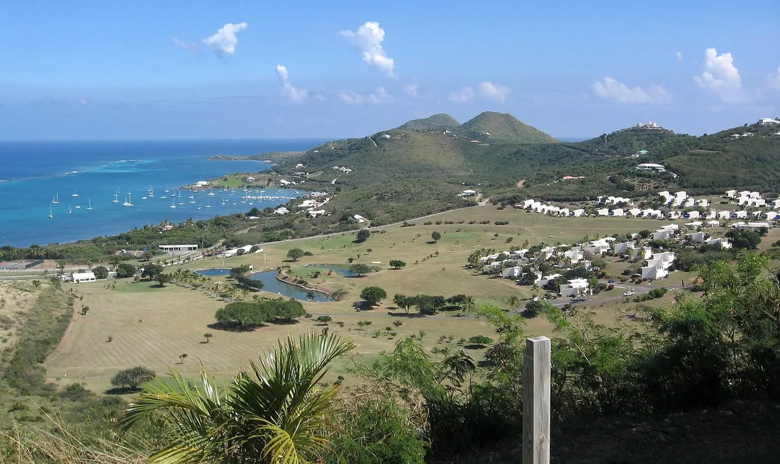
One thing surprises most first-time visitors: St. Croix holds two landscapes at once. The west end is lush, with a small rainforest that catches more than 50 inches of rain a year; the east end is dry and scrubbed with cactus, closer to 25 to 38 inches. You can drive from one to the other in under an hour and feel like you have changed islands.
What draws many people is the combination of Caribbean and convenient. Because it is a U.S. territory, a trip here skips the friction of foreign travel — no passport for U.S. citizens, familiar money and phones, and a flight home with no customs line — while still delivering a reef, a rainforest and Danish colonial towns. And at 84 square miles with about 41,000 residents, St. Croix stays comparatively unhurried: it has real towns and traffic at rush hour, but also long stretches of coast where a beach can be yours for an afternoon. The rest of this reference walks through the practical questions in turn, from weather and flights to history, beaches and food.
Where St. Croix is, and how the island is laid out
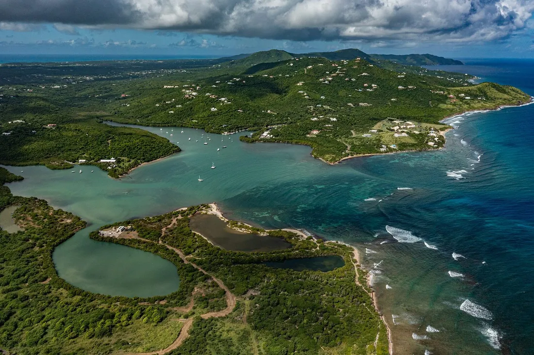
Picture a long, narrow island running east to west. The high ground sits in the northwest, topped by Mount Eagle at 1,165 feet, and the land tips down toward the flat, dry East End. The far tip of that East End is Point Udall — the easternmost point of the United States, and the first place in the country to see the sunrise.
Life centers on two towns. Christiansted, on the northeast coast, is the larger and the older capital, wrapped around a working harbor. Frederiksted sits on the west coast and is the calmer, sunset-facing town, with the island's cruise pier. Locals sometimes call the pair the “Twin City.” Henry E. Rohlsen Airport sits toward the south-central coast, roughly 15 to 20 minutes from Christiansted, 30 to 40 minutes from the East End, and 10 to 15 minutes from Frederiksted.
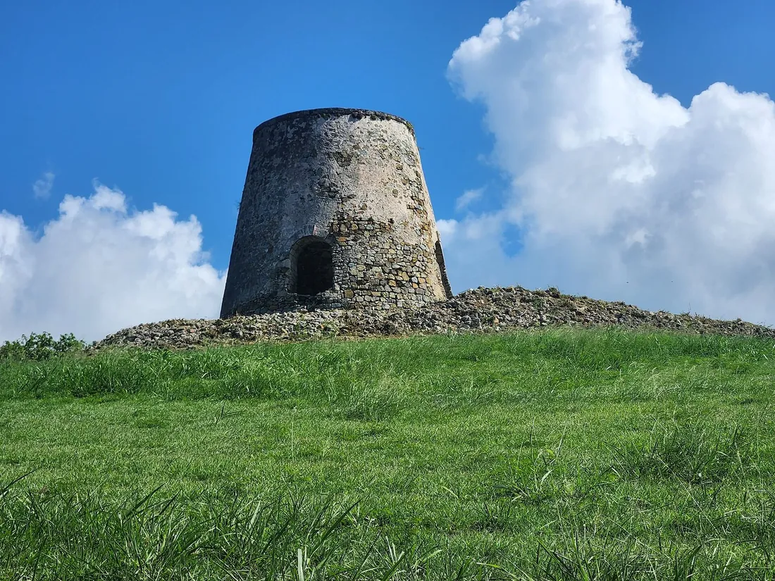
Between the towns, the land tells the island's older story. Sugar built St. Croix — at its peak the island held more than 150 sugar mills — and the ruined stone windmills of those estates still stand on hillsides all over the island, some now framed by the entrances to modern neighborhoods. Driving from the dry, cactus-lined East End to the green, forested northwest, you pass through that history without stopping: the same 22-mile island that gives you a desert beach in the morning gives you a rainforest road in the afternoon.
Do U.S. citizens need a passport for St. Croix?
No. St. Croix is part of the U.S. Virgin Islands, an unincorporated U.S. territory, so for U.S. citizens a trip here works like domestic travel. There is no passport requirement, the currency is the U.S. dollar, and cell phones run on U.S. networks under area code 340. You will not clear foreign customs on the way home — but you will pass a U.S. Department of Agriculture and pre-clearance check at the airport before your return flight, so leave time for it. Travelers who are not U.S. citizens follow the ordinary rules for entering the United States. The one habit to unlearn: on St. Croix you drive on the left, in normal left-hand-drive cars, a leftover of the island's Danish past.
The weather, month by month
St. Croix is warm and even all year. The overall average is around 80°F. Winter days sit near 83°F; summer days climb to about 88 or 89°F. It rarely falls below 68°F or rises above 90°F, and the sea stays swimmable in every month. What changes through the year is not the heat but the rain and the wind.
The dry season runs from January into April, with March the driest month of all. The wet season stretches from May to December, but with a reliable drier lull in June and July; the wettest stretch is September through November, when close to 40% of the year's rain falls and September is the heaviest. Even then, rain here usually arrives as short passing showers rather than all-day gray. From about mid-December to mid-March the trade winds pick up — the “Christmas Winds” — and bring the coolest, driest, breeziest weather of the year.
| When | Season | What to expect |
|---|---|---|
| December–March | Peak season · the Christmas Winds | The coolest, driest and breeziest stretch, with brisk trade winds and days around 83°F. The busiest and most expensive time to come. |
| January–April | Dry season | The least rain of the year, with March the driest month. Reliable weather for the beaches and for diving. |
| May–August | Early wet season | Warmer, with days around 88–89°F and a drier lull in June and July. Rain tends to come as short passing showers; fewer visitors. |
| September–November | Wettest & quietest | Roughly 40% of the year's rain falls now, heaviest in September. The greenest, quietest and best-value stretch — and the most active part of Atlantic hurricane season. |
When is the best time to visit St. Croix?
There is no bad month to swim, so the question is really about crowds, price and rain. The peak is December through April: the Christmas Winds keep things cool and clear, the water is calm for diving, and the island is at its busiest and most expensive. If you want the best weather and do not mind paying for it, come then.
For value and quiet, look at September through November. The island is at its greenest, the beaches are near-empty, and rates drop — but this is also the most active part of the Atlantic hurricane season, which runs June 1 to November 30 and peaks in August and September. Most days in that window are ordinary warm Caribbean days; the sensible move is to carry travel insurance and book a home with a flexible cancellation policy rather than to avoid the season outright. May through August is a middle ground: warm, a little more humid, with that drier lull in early summer and far fewer visitors than the winter peak.
It can also be worth timing a trip to an event. The Crucian Christmas Festival runs the carnival season from late December into early January, with the parades in Frederiksted. AgriFest, the island's farm-and-food fair, lands around the Presidents' Day weekend in mid-February. Taste of St. Croix, the big chefs' tasting, falls in June. Any of these turns an ordinary week into a busier, more festive one — and they book up local rooms and tables, so plan earlier if you are coming for them. Dates shift year to year, so confirm against the official calendar before you lock in flights.
How do you get to St. Croix?
Every visitor flies into Henry E. Rohlsen Airport (STX). A handful of U.S. cities have nonstop service, though some routes are seasonal or run only on certain days of the week — the schedules below were checked in August 2026 and are worth re-confirming before you book.
| Airline | From | Schedule (as published Aug 2026) | Flight time |
|---|---|---|---|
| American Airlines | Miami (MIA) | Year-round, one to three flights daily by season | about 3 hours |
| American Airlines | Charlotte (CLT) | Paused until Saturdays return November 7; daily beginning December 17, 2026 | about 3¾ hours |
| American Airlines | Chicago O'Hare (ORD) | Winter Saturdays beginning December 5, 2026 | about 4¾ hours |
| Delta Air Lines | Atlanta (ATL) | Saturdays through September 5; Saturdays again from November 14; daily except Mondays beginning December 19, 2026 | about 4 hours |
| United Airlines | Newark (EWR) | Saturday nonstops beginning October 31, 2026 | about 4½ hours |
If your city is not on that list, you will almost certainly connect through San Juan, Puerto Rico, which has the most frequent service into St. Croix. And if you are already in the Caribbean, a few short hops land here directly.
| Airline | From | Service | Flight time |
|---|---|---|---|
| Cape Air / JetBlue | San Juan, Puerto Rico (SJU) | Multiple daily, year-round | about 50 minutes |
| Fly The Whale | San Juan — Isla Grande (SIG) | Several round trips daily | about 40 minutes |
| Cape Air / Fly The Whale | St. Thomas, USVI (STT) | Multiple daily, year-round | about 25 minutes |
| Seaborne (seaplane) | St. Thomas — Christiansted Harbor to Charlotte Amalie | Schedules vary; one aircraft on the route | about 25 minutes |
| Cape Air | Nevis (NEV) | Fridays and Sundays | about 1 hour |
St. Croix and St. Thomas are also joined by a Seaborne seaplane between Christiansted Harbor and Charlotte Amalie, a flight of about 25 minutes (one aircraft flies the route in 2026, so check the current schedule), and by the QE IV passenger ferry between Gallows Bay and Charlotte Amalie, which takes a bit over two hours and costs about $70 one way (the schedule skips certain days, so check the week of your trip).
On the island itself, plan to rent a car. Remember the left-hand driving, and note that there is no Uber or Lyft here; taxis and taxi tours cover the gap if you would rather not drive. From the airport it is a short run to any of the three population centers.
Getting around the island
A rental car is the practical default. St. Croix is small — you can cross it in under an hour — but there is no ride-hailing, and the beaches, dive sites and towns are spread out, so a car turns the whole island into day trips. Several companies rent here, including Centerline, Judi of Croix, Olympic, Skyline, Budget and Hertz; some have airport counters and some deliver the car to your home, so it is worth asking when you book. Drivers used to the mainland adjust to two things: you drive on the left, and the roads are narrow and hilly in places, with the occasional free-roaming goat or chicken. Speeds are low across the island, which makes the left-hand driving easier to get used to than it sounds.
If you would rather not drive, taxis and taxi tours cover the island, and a half-day taxi tour is a common way for cruise and first-time visitors to see the highlights. Wherever you stay, plan to provision on the way in: the island's larger supermarkets, such as Seaside Market and Plaza Extra, are the easiest stops to stock a villa kitchen before you settle in, and buying groceries for the week is a big part of why so many visitors choose a home with a kitchen over a hotel room.
A short history of St. Croix
Few small islands have changed hands as often. Seven flags have flown over St. Croix — Spain, the Netherlands, England, France, the Knights of Malta, Denmark and the United States — and each left something behind.
The recorded history starts on November 14, 1493, when the fleet of Columbus's second voyage anchored at Salt River Bay. It is the only known place where his crew set foot on what is now U.S. soil, and it was the site of the first recorded armed clash between Europeans and Native people in the Americas. Today Salt River Bay National Historical Park and Ecological Preserve protects 1,015 acres there, including some of the territory's largest remaining mangrove forest and a submarine canyon offshore.
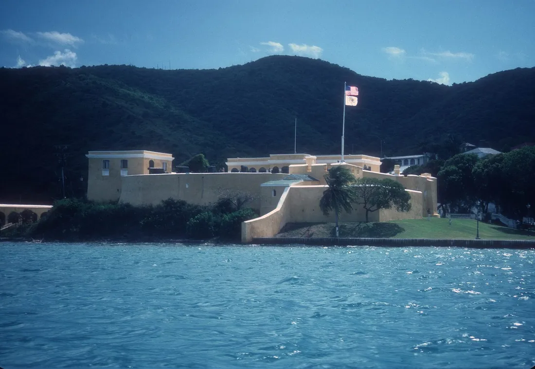
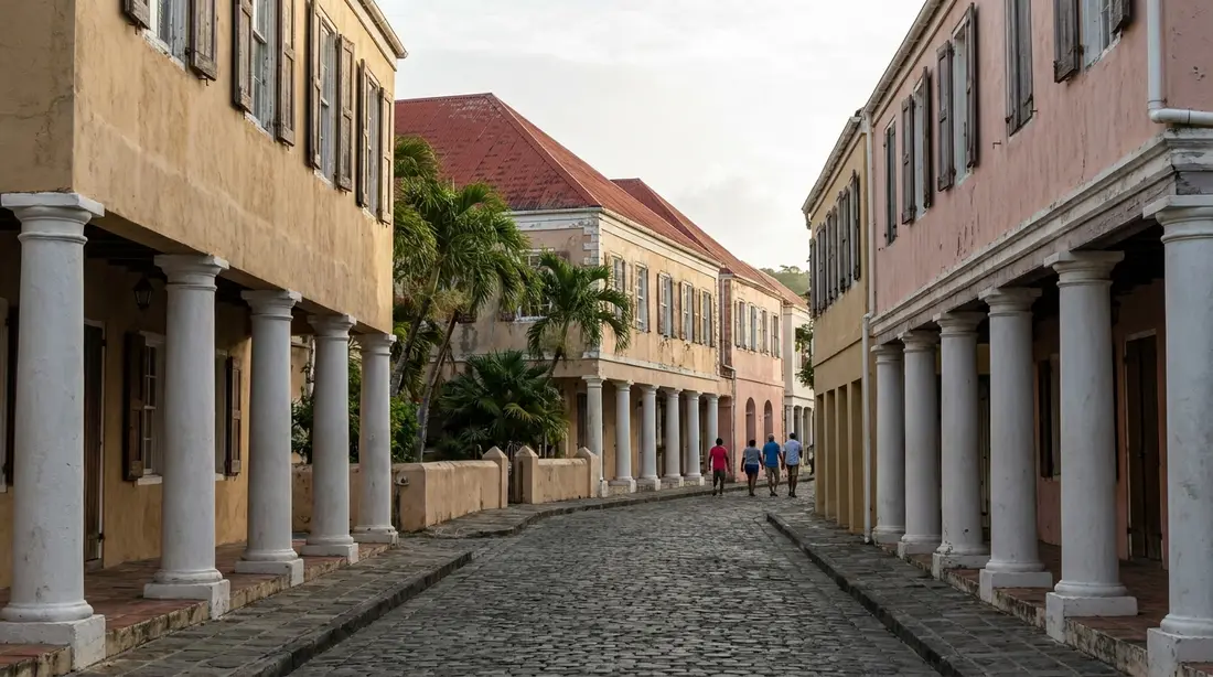
The island's shape today, though, is mostly Danish. In 1733 Denmark bought St. Croix from France for 750,000 livres, and the French handed it over in a ceremony on January 8, 1734. That year Frederik Moth founded Christiansted, which became the capital of the Danish West Indies; Fort Christiansvaern, built of yellow Danish brick, was finished by 1740. Christiansted is often described as one of the world's few African-Danish towns — laid out to Danish plans but built by enslaved Africans, with pastel stone buildings, red roofs, and the arcaded sidewalks, called galleries, that still shade King and Company Streets. A young Alexander Hamilton lived on Company Street from about age eleven, where his mother kept a shop, and clerked for the trading firm Beekman & Cruger before he sailed for New York in 1772. On the west coast, Frederiksted was laid out on a grid and guarded by Fort Frederik, built between 1752 and 1760.
It was at Fort Frederik that the island's most important day unfolded. On July 3, 1848, some 8,000 enslaved people, led by Moses “General Buddhoe” Gottlieb, marched on the fort, and Governor-General Peter von Scholten proclaimed emancipation from its ramparts. July 3 is still marked as Emancipation Day across the U.S. Virgin Islands. Three decades later, on October 1, 1878, the “Fireburn” labor revolt — led by four women, the best remembered of them “Queen Mary” Thomas — burned much of Frederiksted and some 50 plantations; the gingerbread-Victorian look of the town today dates from the rebuild.
The American chapter began on March 31, 1917 — Transfer Day — when the United States bought the Danish West Indies for $25 million in gold; residents became U.S. citizens in 1927. Through all of it, one Crucian institution simply kept running: rum has been distilled at Estate Diamond since 1760, and the tradition carries on under the Cruzan name today.
You can still walk a lot of this history. The Danish forts at both towns are open to visitors, the ruined windmills of the sugar estates stand on hillsides island-wide, and heritage sites such as Estate Whim preserve the grounds of a plantation era built on enslaved labor — though which buildings are open, and their hours, change over time, so it is worth checking before you drive out. Taken together, the forts, the estates and the two old towns make St. Croix one of the more legible Caribbean islands for anyone interested in how it came to be.
The towns: Christiansted and Frederiksted
Christiansted is the island's historic heart. The Christiansted National Historic Site protects five Danish structures along the waterfront — Fort Christiansvaern, the Steeple Building, the Scale House, the Danish Customs House, and the Danish West India & Guinea Company Warehouse. The fort is open daily, generally 8:30 a.m. to 4:30 p.m. (closed Thanksgiving and Christmas). Around it, a boardwalk runs along the harbor and the shaded galleries of King and Company Streets hold shops and restaurants. Several times a year the town throws Jump Up, an evening street festival with music, food and stilt-walking mocko jumbies.
Frederiksted, on the west coast, is quieter and built for the sunset. Fort Frederik — where emancipation was declared — anchors the waterfront, the cruise pier draws divers and day visitors, and the town beach is a favorite for sea-glass hunting. The island's Crucian Christmas Festival parades run down King Street here in Frederiksted, not in Christiansted, a detail worth knowing if you are timing a trip to the carnival season.
Day to day, Christiansted is where most visitors eat and browse: the harbor boardwalk lines up restaurants and bars, the shaded galleries hold shops and jewelers, and the boats to Buck Island and the seaplane to St. Thomas both leave from the harbor here. Frederiksted moves at a slower pace, coming to life on cruise days and again at sunset, when the west-facing beach and pier draw people down to the water. Between the two, the smaller settlements and estates are mostly residential — which is why so many rental homes sit on the East End or the quieter coasts rather than in the towns themselves.
The beaches
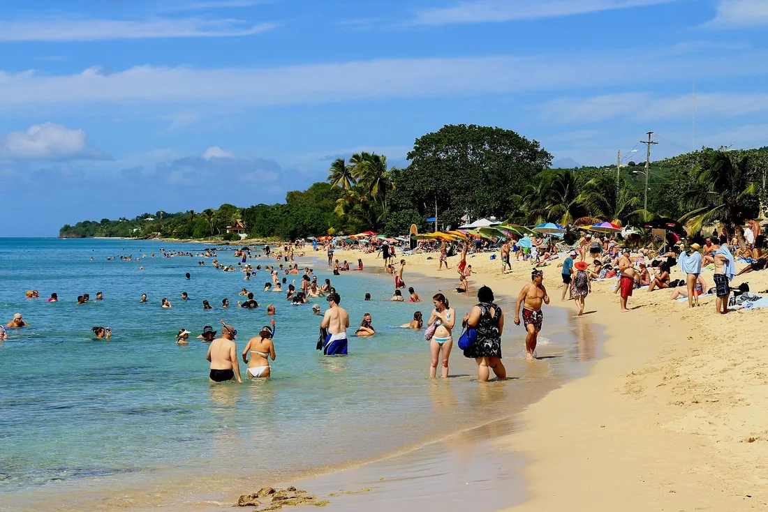
For an island 22 miles long, St. Croix has an unusual range of beaches — from the dive-and-snorkel hub at Cane Bay to hike-in coves you will likely have to yourself. Nearly all are free and public. A few of the ones visitors ask about most:
| Beach | Where | Good for |
|---|---|---|
| Cane Bay | North Shore | Shore snorkeling and diving over the Cane Bay Wall; dive shops and beach bars steps away |
| Rainbow Beach | West end | Calm swimming, water-sports rentals and a long-running beach bar; faces the sunset |
| Sandy Point NWR | Southwest | Two undeveloped miles of white sand — open weekends only 10–4 and closed entirely April 1–August 31 for turtle nesting |
| The Shoys | East of Christiansted | A calm, secluded crescent reached through the Estate Shoys gate; small reef at the east end |
| Chenay Bay | East End | Shallow, protected and family-friendly; kayaks and SUPs; turtles and rays are common |
| Jack's & Isaac's Bays | Far East End | Hike-in beaches inside a 301-acre nature preserve; reef snorkeling and nesting turtles; no facilities |
| Turtle Beach | Buck Island | Powder sand reached only by boat, on the west end of Buck Island |
| Frederiksted Beach | West coast | Town beach for sunsets, calm water and sea-glass hunting; busier on cruise days |
| Cramer's Park | East End | A public park beach with pavilions, popular with local families; easy swimming |
| Columbus Landing | Salt River | Shallow, calm water inside Salt River Bay National Historical Park, where the 1493 landing happened |
| Davis Bay | North Shore | A dramatic north-shore setting by Carambola, with two reefs — one shallow, one deeper |
| Dorsch Beach | South of Frederiksted | Soft sand, palms and calm water; quiet on weekdays |
| Grapetree Beach | Southeast | A long, narrow, secluded stretch with some surf and no facilities |
| Ha'penny Beach | South shore | A wild stretch for walkers, surfers and shore fishermen; also a turtle-nesting shore |
One rule is worth repeating, because it catches people out: Sandy Point National Wildlife Refuge, with its two undeveloped miles of sand, is open to the public on weekends only, 10 a.m. to 4 p.m., and is closed completely from April 1 through August 31 while leatherback turtles nest.
A quick way to choose: for easy family swimming, Chenay Bay and Cramer's Park on the East End are shallow and protected. For snorkeling and diving straight off the sand, Cane Bay and Davis Bay on the North Shore are the ones. For sunsets and a beach bar, the west end — Rainbow Beach and Frederiksted — faces the right way. And for a beach you may have to yourself, hike in to Jack's and Isaac's Bays or drive out to Grapetree in the southeast, both without facilities, so bring your own water and shade.
On the water: Buck Island, diving, the bio bay and fishing
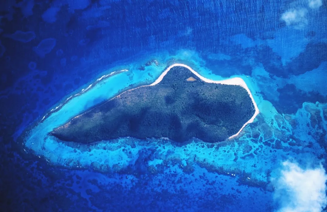
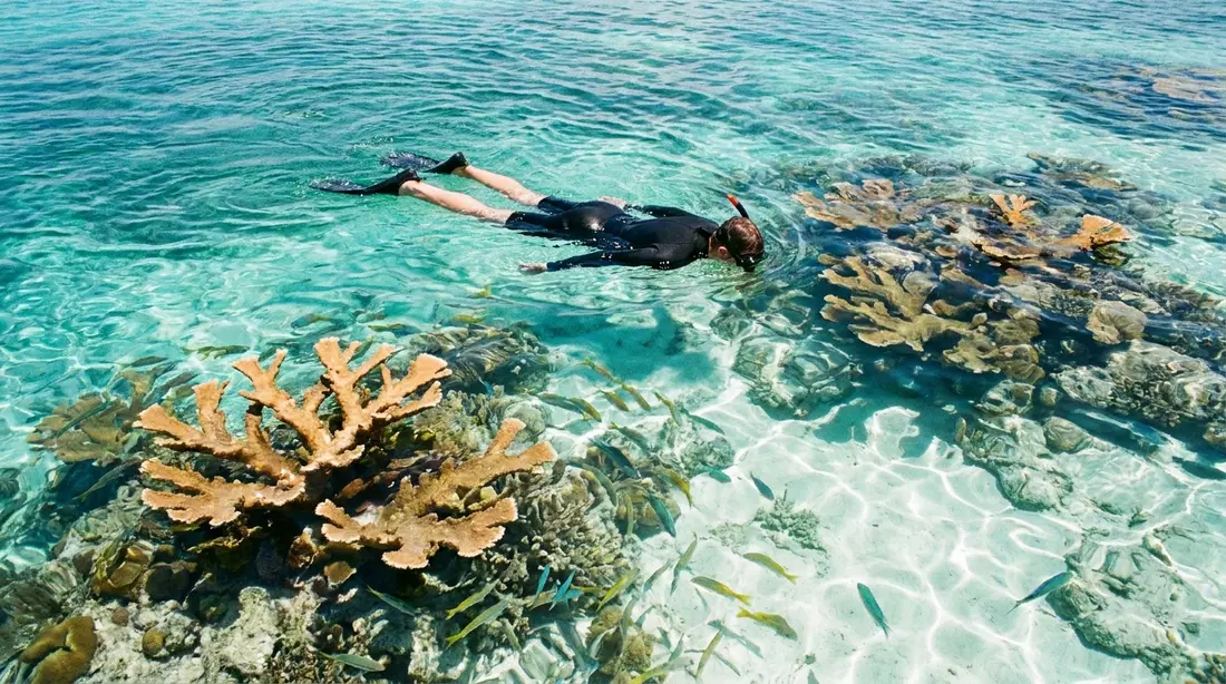
The reason many people fly here is offshore. Buck Island Reef National Monument, about 1.5 miles northeast of the island, was established by President Kennedy on December 28, 1961, and expanded by President Clinton in 2001 to 19,015 acres in all — a 176-acre island ringed by 18,839 acres of protected water. It is a no-take reserve, and an elkhorn coral barrier reef wraps around two-thirds of the island. Its marked underwater snorkel trail is one of only three in the United States, and a land trail climbs to an observation point about 300 feet up. You can only visit with one of the five National Park Service concessionaires or on a permitted private boat; the crossing from Christiansted runs about 40 to 90 minutes.
Back on the main island, the diving is among the Caribbean's best and much of it starts from shore. The signature dive is the Cane Bay Wall, which you reach by swimming out from the beach:
| Site | Where | What it is |
|---|---|---|
| Cane Bay Wall | From shore at Cane Bay | A drop that starts around 40 feet, about 100 yards off the beach, and falls away toward depths over 13,000 feet |
| Frederiksted Pier | West coast, 25–90 ft | A macro-life pier dive — seahorses, frogfish and octopus; one of the island's top night dives |
| Butler Bay wrecks | Northwest coast | Several sunken ships, from shallow to deep, on one stretch of coast |
| Salt River Canyon | Salt River Bay park | East and west canyon walls inside the national park; one dive shop operates within the park boundary |
Salt River Bay deserves its own mention. The same bay where the 1493 landing happened is now a national historical park protecting mangrove forest and a submarine canyon, and its east and west canyon walls are among the island's best dives — a single dive shop operates inside the park boundary. Above the water, kayak tours thread the mangroves by day. It is one of the few places on St. Croix where the history, the nature and the diving all sit on top of each other.
After dark, the water does something else entirely. The Salt River estuary holds one of the world's few year-round bioluminescent bays, and night kayak tours — some in clear-bottomed boats — paddle out to see the glow. It rises and falls with the moon, so the operators' calendars are the guide to use; no tour can promise a bright night. A second bio bay lies at Altona Lagoon. For fishing, Lang Bank, about 3 to 10 miles off the east tip, is the prime offshore ground for mahi, wahoo, kingfish, tuna, marlin and sailfish, and sunset and day sails run from both Christiansted and Frederiksted.

On land: hikes, views and golf
The dry East End is hiking country. Point Udall is a drive-up, and its Millennium Monument sundial was built for the first U.S. sunrise of the year 2000; nearby, the trail to Jack's and Isaac's Bays drops through cactus to empty sand. Goat Hill, about 672 feet, gives a 360-degree ridge view back toward Buck Island. In the wetter west, the round-trip to the Annaly Bay tide pools runs about 3.6 miles with roughly 550 feet of climb from the Carambola trailhead — and it should only be attempted at low tide and in calm seas, because the pools are dangerous in any swell. The uphill walk to Ham's Bluff Lighthouse, a Danish cast-iron light from 1915, ends about 360 feet above the sea.
The western Rain Forest is best seen slowly, driving Mahogany Road (Route 76) under mahogany, kapok and turpentine trees, past the 1926 Creque Dam and the Mt. Pellier Domino Club, a rainforest bar running since 1971 and famous for its beer-drinking pigs. Golfers have three choices: Carambola, an 18-hole par-72 Robert Trent Jones Sr. course that opened in 1966 and is the territory's only championship-length layout; The Buccaneer, an 18-hole par-70 with ocean views and public play; and the 9-hole par-35 course at The Reef at Teague Bay, which also has disc golf.
The two ends of the island give two very different walks. On the dry East End, trails are open and sun-baked, with long views and cactus underfoot — Goat Hill and the drop to Jack's and Isaac's Bays are the classics. In the wetter northwest, the walking is shaded and green: the climb to Ham's Bluff Lighthouse can be extended toward Maroon Ridge, which sheltered people who escaped slavery, so a hike here doubles as a walk through the island's history. Whichever end you pick, go early, carry water, and check the tide and the sea state before any coastal scramble.
Food, rum and Crucian culture
Crucian cooking is West African, Caribbean and Danish all at once. Look for pate (a fried stuffed pastry), johnny cakes, fungi (cornmeal and okra, served with fish), the green stew called kallaloo, saltfish, peas and rice, stew conch, and boiled “provisions” like breadfruit and cassava, alongside whatever came off the boat — wahoo, mahi, pot fish, lobster. Local roadside spots like La Reine Chicken Shack, known for spit-roasted chicken and johnny cakes, are island fixtures in their own right.
Pate is the snack to know first — a fried, stuffed half-moon pastry that comes with saltfish, beef or a vegetable filling, sold from roadside spots and shacks all over the island. A Crucian breakfast might be saltfish, and a proper sit-down plate pairs fish with fungi and a side of kallaloo, a green stew with deep West African roots. For dinner, the range runs from the Christiansted boardwalk out to the restaurants along Church Street and beyond; in high season the better tables fill up, so it is worth booking ahead when you can.
Rum is the through-line. Beyond the historic Cruzan distillery, the Captain Morgan Visitor Center runs weekday tours (generally Monday to Friday, 10 a.m. to 4 p.m., with tastings around 1 p.m.), and Sion Farm Distillery makes Mutiny Island Vodka, billed as the world's first breadfruit vodka and a San Francisco Spirits gold medalist in 2022, with free weekday tours. For beer, Leatherback Brewing in Kingshill brews with rainwater and is open daily. Hours shift with the season, so it is worth a quick call before you drive out to any of them.
Two small things say “St. Croix” more than anything else. One is the hook bracelet, designed in the mid-1960s by Sonya Hough of Sonya Ltd. on Company Street: worn with the hook turned toward your heart it means you are taken, turned away it means you are open. The other is the sound and sight of carnival — the stilt-dancing mocko jumbies and the traditional quelbe, or “scratch band,” music that is the folk sound of the Virgin Islands.
The festival and events calendar
The island's calendar turns on a handful of big events. Exact dates move every year, so treat these as the pattern and confirm against the official calendar before you plan around them.
- Crucian Christmas Festival — the carnival season, running from late December into early January, with the Festival Village and the children's and adults' parades held in Frederiksted.
- AgriFest (the Agriculture and Food Fair) — the territory's big farm-and-food fair, held around the Presidents' Day weekend in mid-February at Estate Lower Love; the 2026 edition, the 54th, ran February 14 to 16.
- Mardi Croix — a beach-parade day at Cane Bay in early February (February 7 in 2026).
- Taste of St. Croix — an annual chefs-and-restaurants tasting; the 26th edition was set for June 11, 2026, at Divi Carina Bay.
- Jump Up — Christiansted's evening street festival, held several times a year downtown and along the boardwalk.
Wildlife and nature
Sea turtles define the island's nature calendar. Leatherbacks nest at Sandy Point roughly from March into July — the reason the refuge closes in that window — and green and hawksbill turtles nest there too, as well as at Buck Island, the East End bays and Ha'penny. The St. Croix Sea Turtle Project and the summer Turtle Watch programs run guided nesting-season visits for anyone who wants to see it responsibly. Beyond the turtles, the elkhorn barrier reef around Buck Island, the mangroves and submarine canyon at Salt River, and the sea glass that washes up on Frederiksted's town beach are the pieces of St. Croix's natural side that visitors come back for.
The parks and protected places
For a small island, St. Croix protects a lot of ground, on land and underwater. Knowing what each place is helps you plan, because several have their own access rules and hours.
- Buck Island Reef National Monument — a National Park Service marine reserve of 19,015 acres off the East End, with a marked underwater snorkel trail; reached only by permitted boat.
- Salt River Bay National Historical Park and Ecological Preserve — 1,015 acres protecting the 1493 landing site, mangrove forest and a submarine canyon, jointly managed by the Park Service and the territory.
- Christiansted National Historic Site — five Danish structures on the Christiansted waterfront, including Fort Christiansvaern, open daily.
- Sandy Point National Wildlife Refuge — a U.S. Fish and Wildlife Service refuge and the largest leatherback nesting site under U.S. jurisdiction; open weekends only and closed April 1 through August 31.
- Jack's and Isaac's Bays Preserve — 301 acres on the far East End protected by The Nature Conservancy since 1999, reached on foot through cactus scrub.
- Point Udall — not a park, but public land at the easternmost tip of the United States, with the Millennium Monument sundial and the trailhead down to those bays.
Between the marine monument, the historical park, the refuge and the Nature Conservancy land, a good share of St. Croix's coast is set aside — which is part of why the snorkeling, the turtles and the empty beaches are still here to see.
Where visitors stay
Because the island holds two landscapes and three centers of life, where you base yourself shapes the trip. Most visitors settle in one of a few areas:
- Christiansted — the historic town, its boardwalk and restaurants, and the departure point for most Buck Island boats. Good if you want to walk to dinner and be near the action.
- The East End — drier, quieter and higher, with many homes looking across the water to Buck Island and easy reach of Point Udall and the hike-in East End beaches.
- The North Shore, around Cane Bay — the diving and snorkeling side, where the wall is a swim from the sand and the beach bars are close.
- The west coast, near Frederiksted — the calmest water and the sunsets, farther from Christiansted but closer to the rainforest and the west-end beaches.
Hotels exist, but a large share of visitors — families and groups especially — rent a private villa or condo for the extra room, a kitchen and often a pool. It is the same reason provisioning at a supermarket on arrival is worth the stop: a week of breakfasts and a few dinners at the house is both cheaper and easier than eating out every meal on an island where the good tables can book up in high season.
SP Vacations, the rental side of Sterling Point Real Estate, manages a set of St. Croix homes across exactly these areas, from Christiansted condos to East End villas facing Buck Island to a quiet oceanside home near Frederiksted, and books them directly. If you are weighing where on the island to base yourself, the homes and the island map are the quickest way to see how the areas differ, and the guides and things to do go deeper on everything above.
Common questions
Do you need a passport to visit St. Croix?
No — St. Croix is part of the U.S. Virgin Islands, an unincorporated U.S. territory, so U.S. citizens travel without a passport. The currency is the U.S. dollar, cell phones run on U.S. networks (area code 340), and there is no foreign customs check on the way home, though there is a U.S. agriculture and pre-clearance check at the airport before you fly back. Citizens of other countries follow the normal rules for entering the United States.
Which side of the road do you drive on in St. Croix?
On the left, in ordinary left-hand-drive cars — a quirk left over from the Danish era. There is no Uber or Lyft on the island, so most visitors rent a car; taxis and taxi tours are the alternative.
When is the best time to visit St. Croix?
The most reliable weather runs from about mid-December through April, the dry season, when the brisk “Christmas Winds” keep the island cool and breezy; this is also the busiest and most expensive stretch. September through November is the quietest, greenest and best-value time, and also the most active part of hurricane season.
Is St. Croix in the hurricane zone?
Yes. The Atlantic hurricane season runs June 1 to November 30 and is statistically most active in August and September. Most days in that window are simply warm and sunny with passing showers, but for a late-summer or fall trip it is worth carrying travel insurance and booking a home with a flexible cancellation policy.
How do you get to St. Croix?
Fly into Henry E. Rohlsen Airport (STX). There are verified nonstops from Miami, Charlotte, Chicago, Atlanta and Newark, though several are seasonal or run only on certain days; everywhere else connects through San Juan, Puerto Rico. A seaplane and a ferry link St. Croix with St. Thomas.
How big is St. Croix, and how many people live there?
St. Croix covers 84 square miles — about 22 miles east to west and 7 north to south — which makes it the largest of the U.S. Virgin Islands. The population was 41,004 at the 2020 U.S. Census.
How do you visit Buck Island?
Buck Island Reef National Monument is a no-take marine reserve about 1.5 miles off the East End, with a marked underwater snorkel trail. You can only reach it with one of the five National Park Service concessionaires or on a private boat with a permit; the crossing from Christiansted takes roughly 40 to 90 minutes.
Is Sandy Point beach open?
Sandy Point National Wildlife Refuge, on the southwest tip, opens to the public on weekends only, from 10 a.m. to 4 p.m., and closes entirely from April 1 through August 31 for leatherback sea-turtle nesting. Plan around those hours, or choose another beach in that window.
Can you swim year-round on St. Croix?
Yes. The sea stays swimmable all year. Air temperatures average around 80°F overall, with winter days near 83°F and summer days around 88 to 89°F; it rarely drops below 68°F or climbs above 90°F.
What is there to do on St. Croix?
Snorkel Buck Island's reef, dive the Cane Bay wall straight from the beach, kayak the Salt River bioluminescent bay after dark, tour rum distilleries that date back to 1760, walk the Danish forts and warehouses of Christiansted and Frederiksted, and drive out to Point Udall, the easternmost point of the United States.
Is St. Croix good for families?
Yes. For U.S. families it works like domestic travel — no passport, U.S. dollars, U.S. phones — and the island has calm, protected beaches like Chenay Bay and Cramer's Park that suit young swimmers, turtles to see in nesting season, and a lot of villas and condos with kitchens and pools that make a week with children easier than a hotel room.
How many days do you need on St. Croix?
There is no fixed answer, but a long weekend is enough to see Buck Island, walk historic Christiansted and get one dive or snorkel in. A week lets you add the west-end rainforest, the bioluminescent bay, the far East End beaches and a distillery or two without rushing — which is why many visitors book a home for the week rather than a few hotel nights.
What is St. Croix known for?
Rum distilled on the island since 1760, the protected reef at Buck Island, the Danish colonial towns of Christiansted and Frederiksted, Point Udall as the easternmost point of the United States, and the fact that it is a Caribbean island U.S. citizens can visit without a passport.
About this reference
This profile was written from official and first-party sources — the National Park Service, the U.S. Fish and Wildlife Service, the U.S. Census, weather records, the U.S. Virgin Islands tourism board, and each business's own information — and checked in August 2026. Opening hours, flight schedules and event dates change; anything time-sensitive here is worth a quick confirmation before you rely on it. If you spot something out of date, tell us and we will fix it.
The downloadable PDF is a snapshot of this page at the time you save it; the version here is the one we keep current, so check back before a trip. The same verified facts sit behind the individual island guides, the things-to-do pages and the island map, if you want to go deeper on any one part of St. Croix touched on above.
In this reference

Sources
Written from official park, refuge, census, weather, tourism-board and business sources and checked August 2026. Hours and dates change; verify before you go.
Download the St. Croix reference
The whole profile as a printable PDF — for the plane, or to share with the group.


