Ham's Bluff Lighthouse
A steady 30-minute climb to a 1915 Danish cast-iron lighthouse 360 feet over the sea, extendable to historic Maroon Ridge.
Ham's Bluff Lighthouse is the cast-iron Danish light that has stood on St. Croix's north-west point since 1915, on a headland that falls about 360 feet to the sea. The Coast Guard switched it off in the mid-1990s and a steel skeleton tower took over the working beam, so what waits at the top of the walk now is a rusting monument with one of the widest views on the island. This page covers the lighthouse and its bluff in full: how the structure came to be built, who kept it, the shape it is in today, how to reach it, and what you can and cannot do once you are standing beside it.
The light on the point
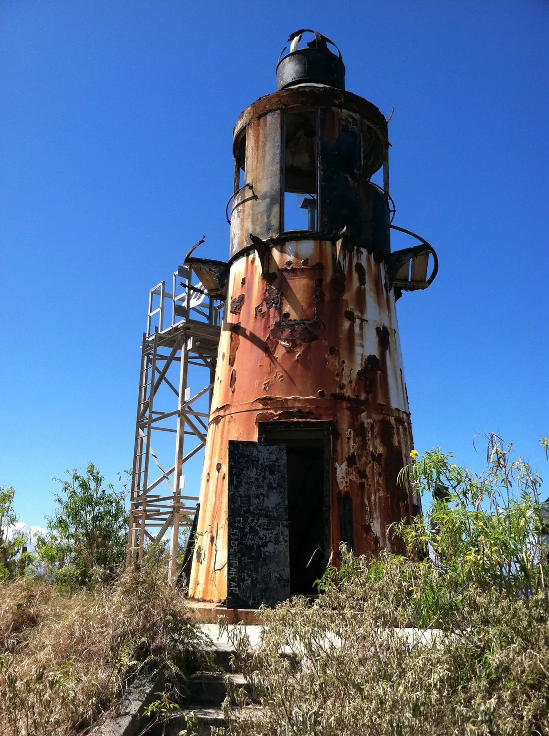
The tower is a Danish colonial lighthouse, first lit in 1915. It was designed and raised by the Directorate of the Danish Lighthouse Service, the same administration that ran the aids to navigation across the Danish West Indies before the islands changed hands. The build is straightforward and durable: a conical shaft of cast iron, roughly 35 feet tall, bolted to a concrete foundation on the crown of the bluff. It carried a lantern room and a walkway at the top, and it was painted the classic day-mark scheme — a white shaft under a dark cupola — so ships could pick it out against the green ridge in daylight as well as by its beam after dark.
The numbers that get quoted for Ham's Bluff can look like they contradict each other; they do not. The bluff itself stands about 360 feet above the water. The tower adds another 35 feet or so on top of that, which is why the light's focal plane — the height of the beam above the sea, the figure that matters to a navigator — is charted at 394 feet. So the beam sat nearly 400 feet up, one of the highest working lights in the Lesser Antilles for its era, thrown from a modest little tower perched on a very tall cliff. That combination of a short structure on a high headland is the whole design idea of the place.
Why a light was built here
The timing is the tell. The Panama Canal opened in 1914, and the Danish administration expected it to redraw the shipping map of the eastern Caribbean, pouring traffic through the passage between St. Thomas and St. Croix that had been comparatively quiet before. A new light on the islands' north-west shoulder was a direct response to that forecast — a marker for vessels rounding the corner of St. Croix and lining up the approach to Frederiksted on the west coast.
The corner needed marking. St. Croix's north-west coast is its most unforgiving: high cliffs with no harbor, deep water running right up to the rock, and a shoreline that gives a ship no room to recover from a mistake at night. Frederiksted itself has no enclosed harbor — vessels worked an open roadstead off the town — which made a dependable landfall light on the high ground above the approach matter more, not less. The same steep-to profile that makes the coast dangerous for boats is what puts whales within sight of the cliffs a few months a year, a point the wildlife section returns to below. A high, far-throwing light on the bluff let a captain fix the island's position from well out to sea and give the whole north-west shoulder the berth it demands. For the geography behind why this end of the island is so tall, wet and wild, see Two Landscapes, One Island.
Who kept the light
For most of its working life this was a staffed station, not an automatic beacon. The first keeper on record was A.L.F.L. Madsen, and the station was built to house a keeping family in the isolation the job required: historical records document two single-story keepers' dwellings on the site, a principal keeper's quarters and an assistant keeper's quarters, set back from the tower on the ridge. The buildings were documented for the Library of Congress historic survey, which is part of why the station's early layout is known at all.
A keeper's life on Ham's Bluff meant tending a flame and clockwork optic through the night, hauling supplies up a rough track, and living miles from either town on a headland that took the full weight of the winter trade winds. That era ended with a specific date. The Coast Guard automated the light on February 7, 1975, after which no one lived on the bluff to run it; the machinery did the work, and the dwellings fell out of use. The ruins of that keeping community are part of what walkers pass on the way up, and part of what the preservation effort described below is trying to protect.
From Danish light to skeleton tower
The lighthouse changed nationality without moving an inch. When the 1917 Transfer handed the Danish West Indies to the United States, the light passed to the U.S. Coast Guard, which operated it for the rest of the twentieth century — automated from 1975, as above, and quietly aging on its cliff. In the mid-1990s the Coast Guard deactivated the original tower altogether. For roughly fifteen years the point had no working light at all from a permanent structure.
Then, in 2010, a steel skeleton tower went up beside the old cast-iron one to carry the modern beacon. That truss tower — a square-section metal frame about 30 feet tall — is what actually guides ships today. Its light shows two white flashes every 30 seconds and is charted to a range of about 16 nautical miles. The working aid and the historic monument now stand side by side on the same bluff: a plain steel frame doing the job, and the graceful old Danish shaft standing dark next to it. In the official light lists the station carries U.S. Coast Guard number 3-32845, British Admiralty number J5640, and Amateur Radio Lighthouse Society reference VIR001, if you want to look it up on a chart.
How to read the light
The modern beacon speaks in a code any navigator can read off a chart, and it is worth decoding, because it explains what the tower is for. Its character is written as two white flashes every 30 seconds: the light blinks twice, holds dark, then repeats on a fixed 30-second cycle. That rhythm is the light's signature. No other aid nearby flashes the same way, so a captain counting flashes and timing the gap can name the point of land ahead before the coast itself resolves in the dark. The charted range of about 16 nautical miles is the light's nominal reach in clear air, which puts the flash over the horizon to a ship still well out to sea. And because the beam sits nearly 400 feet up, a vessel picks it up sooner than a low shore light of the same power, since height alone buys a longer sight line to the horizon. The steel frame carrying that light looks like nothing; the task it performs is the one the Danish tower was raised for in 1915.
The tower today, inside and out
Set expectations before the walk: the original lighthouse is a ruin, and it is meant to be looked at rather than entered. Decades of salt air and no maintenance have done predictable damage. Rust bleeds in long streaks down the cast-iron plating. The railing around the cupola is broken through in places. Whole sections of the shell have corroded clean through to the interior, and inside, the space is damp, the flooring has failed, and the walls carry graffiti. There is no safe way up the tower and nothing to see from inside it that the outside does not offer better.
So the standing advice on this page is simple and firm: photograph and admire the tower from the ground around it, and stay out of the structure. It is federal property, retained by the Coast Guard, and it is not maintained for visitors — there is no guardrail, no signage, no one on site, and no help within easy reach if a rotten floor or a jagged edge does what rotten floors and jagged edges do. The bluff and the view are the reward here; the tower is a monument to stand beside, not a ruin to climb around in.
The effort to save it
Ham's Bluff has advocates. In 2019 the light station was added to the National Register of Historic Places, formal recognition that the tower and its keeping community are worth preserving. Building on that, a volunteer group — the Ham's Bluff Beacon Project, working under the banner "Light the Bluff" — has organized to protect and eventually restore the station as a cultural landmark and interpretive site tied to Crucian maritime heritage. As of 2026 the group was forming as a nonprofit and laying out a phased, roughly ten-year plan reaching toward 2036, with fundraising to open once its status is confirmed.
For a visitor, two things follow from this. First, the tower's condition may improve over the life of your future trips, but at last check nothing had been stabilized yet — treat it as the ruin described above. Second, the fact that local people are fighting to keep this light standing is part of what makes the walk worth taking respectfully: leave the structure as you found it, take out what you carry in, and let the place stay in one piece for the restoration that its supporters are working toward.
Lighthouse at a glance
Figures below are drawn from the U.S. Lighthouse Society, the light lists and the preservation group; treat any single number as a reference point rather than a survey.
| Feature | Detail |
|---|---|
| First lit | 1915, Danish colonial administration (raised 1913–1915) |
| Original tower | Cast iron, conical, about 35 feet tall on a concrete base; white shaft, dark cupola |
| Focal plane | Charted at 394 feet above the sea |
| Bluff height | About 360 feet above the water |
| Original purpose | Mark the north-west corner and the approach to Frederiksted |
| Automated | February 7, 1975 (Coast Guard) |
| Deactivated | Mid-1990s |
| Working light now | Steel skeleton tower (2010): two white flashes every 30 seconds, range ~16 nautical miles |
| Chart references | USCG 3-32845; Admiralty J5640; ARLHS VIR001 |
| Status | National Register of Historic Places (2019); federal property; exterior viewing only |
The bluff and the view
The lighthouse is the destination, but the bluff is the payoff. From the open ground around the tower the land drops sharply to the sea, and the north-west coast of St. Croix lays itself out in both directions. Look north and east and the coastline runs away toward Davis Bay, the Carambola resort's beach and the mouth of Annaly Bay, with the green ridge climbing behind them. Look west and down and Ham's Bay curls below you, usually with a line of surf working the rocks at its edge. On a clear day other islands sit low on the horizon out to the north and west.
This is a viewpoint that rewards timing more than effort. Morning gives you the coolest walk up and the cleanest light on the water, before the day's haze builds; the panorama reads sharpest in the first few hours after sunrise. Because the whole point faces open ocean with nothing between you and the weather, it is also a place to feel the trade winds at full strength — steady, sometimes strong, and worth respecting near the edges. For where Ham's Bluff sits among the island's high lookouts, and how it compares with the drive-up options, see best viewpoints.
Whales off the point in winter
A few months a year the bluff becomes a whale-watching perch. Humpback whales travel through Caribbean waters in the winter to calve and to mate, and their route brings them past St. Croix's north shore, most reliably in the late-winter window around February and March. The reason they come within sight of the cliffs is the same deep water that made a lighthouse necessary here: the sea floor plunges into trench depths very close to this coast. The Puerto Rico Trench just north of the islands is the deepest water in the Atlantic Ocean, and it runs near enough to this shore that deep-water animals can pass almost under the headland — so whales that prefer open depths come close inshore, where a watcher on a high point has a real chance of catching a blow, a fluke, or a breach far below.
Keep expectations calibrated. These are wild animals on migration, not a scheduled show, and plenty of clear winter mornings pass with nothing but open water. Bring binoculars, give it time, and treat a sighting as a bonus rather than the plan. If whales are a priority for your trip, the north-shore dive and sail operators track them through the season; the broader roster of what lives on and around the island is in the wildlife guide, and the timing of the island's other big marine event, turtle nesting, sits in the weather and seasons guide.
Wildlife on the walk up
The climb through the shaded forest has its own small cast. Anole lizards do their push-ups on warm rocks and tree trunks. Hermit crabs work through the leaf litter in numbers, so watch your feet on the trail. Butterflies move through the sun gaps where the canopy opens, and a mongoose will occasionally cross the path ahead of you and vanish. None of it is dangerous and none of it is certain; it is the ordinary background traffic of the island's wet-side woods, and it makes the walk more than a means to the tower. The exposed cliff faces around the point also draw seabirds riding the updrafts, though the island's reliable birding grounds are elsewhere.
Getting to the lighthouse
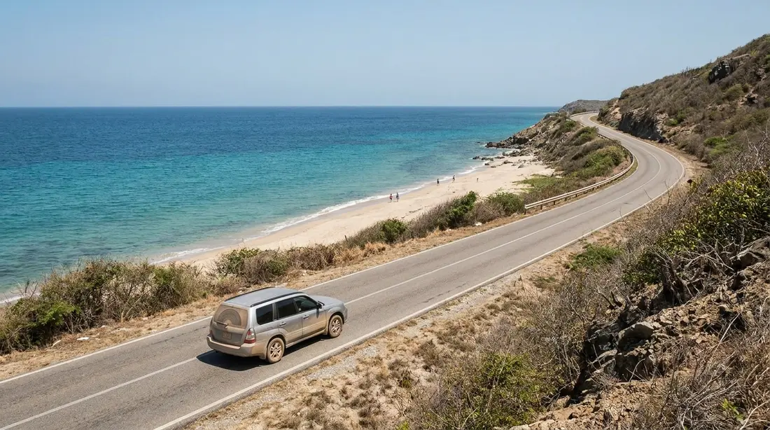
The approach runs off the west end of the island. From Frederiksted you follow Route 63 north along the coast until the paved coast road runs out, and turn onto the lane that heads out toward Ham's Bay and a decommissioned National Guard compound; the parking is at that old facility. From there the footpath begins — walkers keep to the ocean side of the compound fence and pick up the trail climbing the bluff.
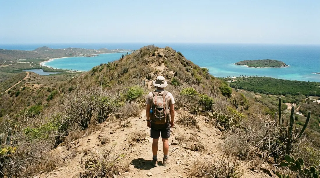
The walk is short and steep. Reckon on about 1.6 miles for the round trip, gaining on the order of 270 vertical feet, with something like 20 minutes of climbing to reach the top at an unhurried pace. It is mostly shaded forest track, which is a mercy, though it can grow over in stretches and the footing is rocky and uneven, so closed shoes and a bottle of water are the right call. The access lane in is another matter: it is rutted and often muddy, drivable slowly in an ordinary car during dry spells but rough after rain. The full read on that road, and the ridge tracks that connect above it, lives in the Scenic Road guide; where the lighthouse fits in the island's whole ladder of walks is in the hiking guide.
One caution has to be said, because it is a recurring problem at remote St. Croix trailheads and this one in particular: cars left at the lot get broken into. The fix is to give a thief nothing to want. Travel to the trailhead with the vehicle already empty — no bags on the seats, no electronics in the console, nothing locked in the trunk that would be worth a smashed window. The safety guide covers the island-wide version of this habit.
Sunset from the bluff
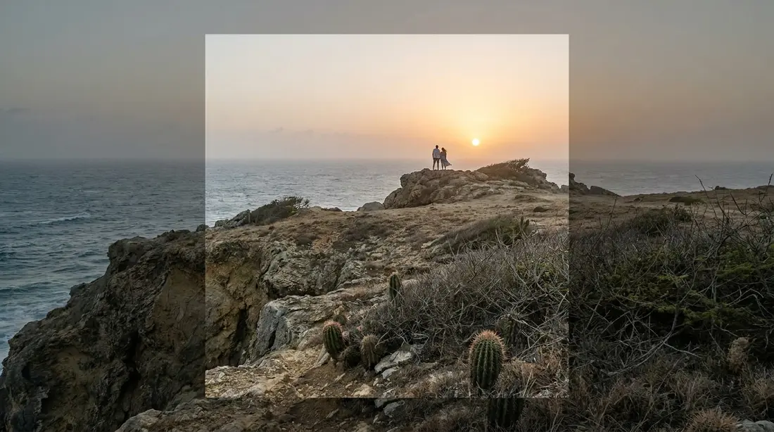
Because the point faces west and open water, sunset from Ham's Bluff is a genuine event — the sky going gold behind the old tower, the cliff and the sea below dropping into shadow. The catch is the walk. The trail is unlit forest, and the descent after dark on rocky, uneven ground is a poor idea without preparation. If you want the light at the lighthouse, carry a real headlamp, start down while you can still see the trail, and give yourself margin. For most visitors an easier sunset is the better call: Rainbow Beach and the Frederiksted waterfront sit a short drive south with the same western horizon and no cliff walk in the dark. The island's full sunset roster, ranked, is in the sunset guide.
The wild coast on either side
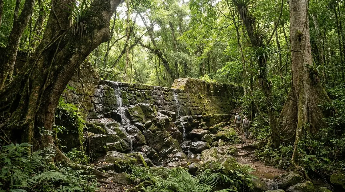
The lighthouse is one stop on the island's roadless north-west shoulder, and it connects to the rest. East of the tower the cliff country runs on as Maroon Ridge, where escaped enslaved people built free settlements in the eighteenth century — the walk beyond the lighthouse enters that ground, and the Maroon Ridge guide covers its history and its real difficulty. Down the same coast lie the Annaly Bay tide pools, reached by a separate trail from the Carambola side, and inland the wet forest around Creque Dam. A full western day, stringing the forest, the coast and the beaches together, is laid out in the drive-around guide, and the ridge behind the point is the Scenic Road.
Photographing the tower
Ham's Bluff photographs well because it gives you two subjects at once: a weathered iron tower with real texture, and a big open seascape behind it. The rust and the broken cupola read as character in close frames; step back and the tower becomes a small vertical against the whole north coast. First light and the hour before sunset do the heavy lifting, when the low sun rakes across the plating and the sea holds color. Wind is the practical enemy — the point is exposed, so brace the camera and mind loose gear near the edges.
On drones, be clear-eyed. The steel tower beside the ruin is an active aid to navigation on federal property, and the airspace and rules that go with that are real: know the current FAA requirements before you fly anywhere in the U.S. Virgin Islands, keep well clear of the working light and of any people on the bluff, and expect gusty, unpredictable air over a cliff edge that has ended more than one flight. If you are unsure of the rules on the day, the safe choice is to leave the drone in the bag and shoot from the ground, where the best frames are anyway.
Safety and practical notes
- No facilities. There is no water, no restroom, no shade at the top and no vendor anywhere on the route. Carry more water than the short distance suggests, and a hat.
- Go in daylight. Start early for the cool and the light. If you stay for sunset, carry a headlamp and leave before you lose the trail.
- Mind the cliffs. The edges are unfenced and undercut in places. Stand well back from the drop, and hold onto small children on the open ground up top.
- Stay out of the tower. The interior is unsafe — failed floors, rusted-through metal, sharp edges. Admire it from the ground.
- The road and the lot. The access lane is rough after rain; the trailhead has a break-in history. Drive it slowly and arrive with an empty car.
- Signal is unreliable. Coverage drops out on the north-west corner. Tell someone at the villa your plan and a turnaround time before you set off, as you would for any remote walk here.
- Pack for sun and rock. Closed shoes with grip, mineral sunscreen, and the short list in the packing guide.
Visit facts
| Item | Detail |
|---|---|
| Getting there | Route 63 north of Frederiksted to the Ham's Bay lane; park at the old National Guard site |
| The walk | About 1.6 miles round trip, ~270 ft of climb, roughly 20 minutes up |
| Difficulty | Moderate: steep but short; shaded forest, then open bluff |
| Best time | Early morning for light and cool; sunset if you carry a headlamp |
| Cost | Free; no gate, no hours, no staff |
| Facilities | None — no water, restroom, shade or reliable signal |
| The tower | Exterior viewing only; interior is unsafe and off-limits |
| Cautions | Trailhead break-ins; unfenced cliff edges; rough access lane after rain |
| Pair with | Annaly Bay, Maroon Ridge, Rainbow Beach, the Scenic Road |
Questions guests ask
Can you go inside or climb the lighthouse?
No. The original cast-iron tower is a decommissioned ruin: the interior flooring has failed, sections of the shell have rusted through, and the cupola railing is broken. It is federal property, unmaintained, with no one on site and no rail or signage to keep you safe. The right way to experience it is from the ground around the base, where the views and the photographs are anyway. Treat the structure as a monument to stand beside, and leave the climbing to the imagination.
How long is the walk and how hard is it?
Short and steep. It runs about 1.6 miles round trip with roughly 270 feet of climb, and most reasonably fit visitors reach the top in around 20 minutes at a vacation pace. The track is mostly shaded forest, which helps, but the footing is rocky and it can be overgrown, so wear closed shoes and carry water. Kids who are happy to hike uphill for half an hour manage it well; the heat, more than the distance, is the limiter, so go in the morning.
Can you drive all the way to the lighthouse?
No. You drive to the old National Guard site at the end of the Ham's Bay lane and walk up from there. The lane itself is unpaved, rutted and often muddy — passable slowly in an ordinary car during dry weather, rough after rain, with the detail on its condition covered in our Scenic Road guide. Whatever you drive, the final climb to the tower is on foot.
Is the lighthouse still working?
The original one is not — the Coast Guard deactivated it in the mid-1990s. The working light for ships is now a steel skeleton tower raised beside it in 2010, which shows two white flashes every 30 seconds and is charted to about 16 nautical miles. So the point still guides vessels, just from a plain modern frame rather than the historic Danish tower standing dark next to it.
Can you see whales from Ham's Bluff?
Sometimes, in winter. Humpback whales pass St. Croix's north shore on their Caribbean migration, most reliably around February and March, and the deep water close to this coast lets them come within sight of the cliffs. A high headland like this one is a plausible perch for spotting a blow or a breach — with binoculars, patience, and no certainty, since these are wild animals on the move. Come for the lighthouse and the view; count a whale as a lucky extra.
When is the best time to go?
Early morning, most days. The climb stays cool in the early hours, the water shows its cleanest light then, and you sidestep the noon heat on open ground. Sunset is spectacular from this west-facing point, but only if you carry a headlamp for the walk down through unlit forest. Across the year, the drier winter-to-spring stretch gives the firmest footing on the trail and the access lane; after heavy rain, give both a day to drain.
Staying near the north-west
Ham's Bluff is a west-end outing, and it is easiest as an early start. Sunset Sea-Clusion, our home in Frederiksted, sits closest to the lighthouse road, close enough to check the weather with a short morning drive and still fall back to a beach day if the lane is too wet. From our East End and Christiansted houses, including The Cerulean, the point is under an hour away — a comfortable dawn launch for a group pairing the lighthouse with Annaly or the Maroon Ridge walk. Browse the full collection, and tell us if the north-west corner is on your list; we will help you time the drive around the weather.
Sources
Written from official and first-party sources, checked August 2026. Hours, prices and event dates change — confirm before you go.
In this guide
Stay nearby
On The Shoys beach: six bedrooms, six baths, pool and hot tub, room for twelve, and the beach through the back garden.
 Shoy's Beach House6 bd · 6 ba · sleeps 12 · Christiansted
More in Land & Adventure
Sources
6 references, listed in full at the end of this guide — official park, refuge, tourism-board and business sources, checked August 2026.