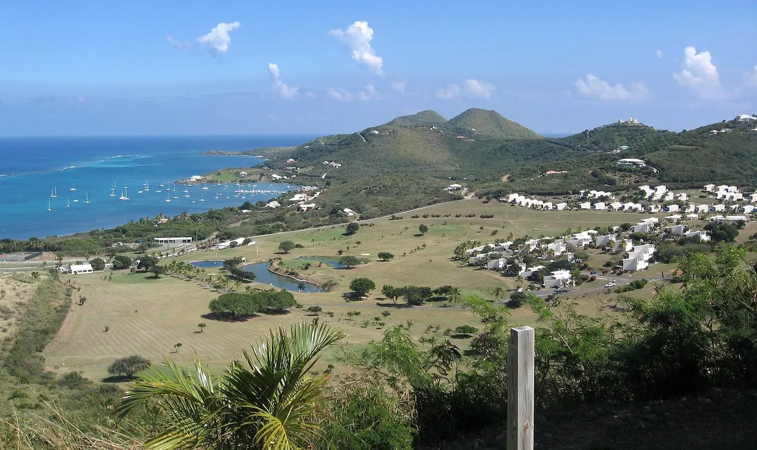
The East End
Dry hills, quiet bays, Buck Island on the horizon, and the first sunrise in the United States. The villa country of St. Croix.
Drive east out of Christiansted and the island changes: green gives way to cactus, the traffic thins, and the sea shows up on both sides of the road. This is the East End, the driest third of St. Croix. It holds the first American sunrise at Point Udall, the territory's first marine park, four of the island's best beaches and most of the homes we manage. This page is the reference for the whole quarter, gate to monument.
What the East End covers
For this guide, the East End means everything east of Christiansted: the coast road past The Buccaneer and Green Cay Marina, Teague Bay and its yacht club, Cramer's Park, the ridge that carries Goat Hill, and the narrowing point of land that ends at Point Udall. The south side of the same wedge, Grapetree Bay and the Divi resort area along South Shore Road, belongs to it too. It is a small territory. From the edge of Christiansted to the Millennium Monument is about ten miles of road, and no two points in this guide are more than about half an hour apart by car.
The defining fact out here is rain, or the lack of it. The eastern hills take roughly 25 to 38 inches in a typical year while the island's western forest takes 50 or more, so the two ends of one 22-mile island wear two different landscapes. The east grows tan turk's cap cactus, acacia scrub and century plants instead of mahogany canopy. For a visitor that translates simply: when showers sit over the west end, the East End is often still in sun, and a beach plan out here survives most weather forecasts.
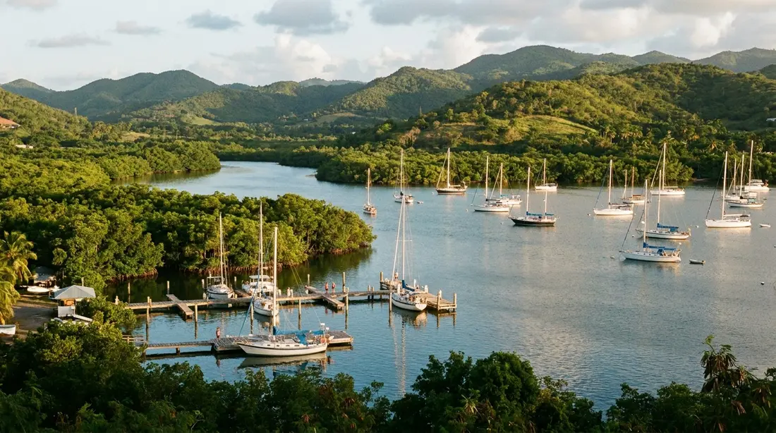
Geography does a second favor. The northeast coast bends into a chain of bays sheltered by reef and headland, which is why the calm family water at Chenay Bay, The Shoys and Cramer's Park all sits on this shore. The southeast coast faces the open trade-wind swell, which is why Grapetree stays wilder and emptier. Two kinds of coastline, one short drive apart, is the East End's whole argument.
Wind is the other constant. The trades blow along the length of the island all year and hit this end first, which keeps the ridge houses ventilated and the afternoons comfortable even in August. From mid-December into March the seasonal Christmas Winds stiffen everything a notch: better sailing off Teague Bay, more chop on the exposed shores, flatter mornings than afternoons everywhere. The practical reading for a beach schedule is the same in every season, and worth repeating because it decides good days out here: swim and snorkel before lunch, save the wind-facing coasts for calm spells, and let the breeze have the afternoons.
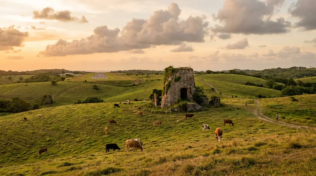
The drive out on Route 82
Route 82, the East End Road, is the spine of the quarter, and the drive itself is worth taking slowly the first time. Leaving Christiansted you pass Gallows Bay, where the St. Thomas ferry docks, then the entrance to The Buccaneer, the resort that has anchored this coast since 1947. The guard gate for Estate Shoys sits beside it; that is the turn for The Shoys beach, covered below.
A few minutes on, a marked turn drops to Tamarind Reef and Green Cay Marina, with the small green hump of Green Cay itself offshore. The road then runs the shoreline past the Southgate Coastal Reserve and Coakley Bay, with Buck Island holding steady on the horizon to the north. Chenay Bay comes next, then Teague Bay: the nine-hole Reef course on the hillside, the St. Croix Yacht Club flying its burgee on the water side, and Duggan's Reef at the bay's east end.
Past Teague Bay the land dries out in earnest. Cramer's Park appears on the left under its sea-grape shade, and just beyond it the white dish of a 25-meter radio telescope stands in the scrub, the strangest landmark on the island and a real one, covered below. From there the road climbs and narrows to the parking loop at Point Udall. The pavement is good the whole way; a regular rental car handles every stop in this guide. Allow 30 to 40 minutes from town to the point if you drive straight through, which nobody does.
Point Udall and the Millennium Monument
Point Udall is the eastern extremity of St. Croix and, measured by travel across U.S. territory, the easternmost spot in the United States. It took its name in 1969 from Stewart Udall, Secretary of the Interior under Presidents Kennedy and Johnson. The headland is a drive-up overlook: cliffs, wind, the open Atlantic in front of you and Buck Island up the coast to your left.
On the rise above the point stands the Millennium Monument, a large masonry sundial raised for the new year of 2000. It was designed by William "Bill" Rich of St. John, and its geometry is specific: a slotted central pillar lines up with a shorter post to its east, and the alignment marks the compass bearing where the sun first broke the horizon over the United States on January 1, 2000. Stand at the slot at dawn and the sun still comes up close to that line each new year.
Sunrise is the classic reason to come, and it needs only a little planning: check the day's sunrise time, leave the villa early enough to arrive with light still gray, and bring a windbreaker, because this is the breeziest corner of the island. The full playbook, including what our guests say about doing it from the East End villas, is in the Point Udall sunrise guide. Daylight visits are worth it too; the parking lot just west of the point doubles as the trailhead for the walk down to Jack's and Isaac's Bays.
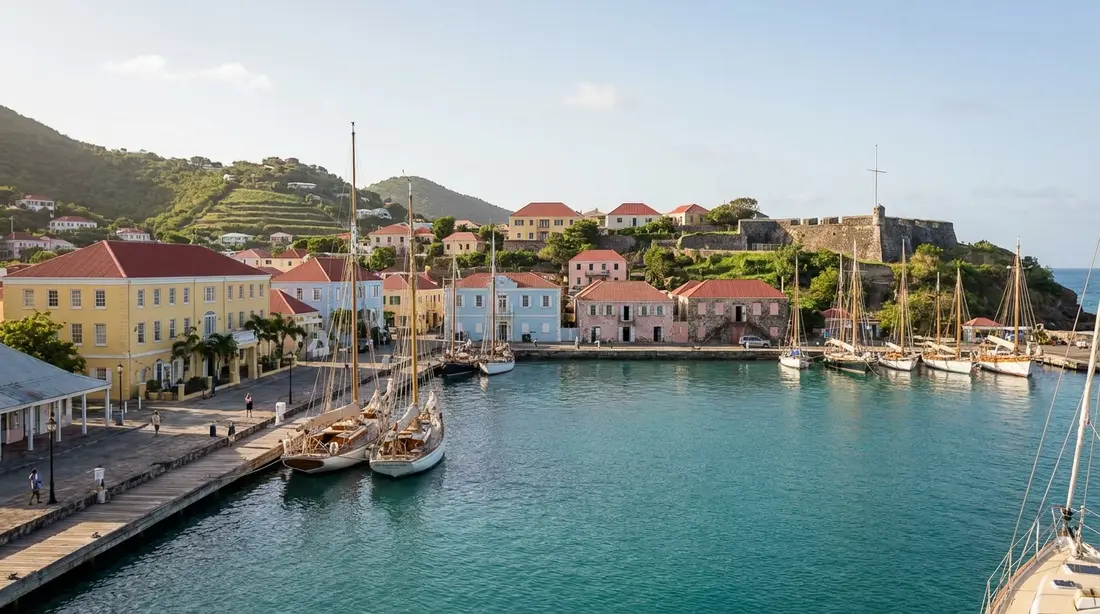
The radio telescope on the East End road
The dish near Cramer's Park is a working instrument of the National Radio Astronomy Observatory. It is the St. Croix station of the Very Long Baseline Array, a chain of ten identical radio telescopes spread from here to Mauna Kea in Hawaii that observe together as one enormous virtual antenna. St. Croix holds the array's eastern anchor; the span from this dish to the Hawaiian one runs close to 5,000 miles, and that spread is what gives the array its extraordinary resolving power.
The antenna itself is 25 meters, about 82 feet, across, stands roughly ten stories tall and weighs on the order of 240 tons. Nobody sits inside running it; the whole array is steered remotely from an operations center in Socorro, New Mexico. There is no visitor center, but the dish is clearly visible from the road and makes an odd, excellent photo with cactus in the foreground. Hikers on Goat Hill use it as the landmark for finding the trail.
The beaches at a glance
Every East End beach has its own page on this site, so this section stays short and points you to the details.
- The Shoys — the calm crescent behind the Estate Shoys gate, closest to town, quiet water and a small snorkel reef. Details in The Shoys guide.
- Chenay Bay — the shallow, protected family bay, with turtles over the seagrass and easy paddling. See Chenay Bay.
- Cramer's Park — the public territorial park beach: pavilions, grills, restrooms, real shade and gentle water, with a lively local weekend scene and an Easter camping tradition. See Cramer's Park.
- Jack's and Isaac's Bays — the two hike-in beaches at the island's tip, covered in the next section.
- Grapetree Beach — the long, empty south-shore ribbon behind the sea grapes, best for walkers and confident swimmers. See Grapetree.
Two smaller shorelines fill out the map. The Southgate Coastal Reserve, kept by the St. Croix Environmental Association between Green Cay and Chenay Bay, is a turtle nesting shore where walking matters more than swimming, and Coakley Bay next door is a quiet local stretch with nothing built on it. Neither has facilities of any kind.
Jack's and Isaac's Bays on foot
The far tip of the island belongs to a Nature Conservancy preserve of roughly 300 acres that has protected Jack's Bay and Isaac's Bay since the late 1990s. There is no road to the sand. You park in the lot just short of Point Udall and walk a cactus-lined trail down, about fifteen to twenty minutes each way with no shade anywhere on it. Isaac's arrives first; Jack's takes an extra push over a rise and is emptier for it.
What the effort buys is the least developed swimmable coastline on St. Croix: white sand, dry forest behind, reef in front, and often no other person in sight. These two bays also hold the island's densest green and hawksbill turtle nesting, monitored by the Conservancy for more than two decades, so summer and early-fall visitors should stay clear of any marked or disturbed sand. Water, real shoes and an early start are the whole kit. The full guide covers trail, snorkeling and rules.
The East End Marine Park
Nearly all the water in this guide sits inside the St. Croix East End Marine Park, and knowing what that means makes you a better guest of it. The Legislature created the park with Act 6572 on January 9, 2003, making it the first marine protected area designated and run by the territory itself, under the Department of Planning and Natural Resources. Its boundaries take in about 60 square miles of sea along some 17 miles of coast, from Green Cay around the point to Great Pond Bay on the south shore, reaching from the high-tide line out to the three-nautical-mile territorial limit.
The park works through zones, marked with buoys where it matters:
- Recreation areas allow line fishing from the beach out to 100 feet and permit personal watercraft, with spearfishing banned.
- No-take areas welcome swimmers, snorkelers and divers and prohibit every kind of fishing and collecting.
- Turtle wildlife preserve waters lie off East End Bay, Isaac's Bay and Jack's Bay, running about 1.25 miles offshore to guard the nesting beaches.
- Open fishing areas, the bulk of the park, follow standard Virgin Islands fishing rules, with trawling and drilling off the table everywhere.
Only about 8.6 percent of the park bans fishing outright; the design protects the reef, seagrass and mangrove system, including the big mangrove stand at Great Pond Bay, while leaving most of the water working. For a villa guest the rules compress to this: take nothing living, no spears, give the buoys their meaning, and leave coral, conch and shells where they lie.
Green Cay, the refuge and the marina
The small island off Tamarind Reef is Green Cay National Wildlife Refuge, all 14 acres of it, set aside in 1977 for one animal: the St. Croix ground lizard, a federally endangered species wiped off the main island generations ago, largely by the mongoose. Green Cay carries the largest natural population left anywhere, which is why the refuge is closed to visitors entirely. You admire it from the shore, the marina wall or a passing boat, and that is the correct full experience.
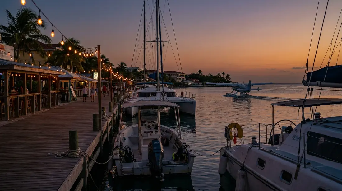
Onshore opposite the cay, Green Cay Marina shelters about 154 slips inside a protected lagoon, one of the island's best hurricane holes and the East End's working waterfront. It shares grounds with the Tamarind Reef Resort, and the resort's restaurant, the Deep End Bar & Grill, is the East End's all-day room: breakfast, lunch and dinner seven days a week at last check, with tables under cover, by the pool and near the sand, looking straight out at the cay. This is also the dock our East End guests use most, because two of the five authorized Buck Island boats leave from it.
Teague Bay
Teague Bay is the East End's little activity hub, three institutions on one reef-protected bay. On the hill sits The Reef, a nine-hole, par-35 golf course with a driving range and The Iguana, an 18-hole disc golf layout that was the first of its kind in the region; rates, hours and the Friday scramble live in the Reef golf guide.
On the waterfront, the St. Croix Yacht Club has occupied its site since 1952, close to six acres of grounds with a private membership and a public reputation: since 1992, when Commodore Nick Castruccio talked Mumm's into sponsoring the first one, the club has hosted the St. Croix International Regatta, now sailed each November, along with smaller races through the year. Regatta week fills the bay with sails and is worth timing a drive past. Llewellyn's Charters, one of the five permitted Buck Island operators, runs from the club's shore.
And at the end of the bay stands Duggan's Reef, the family-run beachfront restaurant that has fed this coast since 1983, with its Irish whiskey lobster as the signature plate. It serves dinner only, reservations required; at last check it ran Tuesday through Saturday evenings, and days shift with the season, so call before driving out. Windsurfers work the flat water off its tables most afternoons.
Buck Island from the East End
Buck Island Reef National Monument sits closer to the East End than to anywhere else on St. Croix, about a mile and a half off the northeast coast, and the view of it is the standing amenity of this whole quarter. Reaching it takes one of the five boats holding National Park Service permits, and two of the five sail from Green Cay Marina: Teroro II, carrying up to 24 guests, and Dragonfly, an eight-guest boat, both under the long-running Buck Island Charters operation. Llewellyn's adds a third East End departure from the yacht club. Leaving from this side shortens the crossing compared with the Christiansted boardwalk boats, which matters to anyone prone to seasickness and to families with short-fused children.
The comparison of all five operators is in Buck Island boat tours, and the island itself, reef, underwater trail, turtles and history, has its own full page in our Buck Island Reef National Monument guide.
The south shore on Route 60
South Shore Road, Route 60, closes the loop. It splits from the East End Road and runs the windward coast westward past Grapetree Bay, where the reopened Grapetree Bay Hotel anchors one end of the long beach, and the Divi Carina Bay resort, the East End's one full-scale hotel strip and a venue the island's food festival has used. Beyond them the road passes Great Pond Bay, whose mangrove stand is among the largest left on St. Croix and a magnet for shore birds; the pond is a place to pull over with binoculars rather than a swimming stop.
This coast feels different from the northeast bays because it is different: open fetch, steady trade wind, surf on many days, and long stretches with no building in sight. Swim here on the calm days and walk it on the rough ones. Driving the full loop, out on 82, back on 60, takes well under two hours with stops and shows you both faces of the East End in one outing.
The neighborhoods behind the gates
Most East End addresses sit in a handful of named estates, and knowing them helps you read a villa listing. Estate Shoys, behind its guard gate by The Buccaneer, is the old one: its first recorded building went up in 1653 under Charles Martel, a Knight of Malta, and the name comes from Michael Shoy, who later grew cotton on the ground. Today it is a leafy residential enclave wrapped around the beach, and the gate protocol is simple: give your name, state your business, drive through.
The Buccaneer itself, opened by the Armstrong family in 1947 on land they had held since 1922, was the first hotel on St. Croix built and run by an island family and is still in the family's fourth generation, 340 acres with a Danish-era sugar mill on the grounds and an 18-hole golf course that shows the sea from most of its holes. It matters to villa guests as a neighbor: its Terrace restaurant and casual Grotto Grill are open to the public, and its gate marks where the East End begins.
Farther out, Teague Bay and Solitude carry hillside homes with Buck Island panoramas, the reason so many houses out here, ours included, are named for the view. On the south side, the Grapetree area holds a quieter mix of homes above and behind its beach. These are residential neighborhoods rather than resorts: no shops, no strip, dark skies at night, and roads where deer outnumber streetlights, which brings us to the wildlife.
Deer on the roads, turtles on the sand
The East End's most surprising resident is the white-tailed deer. A Danish ship's log records five of them released on St. Croix by 1790, and their descendants still browse the island's edge habitat where scrub meets clearing, which describes most of the East End. You will see them crossing Route 82 and the estate roads, most often at dusk and dawn. Treat that as a genuine driving caution, the same as you would in rural Virginia: slow down in the low-light hours, especially on the unlit stretches past Teague Bay, and assume the second deer follows the first.
The beaches carry the more famous wildlife. Green and hawksbill turtles nest along the East End bays through summer into fall, with Jack's and Isaac's the standing strongholds, and any guest here in season should read the turtle watch guide for the rules and the guided-visit options. Offshore, the ground lizards hold Green Cay, pelicans work the bays year-round, and the reef inside the marine park does the rest of the show. None of it needs chasing; on the East End the wildlife commutes past you.
Drive times and facilities
Every time below is measured from downtown Christiansted, driving Route 82 east, and every one is approximate; island traffic is light but slow. Subtract ten to fifteen minutes from most rows if you are starting at one of our East End villas.
| Spot | Drive from Christiansted | Facilities |
|---|---|---|
| The Shoys (via Estate Shoys gate) | About 10 minutes | None; bring everything |
| Green Cay Marina / Tamarind Reef | 10 to 15 minutes | Restaurant, marina, resort beach |
| Chenay Bay | About 15 minutes | Concession varies; assume none |
| Teague Bay (golf, yacht club, Duggan's) | 15 to 20 minutes | Restaurants, golf shop |
| Cramer's Park | 20 to 25 minutes | Pavilions, grills, restrooms |
| Jack's / Isaac's trailhead | 25 to 30 minutes, then the hike | None anywhere on the trail |
| Point Udall | 25 to 30 minutes | Parking loop only |
| Grapetree Beach (via Route 60) | 25 to 30 minutes | None on the public sand |
One good East End day
The pieces above assemble into a day that guests repeat all week with the parts swapped. Start in the dark: drive the empty road to Point Udall and watch the country's first light come up over the sundial. While the morning is still cool, either take the trail down to Isaac's Bay for a swim on empty sand, or, if legs vote no, backtrack to Cramer's Park, where the water is gentle and the shade is real. Late morning, roll west to Tamarind Reef for a long breakfast-into-lunch at the Deep End with Green Cay in view.
The afternoon splits by temperament. Families go to Chenay Bay for shallow water and turtle-spotting; golfers and disc throwers take the twilight hours at The Reef; the ambitious save Goat Hill for the last cool hour and get the whole quarter laid out below them, Buck Island to the point. Finish at Duggan's Reef if you reserved, or back at the villa grill if you did not, which on this end of the island is nobody's consolation prize. Total driving for the entire day: under an hour.
Dinner on the East End
Three reliable dinners live out here, all covered in depth in East End restaurants: Duggan's Reef at Teague Bay, the Deep End at Tamarind Reef, and the Terrace at The Buccaneer, with the Grotto Grill handling daytime. The Galleon, the marina landmark of earlier decades, is gone and stays gone; do not let an old guidebook route you there. For everything else, Christiansted's full restaurant row runs about 15 to 20 minutes from most East End villas, which in practice means the East End trades nightlife for stars and gets the better of the deal. Most of our guests out here cook more than they expected to, because the villas have real kitchens and the grills face the water.
Questions guests ask
Do I need a four-wheel drive for the East End?
No. Route 82 is paved to the Point Udall parking loop, Route 60 is paved along the south shore, and every beach, restaurant and overlook in this guide is reachable in an ordinary rental car. The final approach to the point is narrow and the estate roads have their potholes, so drive them at island speed. The only East End outings that leave pavement, Goat Hill and the trail to Jack's and Isaac's Bays, are done on foot from paved parking, so bring hiking shoes instead of upgrading the car.
How early should I leave for sunrise at Point Udall?
Check the day's sunrise time and plan to stand at the monument 20 to 30 minutes before it, when the color starts. From Christiansted that means leaving about an hour ahead; from our East End homes, 15 to 30 minutes ahead depending on the house. Drive gently in the dark, both for the deer and for the last narrow stretch of road. Bring coffee and a layer for the wind, and stay past the sunrise itself; the light on Buck Island in the first half hour is the part people photograph.
Where do we buy groceries when staying out east?
Stock up before you settle in. The serious provisioning, full supermarkets and warehouse stores, sits in and west of Christiansted, 15 to 25 minutes from the East End villas, so the standard move is one big shop on arrival day and small top-ups after. Our groceries and provisioning guide maps the stores. Nothing on the East End itself replaces a supermarket run, so build it into the first day rather than discovering the gap at dinner time.
Is the water swimmable everywhere on the East End?
The northeast bays, The Shoys, Chenay Bay and Cramer's Park, are the dependable swimming water: sheltered, shallow near shore and calm most mornings. The south shore at Grapetree and the far bays at Jack's and Isaac's face more wind and swell, fine on flat days and worth respecting on rough ones. No East End beach has a lifeguard, so judge the water from the sand before anyone goes in, and put small children in the northeast bays as the default.
Can we fish from the beach?
In most places, yes, within the marine park's rules: recreation zones allow line fishing from the sand out to 100 feet, open zones follow the territory's standard regulations, and the buoyed no-take zones allow no fishing at all. Spearfishing is banned in the recreation zones and collecting conch or coral is off-limits generally. If you want more than casual casting, the charter fleet out of the marinas covers everything from flats to blue water; ask us and we will point you to current operators.
Are the deer on the road a real hazard?
Real enough to plan around. White-tailed deer have lived on St. Croix since the Danish era, a ship's log puts their release here by 1790, and the East End's scrub is their favorite ground. They cross the roads mostly at dusk, dawn and full dark, exactly the hours of sunset dinners and sunrise drives. Keep speeds down after dark, use high beams where the road is empty, and expect a trailing animal behind any deer you see. Daytime driving out here carries no special concern.
Is staying on the East End inconvenient?
It is the trade our guests choose on purpose. You are 15 to 20 minutes from Christiansted's restaurants, shops and boat docks, close enough for any evening in town, and far enough that nights are silent and dark and the beaches near the house stay uncrowded. With a rental car, which every St. Croix trip needs anyway, nothing on the island is more than about 45 minutes away. Guests who want to walk to bars should base in town; guests who want the island at arm's length base here.
Our East End homes
This quarter is where most of our portfolio lives. The Cerulean sits oceanfront with its own sandy beach a few minutes from the Jack's and Isaac's trailhead. Shoy's Beach House opens onto The Shoys inside the Estate Shoys gate, and Toes in the Sand Beach House puts a gated-community beach at the front door. On the ridges, The Buck Island Overlook, Ocean View Villa with Buck Island Views, Dragonfly Villa and Moko Vista are all built around the water views this guide keeps mentioning. Browse the full East End collection and ask us which house fits your group; we live with these roads and beaches year-round.
Sources
Written from official and first-party sources, checked August 2026. Hours, prices and event dates change — confirm before you go.
In this guide
Stay nearby
On The Shoys beach: six bedrooms, six baths, pool and hot tub, room for twelve, and the beach through the back garden.
 Shoy's Beach House6 bd · 6 ba · sleeps 12 · Christiansted
More in Towns & Areas
Sources
12 references, listed in full at the end of this guide — official park, refuge, tourism-board and business sources, checked August 2026.