Salt River Bay, 1493
The only known place where Columbus's crew set foot on what is now U.S. soil — and the first recorded resistance to them in the Americas.
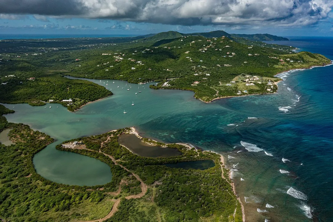
Salt River Bay is the most consequential square mile of ground in the United States Virgin Islands. People had been living, farming, and holding ceremonies on its shores for roughly fifteen centuries when seventeen Spanish ships appeared off the reef on November 14, 1493, and the fight that followed at the mouth of the bay entered the written record as the first armed stand Indigenous Americans ever made against Europeans. This page is our full reference for the site: the deep settlement history, what the 1493 accounts actually say, the earthen fort that still sits on the point, and what a visit to the national park looks like now.
Two thousand years before the fleet
The National Park Service traces settlement at the bay back about 2,000 years, to the Igneri, an Arawakan-speaking people who had moved up the island chain from South America. They were farmers, fishermen, and long-distance canoe builders, and the sheltered estuary suited all three trades: fresh water came down the guts from the hills, the mangrove shallows held fish and shellfish, and the bay offered the best protected anchorage on St. Croix's north coast. Around the seventh century a second Arawakan wave, the people we now call the Taino, arrived and gradually absorbed Igneri society. Under the Taino the bay became something larger than a fishing village. Archaeologists working the site have concluded it served as a regional ceremonial center, and the finds from its soil back that up: religious charms, carved stones, burials, and the ceremonial court described below.
The Taino called the island Ay Ay, a name usually rendered as "the river." Their world at Salt River was organized, agricultural, and connected by sea to the Greater Antilles cultures of Puerto Rico and Hispaniola. It was also, by the fifteenth century, under pressure. Around 1425 a third wave of newcomers, the Kalinago, called Caribs in the European chronicles, pushed into the bay, displaced the Taino leadership, and took control of the settlement. The people the Spanish would meet in 1493 were a Kalinago community holding Taino captives, on ground that had been continuously inhabited for well over a millennium.
The ball court on the point
The single most important pre-Columbian find in the Virgin Islands came out of the flat ground behind Salt River Point. In 1922 and 1923 the Danish archaeologist Gudmund Hatt, working for the National Museum of Denmark, ran an excavation survey across the old Danish West Indies and spent most of it on St. Croix. At Salt River he uncovered a row of nine large stone slabs, roughly 26 feet long and about half a meter high, the edge of a batey, the ceremonial ball court of the Taino world. Four of the slabs carried carvings, among them a female face archaeologists describe with motifs known from the Greater Antilles and from South America, including figures called the wrapped ancestor and the Frog Woman.
The claim attached to this find needs stating carefully, because different institutions word it differently. The Park Service calls it the only ball court known to exist in the Virgin Islands. The National Museum of Denmark, which holds the excavated material, goes further and calls it the only known ball court in the Eastern Caribbean; the island's tourism literature repeats that as the only one found in the Lesser Antilles. Either way, the point stands: the ceremonial game played on stone-lined courts across Puerto Rico and Hispaniola, a ritual contest in which teams kept a natural-rubber ball in the air with hips, shoulders, and heads, has left physical evidence in the Lesser Antilles at exactly one place, and it is this bay. That is the strongest argument archaeology can make that Salt River was a religious and political center, first Taino, later Kalinago, and a place of standing in the wider Caribbean world.
Hatt's dig was one chapter of many. The Park Service counts more than a dozen major archaeological investigations at the bay since 1880, which makes Salt River one of the most heavily studied pre-Columbian sites in the eastern Caribbean. Most of what those digs produced before the American era went home with the excavators, which is why the finest Salt River artifacts sit today in Copenhagen; the National Museum of Denmark has digitized its Salt River Bay collection for anyone who wants to see the carvings.
The bay the fleet found
Set the scene as the 1490s knew it. A Kalinago-controlled village stood near the western side of the bay, on and behind the point now called Salt River Point. Taino people lived there too, held as captives of the Kalinago after the takeover two generations earlier; the Spanish accounts are explicit about meeting both groups. Gardens and fruit trees surrounded the houses. Canoes worked the estuary and the coast. The court on the point, whether still in ceremonial use under the Kalinago or inherited from the Taino era, marked the place as significant. Nothing about Salt River in November 1493 was empty, and nothing about it was new. That matters for how the events of the 14th should be read: the fleet did not find a wild shore. It found a town.
November 14, 1493
Columbus's second Atlantic crossing was an armada, planned for colonization rather than reconnaissance: seventeen ships carrying, by the Park Service's count, about 1,200 men, several times the size of the 1492 voyage. The fleet had left Spain in late September 1493, made the Lesser Antilles in early November, and worked north along the island arc. On November 14 it stood off St. Croix's north shore, and Columbus named the island Santa Cruz, the name that survives, through the French, as St. Croix. The ships anchored off Salt River Bay, and the admiral, who never left his ship here, sent a longboat with roughly 25 armed men ashore to look for fresh water and to learn where the fleet was.
The shore party landed at the beach on the west side of the bay, the spot now marked as the Columbus Landing Site, and walked into the village. Most of its people had fled as the boats came in. The Spaniards found the houses, the gardens, and a number of Taino women and boys, captives of the Kalinago, and took several of them back toward the boats. The chroniclers frame this as liberation; the same chronicles show the freed captives kept aboard as the fleet sailed on, which tells you what the framing is worth. Reading the Spanish record against itself is most of the work of understanding this day.
The fight at the Cape of the Arrows
As the longboat pulled back toward the fleet, it crossed paths with a canoe coming around the eastern headland: a handful of Kalinago, the accounts say about four men and two women, returning home with no warning of what sat in their bay. Dr. Diego Alvarez Chanca, the fleet's physician and one of its chroniclers, wrote that the canoe's occupants held still in astonishment at the sight of seventeen ships for a long moment. Then, facing a rowed boat full of armed men, they picked up their bows.
They shot well. Arrows went through Spanish shields; one struck a sailor in the chest, a wound that killed him within days. The Spaniards ran the canoe down and rammed it, and the fight ended in the water. One Kalinago man who kept fighting while swimming was hauled in and killed on the spot, beheaded, by the account of Michele de Cuneo, an Italian gentleman-adventurer sailing with the fleet. The survivors were taken captive. Cuneo's letter records that he was given one of the captured women, and his matter-of-fact description of raping her stands as one of the earliest written records of sexual violence in the European colonization of the Americas. Columbus named the eastern headland Cabo de las Flechas, the Cape of the Arrows, for the fight and for the sailor it cost him.
Four separate eyewitness accounts of the encounter survive, and they disagree on details, on the number of people in the canoe, on the sequence of the fight. All four are European. No Kalinago version was ever written down, which is the record's deepest gap: the only description we have of the people who defended Salt River that day comes from the men in the other boat. What the accounts agree on, and what even the hostile chroniclers clearly respected, is that a canoe carrying six people saw an armada of seventeen ships and chose to fight.
What the record supports
Two large claims attach to Salt River Bay, and both are worth stating with the precision the Park Service uses.
First, the resistance claim. The NPS describes the fight at the Cape of the Arrows as the first documented armed resistance by Native people to European colonization, and as the first recorded conflict between Indigenous Caribbean peoples and Europeans. Fighting almost certainly occurred somewhere in the Americas before this, and the men of La Navidad, the garrison Columbus left on Hispaniola in 1492, were already dead by the time the second fleet arrived, but the canoe fight of November 14, 1493 is the earliest such fight that eyewitnesses wrote down. Documented is the load-bearing word.
Second, the landfall claim. For decades the site's National Historic Landmark description has called this the only known site where members of a Columbus expedition walked ashore on ground that today belongs to the United States. The Park Service's current wording is more careful: one of two documented landfalls on present-day U.S. territory, because the same fleet watered on the west end of Puerto Rico five days later. The distinction between the two claims is that no one can point to the Puerto Rico spot; the landing there is documented, the location is not. Salt River is the one piece of American ground where you can stand on the identified beach. However you weigh the wording, the designation is old and settled: the Columbus Landing Site was declared a National Historic Landmark on October 9, 1960, three decades before the park existed.
The century after the fleet
Spain claimed Santa Cruz and never made anything of the claim. What it did instead was empty the island. Raids in the early 1500s carried off the bay's people into slavery on Hispaniola and Puerto Rico under royal policies that treated the Kalinago as legitimate targets, and disease did much of the rest. The Park Service summarizes the era as Spanish capture and removal of the island's Amerindian peoples, met by continued resistance from Indigenous communities, and by the late 1500s the settlement story at Salt River Bay simply stops: an inhabited landscape of some fifteen centuries' standing went quiet within three generations of the 1493 landing. When Europeans next tried to live at the bay, in the 1600s, they found ruins and regrowth. The Kalinago themselves were not erased as a people; their descendants live today in the eastern Caribbean, most visibly in the Kalinago Territory on Dominica, and their side of the 1493 story is increasingly part of how the park interprets the site.
Fort Flamand, Fort Sale, and the flags on the point
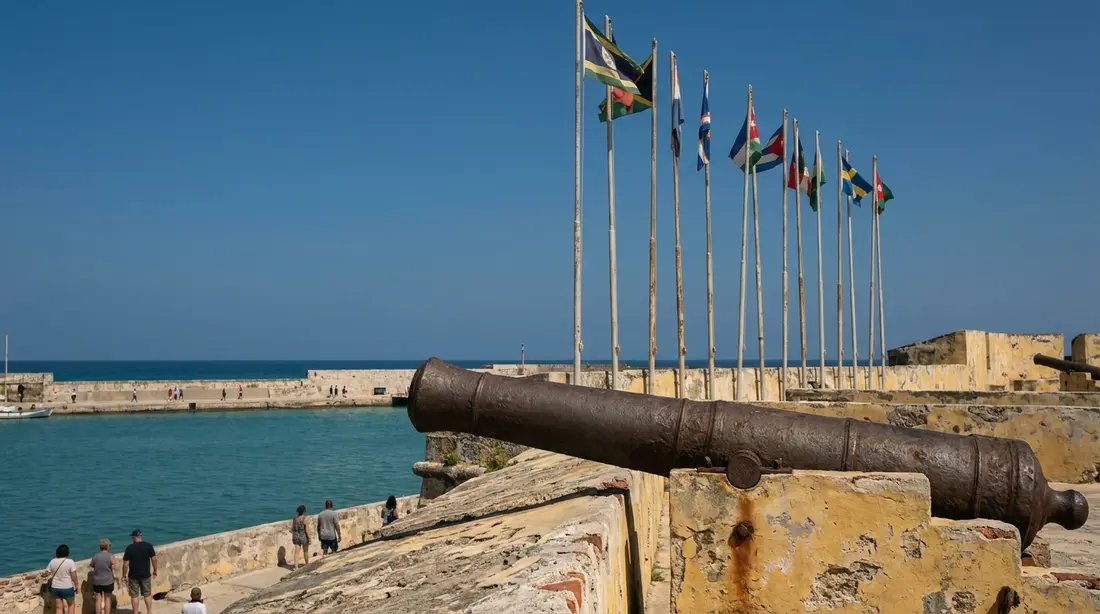
The European scramble for St. Croix in the mid-1600s played out at Salt River before it played out anywhere else, and it left the park its one standing colonial structure. English colonists began a fortification at the western entrance of the bay in 1641; Dutch settlers finished it in 1642 as a triangular earthwork remembered as Fort Flamand, the Flemish fort. Over the following decade the little fort changed hands with the island: English again through the late 1640s, briefly Spanish in 1650, then French from 1650, who renamed it Fort Sale. From 1653 to about 1665 St. Croix was held under the Knights of Malta, the crusading order to which the French crown leased the island, before France took direct control back and moved the main settlement east to the harbor the Danes would later build into Christiansted. The whole seven-flags churn of St. Croix's ownership, told in full in our seven flags guide, ran its first laps around this one earthen triangle.
What makes Fort Sale remarkable is that it survives. The Park Service calls the earthwork one of the oldest extant European fortifications in the New World. Nothing was ever built over it; the embankments still hold undisturbed archaeological material, and the triangular trace and ramparts are still legible in the ground at the western entrance to the bay, a few steps from the prehistoric village site and the ball court location. Stand there and you have three worlds within a stone's throw: the Taino-Kalinago town, the 1493 beach, and the 1640s fort.
The Danish estates and the Well Tower
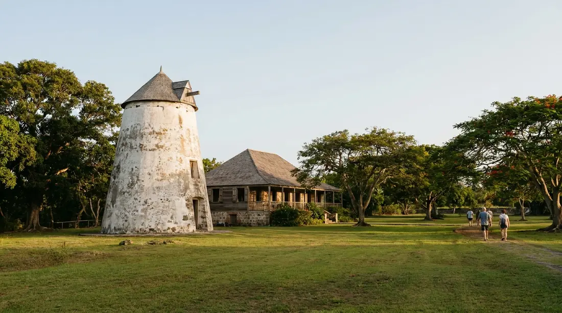
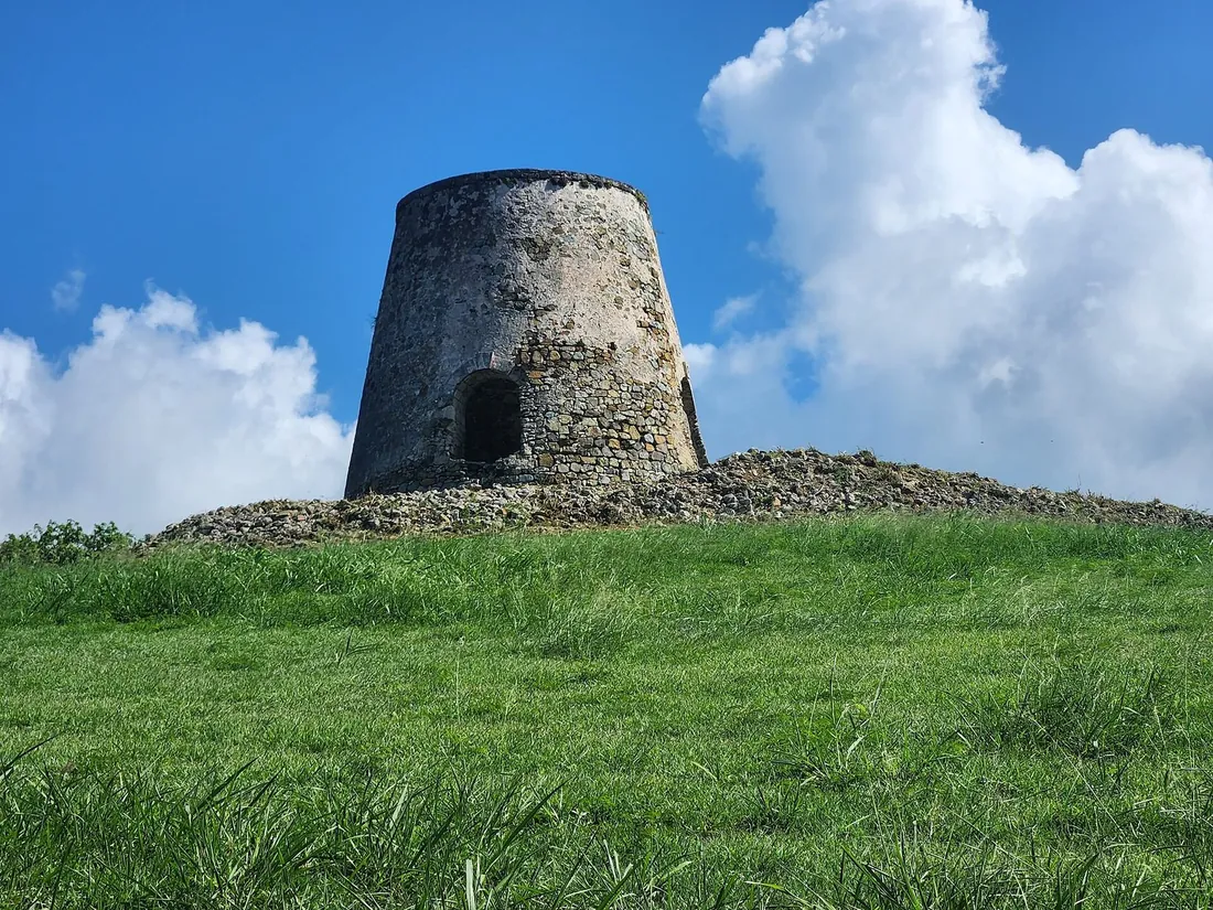
Denmark bought St. Croix from France in 1733 and turned the island into a sugar machine worked by enslaved Africans. Salt River's share of that economy is quieter than the great plantation museums like Estate Whim, but the park holds one substantial Danish-era monument: the Well Tower, off North Shore Road on land cultivated from 1750 as part of Estate Morningstar. Built in the 1790s of brick and coral-block masonry, roughly 16 feet across and more than 40 feet tall, it used wind power to lift water from the Salt River for the surrounding estates, one of only a handful of such towers surviving anywhere in the Virgin Islands. The NPS Historic Preservation Training Center has run stabilization work on it, and the tower is open to walk around from sunrise to sunset. The larger Danish story on St. Croix, emancipation in 1848, the 1878 Fireburn, the 1917 transfer to the United States, happened mostly elsewhere on the island, but the salt-making and estate names around the bay carry the era's imprint.
From landmark to national park
Protection came in stages. The 1960 National Historic Landmark designation covered the landing site; the park came a generation later, after development proposals for the bay, including a large marina scheme, pushed preservation to a head. On February 24, 1992, Congress created Salt River Bay National Historical Park and Ecological Preserve through Public Law 102-247, and the law built in an unusual arrangement that still defines the place: the park is run cooperatively, National Park Service alongside the Government of the U.S. Virgin Islands, with much of the land, including the landing beach itself, owned by the territory and co-managed with the NPS. The boundary takes in about 1,015 acres of point, estuary, mangrove forest, reef, and water. In November 2020 the park received a small piece of national attention when the U.S. Mint issued the Salt River Bay quarter, the 53rd coin in the America the Beautiful series, with a red mangrove on the reverse, a fair choice of emblem, since the mangroves are as central to the park's purpose as the history.
What a visit looks like today
Be realistic about the built facilities: they are modest, and that is part of the place's character. The visitor contact station, built in 2004 on the hill above the bay's west side, took hurricane damage in 2017 and has not reopened; it remained shut at last check. The Park Service directs visitors to the visitor center at Fort Christiansvaern in Christiansted for park information, or to the park line at 340-773-1460. There is no entrance fee, no gate, and often no ranger on site. Hours are simple where they are posted at all: the Well Tower and the trails on the bay's east side are open sunrise to sunset.
What you actually see, and it rewards a slow hour, is the landscape itself. From the rise on the west side the whole 1493 geography reads at a glance: the beach where the longboat grounded, the estuary behind it, and the eastern headland, the Cape of the Arrows, closing the bay's mouth. The Fort Sale earthworks sit near the old contact station, their triangular banks plain once you know to look. Columbus Landing Beach below is a calm, shallow, family-friendly strand with restrooms, grills, and picnic tables, used more by Crucian families than by tourists, and swimming there puts you in the water the fleet anchored over. The east-side trails wander through dry forest and mangrove edge to bay overlooks. Interpretive signage exists but is weathered; bring this page or the NPS site on your phone. For guided depth, Virgin Kayak Tours runs a daytime paddle built around the bay's history, telling the landing story from water level, and the kayak outfits at the marina cover the ecology; there is no regular ranger-led tour to count on, so check the park's calendar or call if a ranger program matters to you.
The estuary, the glow, and the canyon
The ecological half of the park's double name is not decoration. Salt River Bay protects some of the largest remaining mangrove stands in the Virgin Islands, ringing an estuary where fresh gut-water meets the sea, and those roots shelter juvenile reef fish through their vulnerable first seasons; our wildlife guide covers what lives in and over them. After dark the lagoon arm of the bay runs its famous show, water that sparks blue-green around anything that moves, every night of the year; the science, the moon math, and the tour operators are all in the bio bay guide, and the calm-water case for a morning paddle is in the daytime kayaking guide. Offshore, the sea floor splits into a submarine canyon whose two walls, dived from boats out of the marina, drop toward depths in the hundreds of feet with sponges and black coral on the faces. Divers should read the Salt River Canyon guide and the island-wide scuba guide for the sites and operators.
Timeline
| Date | Event |
|---|---|
| ~2,000 years ago | Igneri people settle the bay: farming, fishing, canoe building |
| ~600-700 CE | Taino era begins; the bay grows into a ceremonial center |
| ~1425 | Kalinago take control of the settlement and its Taino population |
| Nov 14, 1493 | Columbus's 17-ship fleet anchors; landing party goes ashore; fight at the Cape of the Arrows |
| 1500s | Spanish slave raids and disease empty the island; the bay falls silent by the late 1500s |
| 1641-1642 | English begin and Dutch complete the triangular earthen fort (Fort Flamand) |
| 1650-1665 | French take the fort, rename it Fort Sale; Knights of Malta hold the island 1653-1665 |
| 1733 | Denmark buys St. Croix; estate agriculture spreads around the bay |
| 1790s | Well Tower built on Estate Morningstar land to lift water by wind power |
| 1880 onward | More than a dozen major archaeological investigations begin |
| 1923 | Gudmund Hatt uncovers the ball court, the only one known in the region |
| Oct 9, 1960 | Columbus Landing Site designated a National Historic Landmark |
| Feb 24, 1992 | Congress creates the park, co-managed by NPS and the territorial government |
| 2004 | Visitor contact station built on the western overlook |
| 2017 | Hurricane damage closes the contact station; still closed at last check |
| Nov 2020 | Salt River Bay quarter issued, 53rd in the America the Beautiful series |
Planning a Salt River day
The park sits on Route 80 on the north shore, about 20 to 25 minutes from Christiansted, with parking at the marina area and at Columbus Landing Beach. As a stop it takes anywhere from 30 minutes, overlook, fort banks, beach, to half a day if you add a paddle. The natural pairing is a north-shore run: history at Salt River in the morning, then west along the coast for Cane Bay and lunch, with the Annaly Bay tide pools or the Maroon Ridge country beyond for the ambitious; the full loop logic is in our island driving guide. History-minded visitors should bracket the bay with Christiansted itself, since the national historic site in town holds the park's working visitor center and the Danish side of the story. The strongest single-day combination on the island may be Salt River by daylight and the same bay again after dark by kayak: five centuries of history at noon, bioluminescence at ten. The area's marina, dive shop, and charter details live in our Salt River area guide.
Questions guests ask
Is the Salt River visitor center open?
At last check, no. The contact station on the hill above the bay's west side has been closed since Hurricane Maria damaged it in 2017, and reopening has been discussed for years without a firm date. The park itself never closes in the way a building does: the beach, the fort earthworks, the Well Tower, and the east-side trails are all accessible sunrise to sunset without a ranger. For maps, stamps, and staffed information, use the visitor center at Fort Christiansvaern in Christiansted, or call the park at 340-773-1460 before your visit; ranger programs at Salt River happen but are intermittent.
Did Columbus himself step ashore here?
No, and the park's materials are careful about this. Columbus stayed with the fleet; the people who landed on November 14, 1493 were a shore party of roughly 25 men sent in by longboat for water and reconnaissance. The correct claim is that members of his expedition came ashore, which is why the site's formal description says members of a Columbus expedition rather than the admiral himself. It changes nothing about the site's significance, the landing, the fight, and the documentation are what matter, but it is the kind of detail worth getting right when you are standing on the beach in question.
Why is it called Salt River?
The naming trail is only partly documented. Columbus called the island Santa Cruz and the eastern headland Cabo de las Flechas; the French, holding the point in the 1650s, called their earthwork Fort Sale, the salt fort, and the salt association stuck through the Danish era, when a salt pond sat behind the bay's beach as it still does. No source we have found pins the exact moment "Salt River" became the bay's name, so we leave it at what the record shows: the salt reference is at least as old as the French fort, and the modern name was standard by the plantation period.
Can we swim at Columbus Landing Beach?
Yes. It is a calm, shallow beach inside the bay, protected from open swell, with restrooms, grills, and picnic tables, one of the easier family swims on the north shore, and a locals' weekend spot more than a tourist scene. There is no lifeguard, as almost nowhere on St. Croix has one, and the estuary side can be murky after heavy rain when the guts run. Treat it as a swim inside a historic site: the sand you walk down is the documented 1493 landing ground, which is not something any other beach in the country can say.
Where are the artifacts from the excavations?
Mostly in Copenhagen. The major digs before the American era were Danish, above all Gudmund Hatt's 1922-1923 survey, and the finds went to the National Museum of Denmark, which has digitized its Salt River Bay collection online, carved stones, charms, and ceramics included. Later NPS-era archaeology remains in institutional collections; with the contact station closed there is no permanent exhibit at the bay itself at last check, which is the real gap in the visit. Seeing the ball-court carvings therefore means a museum website rather than a museum, at least until the station reopens with its displays.
How much time should we give it, and what does it cost?
Admission is free, and there is nothing to book for a self-guided visit. A focused stop, overlook, fort banks, ten minutes on the beach, runs half an hour to 45 minutes; add an hour for the east-side trails or the Well Tower, and a half day if you put a kayak in the water. Photographers should come in the last two hours of light, when the low sun models the earthworks and the mangrove line. Combine it with Cane Bay and you have the north shore handled in one unhurried day, with the bio bay available as the same day's second act after dark.
Staying near the history
Salt River sits mid-island on the north shore, an easy 20-to-25-minute run from our Christiansted-side homes, which makes the history day and the bio-bay night simple to stack in one visit. Guests at our East End villas reach the park along the waterfront road through town; the beachfront collection adds its own swim before or after. If the 1493 story is a centerpiece of your trip, tell us when you book and we will map the history circuit, Salt River, the Christiansted forts, Estate Whim, against your dates, including any ranger events the park has scheduled that week. Browse all of our homes on the villas page.
Sources
Written from official and first-party sources, checked August 2026. Hours, prices and event dates change — confirm before you go.
In this guide
Stay nearby
On The Shoys beach: six bedrooms, six baths, pool and hot tub, room for twelve, and the beach through the back garden.
 Shoy's Beach House6 bd · 6 ba · sleeps 12 · Christiansted
More in History & Culture
Sources
13 references, listed in full at the end of this guide — official park, refuge, tourism-board and business sources, checked August 2026.