The Mangroves of Salt River
Some of the Virgin Islands' largest mangrove forests still line Salt River Bay — nursery, storm buffer, and kayak country.
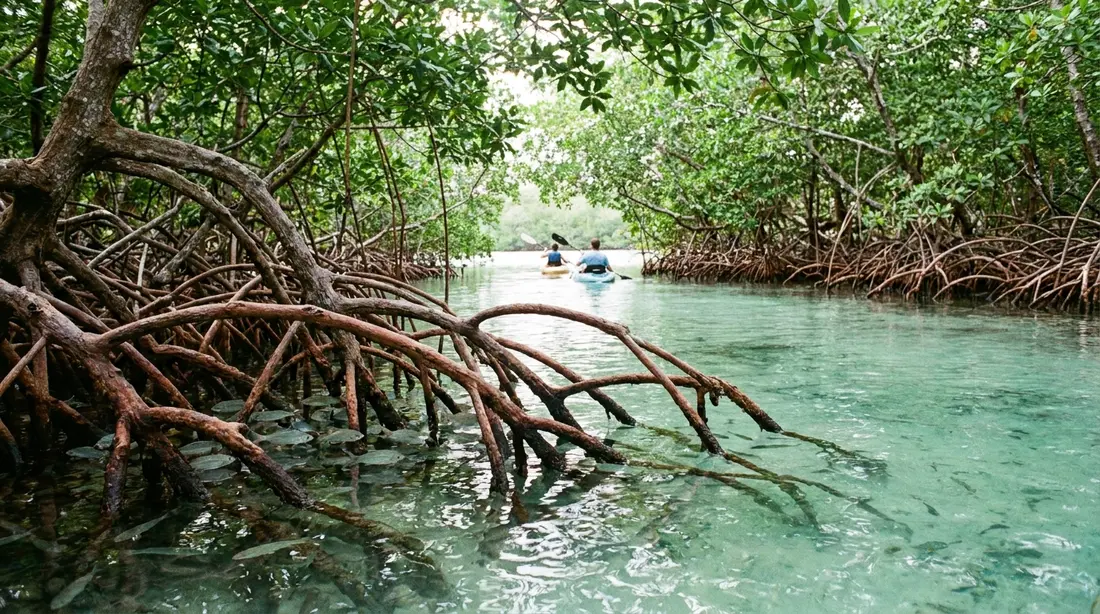
The dark green wall that lines Salt River Bay is a forest of trees that live in salt water. It is one of the largest mangrove systems left in the U.S. Virgin Islands, protected inside the 1,015-acre Salt River Bay National Historical Park and Ecological Preserve on the north shore, and acre for acre it does more work than any other ground on St. Croix. It raises the fish that stock the reefs, holds the coastline in place through a hurricane, banks carbon in its mud, and feeds the plankton that light the bay after dark. This page is about the forest itself, the biology of how it lives and what it does. The paddle through it, the glow it feeds, and the 1493 landing on its beach each have their own guide.
What a mangrove is
Mangroves are trees and shrubs that grow where almost nothing woody can, in the tidal zone where land, fresh water, and the sea meet and the ground floods twice a day. Around 80 species grow worldwide, all of them held to the tropics and subtropics because none survives a hard frost. What they share is a set of answers to three problems that would kill an ordinary tree: the water is salt, the mud holds almost no oxygen, and the tide never stops shifting the ground underfoot. A mangrove is any tree that has solved all three at once. Salt River is the Virgin Islands' best place to see those solutions lined up together, because the estuary behind the reef gives the trees the calm, shallow, brackish water they need, and the park has kept the forest from being cleared. The National Park Service calls the bay's mangroves, estuary, coral reefs, and submarine canyon a single "vitally important ecosystem," and names the mangrove stand here as "some of the largest remaining mangrove forests in the Virgin Islands."
The three mangroves at Salt River
St. Croix has three true mangrove species, and all three grow at Salt River. Botanists sort them by how much salt water each can stand, which lays them out along the shoreline in bands you can read from a kayak, from the open water inland.
- Red mangrove (Rhizophora mangle) holds the front line, growing at the water's edge and out into the shallows. It is the tree most people picture, standing clear of the water on arching prop roots that drop from the trunk and the branches. In the tropics it can reach about 80 feet. At Salt River the red mangrove forms the outer fringe a boat slides along.
- Black mangrove (Avicennia germinans) grows just behind the red, on ground that floods at high tide and in storms rather than staying underwater. It runs 30 to 40 feet tall and is known by the crowd of thin, dark, finger-like shoots that stand up out of the mud around its base.
- White mangrove (Laguncularia racemosa) takes the higher, drier ground behind the black, and often shows no special roots at all.
On land that the tide reaches only in a surge grows buttonwood (Conocarpus erectus), named for its round, cone-like clusters of fruit. Botanists count it as a mangrove associate rather than a true mangrove, because it lacks the specialised roots and the seed trick the other three depend on. Read from the sea inland, the order runs red, black, white, buttonwood, each species holding the zone that matches its tolerance for salt. Learning the sequence is the single most useful thing a visitor can do before a paddle, because it turns an undifferentiated green thicket into a legible piece of country.
Where the roots do not give a tree away, the leaves do. A black mangrove leaf is often dusted with the salt it has pushed out through its glands, and tastes of it if you touch a finger to the surface; a white mangrove carries a pair of small salt glands where each leaf meets its stalk; the red mangrove's leaves are thick, leathery, and glossy dark green; and the buttonwood announces itself with the little cone-like buttons of fruit it is named for. Between the root form, the leaf, and the zone each tree occupies, the four are straightforward to tell apart within a minute of having them pointed out, which is most of what a good guide does on the water.
Roots that breathe
The forest's most striking feature is a fix for the oxygen problem. Waterlogged mud is nearly airless, so a mangrove cannot take in oxygen through its roots the ordinary way, and each species has grown a different workaround. The red mangrove's prop roots arch down from the trunk, with thinner roots dropping straight from the branches, and the parts standing above the waterline are dotted with pores that draw in air and carry it to the drowned roots below. The black mangrove does the reverse: from roots buried in the mud it sends up thousands of slim vertical shoots called pneumatophores, which clear the surface by a few inches and breathe through open pores whenever the tide is out. A stand of black mangrove looks like a bed of dark spikes pushed up through the sand. Those root systems do a second job that reaches far past the shoreline. The tangle slows the water moving through it, and the sediment the water carries drops out and settles among the roots instead of drifting onto the reef, where it would choke the coral. Season by season the forest builds the very ground it stands on, pushing the land a little farther out to sea.
Trees that drink seawater
Salt is the second problem, and the three species split into two camps. The red mangrove is an excluder: its root membranes work as a filter, holding back most of the salt in the seawater while letting the water itself pass into the tree. The black and white mangroves are excreters: they take the salt up and then push it back out through glands on their leaves, so on a black mangrove leaf you can sometimes find dried salt crystals, and taste the salt on the surface. The white mangrove adds a second tactic, growing thick, fleshy leaves that store salt and carry it off when they drop. None of this comes free. Moving water and dumping salt against that kind of gradient costs the tree energy that a freshwater tree spends on growing, which is part of why mangroves grow slowly and why a cleared stand is so slow to return.
Seeds that grow before they fall
Mangroves answer the third problem, a substrate that never holds still, with one of the odder reproductive habits in the plant world. Rather than dropping a dormant seed that the tide would carry off before it could root, a mangrove lets its seed germinate while it is still attached to the parent tree, a habit called vivipary. The red mangrove's seed grows into a slim, pencil-shaped propagule, anywhere from a hand's length to roughly half a meter long, that hangs from the branch until it drops. Once it falls it can drift on the tide for months, staying alive the whole time, before it grounds in the mud somewhere and puts down roots, which is how one forest seeds new shorelines across a bay or clear across open water to another island. The pale green propagules dangling from the red mangroves along Salt River are next year's forest, already begun.
The ocean's nursery
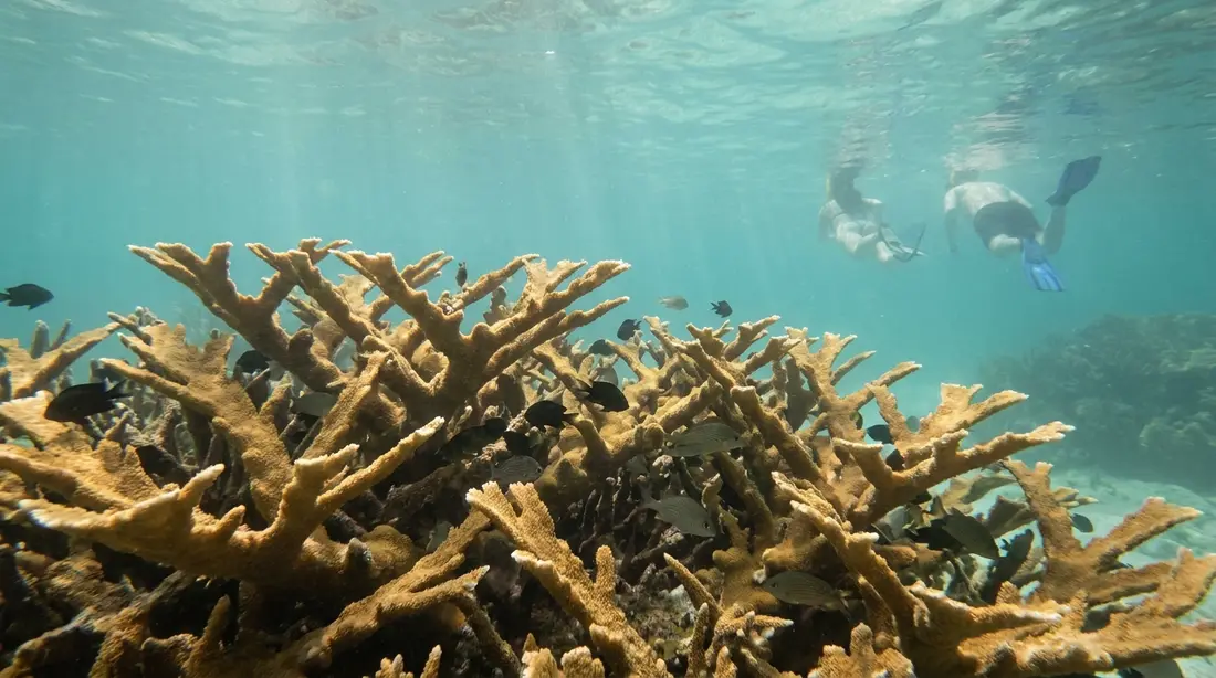
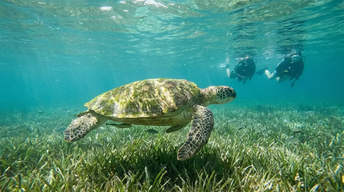
The reason a mangrove forest matters to a fisherman miles offshore is that it is where the fish begin. The flooded root maze is shaded, thick with food, and too tight for big predators to hunt in, which makes it the safest place on the coast for a young fish to grow. The reef, the seagrass meadows on the bay floor, and the mangroves work as one connected system: many species spawn out on the reef, drift in as larvae to settle among the seagrass and the roots, grow through their most vulnerable weeks in that shelter, and move back out to the reef as adults. Break one link and the others weaken.
Three things make the root zone safe, and they compound. The roots themselves are a physical maze a hunting jack or barracuda cannot swim through at speed. The brackish estuary water is cloudier than the clear blue outside the reef, so a small fish is simply harder to see. And the food is everywhere, so a young fish barely has to leave cover to eat. Many species climb the habitat ladder as they grow, moving from the roots to the seagrass flats to the reef in step with their size, so a single bay raises fish through several stages at once. It is why a reef with no nursery upstream runs thin no matter how healthy the coral looks.
The roll call of fish that pass through is long and commercially serious. Gray snapper, also called mangrove snapper, settle among the red mangrove roots and the seagrass as juveniles and feed there until they are a few inches long, then head out to the reef where they are caught as adults. Grunts follow the same path. Tarpon cruise the deeper water alongside the roots, great barracuda hold station in the channels, and young grouper use the forest at some stage of their lives. A large study across the Caribbean found that reefs with a healthy mangrove forest beside them carried far more fish than reefs without one, with the mass of several important snapper and grunt species roughly doubling where reef and mangroves stayed connected. In Florida, where the same species mix has been studied for decades, researchers estimate that 75 percent of game fish and 90 percent of commercially harvested species depend on the mangrove system at some point in their lives.
Salt River's nursery has been measured directly. A NOAA survey ran from May 2018 through May 2019 and set the bay's young fish against a count made 25 years before. It found juvenile fish three to seven times more abundant than a generation earlier, though spread across 30 to 50 percent fewer species, and tied the shift to natural swings in fish recruitment, changing conditions, storm disturbance, and the decline of adult fish stocks out on the reef. The plain reading is that the nursery is still crowded, and still doing its job.
Life among the roots
The fish are only the part that swims away. The submerged prop roots are hard surface in a bay of soft mud, and a whole community fastens onto them: oysters and barnacles cement themselves to the bark, sponges and sea squirts and small mollusks crust the underwater sections, and shrimp, snails, and worms work the crevices between. Mangrove tree crabs scuttle up the roots and trunks above the waterline, fiddler crabs wave from the mud at low tide, and in the warm shallows the upside-down jellyfish lies on the bottom with its frilled arms turned toward the sun. All of it runs on fallen leaves. Mangrove leaves drop year-round, and fungi and bacteria break them down into detritus, the fine organic litter that the outgoing tide flushes through the estuary and out toward the reef, feeding shrimp, crabs, and fish along the way. That detritus is the base of the whole food web here: the leaf becomes litter, the litter feeds the small animals, the small animals feed the young fish, and the young fish feed the reef. A mangrove forest is, in effect, a machine for turning sunlight and leaves into fish.
Birds of the mangroves
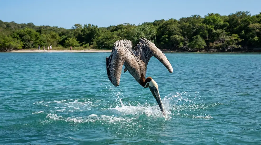
The forest feeds birds as readily as fish, and a quiet paddle or an early walk along the beach turns up a cast that works the mangrove edge rather than the open sand. Wading birds hunt the shallows in and around the roots: the great blue heron, the smaller green heron that crouches low over the water, the yellow-crowned night heron that comes out toward dusk, and great and snowy egrets stalking the flats. Brown pelicans, once endangered and still protected, plunge for fish at the mouth of the bay and roost in the branches, and the belted kingfisher hovers and drops for the small fry the roots shelter. Two birds belong to the mangroves more than to anywhere else on St. Croix. The mangrove cuckoo is a shy brown-and-buff bird, heard far more often than seen, whose low guttural call carries out of the dense canopy; coastal mangrove and thicket is its home ground, and it is one of the harder island birds to lay eyes on. The yellow warbler works the outer branches, a small bright bird with a carrying song. The island-wide bird list, the salt-pond flocks, and the best places to find them are in the wildlife guide; this shoreline is one of its richest chapters. Green iguanas, common along the bay, drape the same branches, more reptile than bird but part of the same edge.
The bay that glows
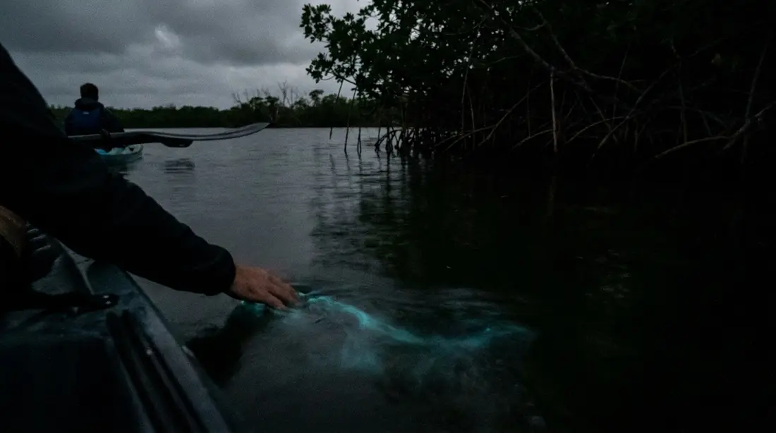
The mangroves are also the reason Salt River lights up at night. The dinoflagellates that make the glow depend on nutrients and bacteria that come from the forest's decaying leaves, so the trees are the engine behind one of the world's few bays that glow every night of the year. The mechanism, the moon math, and the tours belong to the bio-bay kayak tour guide and the shorter why the bay glows page, which cover the light in full; the point for this page is simply that the forest feeds it.
Carbon, storms, and the shoreline
A mangrove forest earns its protection several times over. It is one of the most efficient carbon stores on the planet. Coastal wetlands like these pull carbon out of the air roughly ten times faster than a mature tropical forest, and hold three to five times as much of it per acre, because most of the carbon settles into the waterlogged mud rather than the wood, where the lack of oxygen keeps dead leaves and roots from rotting and giving it back. The world's mangroves together store on the order of three billion tonnes of carbon. Closer to the villa, the forest is the island's cheapest sea defence. The band of roots takes the force out of waves and storm surge before they reach the land behind, and binds the shoreline sediment so it cannot wash away, which is why a coast that keeps its mangroves loses far less ground in a hurricane than one that has been stripped. The sediment those roots trap also keeps the water over the reef clearer, which the corals need to survive. One acre of Salt River mangrove works as a carbon vault, a seawall, and a water filter at the same time, and asks nothing in return.
Damage, recovery, and protection
The threats are the ordinary ones. Mangroves the world over have been cleared for marinas, resorts, and fill, and the Virgin Islands lost stands the same way before the value of the forest was widely understood. Salt River's survival owes a great deal to its sitting inside a federal park where it cannot be developed, the same park that protects the 1493 landing on its western beach, told in the Salt River, 1493 guide, and the wider bay covered in the Salt River area guide. Storms are the other force. The 2017 hurricanes Irma and Maria tore into the territory's mangroves and shrank the habitat, and the forest has been slow to grow back on its own, with some patches barely regrowing at all. Where nature will not refill the gaps, the forest is being replanted. Along Sugar Bay, one arm of the Salt River estuary, thousands of red mangrove propagules were set out between 1999 and 2001, planted in plots on the western shore and as a fringe along much of the eastern side, so that parts of the shoreline you pass today are a young forest people started rather than an old one that seeded itself. Mangroves grow slowly, so this is patient work measured in decades, not seasons.
Seeing the forest without harming it
You meet the mangroves from the water, quietly. A guided daytime kayak or a paddleboard is how most visitors do it, sliding along the root line on the calm inner bay; the daylight paddle, the operators, and the boats are covered in the daytime kayaking guide and the paddleboard guide, and the after-dark trip in the bio-bay guide, so this page leaves the paddle to them. On foot, Columbus Landing Beach on the western arm sits right at the forest's edge, with calm shallow water and picnic ground. However you come, the forest asks for a light touch. Keep your hands off the roots and never snap a branch or pull a propagule; hold to the open channels your guide follows rather than pushing a hull in over the seedlings; and leave as little wake as you can, both to spare the young shoreline and to keep the mud from clouding. On a night tour, keep insect repellent and sunscreen off your skin entirely, for the reason the bio-bay guide explains. The bay is a working nursery, and it stays one only when visitors treat it the way the fish do, as shelter.
The wider island's mangroves
Salt River holds the island's largest mangrove system, but not its only one. Great Pond, on the south-east shore, is among the biggest mangrove tracts left on St. Croix and carries an Important Bird Area designation; the Southgate Coastal Reserve near Christiansted wraps mangrove around a salt pond behind its beach; and Altona Lagoon, just east of town and ringed with red mangrove, is the island's second glowing bay. All three, along with how the island's wet and dry coasts fit together, are in the two-landscapes guide and the wildlife guide. Salt River is simply the one with the park, the tours, and the deepest forest, which is why it carries this page.
The mangroves at a glance
| Species | Where it grows | Roots | Salt strategy | What it does here |
|---|---|---|---|---|
| Red mangrove | At the water's edge and into the shallows | Arching prop roots from trunk and branches | Excludes salt at the root membrane | Front-line fish nursery and wave buffer |
| Black mangrove | Just inland, flooded at high tide and in storms | Upright pneumatophores from buried roots | Excretes salt through leaf glands | Binds sediment across the middle band |
| White mangrove | Higher, drier ground behind the black | Often no visible specialised roots | Excretes and stores salt in the leaves | Upper edge of the true forest |
| Buttonwood | Upland, above most tides | Ordinary roots | Salt-tolerant associate, not a true mangrove | Transition to dry-land vegetation |
Questions guests ask
How many kinds of mangrove grow at Salt River?
Three true species, and all three are here: the red mangrove at the water's edge, the black mangrove just inland, and the white mangrove on higher ground behind them. A fourth tree, buttonwood, grows at the dry upper fringe and is usually counted as a mangrove associate rather than a true mangrove. You can read the three off the shoreline in bands, because each holds the zone that matches how much salt water it tolerates. The red mangrove, up on its arching prop roots, is the one most visitors picture when they picture a mangrove at all.
Why are mangroves called the ocean's nursery?
Because most of the reef's fish spend their first weeks of life here. The flooded tangle of roots is shaded, full of food, and too tight for large predators to hunt in, so young snapper, grunts, and many other reef species shelter and grow among the roots and the neighbouring seagrass before moving out to the reef as adults. Studies across the Caribbean have found far more fish on reefs that still have mangroves beside them. A NOAA survey of Salt River in 2018 and 2019 counted juvenile fish several times more abundant than a generation earlier.
What are the finger-like sticks standing up out of the mud?
Those are pneumatophores, the breathing roots of the black mangrove. The mud a mangrove grows in holds almost no oxygen, so the black mangrove sends up thousands of slim vertical shoots from its buried roots; each one draws in air through open pores when the tide falls and carries it down to the roots below. The red mangrove solves the same problem a different way, with the arching prop roots that lift it clear of the water. Both are ways of breathing in ground that would drown an ordinary tree.
Are the mangroves the reason the bay glows?
They are a large part of it. The dinoflagellates that light Salt River after dark rely on nutrients and bacteria that come from decaying mangrove leaves, so the forest feeds the plankton that make the glow. It is also why Salt River glows every night of the year while some other bays have dimmed: the forest that feeds it is locked inside protected parkland, closed to the clearing and filling that has cost glowing bays elsewhere. The glow itself, the science, and the night tours are covered in the bio-bay guide, not on this page.
What is the best way to see the mangroves?
By water, slowly. A guided daytime kayak or a paddleboard lets you slide right up to the root line on the calm inner bay, and the night kayak passes the same shoreline on its way to the glow; both have their own guides. On foot, Columbus Landing Beach on the western arm sits at the forest's edge. Whichever you choose, keep your hands off the roots, stay in the open channels, and leave little wake, because the forest is a working fish nursery inside a protected park.
Did the 2017 hurricanes destroy the mangroves?
They damaged them. Hurricanes Irma and Maria in 2017 shrank the territory's mangrove habitat, and the forest has been slow to come back on its own in places. Salt River fared better than an open coast partly because a healthy mangrove stand absorbs a storm rather than being flattened by it, which is the same protection it gives the land behind it. Replanting has helped where natural regrowth stalled: thousands of red mangrove propagules were set out along Sugar Bay around the turn of the century, and that young forest is still filling in.
Staying near Salt River
The houses we manage cluster on the Christiansted side of St. Croix, roughly thirty minutes from the bay, which puts the mangrove forest within an easy morning of a nature-minded stay. Guests at our beachfront collection and the East End homes reach the bay along the north-shore road, and a few of these houses lend out kayaks or boards that carry down to the free put-in at Columbus Landing for a quiet paddle among the roots. The west-end homes sit farther from the bay but nearer the sheltered Frederiksted diving for the rest of the week. For the fullest look at the forest and everything it feeds, pair a slow morning on the water with the birding at first light, when the herons are working the shallows. The full list is on the villas page.
Sources
Written from official and first-party sources, checked August 2026. Hours, prices and event dates change — confirm before you go.
In this guide
Stay nearby
Private oceanfront on the East End with a sandy, swimmable beach, pool, outdoor kitchen and a separate guest cottage. Sleeps twelve.
 The Cerulean5 bd · 5 ba · sleeps 12 · Christiansted
More in Nature & Wildlife
Sources
11 references, listed in full at the end of this guide — official park, refuge, tourism-board and business sources, checked August 2026.