The Rainforest & West End
Mahogany Road, the Domino Club, Creque Dam, and the wet, green quarter of an otherwise dry island.
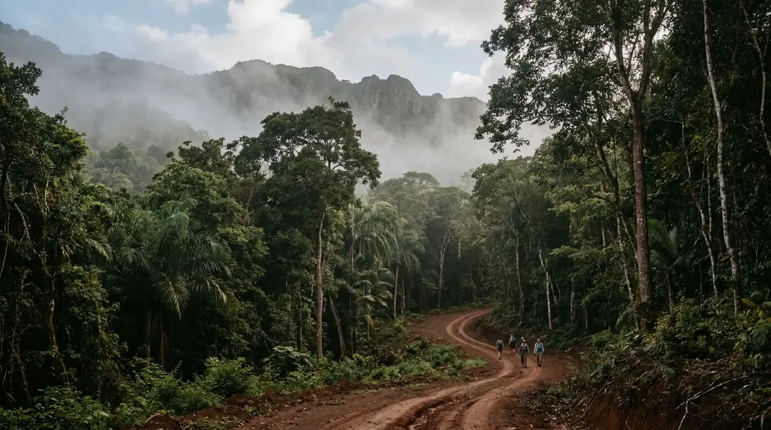
The northwest quarter of St. Croix is the island's green corner: forested hills above Frederiksted where yearly rainfall passes 50 inches, roughly double the 25 to 38 the dry East End collects. Crucians call it the Rain Forest, capital letters and all. This page is the region overview — what "the rainforest" actually means on St. Croix, where its edges run, what it feels like to be in it, and every way to experience the whole green quarter, each routed to the deeper page that covers it in full.
Where the rainforest is
The forest occupies the island's northwest, the wettest and steepest ground St. Croix has. It climbs from the west coast road above Frederiksted into a range of hills topped by Mount Eagle, the island's high point at 1,165 feet, and spreads north toward the coast at Davis Bay and Cane Bay. Draw the rough boundary by road: Route 63 along the west coast, the north shore to the top, Centerline Road and Mahogany Road across the bottom, and the Mount Eagle ridge down the spine. Inside that box sit the old estate lands whose names still label the maps — Caledonia, Creque, Mount Victory, Little La Grange, Mount Washington, Sprat Hall, Annaly, Windsor — most of them forest now where cane once grew.
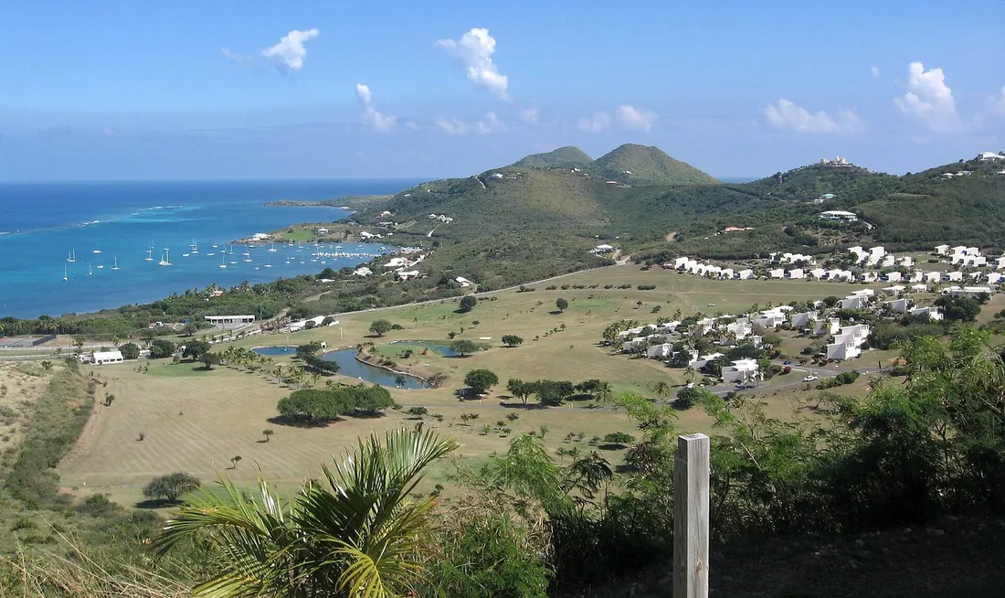
The label deserves a footnote, and it is a short one. By the textbook rule this is not true rainforest: that label needs at least 100 inches of rain a year, and St. Croix's wettest ground manages barely half, so ecologists log the hills as moist tropical forest. Under the leaves the distinction dissolves. The reason the northwest is green while the eastern tip carries cactus is the trade winds hitting this tall ground and dropping their moisture on it, a rain-shadow mechanism explained in full in the two-landscapes guide — this page takes the green as given and gets you into it. The scale is what makes it worth the trip: you can leave a desert coastline and stand under a closed forest canopy inside 40 minutes, without leaving an island of 84 square miles.
Within that box the ground folds into named valleys and drainages, and a few of them orient the whole quarter. The Caledonia Valley, in the deepest northwest, carries the island's only natural waterfall down a seasonal gut. Mount Eagle and the ridge around it hold the tallest, wettest forest. Sprat Hall and Annaly sit on the coastal shoulder where the hills meet the sea on the northern side. And the plain immediately below the forest — Estate Little La Grange, Grove Place, the Centerline estates — is the farmed transition where the green gives way to pasture. The forest is small enough to cross in a morning and layered enough to fill a week.
What the green quarter feels like
The change registers on the skin before the map confirms it. Turn off the coast road and climb, and within a mile the air cools enough to notice through an open window, the light goes dim and green as the leaves close overhead, and the road surface stays damp long after the coast has baked dry. Birdsong replaces surf. The smell shifts to wet earth and leaf. The whole quarter runs a few degrees cooler and a great deal wetter than the beaches below it, and that microclimate is the point of coming.
The trees make the roof. Mahogany is the signature, planted along these roads in Danish times and now arching two and a half centuries old over the pavement; kapok, the silk-cotton giant that Crucians call the jumbie tree, throws the widest trunk; the turpentine tree peels its coppery bark, and samaan spreads its crown over the clearings, with ferns and vines packing every layer below and feral mango and breadfruit — escapees from the old estate kitchens — dropping fruit onto the road in season. The botany of all of it, and why a semi-arid island grows any of it, belongs to the two-landscapes guide; from the driver's seat the short version is that you are crossing the one corner of St. Croix that behaves like the tropics of the brochures.
The forest wears rain better than anywhere else on the island, which flips the usual vacation logic. A shower that ruins a beach morning is exactly what switches the rainforest on — steam rising off the road, bark gone black with wet, the guts running, the light silvered. The wettest quarter is the one place a gray sky improves, which is why a rainy afternoon is a rainforest afternoon here.
Driving through the forest
The easiest way in is behind a windshield, and the forest gives you three grades of road for it. Mahogany Road, Route 76, is the one for everyone: paved end to end, narrow and bendy under a solid canopy, crossable in any rental car at a sensible pace, and the prettiest stretch of asphalt on St. Croix. It links the west coast above Frederiksted to Grove Place in the island's middle in five or six winding miles.
Creque Dam Road, Route 58, is the forest for the willing — rougher, climbing past a stone dam finished in 1926, tame in a car on its lower reaches and best walked or driven with clearance higher up. The Scenic Road, Route 78, is the forest for the equipped: an unpaved ridge route that wants a high-clearance four-wheel-drive and a dry week, and strands ordinary cars after rain. If you would rather fold the forest into a lap of the whole island, the western hills are one leg of the classic circuit laid out in the drive-around-the-island guide, which sequences the coast, the canopy and the sunset into a single day.
Walking the forest
No other U.S. Virgin Island offers as much walkable ground as St. Croix, and almost none of it is signed; the northwest concentrates the best of that paradox. The full lineup, west to east, lives in the hiking index; the forest's own routes are these. The gentlest is the road walk up Creque Dam Road to the old dam — shaded, graded, free, and the simplest self-guided rainforest walking on the island. The most famous is the trek to the Annaly Bay tide pools on the north shore, a hot 3.6-mile round trip that pays off in natural rock pools you swim only when the sea is calm.
North and west, the cliff country runs high above the water. The short climb to Ham's Bluff Lighthouse, a Danish cast-iron tower from 1915, gains an open bluff over the whole north coast in about half an hour. Beyond it runs Maroon Ridge, the high country where people who had escaped slavery founded free settlements — the weightiest walk on St. Croix and the least casual, worth a guide the first time. Gentler options round it out: the maintained Windsor Farm loop and the open grounds of Estate Mount Washington both sit in the hiking index, and the island's one natural waterfall, in the Caledonia Valley, runs after rain and asks for a guide up its gut. Every forest walk shares one rule: stay out of the streambeds when heavy rain is falling or forecast, because they flood fast.
The Domino Club and the roadside stops
The forest's famous stop sits on Mahogany Road at the Mt. Pellier Domino Club, a roofed, wall-less bar that has held a license since 1971 and is known island-wide for two things: its house rum infusion, MamaWanna, and a pen of large pigs that empty cans of non-alcoholic beer with alarming speed. It is the anchor lunch of any rainforest drive, cash only, on its own loose schedule.
Two working stops share the same roads. St. Croix LEAP, the open-air woodworking shop that mills bowls and boards from storm-salvaged local mahogany, stands about two miles up Mahogany Road — sporadically staffed, worth a slow-down when it is open, and covered in the Mahogany Road guide. Ridge to Reef Farm, the certified-organic spread at Estate Little La Grange just off Creque Dam Road, sells produce, sauces and jams at its stand on posted days; the Creque Dam guide has the specifics. The club also turns up in our journal round-up of the island's overlooked places, which frames the whole quarter around the access catch attached to each spot.
Riding the back country
The interior of the northwest — the private estate roads and forest tracks a rental car cannot reach — opens up on a guided machine. Two outfits run ATV and side-by-side tours off the west coast, one from Rainbow Beach and one from downtown Frederiksted, threading two-hour routes through rainforest, mud holes, sugar-mill ruins and hilltop overlooks that take in both coasts at once. The riding is guided-only for a reason: the good ground is private, and the public roads are posted for cars driven on the left. First-timers are the norm, and a guide-driven UTV carries families and non-drivers over the same tracks.
Horseback rides once threaded the same forest edge — Paul & Jill's stable in the historic Sprat Hall area, off Route 63 north of Frederiksted, ran rainforest and hilltop trail rides for more than 30 years. At last check the stable was closed until further notice and booking no rides, so treat it as paused rather than a plan, and confirm current status before counting on a horse.
Where the forest meets the sea
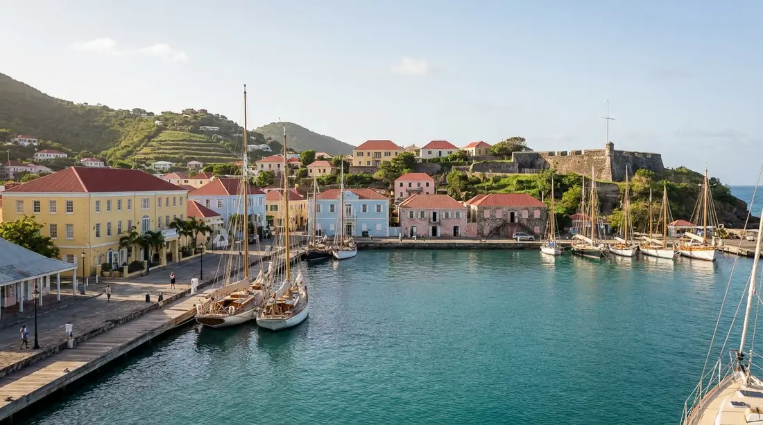
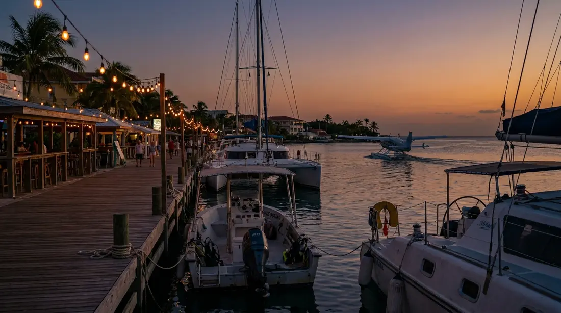
The best feature of a rainforest day on St. Croix is where it ends. Drop out of the canopy on the west side and you are minutes from the island's calmest, sunset-facing water. Rainbow Beach, a few minutes up the coast from Frederiksted, has white sand, a water-sports shack and a beach bar that has poured for around thirty years. Frederiksted itself, the west-coast town, faces due west over a long open roadstead, so evening brings the sun down over open water beyond the long pier — the beaches near Frederiksted guide maps the whole strand, and Dorsch Beach south of town keeps the quietest sand.
Come out on the north side instead and the forest roads deliver you near Davis Bay and Cane Bay. Davis Bay, below the Carambola resort, is one of the island's most dramatic north-shore beaches; Cane Bay a little east is the north shore's hub, with the famous wall reef a short swim off the sand. Either exit turns a forest morning into a swim by mid-afternoon, and the west-coast finish lines up with the island's best sunset beaches.
What lives in the moist forest
The damp forest gathers the island's woodland birds that the parched east largely goes without. The bananaquit, named the territory's official bird, hits every bloom; both resident hummingbirds patrol the flowering trees; pearly-eyed thrashers raid the fruit; and scaly-naped pigeons clatter through the canopy overhead. The one to hope for is the bridled quail-dove, a secretive dove that feeds on foot in deep forest and holds on across St. Croix almost only in this northwestern quarter — rare enough that a single glimpse reads, to a birder, as a sign the woods are still whole. At the tree line, white-tailed deer slip out at first and last light, and mongooses trot across the road at midday.
Birders put the wet forest at the top of the island's land birding for exactly that reason — it shelters species the dry east rarely turns up — and the method is a slow, early, quiet walk rather than any one lookout: go slow, listen before you look, and let the forest's hush turn the birds up. The shaded stretches of Creque Dam Road and Mahogany Road are the ground that pays off, best in the first hour of light before the heat kills the movement.
Two forest residents earn a mention before you go. Mosquitoes concentrate in this damp shade like nowhere else on the island, so the northwest is the one corner where repellent earns its space. And the boa constrictors that have established on St. Croix since pet releases around 2012 are densest in these western forests — non-venomous, secretive, nocturnal, and no concern to a visitor, though the territory asks that sightings be reported. The full field reference, birds to boas, is in the wildlife guide; there are no venomous snakes and nothing here that should change a plan.
The estates in the hills
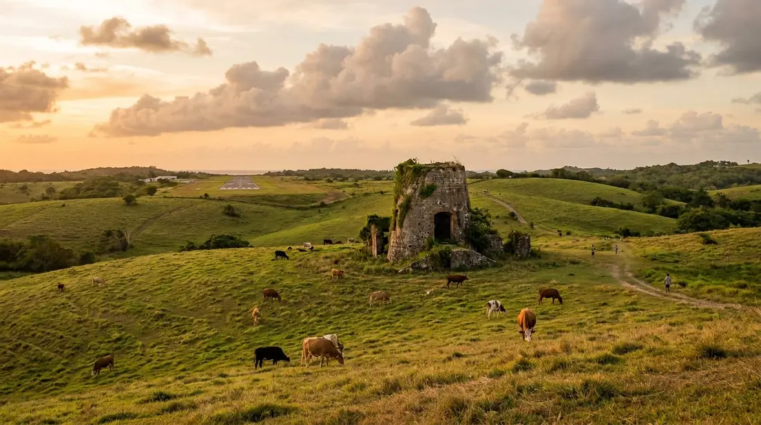
The forest you drive through is young, and that youth explains why it exists at all. These hills were sugar estates, stripped so completely at the industry's height that around 96 percent of St. Croix lay deforested by the 1830s; the cover on the northwest today is second growth that crept back as farming retreated, and the U.S. Forest Service now puts the island near 56 percent forest. The estate names survive on the map even where the cane is gone, and the ruins survive in the trees — mill towers, factory walls and great-house shells that the forest is slowly reclaiming.
Two estates carry that story where a visitor can reach it. Estate Mount Victory, on Creque Dam Road, holds a National Register group of sugar-works ruins and an 1841 country school built to teach enslaved children, seven years before emancipation, now wrapped into a small eco-lodge; the Creque Dam guide tells the full tale. The roadside mahoganies go back to a Danish government planting begun in 1775, a story the Mahogany Road guide carries. Below the hills, on the central plain, sit the quarter's easy history stops: the Cruzan Rum distillery, the Estate Whim museum, and the St. George Village Botanical Garden, whose collections grow up among the ruins of a plantation village and set the island's wet-side and dry-side plants side by side.
Who protects the northwest
The green quarter is the focus of the island's biggest conservation push in a generation. In August 2025 the territory closed on roughly 2,400 acres of this northwest country — the largest land purchase in the history of the U.S. Virgin Islands government, funded through a federal award — and set it aside as the Maroon Sanctuary Territorial Park. The park runs to about 2,386 acres, nearly four percent of the island, holds St. Croix's largest intact forest, and takes in the ground behind the Annaly tide pools and the Cane Bay reef. Its name honors the Maroons, the enslaved Africans who escaped into these ridges, cliffs and caves between the mid-1600s and the 1760s and built free settlements in country too steep to police; a 1791 census counted more than ten percent of the enslaved population as runaways. The park was championed for decades by the V.I. ecologist Olasee Davis, and for now its Ham's Bluff and Maroon Ridge ground is reached on foot, largely through the St. Croix Hiking Association's scheduled walks.
The rest of the quarter is a patchwork of smaller protected and working lands. In 2022 the Virgin Islands Trail Alliance cleared and opened the maintained Windsor Farm trail system off Northside Road. The Nature Conservancy keeps Estate Little Princess near the forest's northeast edge, a plantation ruin that doubles as a coral-restoration campus, open on scheduled visits. And Ridge to Reef Farm has run the territory's only certified-organic operation at Estate Little La Grange since 2010. Together they are turning the island's old back country into ground with a future as well as a past.
The roads
The forest's roads reward respect more than horsepower, and the vehicle question sorts cleanly. Mahogany Road is paved and takes any car; Creque Dam Road roughens as it climbs; the Scenic Road is four-wheel-drive-only, unpaved and washout-prone after rain. Many St. Croix rental contracts exclude unpaved roads entirely, so read yours before you turn off the pavement — the rental-car guide covers the fine print, and the driving guide covers the left-side habit and the animal hazards on narrow bends.
Beyond the surface, the forest runs on a few fixed facts. There is no fuel anywhere in it and no food beyond the Domino Club, so fill the tank and carry water before you climb. The canopy brings dusk early — the roads go dark well before the coast does, and none of them are lit — so cross in daylight and save the last light for the beach. Phone signal drops in the valleys, so download offline maps first. Trailhead break-ins are a documented pattern on the west end, so leave nothing visible in a parked car. And the after-rain glow that makes the forest worth photographing comes with the one hard rule of the quarter: stay out of the guts, the steep seasonal streambeds, while rain is falling or forecast upstream, because they flash-flood without warning.
A half-day rainforest loop
The whole green quarter fits into a half day from the west coast, and the pieces link naturally. Start in Frederiksted and head north up Route 63, the water on your left. Turn up Creque Dam Road and either drive to the 1926 dam or park low and walk up to it through the shade, which is the better version when the weather cooperates. Back on the coast road, continue a short way south to the foot of Mahogany Road and climb east under the canopy, stopping at St. Croix LEAP if it is open and at the Domino Club for lunch and the pigs.
From there the loop has two natural finishes. Carry on east and the forest lets you out at Grove Place, minutes from the plain's distillery, museum and garden — a full day if you take them. Or turn around, drop back down Mahogany Road, and be on the sand at Rainbow Beach by mid-afternoon with the sunset ahead of you. Anyone with a high-clearance vehicle and a dry forecast can tack on the Scenic Road ridge; walkers who want the waterfall can time a guided Caledonia gut hike for the days after rain. However you finish, keep the forest crossing in full daylight and let the coast take the last hour.
How to spend a rainforest day
The quarter suits a morning of one kind and an afternoon of another. This is the shape most guests settle into, adjustable to the weather and your legs.
| Part of the day | What to do | Where it lives |
|---|---|---|
| Early morning | Walk Creque Dam Road to the dam, or climb to Ham's Bluff Lighthouse before the heat | Creque Dam and hiking guides |
| Late morning | Drive Mahogany Road under the canopy; browse LEAP if open | Mahogany Road guide |
| Midday | Lunch and the beer-drinking pigs at the Domino Club; cash only | Domino Club guide |
| Afternoon | Drop to Rainbow Beach or Frederiksted for the swim and sunset | Rainbow Beach and Frederiksted guides |
| For the equipped | ATV tour of the back country, or the Scenic Road ridge in a 4WD | ATV and Scenic Road guides |
| After heavy rain | Guided gut hike to the Caledonia waterfall; skip the streambeds during rain | Hiking and Creque Dam guides |
The green quarter at a glance
The reference numbers and names for the region, gathered in one place. Figures are approximate and hedged where sources vary.
| Feature | Detail |
|---|---|
| Location | Northwest quarter, the hills above Frederiksted |
| High point | Mount Eagle, 1,165 feet — the island's summit |
| Rainfall | More than 50 inches a year (25 to 38 on the East End) |
| Forest type | Moist tropical forest; the local name is the Rain Forest |
| Paved forest road | Mahogany Road, Route 76 — any car |
| Rough forest roads | Creque Dam Road (Rt 58); Scenic Road (Rt 78, 4WD) |
| Signature stop | Mt. Pellier Domino Club, since 1971 |
| Protected land | Maroon Sanctuary Territorial Park, about 2,386 acres (2025) |
| Services in the forest | None — no fuel, no food beyond the Domino Club |
Questions guests ask
Is St. Croix's rainforest a real rainforest?
Not by the strict definition, and the difference will not matter once you are standing in it. A true rainforest runs to something like 100 inches of rain a year and no true dry season; the wettest corner of St. Croix's northwest gets to about 55, which lands it in the moist-tropical-forest bracket. Locals have called it the Rain Forest for generations anyway, capital letters included, because under the canopy the closed shade, damp air, ferns and hundred-foot trees deliver exactly what the name promises. The two-landscapes guide covers the science of why this one corner is green.
Do I need a four-wheel-drive to see the rainforest?
No, for the main experience. Mahogany Road, the paved canopy drive, and the lower reaches of Creque Dam Road are fine in an ordinary rental car driven at forest speeds. You need clearance and a dry forecast only for the unpaved Scenic Road along the ridge, and for the upper forest roads after rain. Check your rental contract before turning onto dirt, because many St. Croix agreements exclude unpaved roads. If the ridge tempts you and the car does not, a guided ATV tour reaches the same back country without the paperwork.
What is there to actually do in the rainforest?
More than a single drive. You can cross it on Mahogany Road, walk it on Creque Dam Road or up to Ham's Bluff Lighthouse, hike to the Annaly tide pools or the seasonal Caledonia waterfall, stop for lunch and the beer-drinking pigs at the Domino Club, ride the back country on a guided ATV, and drop out to a west-coast beach for the swim and sunset. Each of those has its own page on this site; this guide is the map that ties them together into a half day or a full one.
When is the rainforest at its best?
Right after rain, and greenest in the fall. A shower is what the forest is built for: the road steams, the bark darkens, the guts run, and the light turns silver, so a gray afternoon is the one to spend up here. Across the year, the September-to-November stretch delivers the most rain and the deepest green, while the January-to-April dry season gives firmer footing on the walking routes at the cost of a quieter waterfall. The weather guide has the month-by-month picture; the one caution is to stay out of the streambeds while heavy rain is moving through.
Are there services or bathrooms in the forest?
Almost none, so plan for it. There is no gas station anywhere in the northwest hills and no food beyond the Domino Club, which runs on its own schedule and takes cash. Fill the tank and carry water before you climb, bring what you need for the day, and use the restrooms in Frederiksted on the way in. Phone signal drops in the valleys, so download offline maps first, and leave nothing on show in a parked car, since break-ins at west-end trailheads are a known problem.
Is the rainforest safe? Anything dangerous up there?
Nothing up there should alter your plans. The island has no venomous snakes and no large predators; the boa constrictors in these western forests are harmless — non-venomous, secretive, and no threat to a visitor. The real cautions are practical: mosquitoes concentrate in the damp shade, so wear repellent; the guts flash-flood, so stay out of the streambeds during and right after heavy rain; deer cross the roads at dawn and dusk; and the canopy brings dusk early, so cross in daylight. The wildlife guide covers what lives up there in full.
Villas for the green side
The green quarter rewards a base on the west end. Our Frederiksted home, Sunset Sea-Clusion, sits about ten minutes from the Route 63 forest gate — near enough to walk into the canopy at first light and be on the sand by mid-morning — and the other west-end homes sit on the same doorstep. Staying over in Christiansted or on the East End, at The Cerulean on its own beach or elsewhere, the forest becomes the island's finest half-day outing: a drive of under an hour to the wettest, greenest ground on St. Croix, then a run home past the west coast's best dinner tables. Look through the whole set of villas and condos and choose the porch that suits how you want the drive to end.
Sources
Written from official and first-party sources, checked August 2026. Hours, prices and event dates change — confirm before you go.
In this guide
Stay nearby
A two-bedroom oceanside villa with a private pool on the calm, sunset-facing west end near Frederiksted; sleeps four.
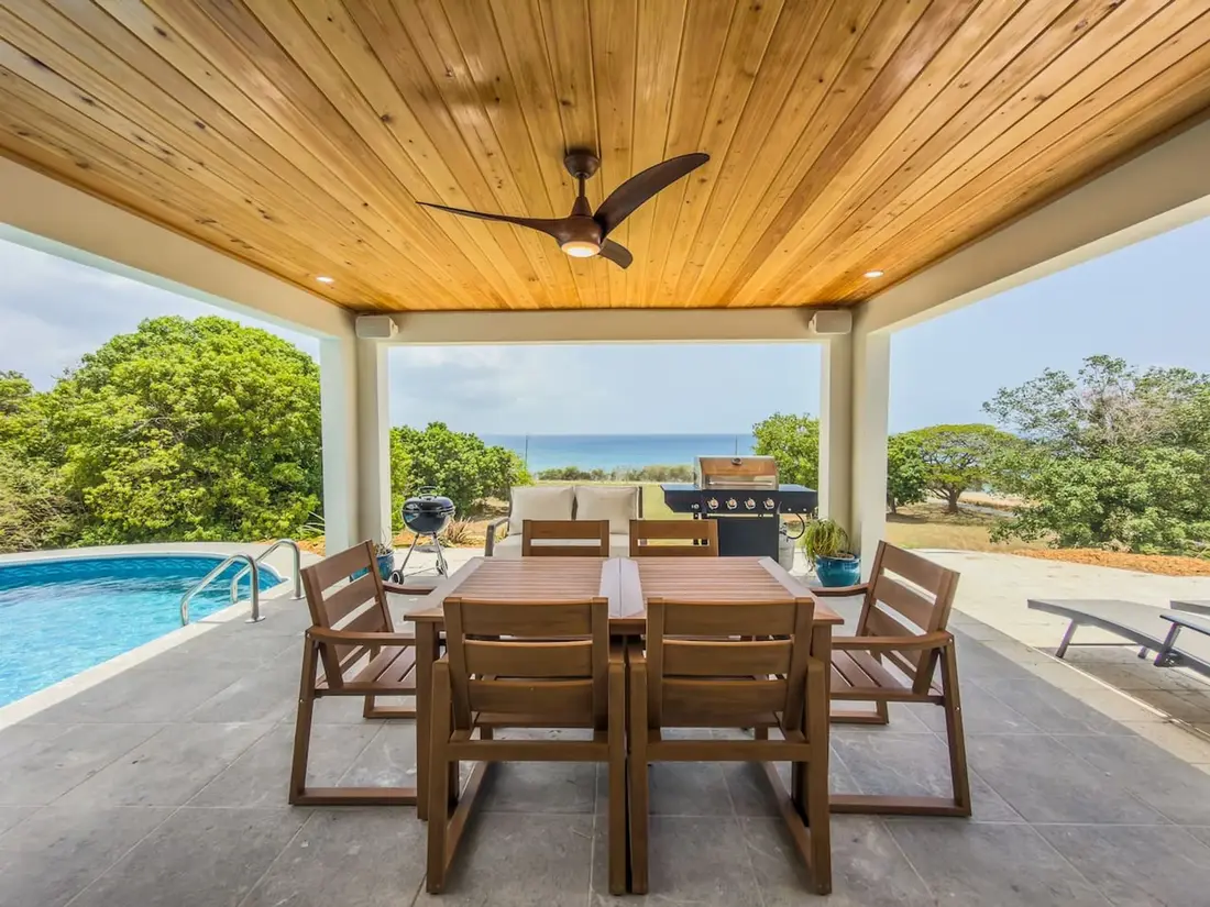 Sunset Sea-Clusion2 bd · 2 ba · sleeps 4 · Frederiksted
More in Towns & Areas
Sources
11 references, listed in full at the end of this guide — official park, refuge, tourism-board and business sources, checked August 2026.