The Annaly Bay Tide Pools
A 3.6-mile round-trip through rainforest to natural tide pools on the wild north coast. Worth it — at low tide, in calm seas, in real shoes.
The Annaly Bay tide pools are swimmable rock basins the ocean has cut into a volcanic shelf on St. Croix's roadless north-west coast. No pavement reaches them: you walk in through rainforest from the Carambola resort, or ride a 4WD tour over the ridge. This page is the site's full reference for the place — what the pools actually are and why they formed here, the trail in detail with the conflicting distance figures reconciled, the jeep alternative, the sea rules that decide who gets in the water, and the seasons that tilt the odds.
What the pools are
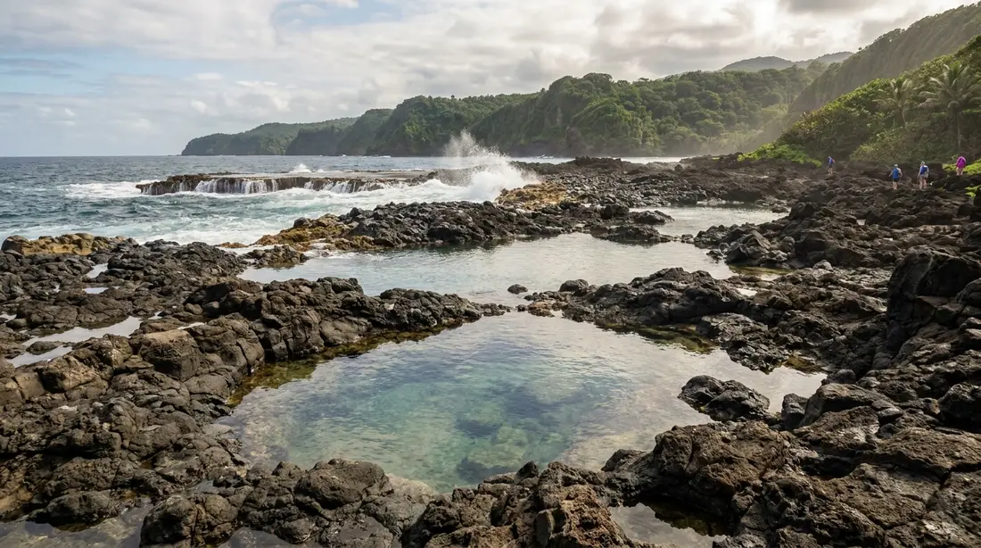
West of the bay, the shoreline runs as a shelf of bare rock at the foot of the headland, and the surf has quarried a chain of basins into it. The biggest are close to backyard-pool size and, at last report, four to six feet deep, with sand and cobble on the bottom. A crevice in the outer rocks connects the main pool to the open sea: waves push water in through the gap, the same gap drains it back out, and that steady exchange keeps the pool clear and cool on days when the ocean outside is quiet. Marine life rides in with the water — reef fish, crabs, and sea urchins turn up in the basins regularly, one of several reasons closed water shoes belong on your feet here.
The name undersells the scale and slightly misstates the plumbing. These are wave-fed pools far more than tide-fed ones, a distinction with real planning consequences covered below. On a flat day the main basin behaves like a natural plunge pool: sheltered, refreshed, calm enough to swim a few strokes in any direction and hang on the rim looking out at open water. On a rough day the identical basin turns into a churn loaded by breaking waves, and nobody belongs in it. Every other fact on this page hangs off that one.
The rock they sit in
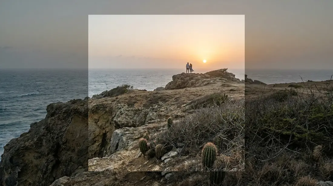
Geologists map the high north-west corner of St. Croix — the ridge country running from Ham's Bluff east past Annaly — as Upper Cretaceous rock of the Mount Eagle Group. The shoreline here belongs to its Caledonia Formation: a stack, thousands of feet thick, of thin alternating beds of sandstone and mudstone built from volcanic debris, laid down on a deep sea floor in the Campanian age or earlier and later faulted and tilted up into today's Northside range. The sand grains themselves eroded off even older volcanic rocks of the type exposed on St. Thomas and St. John, so the shelf under your towel is second-hand volcano, twice recycled by the sea.
That layering is why pools form on this stretch and almost nowhere else on the island. Hard beds and softer beds meet the ocean edge-on along the Annaly shore, and waves excavate the weak layers and the fracture lines faster than the resistant ones, leaving rims of tough rock standing around scooped-out hollows right at the height where winter surf works hardest. Run that process through enough swell seasons and you get the present arrangement: deep basins behind low natural walls, perched a step above the everyday sea surface. The same geology explains the approach problem. The geological field literature notes that the coastal cliffs from Ham's Bluff eastward to Annaly are best examined by boat, because the land drops to the water too steeply for a shoreline route — which is why every path to the pools crosses the ridge instead of following the coast.
Why the tide barely matters
Standard advice for Annaly says to go at low tide. The intent is sound; the emphasis is misplaced. NOAA's tidal datums for Christiansted Harbor put the mean range of tide at 0.69 feet and the great diurnal range at 0.74 feet — on St. Croix the whole distance between high and low water is measured in inches. A tide that small does not decide whether the sea washes into the pools. Swell size decides. An extra two feet of arriving swell changes the shelf more than the entire tidal cycle ever will, so the useful pre-trip question is what the north swell is doing, and a tide chart cannot answer it. Read the marine forecast the way the weather guide's swell section lays out, look at the water from the first overlook on the trail, and let what you see overrule the chart. Low tide during a swell event is dangerous. High tide on a glassy day is fine. If you enjoy optimizing, a low tide on a calm morning is the theoretical best — just know the tide part of that sentence is worth inches.
The trailhead at Carambola
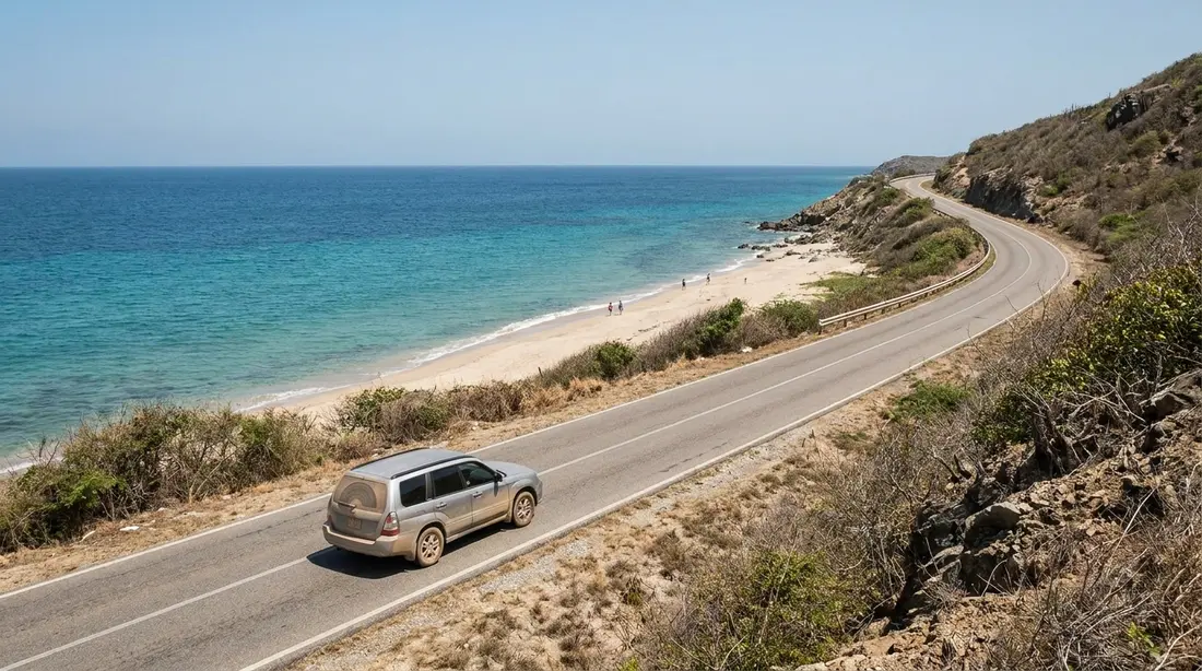
The hike starts inside the grounds of the Renaissance St. Croix Carambola Beach Resort at Davis Bay, where Route 80 ends on the North Shore. The arrangement, at last check, works like this: stop at the resort's guard gate, say you are hiking to the tide pools, and the guard directs you to day-hiker parking and points out where the trail begins. Treat the whole thing as a courtesy the resort extends rather than a right — come early, park exactly where you are told, and leave nothing visible in the car. Remote trailhead lots are the classic break-in spots on this island, and the safety guide covers the bare-seats routine that removes the problem. From the lot you follow the paved resort road a short distance to a wooden footbridge; signs mark where the route leaves the pavement and enters the trees. Maps and apps generally list the path as the Trumbull Trail, and locals also call the destination the Carambola tide pools — same place, two names.
The trail, stage by stage
The forest climb
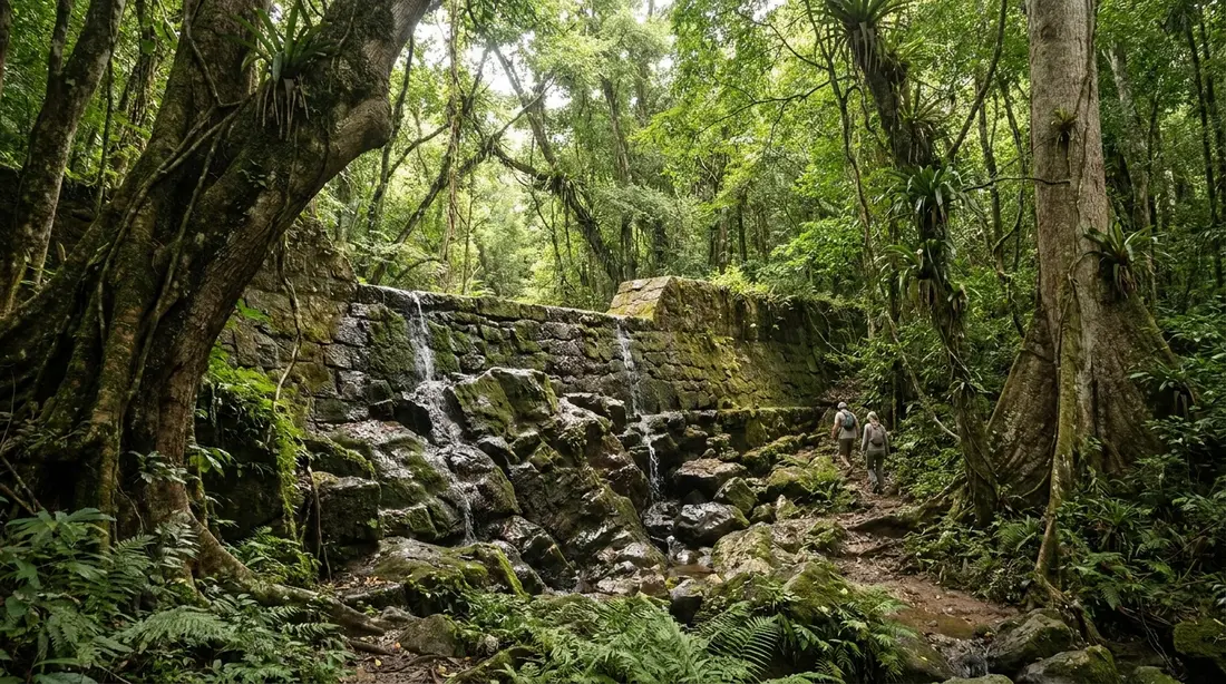
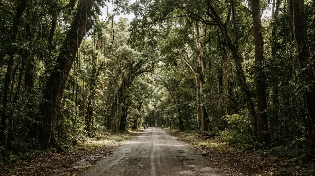
The first stretch goes up through genuine rainforest, the wet end of the island's spectrum, under tall canopy with the light filtering down green. The grade is steady rather than brutal, but the footing asks for attention the whole way: the path is narrow, crossed by tree roots, steep and uneven in sections, and slick wherever recent rain has been. This is the shadiest part of the walk and the coolest hour you will get, which argues for an early start in both directions of the day.
Over the shoulder
The trail crests a shoulder of the ridge at a few hundred feet and the vegetation changes character — canopy gives way to stretches of open growth, including sections of waist-high grass where the sun lands on you directly. Through gaps you get the first views of the coast, and this is the spot to do your sea-reading: if white water is bursting against the rocks below, you have your answer about swimming before you have spent the descent.
Down to the coast
From the shoulder the path drops toward the water on rough ground that mixes rock, dirt, and mud depending on the week's weather. Going in, the descent is easy on the lungs and hard on the knees; coming back, this same stretch is your second climb of the day, which surprises people who assumed the return would be all downhill. There is no direction of this hike that skips climbing.
The shoreline stretch
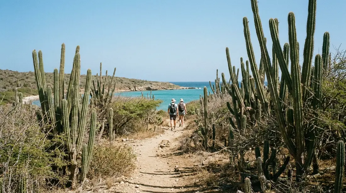
The trail meets the sea at the bay and the last leg runs along the shore over boulders and shelf rock to reach the pools themselves. This finish is the technical crux: bare rock, often wet, sometimes sharp, with waves working nearby and very little shade. Hands come out of pockets, phones go into a dry bag, and the group spreads out so one slip does not take two people down. Budget more time for this quarter mile than the map suggests.
How far it really is
Published numbers for this hike disagree, and the disagreement is worth understanding rather than papering over. The GPS-tracked figure on AllTrails calls the out-and-back 3.6 miles round trip with 547 feet of accumulated climbing. GoToStCroix's write-up calls it roughly 2.5 miles each way, which implies five miles round trip. BushTribe, which walks the route commercially, also describes about five miles round trip with a maximum height around 350 feet. The spread comes from where each source starts counting — the guard gate, the day-hiker lot, and the footbridge are meaningful distances apart inside the resort — and from how much wandering along the shelf and the beach gets included at the far end.
| Source | Distance | Vertical | Basis |
|---|---|---|---|
| AllTrails (Carambola Trumbull Trail) | 3.6 mi round trip | 547 ft of climbing | Aggregated GPS tracks, trail proper |
| GoToStCroix | About 2.5 mi each way | Not stated | Editorial description incl. resort approach |
| BushTribe Eco Adventures | About 5 mi round trip | ~350 ft max height | Guided route as walked, incl. shoreline |
The planning answer: prepare for four to five miles round trip with roughly 500 feet of total climbing split across both directions, and treat the lower figures as the trail-only core of a longer outing. Fit hikers cover each direction in 45 minutes to an hour; in heat, or with kids, or after rain, 90 minutes each way is normal and nothing to apologize for. Add at least an hour at the pools — most people want two — and the whole outing runs three to five hours door to door.
Heat, water, and feet
The two injuries this walk actually hands out are heat trouble and slip-on-rock, and both are packing problems before they are fitness problems. The forest section is shaded but humid; the grass sections and the entire shoreline are open sun at 17 degrees north. Start in the morning so the exposed stretches land early, and carry serious water — a single small bottle per person is the classic mistake on this trail, and there is nowhere to refill from the moment you leave the resort. Sun protection follows the packing guide's rules: a real hat, a sun shirt, and mineral sunscreen, since the USVI bans the common chemical ones. On footwear, the answer is closed shoes with grip that can get wet — trail runners plus water shoes to change into, or a single pair of amphibious shoes that does both jobs. Flip-flops fail twice here: on the root-laced descent and on the wet shelf where urchins sit in the crevices.
The jeep alternative
You can skip the hike entirely and let a tour do the crossing. Tan Tan Tours has run open-air 4WD trips to this coast for years, dropping down a back track to the bay from the Scenic Road corridor, and the drive itself is a large share of the entertainment: real off-road grades through the forest with long views opening between the trees, the kind of route rental contracts exist to keep you off. As published in August 2026, the shortest product is the tide-pool swim at two and a half hours for $200 per person; a 4.5-hour half day at $280 folds in island history stops, and a 7.5-hour full day at $350 adds beaches and lunch. Jeeps go out with a three-rider minimum, and a party of two can pay a $100 private supplement instead. Departures leave from 33 Queen Cross Street in Christiansted, with some trips staging from the Domino Club on Mahogany Road. Even on the driven version, plan on a guided clamber over rocks for the final approach — the jeep reaches the bay, and the last stretch to the pools is still on foot. Confirm prices and minimums when you book; they move.
Going guided on foot
Between self-guided and the jeep sits the guided hike, and for a first visit it is the option we would pick. BushTribe Eco Adventures walks groups to the pools year-round — from $50 per person at last check, about three hours start to finish with roughly 45 minutes of walking each way — and the fee buys the thing no forecast provides: a person who was here yesterday making the swim call for you. The St. Croix Hiking Association also schedules occasional Annaly outings among its monthly public hikes at a nominal fee; the Maroon Ridge guide covers the association and the deep history of the heights above this coast, which its guided walks narrate on the ground. Either way, a canceled trip is a guide doing the job correctly, and the refund beats the alternative.
Reading the sea before you get in
The pools sit behind a low rim of rock, and everything about swimming here reduces to one observation: is anything coming over that rim? Swell arrives in sets — groups of larger waves separated by quiet spells that can run several minutes — so a two-minute glance is not an answer. Sit above the pools and watch for a full ten or fifteen minutes before anyone gets wet. If even occasional waves wash across the rim into the basins, the ocean is telling you the margin is gone: the same set that pushes water in can pull a swimmer against rock or out through the gap. If the rim stays dry through multiple sets and the surface of the pools only breathes gently with the crevice exchange, you are looking at the good version of Annaly.
Color is the other tell. The famous photographs show green-glass water because photographers go on flat days after dry weather. After a swell event the same basins sit cloudy for a day or more while stirred-up sand settles, and after heavy rain the runoff from the guts muddies the whole nearshore band — the clarity logic in the weather guide applies to the pools exactly. Brown pools are the sea's own recent-history report: something rough happened here, recently, and patience is the correct response.
Where people get hurt
This is the section to read twice, because visitors are injured at these pools and the pattern repeats. The mechanism is almost always surge: a set arrives while someone is in or near a basin, water bursts over the rim, and the person is thrown against rock they cannot grip. Wet Caledonia Formation stone is slick, frequently sharp along fracture edges, and unforgiving to bare skin. The second mechanism is simpler — a fall on the shoreline approach, carrying a phone in one hand instead of keeping both free.
Compounding both is the remoteness. There is no lifeguard, no facility of any kind, and phone coverage on this coast ranges from patchy to none — GoToStCroix flags the dead zone explicitly. Help reaches Annaly Bay the same two ways you did: on foot down the Trumbull Trail or by 4WD over the ridge track, and either takes real time. That changes the math on marginal decisions. In town, a bad call costs a scare; out here it costs hours.
So the flat rule, worth stating without softeners: when a big north swell is running, stay out of the pools entirely. No exceptions for strong swimmers, no edging in to test it. The hike still pays on those days — the shelf under heavy surf is a genuine spectacle, and the dry overlook above the pools is a safe seat for it — but the swimming half of the trip is closed, and the sea does not negotiate. Waiting out weather is what a villa week is for; the rainy day plan covers the island's indoor circuit while a system moves through.
When to go
Season first. Winter, roughly December through March, is when distant North Atlantic storms send long-period swell down onto this coast — the same events that put surf on Cane Bay — and a single episode can make the pools unswimmable for days at a stretch. Winter trips to Annaly succeed, but they succeed by watching the forecast and pouncing on the gaps between events. Summer and early fall flip the odds: the trade winds slacken, the north shore spends long spells near glassy, and July through October is statistically the friendliest window for finding the pools calm — with the caveat that a distant tropical system can send swell from hundreds of miles away, so the forecast check never becomes optional. Spring sits between, trending calmer as the winter pattern fades.
Then the day plan. Start early for three separate reasons that all point the same direction: the forest climb is coolest before mid-morning, the light on the pools is best before the sun swings west of the headland, and an early start leaves afternoon margin if the walk runs long — this coast is nowhere to be finding the trail at dusk, and there is no lighting of any kind. On tides, plan your visit around sea state and start time, note the low-tide hour if it happens to cooperate, and spend zero further thought on it; the numbers in the tide section above explain why. Slot the whole outing into the week the way the adventure itinerary does — as the plan that stays mobile and claims the calmest, driest day the forecast offers.
Beyond the pools
The bay itself rewards the extra half hour. The shore at Annaly is a wild cove of dark, smooth stones — cobble and pebble rather than sand — with rough water offshore; the open bay is no swimming spot, and the surf hitting a steep stone beach makes even wading a poor idea, but as a place to sit with lunch it is as removed from resort St. Croix as the island gets. Sea-worn rocks here are striking enough that people pocket them, which they should not; see the next section.
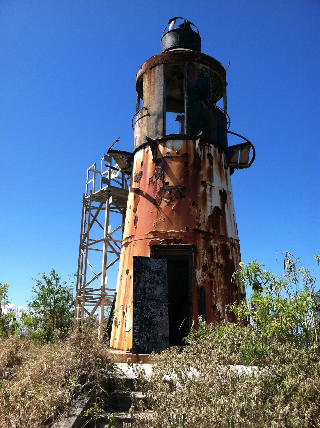
For hikers with legs left, the trail network continues. From the same Carambola side, a branch climbs west toward the Wills Bay overlook at a gentler grade, skirting the edge of the territory's Maroon Sanctuary park — the cliffs and heights above this coast where escaped enslaved people built free settlements, a story the Maroon Ridge guide tells in full. Further west along the same coast stands the 1915 cast-iron lighthouse covered in the Ham's Bluff guide, reached by its own separate trail from the Frederiksted side. For where Annaly ranks among all the island's walks by effort, the hiking overview holds the ladder.
No facilities, and what that means
There is nothing built at Annaly Bay: no restroom, no water, no trash service, no shade structure, no vendor, no signal you can count on. Everything you need comes in on your back and everything you bring leaves the same way, including fruit peels and the corner torn off the snack wrapper. Two specific asks. First, skip sunscreen right before swimming, or use only mineral formulas — the crevice flushes the pools straight into nearshore reef water, and the territory's sunscreen law applies out here with no one watching but the fish. Second, leave the smooth stones and the urchins where they are; a place with this little traffic shows every subtraction. The pools have no gate, no fee, and no hours, which means their condition is entirely the sum of what visitors do.
Taking kids
Split the question in two, because the hike and the swim are separate decisions. The walk suits sure-footed kids of roughly eight and up who have done real trails before — the distance is real work, the roots and the shoreline rocks demand attention, and a child who treats it as an adventure rather than a forced march does fine. The swim is the stricter gate: pools with a surging ocean connection are for confident swimmers, realistically strong swimmers around ten and up, and only on flat days when nothing is crossing the rim. On marginal days kids stay out even when adults judge it fine for themselves, because the margin that saves an adult pressed against rock is body weight. Families with younger children usually take the jeep tour, keep everyone to the shallowest basin edges on calm days, and count the ride as the event. A guided trip is the sensible first visit with children of any age; the kids guide ranks Annaly against the island's easier family outings.
Go or no-go, by conditions
| Conditions | The hike | The swim |
|---|---|---|
| Glassy sea, dry recent weather | Go; best version of the trail | Go, after the ten-minute rim watch |
| Moderate trade-wind chop, no swell event | Go | Judgment call: swim only if the rim stays dry through several sets |
| North swell event running (mostly Dec–Mar) | Go for the overlook if the trail is dry; expect spectacle, not swimming | No entry, regardless of tide or swimming ability |
| During or just after heavy rain | Skip; slick roots, mud, and flashing guts | Skip; pools cloudy with runoff and stirred sand |
| Any water visibly crossing the rim | — | No entry, full stop |
Questions guests ask
Do I need a guide for the Annaly Bay hike?
Need, no — the trail is established, named on the map apps, and walked constantly in season. But a first-timer buys two things with a guide: navigation confidence at the few spots where the path is vague, and a professional swim call from someone who saw the pools yesterday. Since the entire risk of this outing lives in that swim call, guided is the smart default for a first visit, and self-guided makes sense for the return trip once you have seen what good conditions look like with your own eyes.
Can you drive to the tide pools?
Not in a rental car, and not quite to the pools in anything. A rough 4WD track descends to the bay from the ridge, and tour operators run it — Tan Tan Tours is the established name, with the trips and prices listed above. Rental agreements on St. Croix commonly exclude unpaved roads outright, which puts the do-it-yourself version out of bounds for most visitors even in a rented Jeep; the Scenic Road guide covers that fine print. However you arrive at the bay, the final approach to the pools is on foot over shoreline rock.
How hard is the hike compared to the island's other trails?
Upper-middle. It is the most committing of the commonly walked St. Croix trails — longer than Ham's Bluff, rougher underfoot than the Creque Dam forest roads, with climbing in both directions and a technical rock finish that the short East End hikes lack. An average fit adult who hikes occasionally handles it fine with water and real shoes. People struggle when they arrive at midday, underdressed for sun and carrying one small bottle, which is a preparation failure rather than a trail difficulty.
Why do photos show green pools and mine looked brown?
Because the photographs were taken on calm days after dry spells and your visit followed weather. Swell stirs the sand floor of the basins and washes foam and sediment over the rim; heavy rain sends muddy runoff down the guts into the nearshore water. Both leave the pools cloudy for a day or more afterward. The fix is scheduling: put Annaly after a stretch of calm, dry days and the green-glass version appears on your phone too.
Is there a fee, and are there facilities?
No fee, no hours, no gate — and no facilities of any kind: no restroom, no drinking water, no trash cans, no lifeguard, no reliable phone signal. The resort's courtesy parking is the only piece of infrastructure involved, and it belongs to the resort, so follow the guard's directions exactly. Carry in everything you need, carry out everything you brought, and treat the phone dead zone as part of your risk planning rather than a surprise.
Can you swim at the beach at Annaly Bay itself?
No. The cove's shore is smooth dark stone rather than sand, the open bay takes the north coast's full wave energy, and the surf onto a steep cobble beach makes for a dangerous entry and a worse exit. The pools are the swimming at Annaly, on the days they allow it. For actual beach swimming the same day, stop at Cane Bay or Davis Bay on the drive back along Route 80 — the beach guide sorts the north shore options by conditions.
Where to stay for an Annaly morning
Annaly rewards the early start, and the early start is easiest from the west. Sunset Sea-Clusion in Frederiksted puts the Route 80 drive to Carambola — and the Tan Tan alternative — within easy morning range, with Rainbow Beach waiting for the flat-water swim afterward. From our East End and Christiansted homes the trailhead is under an hour, close enough that a calm-forecast morning can be seized at breakfast. Browse the full villa collection and give the pools two chances in your week: the first calm day, and a backup.
Sources
Written from official and first-party sources, checked August 2026. Hours, prices and event dates change — confirm before you go.
In this guide
Stay nearby
On The Shoys beach: six bedrooms, six baths, pool and hot tub, room for twelve, and the beach through the back garden.
 Shoy's Beach House6 bd · 6 ba · sleeps 12 · Christiansted
More in Land & Adventure
Sources
9 references, listed in full at the end of this guide — official park, refuge, tourism-board and business sources, checked August 2026.