Diving Salt River Canyon
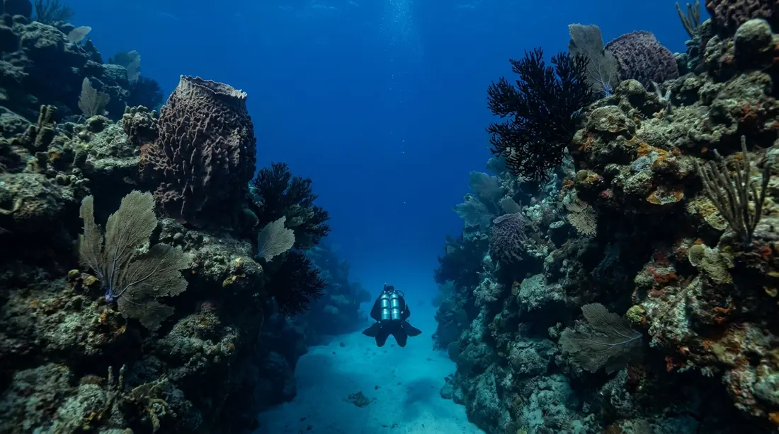
East and west walls plunge along a submarine canyon inside a national park. Anchor Dive Center is the only shop based inside it.
Salt River is where St. Croix's north shore splits open. A submarine canyon notches the reef at the mouth of the bay, and its two faces — the East Wall and the West Wall — are the island's marquee boat dives, run from moorings a short ride off the marina. This page is the full reference for those two sites: how each wall is shaped, what lives on it band by band, how divers choose between them, the skill each one asks for, the boats that reach them, and the north-shore conditions that decide whether the boats go out at all. The bay's history, its glowing lagoon and the drive to the harbor live on our Salt River area guide; this page stays underwater.
The canyon and its two walls
Most of St. Croix's diving happens on a shelf that steps gently seaward. Salt River does something else. At the entrance to the bay the sea floor is cut by a genuine submarine canyon, and the NOAA marine-protected-areas program describes it as a roughly 350-foot canyon carrying deep-water coral and a set of geologic features — caverns, grottoes, ledges and caves — that it counts among only a few such formations found anywhere on earth. That canyon has two sides, and each side is a separate dive with its own mooring, its own profile and its own name.
The East Wall, which the shops label Barracuda Bank, is the fish dive. The West Wall, listed by some operators as The Pinnacles, is the topography dive. Both are boat dives, and that is the first thing to understand about Salt River: unlike the Cane Bay Wall, which a certified diver can reach on a surface swim from a public beach, neither Salt River wall has a practical shore entry. You reach them from a boat that ties to a fixed mooring above the reef, drops you over the edge, and picks you up in the same spot. That makes Salt River the north shore's premier moored wall diving, and one operator markets the West Wall as the most requested boat dive on the island.
How deep the walls ultimately go is the same argument that surrounds every wall on this coast. The published dive-shop figures run to four digits, and beyond the canyon the bottom heads for the deep basin that separates St. Croix from the northern islands; the geology behind that basin, the Virgin Islands Trough and the Puerto Rico Trench system, is laid out on the Cane Bay Wall page and does not need repeating here. For a diver the only depths that matter are the top hundred feet, and those are the ones this page pins down.
The East Wall, or Barracuda Bank
The East Wall is the friendlier of the two and the one most first-time Salt River divers see. The boat moors in about 40 feet of water, close enough to the drop that the stern can hang over roughly a thousand feet of open blue while the mooring line sits on the reef top. You descend the line onto a hard-coral bottom, and from there the terrain slopes rather than plunges: the floor falls away from about 40 feet to about 80, broken into corridors of pale sand that run down between heads and ridges of hard coral. At the bottom of that slope, near 80 feet, the reef finally gives out and drops off sharply into deeper water.
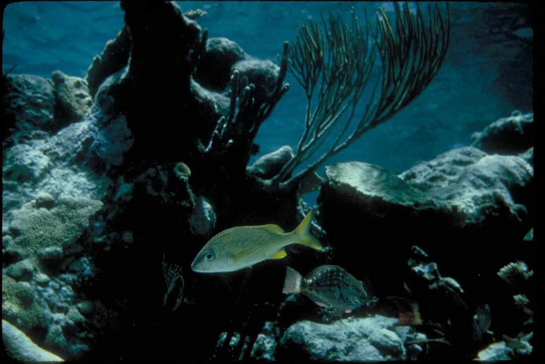
The slope is the whole appeal, because it is where the fish stack up. Shops call this the fishiest dive on the north shore, and the name Barracuda Bank is earned: schools of barracuda hold in the current over the edge, and around them work yellowtail snapper, striped grunts, soldierfish, black durgon and large angelfish, with parrotfish grazing the coral heads. Moray eels sit back in the crevices, lobster tuck under the ledges, and conch plow the sand chutes. The bigger animals patrol the drop-off itself: blacktip reef sharks and spotted eagle rays are the regulars, sea turtles pass through, and a hammerhead turns up now and then as the rare bonus every north-shore wall keeps on its list. Because the interesting life gathers on the slope between 40 and 80 feet, a diver never has to go deep to get the dive, which is what makes the East Wall workable for divers who are newer to walls.
The West Wall, or The Pinnacles
The West Wall trades the East Wall's easy slope for drama. Here the boat moors in only about 20 feet of water, and the wall goes vertical almost from the mooring: shops describe it dropping sheer to around 200 feet, stepping down again toward 500, and then continuing down into figures they quote in the thousands. You are on the edge of the canyon within a minute of leaving the line, which is a different feeling from the East Wall's gradual walk-down.
What sets the site apart is the rock itself. The face is carved into what operators describe as old waterfall formations, and the result is a warren of structure: swim-throughs you can pass inside, deep cuts and clefts, undercut ledges, blind recesses and more of the sand chutes that thread the whole canyon. Divers who like to fly along a vertical wall and duck through its architecture pick this site for that reason. The fish list leans toward the wall specialists and the open-water crowd rather than the dense schools of Barracuda Bank: creole wrasse and squirrelfish work the face, black durgon hang in the column above it, and jacks, grouper, permit and barracuda cruise the edge, with larger pelagic sharks the occasional sight off the blue side. Sponges and black coral coat the deeper wall where the light thins. The trade-off is depth: the good structure sits deep enough that the West Wall rewards a diver who is comfortable managing a wall profile, and it asks for more discipline than the East Wall does.
Choosing between the walls
Divers with a choice tend to split by what they came to see. The East Wall is the pick for fish, for a gentler profile, and for a first dive in the canyon: the slope keeps the best of the action inside comfortable depths, the schooling life is reliable, and a photographer shooting fish rather than scenery will fill a card here. The West Wall is the pick for topography and for the sensation of a true vertical drop: the swim-throughs and overhangs give the dive its shape, and the sheer face is the closer thing to flying, at the cost of watching your depth the entire time.
Preference is not the only factor; conditions and the shop often make the call. Both moorings sit on an exposed north-facing coast, and on a given morning one may be diveable while the other is washed out, so the guide reads the water and points the boat at whichever wall is behaving. Many two-tank Salt River trips simply dive both in a morning — the East Wall for the fish and the West Wall for the terrain — which is the cleanest way to settle the question. A diver newer to walls who can pick only one should take the East Wall with a guide; a diver who lives for structure and holds a steady depth should ask for the West.
What you see, by depth
The canyon reads as a stack of habitats, and the dive changes character as you descend through them. The bands below run shallow to deep and are drawn from how the shops describe the two sites; the exact numbers shift with the mooring and the wall.
The mooring and the reef top, roughly 20 to 40 feet. Hard-coral heads and short ridges, the shallowest on the West Wall and the reef crown on the East. This is where the descent line lands, where the schooling grunts and snapper gather over the coral, and where a multi-level dive spends its final minutes running out the safety stop before the boat.
The slope and the sand chutes, roughly 40 to 80 feet. On the East Wall this is the heart of the dive: sand corridors running down between coral, barracuda and jacks holding above them, rays and the odd turtle crossing the open sand, and the historic anchors the canyon is known for — heavy iron from the sailing centuries, lost by ships that once anchored off this same mouth, now fixed on the reef where no storm shifts them.
The wall face, roughly 60 feet to the recreational limit. Where the reef gives way to vertical rock, sponges and black coral take over the surfaces that the shallower light cannot reach, and the West Wall's swim-throughs, cuts and overhangs open up. Grouper sit in the clefts, and this is the depth band where depth discipline stops being advice and becomes the point: the standard sport-diving floor is 130 feet, and the wall will happily take you past it if you let it.
The blue beyond the face. Nothing lives at the drop, which is exactly why the big animals use it. The open water off the wall is a travel lane for spotted eagle rays, reef sharks, sea turtles and, once in a while, a hammerhead cruising the edge. Dolphins pass. From roughly February into March, humpback whales migrate through the deep water off the north shore, and dive crews sometimes hear them through the boat.
The two dives at a glance
| Dive site | Mooring and profile | The drop | What it is known for | Skill |
|---|---|---|---|---|
| East Wall (Barracuda Bank) | Mooring about 40 ft; sand-chute slope from 40 to 80 ft over hard coral | Sharp lip near 80 ft; roughly 1,000 ft of water under the boat | Barracuda schools, snapper, grunts, black durgon, soldierfish; blacktip sharks, eagle rays, moray, lobster; the fish | Open Water and up, guided; depth optional |
| West Wall (The Pinnacles) | Mooring about 20 ft; vertical almost from the line | Sheer to about 200 ft, stepping to 500 and beyond | Swim-throughs, cuts and overhangs; creole wrasse, squirrelfish, jacks, grouper, permit; black coral and sponges | Comfortable-on-a-wall; depth discipline throughout |
Depths are the working figures the shops publish, rounded, and the profile the guide briefs on the day is the one that governs. Treat the table as planning reference, not as a dive plan.
Who should dive it
Salt River is deeper and more committing than the island's shore dives, and it is a guided, boat-based experience for everyone. That shapes who it suits. The East Wall is within reach of a certified Open Water diver who keeps a sensible depth, because the fish life sits on the slope inside ordinary limits and a guide keeps the group off the edge; it is a fair first wall for a diver stepping up from reef dives. The West Wall asks more. Its best structure sits deep, the bottom is a long way down with no shelf to stop a runaway descent, and clear water flattens the sense of depth, so it rewards a diver who is already easy on a wall and disciplined with a computer. An Advanced Open Water card, or the depth comfort that card represents, is the sensible threshold for the West Wall specifically.
Two practical notes follow from that. First, repetitive multi-day diving to these depths is exactly the pattern enriched-air nitrox was built for, and the shops fill it with notice; ask when you book. Second, a diver whose logbook has gone quiet should plan a refresher or an easy shallow dive before booking the canyon, since a wall is a poor place to shake off rust. Where to get certified, refreshed or moved up to Advanced on the island is set out in the learn-to-dive guide, and the full island dive picture — every shop, every other site — is in the scuba guide.
Boat access and the dive operators
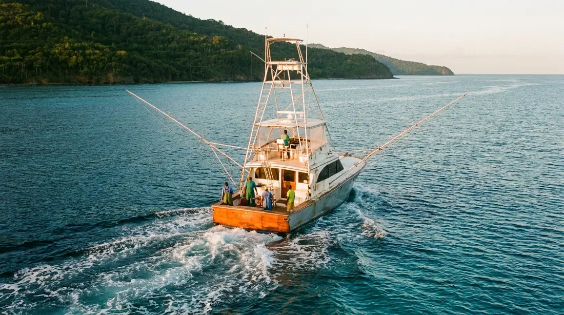
Because both walls are moored boat dives, the shop you book decides your day: its boat, its schedule, and its read on the north-shore weather. The one operator based at the water's edge here is Anchor Dive Center, the only dive shop set inside the Salt River park, which gives it the shortest run out to the canyon moorings; it was listed as a full-service PADI operation running daily morning and afternoon dives at last check, though its exact current schedule is worth confirming when you call. It is not the only way to reach the walls. Christiansted boardwalk shops run Salt River among their moored north-shore sites, and at least one operator loads its boat at the Salt River launch for north-shore mornings, so a canyon dive can start from either town. The full verified roster, with the shops that dive all of the island's moored sites, lives in the scuba guide; reserve directly, and give the shop a day or two of notice in high season.
One detail of the access is worth knowing before you go. These are moored dives on purpose. The bay's waters carry anchoring restrictions as part of the park, so dive boats tie to fixed mooring buoys rather than dropping a hook on the reef, which both protects the coral and gives you a reliable descent and ascent line. The marina the boats leave from, the drive to it, and everything else above the waterline — parking, the two arms of the bay, which side to aim the car at — are covered on the Salt River area guide and do not need repeating here.
How a canyon dive day runs
A Salt River trip is a short, simple morning by the standards of boat diving. You meet at the harbor, load onto a small boat — the north-shore operators run groups measured in single digits rather than dozens — and the run out to the moorings takes minutes rather than the long steam bigger islands are known for. The boat ties to a mooring buoy above the chosen wall, and you descend the line straight onto the reef, which removes the guesswork of finding the site and gives you a fixed reference for the way back up. A two-tank morning is the usual shape: dive one wall, hold the surface interval aboard while your body offgasses, then dive the second wall or a nearby site, and be back at the dock before the midday trades roughen the water.
What to bring is short, because the shops carry the rest. Tanks and weights come with the trip and rental kit is available, so the two items worth traveling with are the personal ones: a mask that seals on your own face, and a dive computer you know how to read, since these are repetitive wall profiles where a computer is a safety item rather than a nicety. Pack exposure protection you are comfortable in for a longer dive, a mineral-based sunscreen for the surface interval, and a windbreaker or rash top, because a wet trade-wind ride back to the dock runs cooler than the midday sand would suggest. The hours you must leave after your final dive before flying home follow the standard Divers Alert Network guidance, laid out in the scuba guide.
Conditions and seasons on the north shore
Salt River faces the open Atlantic, and its diving calendar is the calendar of exposed north-coast water. The sea is warm all year, so a skin or a light wetsuit covers most divers; what shifts with the calendar is whether the walls can be dived on a given morning at all.
The hard limiter is winter swell. Across the heart of winter — the middle of December into March — the trades harden into the Christmas Winds, and, separately, long-period swell generated by North Atlantic storms rolls south and lands on this coast, sometimes under a clear sky with no local wind at all. When that swell is running it puts surge on the canyon walls and chop across the mouth, and the shops answer by shifting operations to the sheltered Frederiksted coast instead of fighting the swell. The practical move for a traveler is to book the canyon early in the trip, so a rough morning pushes the dive later in the week instead of erasing it, and to keep the lee-coast dives as a standing fallback: the Frederiksted pier and the Butler Bay wrecks dive well on days the north shore is closed. Summer and early fall are the flat, clear window of the year on every coast, with the tropical-storm season as the trade-off to watch; our hurricane season guide explains what that means on the ground.
Two more variables belong to Salt River specifically. The first is runoff. The bay drains one of the larger watersheds on the north coast through its estuary, so after a heavy rain the shallows near the mouth can turn cloudy for a day or two as the guts empty into the sea, and visibility on the reef top suffers until it clears; a fair-weather buffer after a real downpour is the fix. The second is the daily rhythm every north-shore dive shares: mornings are calm and the trade-wind chop builds after midday, so the first boat of the day is the good one. Season and clarity across the island are laid out in the scuba guide and the area guide.
The marine park, and diving it lightly
The canyon lies within the national park that wraps Salt River Bay — a roughly 1,015-acre unit jointly managed by the National Park Service and the U.S. Virgin Islands government, protected as both a historical park and an ecological preserve. The "ecological preserve" half of that name is the part a diver meets: the park protects a connected system of mangroves, estuary, coral reef and the submarine canyon itself, along with the threatened and endangered species that depend on them. The NOAA marine-protected-areas program singles out the canyon's deep-water coral and its caverns, grottoes and ledges as features that are rare worldwide, which is a fair reminder of what your fins are near.
Diving here follows the ordinary reef ethic, with the park's protection as the reason to hold to it. Nothing on the wall is for taking or touching: the corals are alive, the sponges and black coral grow slowly, and the historic anchors are artifacts on federal ground. Boats use the fixed moorings rather than anchoring, per the bay's vessel restrictions, and the territory's sunscreen law bans lotions containing oxybenzone, octinoxate and octocrylene, so any sunscreen on board should be mineral-based. Specific park rules and current regulations are the Park Service's to give — the park office is the authority, and the visitor contact station on the hill has been closed since 2017, so questions go to the staffed center in Christiansted covered on the area guide. A separate, stricter case is Buck Island, the island's no-take national monument, open to divers only on authorized trips; it has its own Buck Island guide.
Night diving and the bay that glows above the wall
Two things people ask about Salt River deserve a straight, short answer here rather than a full section, because each has its own page. Salt River is a daytime dive: the island's guided night diving runs at the Frederiksted pier and, conditions allowing, the Cane Bay Wall, and a night trip on the canyon is not a standing product — the whole after-dark picture is in the night diving guide. And the same inlet that gives you a wall dive by day gives you a glowing lagoon by night: Salt River Bay is one of the few year-round bioluminescent bays on earth, and the dive boat and the night kayak share one harbor, which makes a canyon dive and a glow paddle a natural pairing on a moon-dark evening. The kayak trip has its own guide, bio-bay kayak tours, and the bay's history — the 1493 landing that gives Columbus Landing Beach its name — is told on the Salt River, 1493 page.
Questions guests ask
Can I dive Salt River from the shore, like Cane Bay?
No. Both canyon walls are boat dives, reached from a mooring a short ride off the marina, and neither has a practical shore entry. That is the main thing that separates Salt River from the Cane Bay Wall, which a certified diver can swim to from a public beach. If you want a wall dive you can do on your own schedule from the sand, Cane Bay is the one; if you want the canyon, you book a boat. The upside of the boat is the short surface time and a fixed line down onto the reef, with no long swim in full kit at either end.
What certification do I need for the canyon walls?
An Open Water card and a guide are enough for the East Wall, where the fish life sits on a slope inside comfortable depths and the guide keeps the group off the edge. The West Wall is the one to hold back on until you are easy on a wall: its structure sits deep, the bottom is far below with nothing to arrest a slip, and the sense of depth is deceptive in clear water, so Advanced Open Water comfort is the sensible threshold there. Either way these are guided boat dives, not solo outings. See learn to dive on St. Croix for how to earn or refresh the card on-island.
How deep are the dives, and how deep does the wall really go?
The dives themselves are ordinary wall profiles: the East Wall's action runs from about 40 to 80 feet, and the West Wall drops from a 20-foot mooring past the recreational floor if you follow it. How far the wall ultimately falls is the usual north-shore argument — shops quote figures into the thousands, the NOAA program describes a roughly 350-foot canyon at the bay mouth, and the deeper basin beyond belongs to survey ships. For planning, treat the walls as bottomless and dive the top hundred feet; the trench geology is on the Cane Bay Wall page.
Which wall should we ask for?
Pick by what you want to see. The East Wall, or Barracuda Bank, is the fish dive: schools of barracuda, snapper and grunts on a gentle slope, with sharks and eagle rays off the edge, and it is the better first canyon dive. The West Wall, or The Pinnacles, is the topography dive: a sheer face carved into swim-throughs, cuts and overhangs, deeper and more committing. Many two-tank mornings dive both, which is the simplest answer. On a rough day the guide picks whichever wall is sheltered enough to dive, so keep the choice flexible.
When is the diving best, and when is it blown out?
The calmest seas and best visibility come in summer and early fall, which also give the most reliable canyon days, with tropical-storm season the trade-off. Winter is peak visitor season and fully diveable, but from about the middle of December into March the Christmas Winds and long north swell can shut the walls for days at a time, even under blue skies, and the boats move to the sheltered west coast. Book the canyon early in your stay so weather postpones rather than cancels it, and after heavy rain give the reef a day for the estuary runoff to settle. Mornings beat afternoons in every season.
Will we see sharks, rays or hammerheads?
Blacktip reef sharks and spotted eagle rays are regulars along both walls, and sea turtles pass through, so the odds on the headline animals are good. Hammerheads are the rare bonus: the shops list them as an occasional sight off the drop rather than something to expect on any given dive. None of it is baited or staged. The best way to raise your chances is to spend part of the dive watching the open blue off the wall instead of only the reef, since that empty water is the lane the big animals travel.
Where to stay for a Salt River dive trip
The bay lies on the north shore about a half-hour from Christiansted, which puts the canyon in easy morning range of most of our homes. Our East End villas and beachfront homes reach the marina along the waterfront and Route 80, and they sit closest to the Christiansted boardwalk boats that also run the canyon. The west-end homes sit nearer Frederiksted, which cuts the drive to the pier and the wrecks — the fallback sites when the north shore is shut. Look for the practical things a dive week runs on: a place to rinse and hang wet kit, an outdoor shower, and room to lay out tanks between mornings, all standard across our properties. Browse the full collection to match a house to your dive plan.
Sources
Written from official and first-party sources, checked August 2026. Hours, prices and event dates change — confirm before you go.
In this guide
Stay nearby
Private oceanfront on the East End with a sandy, swimmable beach, pool, outdoor kitchen and a separate guest cottage. Sleeps twelve.
 The Cerulean5 bd · 5 ba · sleeps 12 · Christiansted
More in On the Water
Sources
10 references, listed in full at the end of this guide — official park, refuge, tourism-board and business sources, checked August 2026.