Cane Bay & the North Shore
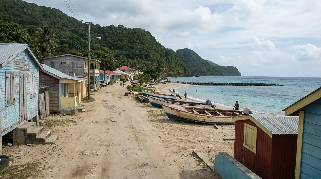
A dive-town strip on one of the Caribbean's great walls, backed by the island's steepest green hills. Where to eat, dive, and linger.
The north shore is St. Croix's north-central coast, the stretch where the reef and the deep water sit closest to the sand. Cane Bay is its hub: a single bend of road where you can dive one of the Caribbean's best-known walls, snorkel off the beach, eat within sight of the water, and set out on the coast drive. This page is the map of the whole coast and how to move across it. Each activity, beach and neighbor has its own deep guide, linked as you go, so this stays a set of directions rather than a repeat of them.
Where the north shore is
St. Croix runs about 22 miles east to west and roughly 7 north to south, with a green ridge down the middle that tops out at Mount Eagle, the island's high ground at 1,165 feet. The north shore is the north-central length of that coast. It reaches from the Salt River inlet in the east to the point where the road quits against the hills near Davis Bay in the west. Christiansted lies just east of it around the corner; the rainforest and Frederiksted sit over the mountains to the west.
What sets this coast apart is underwater. The island's shelf is narrow along its north side, so the reef edge and the deep water crowd in close to shore here instead of lying miles out. That one fact explains most of what the coast is known for: a wall you can shore-dive, reef you can snorkel from the beach, and water that turns deep blue a hundred yards or so from where you waded in. It also shapes the land. The ridge drops almost straight into the sea with little flat ground between, which is why the road runs a thin shelf between mountain and water and why the scenery here is the most vertical on the island.
Hold the island's three coasts side by side while you plan, because they behave nothing alike. The east end is dry and low, cactus-and-scrub country that catches a fraction of the island's rain. The west end is lush rainforest that catches the most. The north-central coast sits between those poles — green hills, reef-close water, a scatter of small settlements and old sugar estates rather than towns. The larger east-versus-west split has its own page in two landscapes, one island; on this coast the takeaway is simply that you get green mountains and serious diving in the same short drive.
Coming out from Christiansted, the near end of the coast is residential. Condo communities and gated estates around Pelican Cove and Gentle Winds sit just past town, and the shore only turns rural once the road bends west and the hills begin to steepen toward Cane Bay. That gradient — tame and built up near town, wild and vertical toward the middle and west — is worth picturing before you set out, because it tells you the good water and the big scenery are the reward for the drive rather than the first thing you meet leaving town.
The road that ties it together
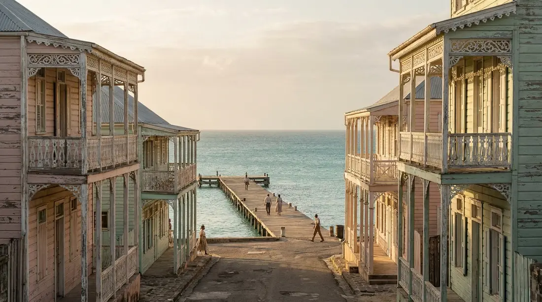
One road serves almost the whole coast: Route 80, the North Shore Road. It leaves the Salt River area and runs west along the water, past Cane Bay and the North Star pulloff, to Davis Bay, where it ends beneath the slopes below the Carambola resort. From Christiansted you reach it by heading north to Salt River and turning west; plan on roughly half an hour to Cane Bay from town, and a similar run from Frederiksted over the interior. There is no bus line along it, and the island has no ride-hailing apps, so the north shore is a rental-car coast. The driving-on-the-left guide covers the habit that catches first-timers off guard, since cars here keep to the left in familiar left-hand-drive vehicles.
The road is also the attraction. It rides the shelf with the sea on one side and the ridge on the other, opening onto pulloffs where the coast lays out below you, and at its western end it climbs the steep inland grade that locals call the Beast on the way toward Frederiksted. Treat the North Shore Road as a drive in its own right and you have the makings of a half-day. The full island circuit that uses it, leg by leg, is in drive around the island; the unpaved mountain track that rides the crest above this coast is the Scenic Road; and the places worth stopping for the view are ranked in best viewpoints.
Cane Bay, the hub
Everything the north shore is known for meets at Cane Bay, a single bend of Route 80 with a beach on one side and a short row of businesses on the other. Four things happen here, and each carries its own guide so this page can stay a map rather than a rerun.
- Dive the wall. The Cane Bay Wall is the dive the island is known for, a drop you reach by finning out from the beach rather than riding a boat. How the swim, the profile and the operators actually work is the whole of the wall diving guide.
- Snorkel from the sand. On a calm morning the inner reef off the beach is one of the best shore snorkels on the island, no boat and no tank required. The spot-by-spot version lives in the snorkeling reference and the beach's own guide.
- Eat on the strip. A beach bar on the sand, a dinner room over the water, and a couple of other kitchens work the same short run of road. Menus, hours and the closed days are in the Cane Bay eats guide.
- Drive the coast. Cane Bay is the natural midpoint of the North Shore Road, the place to park, swim and eat before carrying on west or east.
Two PADI shops work out of the bay — Sweet Bottom Dive Center sits directly across the road, and Cane Bay Dive Shop runs guided trips here as well — which is why even a first-time visitor leaves knowing the place by name. The rest of the cast belongs to the beach and eats guides: The Landing on the sand and AMA over the water are the two dining anchors, and Eat @ Cane Bay, the lunch spot some older maps still list, has closed. For the purposes of this page it is enough to know that a tank, a rental mask, lunch and a sunset drink are all within a few steps of the same parking spot. Nowhere else on St. Croix stacks that many things on one bend of road.
The character of the coast
The north shore is the island's dive-village coast, and its rhythm follows the water. Mornings are shops filling tanks and briefing groups; afternoons are divers hosing salt off gear and a beach bar filling when the boats come in. There are no high-rise resorts and no cruise dock anywhere on this shore — the largest lodging is a small hilltop hotel at Cane Bay and a golf resort at the far end — so the pace stays low and barefoot even on its busiest weekend. Visitors here get absorbed into a small community's own beach rather than catered to at a resort's.
The light works in the coast's favor. This shore faces a little west of due north, so the sun sets down the water rather than behind the hills, and the strip is built for that hour. It is one of the few places on the island where you can finish a dive day with a drink facing the sunset without driving over to the west end for it.
The community here rebuilt itself in living memory. The Category 5 winds of Hurricane Maria struck this coast in September 2017, and the row of businesses at Cane Bay came back over the years that followed — a small hotel reopened in 2021, a bar changed hands and returned in 2024, and one long-running lunch spot never reopened. What is left feels settled and local, run largely by people who live within a few minutes of the water they work. The coast keeps one big date on its calendar: each February the beach becomes the last stop of Mardi Croix, the island's costumed parade, which winds along Route 80 before breaking up into music and vendors on the sand.
West along the coast: Davis Bay, North Star and Carambola
West of Cane Bay the road runs a few more minutes before it ends, and the short stretch holds three stops worth the drive.
Davis Bay is the big-scenery beach where Route 80 finally quits against the hills below Carambola, backed by the steepest forested slopes on the coast and known more as a place to look at than a place to swim, thanks to a shore break that comes and goes with the swell. Its own guide handles the sand, the reefs and the resort behind it. Between Cane Bay and Davis Bay, a small roadside pulloff marks North Star, another wall-and-cavern dive where the bottom falls away offshore. Its useful trait is shelter: it holds up against northeast swell on days when Cane Bay is churned up, which is why it appears with the rest of the roster in the island scuba guide.
Behind Davis Bay sit the Carambola resort and Carambola Golf Club, an eighteen-hole championship course that opened in 1966 — the only one of its length in the territory. From the same western end, a rainforest trail leaves for the Annaly Bay tide pools, a genuine hike with a payoff you can only collect on a calm day at low tide, when the sea is quiet enough to let you near the rocks. Each of those is a page of its own; on the map they are simply the three reasons to point the car west at Cane Bay instead of turning back toward town.
East along the coast: Salt River
In the other direction, about five miles east of Cane Bay, the North Shore Road passes Salt River — the most layered stop on the coast and a national park in its own right. This is where Columbus's fleet anchored in 1493, the only documented place his crews came ashore on what is now United States soil. The same bay holds some of the island's largest mangrove forests, a submarine canyon that ranks among the classic boat dives, and a bioluminescent lagoon that lights up under a paddle on a dark night. The whole park, its history and its water are pulled together in the Salt River area guide. On the coast map, Salt River is the eastern anchor: a north-shore day that opens with a Cane Bay snorkel and closes with a Salt River paddle after sunset runs the length of this shore end to end.
A north-shore day
The coast rewards a plan built around the morning, because the water here is smoothest at first light and roughens as the trade winds fill in through the day. The standing move is water first, food second, road third.
Start at Cane Bay soon after the shops open, while the surface is still glass: a guided wall dive for the certified, an easy shore snorkel for everyone else. Come in for lunch on the strip around midday, when the wind starts to put texture on the bay. Give the afternoon to the road — west to Davis Bay and the North Star pulloff for the scenery, or east to Salt River for the mangroves and, if the timing lines up, a bioluminescent paddle once it is fully dark. Drivers who want the long way home can climb the Beast at the western end and drop into Frederiksted, turning the return into the second half of the island loop rather than a straight retrace.
Two cautions shape any north-shore day. There is no lifeguard anywhere on this coast, so reading the sea state is your own job; when white water is breaking across the reef, swim on the sheltered west side and come back another morning. And the drive back to town is winding and unlit once the sun is down, which argues for finishing the road part in daylight and keeping a sober driver if the sunset drinks run long.
The coast's history in one glance
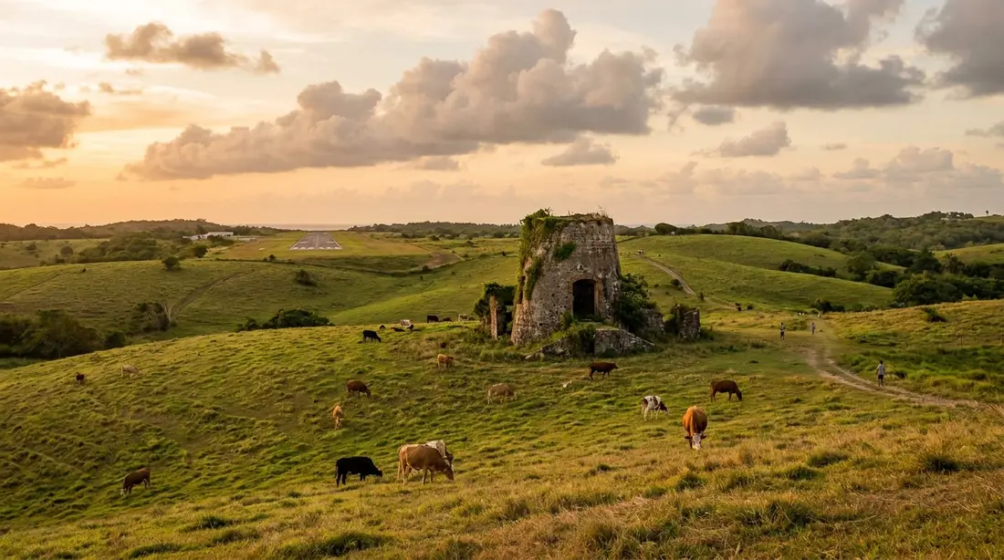
The names on this coast are sugar names. Cane Bay took its from the cane fields that once climbed the estates above the water, and ruined stone windmills still stand on the hillsides where the plantations worked — the same slopes the horseback tours ride down to the beach. Salt River carries an older story still, as the 1493 landfall and the site of the first recorded clash between Europeans and Native people in the Americas. For most of the island's history this was working agricultural coast, not a visitor's one. The turn toward diving and small-scale tourism is a modern chapter: the wall made Cane Bay a destination for divers, the Carambola resort and its golf course opened at the western end in the 1960s, and the strip of shops and kitchens grew up to serve them. The result today is a coast that reads as lived-in rather than built-for-visitors, which is much of its appeal. Those windmill ruins on the ridgelines are the coast's oldest landmarks, and spotting one from the road is a small orientation trick in itself: they mark where the estates stood long before the diving did.
Conditions on this coast
The north shore's one real variable is swell. Through the winter, roughly December into March, far-off storms out in the North Atlantic send long lines of swell down onto this north-facing coast, and they can turn up on a windless, sunny day with nothing in the local forecast to warn you. When that happens, Cane Bay goes to surge and breakers, the dive shops shift their trips to the sheltered west side of the island, and swimmers should take the same hint. The rest of the year the coast is mostly calm, at its flattest from late spring through early fall. The daily pattern holds in every season: quiet water in the morning, more chop as the trades build after midday. How the island's weather runs month by month is in the weather guide, and the summer-storm side of the calendar is covered in hurricane season. The practical planning rule for this coast is short — schedule your Cane Bay morning near the front of the trip, so if the swell comes up you push the day back rather than lose it.
Who the north shore suits
This coast is built for two kinds of visitor. The first is divers and snorkelers, for whom the reef-close water is the entire point: no other coast on the island puts a wall this good within a swim of the sand, and a certified buddy team can shore-dive it on their own schedule once they know the entry. The second is anyone who wants a quieter footing than the towns. The north shore trades restaurant choice and nightlife for scenery, low traffic and easy water, which suits families after a calm-morning beach with lunch attached, couples who want a sunset drink over the water, and drivers who treat the North Shore Road as the destination rather than the commute.
It fits some visitors less well, and it is worth being plain about that. There is little to do here once dinner ends, groceries and most of the island's kitchens are a mountain drive away, and a winter swell can close the swimming for days at a stretch. Travelers who want to walk out the door to a range of restaurants, bars and shops are better based around Christiansted and will find the north shore an easy day trip from there. The coast also asks a little more self-reliance than a resort beach does: shade is scarce, standalone facilities are thin, and you carry your own water and sun cover to most of these stops. None of that troubles the traveler this shore is meant for, but it is worth knowing before you commit a full day to it.
Getting here and parking
The whole coast is reached off Route 80, and the practical notes repeat at every stop. Parking is roadside — there are no paved lots at Cane Bay, Davis Bay or the North Star pulloff, and the spaces nearest the water at Cane Bay are gone by mid-morning on a fine weekend, so arrive early or count on a short walk along the shoulder. Keep the car fully clear of the travel lane, leave nothing showing inside it, and remember the road is narrow and shared with cyclists and the occasional horse. The island runs no Uber or Lyft, drivers keep to the left, and the run from the airport or the far east end adds fifteen to twenty minutes on top of the half-hour figure from Christiansted. First-time arrivals should read getting to St. Croix for the flights and the airport, then the driving guide before collecting the rental car that this coast quietly requires.
Staying on the north shore
Lodging on this coast is small and particular: a hilltop hotel of a few suites at Cane Bay, estate cottages on the old plantation behind the beach, a scatter of private condos and homes along the road, and the Carambola resort at the western end. In season it fills up fast, simply because there is so little of it to go around. Our own collection sits east and west of this shore rather than on it — our homes cluster around Christiansted and the East End, with one on the Frederiksted side — so for our guests the north shore works as a day-trip coast rather than a base. Most travelers land on the same compromise: keep a full villa with a kitchen, a pool and room to spread out, and give the north shore one or two of the week's biggest days.
The north shore, east to west
| Stop | What it is | Its guide |
|---|---|---|
| Salt River | National park: the 1493 landing, mangroves, bio lagoon, a canyon dive | Salt River area |
| Cane Bay | The hub beach: wall dive, shore snorkel, the dining strip | Cane Bay beach |
| North Star | Roadside wall-and-cavern dive, sheltered from northeast swell | scuba guide |
| Davis Bay / Carambola | Big-scenery beach at the road's end; golf and the tide-pool trail behind | Davis Bay beach |
| Annaly Bay | Rainforest hike to tide pools; calm, low-tide days only | Annaly Bay tide pools |
The north shore by activity
| You want to | Where on the coast | Its guide |
|---|---|---|
| Dive the wall | Cane Bay, and North Star nearby | Cane Bay wall diving |
| Snorkel from the beach | Cane Bay inner reef | snorkeling St. Croix |
| Dive after dark | Cane Bay and island-wide | night diving |
| Eat and drink | The Cane Bay strip | Cane Bay eats |
| Play golf | Carambola, west end of the coast | Carambola Golf Club |
| Hike | Annaly Bay tide pools | Annaly Bay tide pools |
| Paddle the bio lagoon | Salt River | Salt River area |
| Drive the coast | North Shore Road, end to end | drive around the island |
| Stop for the view | North Shore Road pulloffs | best viewpoints |
Questions guests ask
What counts as the north shore of St. Croix?
Locals use it for the north-central coast — the length served by Route 80, the North Shore Road, running from the Salt River inlet in the east to Davis Bay in the west. Cane Bay sits in the middle of that stretch, about five miles west of Salt River. The far east end near Point Udall and the town coast around Christiansted are usually spoken of separately, even though they also face roughly north. When people say they are spending the day on the north shore, they almost always mean the Salt River to Davis Bay run, with Cane Bay as the hub.
How far is Cane Bay from Christiansted and the airport?
From Christiansted, plan on roughly half an hour by car, heading north to Salt River and then west along the coast road. From the airport on the south side, or from the far East End villas, add fifteen to twenty minutes to that. Frederiksted is a similar half-hour away over the interior. None of it is far by mainland standards, but the roads are narrow and winding, there are no ride-hailing apps on the island, and cars drive on the left — so give yourself a little more time than the mileage suggests, especially for the drive home after dark.
Is the north shore better as a base or a day trip?
For most visitors, a day trip. The coast has beautiful water and real scenery, but its lodging is limited, it goes quiet after dinner, and groceries and most restaurants are a drive away over the hills. Basing near Christiansted or on the East End keeps you close to town while leaving the north shore an easy half-hour reach for the days you want it. Divers who plan to be in the water every morning are the exception — for them, staying close to the wall can be worth the trade-offs, and a handful of small hotels and condos on the coast serve exactly that traveler.
When is the water on the north shore too rough to swim?
Mainly during winter swell events, roughly December through March, when long-period swell from North Atlantic storms reaches this north-facing coast. It can arrive under a clear, windless sky with no local warning, putting surge and breaking waves across the reef. On those days the dive shops move to the sheltered west side of the island, and you should follow them — the Frederiksted shore stays calm when the north is up. The rest of the year the coast is mostly calm, flattest from late spring into early fall. In any season the water is smoothest early and choppier by afternoon, so swim and dive in the morning.
Do I need a car for the north shore?
Effectively, yes. There is no bus service along the coast and no Uber or Lyft anywhere on St. Croix, so a rental car is the practical way to reach Cane Bay and the stops on either side. Taxis and taxi tours can run you out and back, and cruise-day vans bring visitors up from the Frederiksted pier, but neither gives you the freedom the coast is built for — parking at one beach, driving to the next, chasing the calm water. Read the driving guide before you pick up the car, since driving here is on the left.
What is there to do on the north shore besides diving?
Plenty, even without a tank. You can snorkel the inner reef off Cane Bay, eat and drink on the strip, ride horseback down through the old estate to the water, watch the sunset over the sea, and drive the coast road with its pulloffs and viewpoints. West of Cane Bay there is golf at Carambola and a rainforest hike to the Annaly Bay tide pools; east of it, Salt River adds mangrove kayaking, a national-park history and a bioluminescent night paddle. A full day on this coast is easy to fill for a non-diver — the diving is simply the thing the north shore is best known for.
Basing near the north shore in one of our villas
None of the homes in our collection sit on the north shore itself, and that is by design — the coast is a day-trip run rather than a place to stay for most guests. What our houses do is put it comfortably in reach: the homes around Christiansted and the East End reach Cane Bay in about half an hour on the coast road, and the whole north shore opens up from there for a morning dive, a beach lunch and a sunset drive home. A full villa gives you the kitchen, the pool and the space that a small coastal hotel cannot, plus an outdoor shower for rinsing the salt off after a day on the reef. Pick the base that leaves the north shore an easy drive away, and treat the coast as one of the week's set-piece days out.
Sources
Written from official and first-party sources, checked August 2026. Hours, prices and event dates change — confirm before you go.
In this guide
Stay nearby
On The Shoys beach: six bedrooms, six baths, pool and hot tub, room for twelve, and the beach through the back garden.
 Shoy's Beach House6 bd · 6 ba · sleeps 12 · Christiansted
More in Towns & Areas
Sources
9 references, listed in full at the end of this guide — official park, refuge, tourism-board and business sources, checked August 2026.