
The brochure version of St. Croix covers Buck Island, the two towns, and the famous beaches. This post covers the rest: a lighthouse you have to walk to, tide pools you have to earn, rainforest roads, plantation ruins, two quiet nature reserves, and a bar where the pigs drink beer. These are the island's hidden gems, and every one of them comes with an access catch. We verified each place in August 2026 and state the catch.
A list like this fails in two ways. The first is staleness: island businesses and trails change faster than the articles about them, so a copied-forward list will happily send you to a restaurant that closed years ago or a refuge that is shut for nesting season. The second is omission: plenty of round-ups mention the Annaly Bay tide pools without mentioning that the hike is hot, exposed, and pointless in rough seas, or name-drop a Nature Conservancy estate without telling you it only welcomes visitors on certain days. Both failures cost you a morning of your vacation, and mornings are the currency a one-week trip runs on.
So this post does the unglamorous work. For each place: what it is, why it earns a detour, exactly how you get in, and the specific thing that goes wrong when people show up unprepared. Where hours or prices appear, they are as published in August 2026, and they can change; anything that depends on a schedule gets a check-before-you-go note. Where we could not confirm a place is still operating, it is either off the list or flagged. That discipline shortens the list a little and makes it worth following.
How this list works
Three ground rules shape everything below. First, you will be driving. There is no Uber or Lyft on St. Croix, taxis do not idle at trailheads, and almost everything in this post sits away from the towns. You drive on the left here, in ordinary left-hand-drive cars, and it becomes automatic within a day. A few of these places also involve unpaved roads, so if rough tracks appeal to you, ask your rental company for an SUV and read the fine print about where you are allowed to take it. Our getting around page covers cars, taxis, and the rest.
Second, the island's geography does the sorting for you. The west end is wet and green, with real rainforest in the hills above Frederiksted; the East End is dry, breezy, cactus country. The lighthouse, the tide pools, the dam, the Domino Club, the botanical garden, and the Frederiksted waterfront all cluster west; Point Udall, Southgate, and the hike-in bays cluster east. Plan one end per day and you will spend your time at the places instead of on Centerline Road.
Third, the catch is part of the place. The tide pools are empty of crowds because reaching them takes work. Estate Little Princess is quiet because visits run on the Conservancy's calendar. A weekday sunrise at Point Udall belongs to you alone because everyone else chose to sleep. None of what follows is a secret in the literal sense; locals know all of it. What keeps these places uncrowded is friction, and the sections below tell you exactly how much friction to expect.
Ham's Bluff Lighthouse
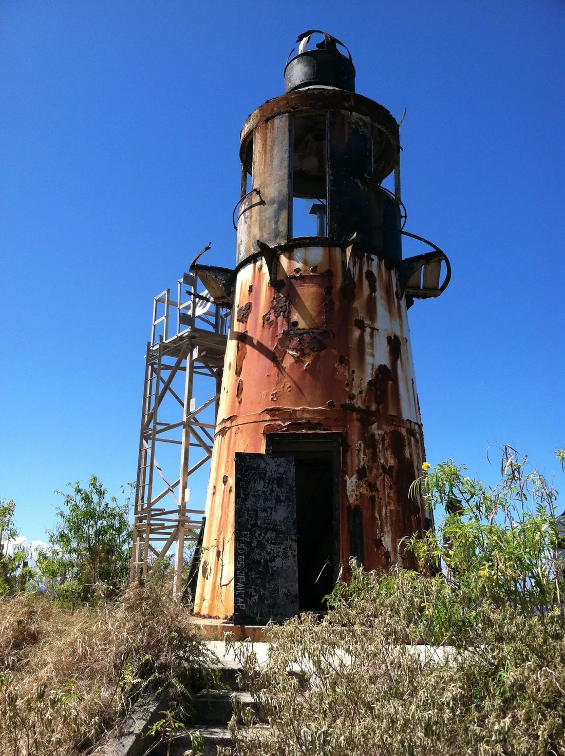
On the island's northwest corner, a cast-iron Danish lighthouse from 1915 stands on a bluff roughly 360 feet above the sea. The tower is out of service and the setting is the point: from the grass around its base you look down the whole north coast, with the wet green hills behind you and open Caribbean in front. It is one of the best short walks on St. Croix and most visitors never hear about it.
The access: from Route 63 north of Frederiksted, a side road runs along Hams Bay to a former National Guard facility, and the trail climbs from there. The road in can be rutted and muddy, so take it slowly in a low car. The walk itself is short but steep, about eight-tenths of a mile round trip with something like 270 feet of climbing on a rocky, uneven track; figure a sweaty 25 to 40 minutes up at a vacation pace. Wear real shoes, carry water, and go in the morning before the heat builds.
Two cautions, both easy to respect. Cars parked at the trailhead have been broken into, so bring nothing valuable and leave nothing visible. And the lighthouse itself is a ruin in slow motion: the floors inside have developed holes and there is sharp rusted metal, so admire the tower from the outside rather than climbing around in it. Strong walkers can continue along the ridge toward Maroon Ridge, the cliff country where escaped enslaved people once built free settlements, which turns a photo stop into a half-day with real historical weight. The full route notes live in our Ham's Bluff guide.
Annaly Bay tide pools
The tide pools at Annaly Bay are natural rock basins on the north shore where the sea washes over a volcanic shelf and settles into clear, calm bowls. On the right day they are the most memorable swim on St. Croix. The phrase "on the right day" is doing heavy lifting in that sentence, and this is the place on the island where reading the conditions matters most.
There are two ways in, and neither is casual. The hike starts near Carambola on the north shore and runs about 3.6 miles round trip with roughly 550 feet of elevation change. Parts are shaded, parts are fully exposed, and the final stretch is a scramble across rocks; in the middle of a Caribbean day it is a hot, serious walk that regularly surprises people who expected a stroll. Start early, carry more water than feels reasonable, and wear shoes that grip wet rock. The alternative is a 4WD tour: Tan Tan Tours runs open jeeps down a back route to the bay, with a tide-pool trip listed at about two and a half hours and 200 dollars per person as published in August 2026, three-person minimum, and a longer half-day version as well. Prices and minimums change, so confirm when you book.
Now the caution that belongs in bold type even though we cannot use bold type for it lightly: the pools are only safe when the sea is calm. The shelf faces open water, and in a north swell waves break over the rocks that separate the pools from the ocean. People have been injured here in rough conditions. If the forecast shows swell, if the sets look big from shore, or if water is surging into the pools, do not get in; the hike to a dry overlook is still worth doing. Winter brings north swell more often, so summer and fall are statistically the friendlier seasons. Our tide pools guide carries the full checklist.
Creque Dam Road and the Scenic Road
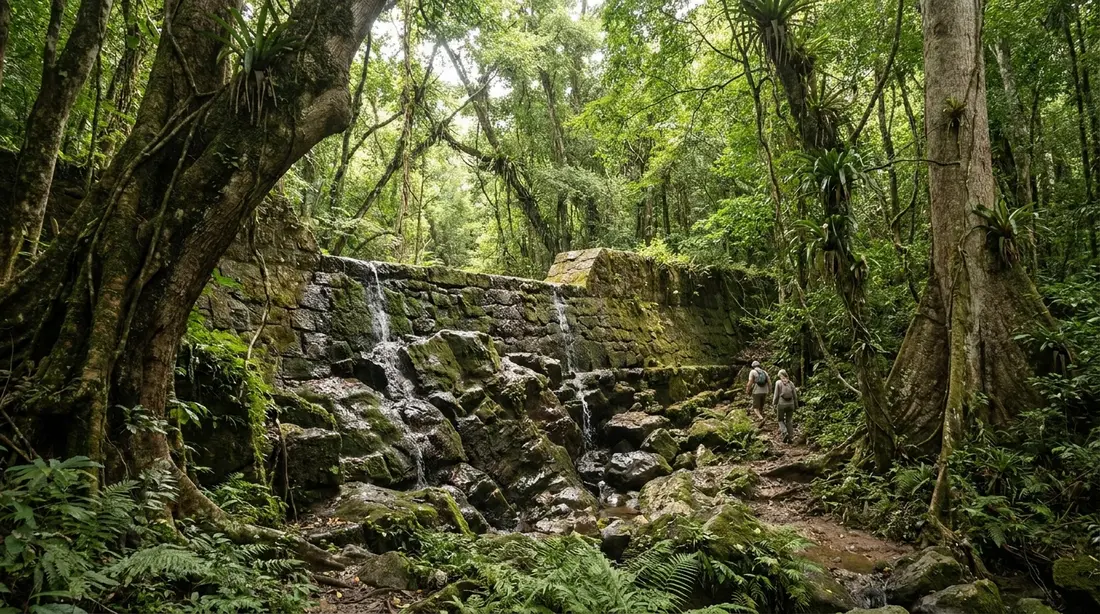
St. Croix keeps an actual rainforest in its northwest quarter, where the hills pull down more than 50 inches of rain a year against 25 to 38 on the dry East End. Threaded through it is a network of old roads, some paved and some emphatically not, and hidden along Creque Dam Road stands a stone dam finished in 1926 to supply Frederiksted with water. Ferns grow from the masonry, the forest has closed back over the reservoir site, and the whole scene feels a century removed from the beach bars twenty minutes away.
You can see the dam with an ordinary car and a short walk in from Creque Dam Road, off Route 63. The deeper experience is the unpaved Scenic Road along the forested spine, which wants a high-clearance 4WD, a dry spell, and a driver who enjoys that sort of thing; after rain it turns greasy and washouts appear without announcements. Check your rental agreement first, because some companies exclude unpaved roads, and ask locally about current conditions, because nobody publishes them. The gentle alternative is Mahogany Road, Route 76, the paved drive through the same canopy, covered in our Mahogany Road guide.
The forest holds one more prize with the biggest caveat on this list. The Caledonia Valley has the island's only natural waterfall, and it is seasonal: it runs after heavy rain and shrinks to still pools, or nothing, in dry stretches. The route to it follows a gut, the local word for a steep streambed, with wading and downed trees, and guts flash-flood when rain is falling upstream. Go with the St. Croix Hiking Association or a local guide, time it for the days after rain, and skip it entirely if storms are in the forecast. Details for the whole area are in the Creque Dam guide.
Mt. Pellier Domino Club
Halfway up Mahogany Road, an open-air bar has been serving the rainforest since 1971, and it is famous for two things: a house drink and a pen of very large pigs that drink beer. The Mt. Pellier Domino Club is exactly the kind of place a round-up like this has to re-verify, because roadside institutions come and go, so here is the current picture. The club is operating. Its founder, Norma George, died in 2021, and longtime friends Nico and Jill Cherubin have carried it on. As published in August 2026, it runs Tuesday through Sunday from 8 in the morning until whenever the day ends, with pig visits during daytime hours; treat those hours as a guide and check before making it the anchor of your day.
The pigs first. The tradition started decades ago when a pig named Buster helped himself to a customer's beer, and it continues with a rotating cast; recent residents have answered to Hamilton, Chester, Kevin Bacon, and Willis. Visitors buy cans of non-alcoholic beer at the bar, a few dollars each at last check, and the pig does the rest with alarming efficiency. It is silly, it is memorable, and the non-alcoholic detail matters: the animals are not being given alcohol.
The drink second. MamaWanna is Norma George's blend of rum, honey, roots, herbs, and spices in the Caribbean bush-rum tradition, poured as shots at the bar and now bottled commercially. There is Caribbean food on many days, and the kitchen's official policy is that the food runs out when it is gone, which tells you most of what you need to know about the pace of the place. Come for a late morning or lunch stop on a rainforest driving day, bring cash, and let whoever is driving stick to water; Mahogany Road is narrow, winding, and driven on the left. More in our Domino Club guide.
Salt River Bay
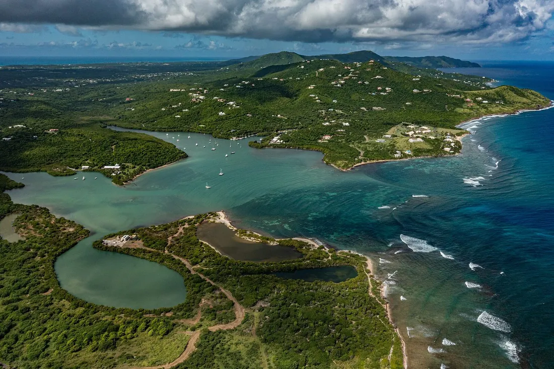
On the north shore, twenty minutes from Christiansted, a mangrove-lined bay holds more history and more biology per acre than anywhere else on St. Croix, and most visitors drive past the turnoff without knowing it. Salt River Bay is where Columbus's fleet anchored on November 14, 1493, on his second voyage; the landing party that went ashore here made this the only known spot where his crews set foot on what is now United States soil, and the skirmish that followed was the first recorded armed clash between Europeans and Native people in the Americas. The bay is now a 1,015-acre National Historical Park and Ecological Preserve, jointly managed by the National Park Service and the territorial government, protecting some of the largest remaining mangrove forest in the Virgin Islands and a submarine canyon that drops away just outside the bay's mouth.
By day, this is a quiet place: a beach with shallow, calm water at Columbus Landing, kayak routes through the mangroves, and an overlook where the whole 1493 story is legible in the landscape. The park's visitor contact station keeps limited hours that shift with staffing, so call the park at 340-773-1460 if a ranger conversation matters to your visit rather than assuming the doors will be open. Our Salt River history guide walks through the site.
By night, the bay does its other trick. Salt River is one of the few year-round bioluminescent bays in the world, and guided night kayak tours paddle into water that lights up around every stroke. The catch is the moon: a bright moon washes out the glow, so operators concentrate tours on the darker half of each lunar month and publish calendars showing which nights they run. Book around the moon, and do it before your dinner reservations fill the good nights. The operators, the clear-bottom kayak option, and the moon math are all in the bio bay guide.
Estate Little Princess
Just west of Salt River, The Nature Conservancy keeps a 25-acre preserve on the grounds of a Danish sugar and rum plantation established more than 250 years ago. Estate Little Princess is two places at once. It is a historic site, with a great house, a windmill tower, a water mill, and outbuildings of limestone and coral built by enslaved Africans, who were the estate's labor force until emancipation came to St. Croix in 1848; the land carries earlier Taino history as well. And it is a working conservation campus: the Conservancy runs one of its Coral Innovation Hubs here, growing and studying corals for reef restoration a few steps from ruins that predate the United States.
Walking trails wind through the ruins and vegetation down to a quiet stretch of beach, and the mix of research nursery, stone ruin, and shoreline makes for an hour you will not replicate anywhere else on the island. The access catch is the calendar. This is a managed preserve and office, and general wandering is not the model; at last check, visits ran on scheduled tours one afternoon a week, with recent visitors reporting Tuesdays at 2 p.m. Do not build a day around that without confirming: contact the Conservancy's Caribbean office through nature.org before you go, and treat an educational event on the grounds as the other reliable way in.

Southgate Coastal Reserve
On East End Road between Christiansted and the East End beaches, a small brown driveway leads into 100 acres of protected coastal land that almost no visitor ever enters. Southgate Coastal Reserve, managed by the St. Croix Environmental Association, wraps around a 25-acre salt pond with upland grassland, mangroves, and beach forest, and it is the easiest genuine birding stop on the island. Three short trails totaling about a mile carry signs and benches, and one of them ends at a raised bird hide on the edge of the pond.
The bird list is the reason to come. Depending on season and water level, the pond and its margins hold brown pelicans, snowy and great egrets, herons, least terns, Wilson's plovers, white-cheeked pintails, and stilt sandpipers, among others; early morning is the productive window, before heat flattens the activity. The beach side of the reserve is also a sea-turtle nesting shore, which is one more reason the association asks visitors to stay on the trails and take nothing but photographs.
The access is charmingly low-key: park on the grass at the driveway entrance off East End Road near Chenay Bay, find the small trailhead marker a few steps west, and walk in. There is no gate, no fee booth, and no facilities, which means no water, no shade infrastructure, and no bathrooms, so come equipped like a hiker rather than a museum-goer. Binoculars turn the visit from a pleasant walk into the point of the morning.
The Grange Estate
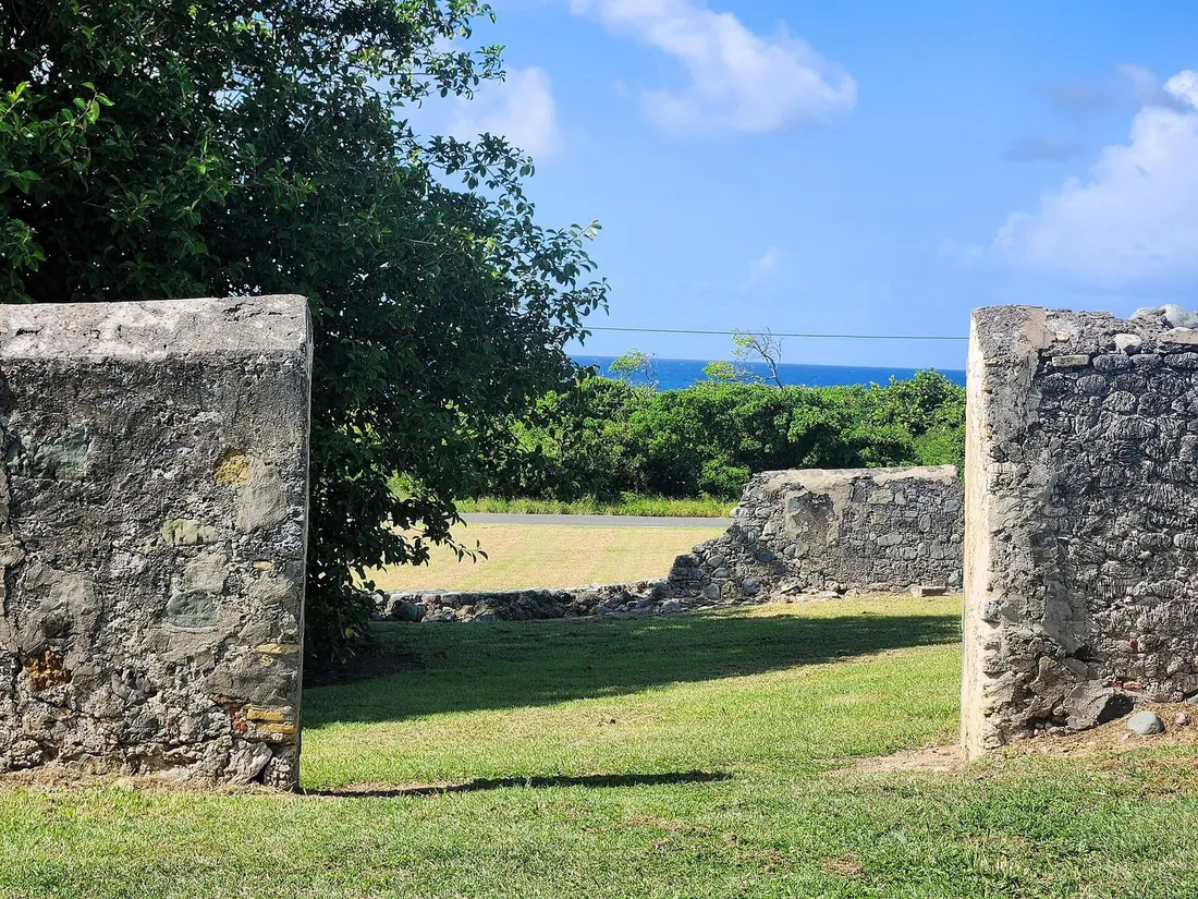
Alexander Hamilton's St. Croix years are usually told through Christiansted, where he clerked on Company Street, and our Christiansted guide covers that walk. The quieter chapter sits inland at Estate Grange, a sugar estate dating to 1733 that belonged to the Lytton family, relatives of Hamilton's mother, Rachel Faucett Lavien. When Rachel died in 1768, the teenage Hamilton buried her here. A memorial stone was placed in 1902, and the actual grave lies unmarked somewhere in the estate's acres, which is its own kind of monument to how the island's history buries and keeps its people.
For years the estate was effectively closed to the public, which is why it stayed off visitor lists. That has changed: the great house has been renovated and now offers scheduled history tours. As published in August 2026, a one-hour guided estate tour ran 10.50 dollars and a self-guided visit 5 dollars, booked through the estate's website with no prepayment; wear walking shoes, because the grounds are real terrain rather than lawn. Confirm the schedule when you book, since small historic properties adjust their calendars often. If the Hamilton thread interests you, do Grange and the Christiansted historic district in the same trip; the shop-clerk town and the family burying ground tell the story better together than either does alone.
Estate Whim and the mill ruins
Sugar built St. Croix, and at the industry's height more than 150 mills turned on the island. Their stone towers still stand everywhere: in pastures, behind shopping centers, on ridgelines, in the middle of housing developments. Once you start seeing them you cannot stop, and a slow cross-island drive becomes a tour of an economy that ran on enslaved labor for over a century. Most towers sit on private land, so photograph from the road unless a site is explicitly open.
The place to turn ruin-spotting into understanding is the Estate Whim Museum on Centerline Road near Frederiksted, a 12-acre plantation museum kept by the St. Croix Landmarks Society, with a restored great house, a windmill, and the factory complex that shows how cane became sugar and rum. One correction worth carrying, because older articles still get it wrong: the great house interior has been closed since the 2017 hurricanes damaged it, and visits cover the grounds and outbuildings. The grounds are the substance of the visit anyway. Whim keeps limited open days rather than daily hours, so check the Landmarks Society's current schedule before driving out; the full picture is in our Estate Whim guide.
St. George Village Botanical Garden
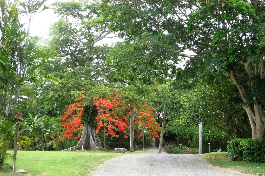
A few minutes from Whim, a 16-acre botanical garden grows through the ruins of an 18th- and 19th-century plantation village at Estate St. George. This is the rare garden where the architecture matters as much as the plants: over a thousand Caribbean and pan-tropical species are planted among stone walls, arches, and workhouses, and a restored worker's cottage museum tells the estate's story across roughly 2,000 years of occupation, from pre-Columbian settlement through the sugar era. Behind the scenes it is a serious scientific institution, with an herbarium of more than 6,000 dried specimens covering about 80 percent of the plant species in the U.S. Virgin Islands and a seed bank for native species.
Practicalities: the garden is open to visitors, with hours that ran roughly 9 to 3 at last check; confirm on the garden's site before you go, and give yourself at least an hour to walk it. July brings Mango Melee, the garden's mango festival, which marked its 30th year in 2026 and is worth planning around if your dates line up. Rain showers pass through the west end quickly and the garden is at its best right after one, when everything drips and the crowds, such as they are, thin out further.
Point Udall on a weekday
Point Udall is on every St. Croix list, ours included, because it is the easternmost point of the United States and the view from the Millennium Monument, the sundial built to mark the first U.S. sunrise of the year 2000, runs straight down the island's dry East End and out to sea. So why does it belong in a post about overlooked places? Because almost everyone does it wrong. They come at midday, in a line of rental cars, take the photo, and leave.
The version most visitors miss costs nothing but an alarm clock. Come on a weekday for sunrise. The drive out the East End road in the dark takes well under an hour from anywhere on the island, the parking area is a few steps from the monument, and on an ordinary Tuesday you will often have the first sunrise in the United States entirely to yourself, with wind, birds, and light doing all the work. Bring coffee. Afterward, the trailhead beside the point drops toward Jack's and Isaac's Bays, two undeveloped hike-in beaches inside a Nature Conservancy preserve, and at that hour you can be swimming at an empty beach before the breakfast places open. The timing details, and the route down to the bays, live in our Point Udall guide.
Frederiksted at the end of the day
Christiansted gets the boutiques and the boardwalk; Frederiksted, the island's west-coast town, gets the sunset, and the difference in visitor traffic between the two remains one of the island's quiet mysteries. The town faces due west over calm water, so the day ends with the sun dropping straight into the sea off the long concrete pier. Walk the waterfront in the last hour of light, watch cruise-ship regulars and local families share the seawall, and you will wonder where everyone else went.
Frederiksted rewards a little history on the way to the sunset. Fort Frederik, the red fort at the north end of the waterfront, built between 1752 and 1760, is where roughly 8,000 enslaved people marched on July 3, 1848, and where Governor-General Peter von Scholten declared emancipation from the ramparts; the fort museum kept weekday and Saturday hours at last check, worth confirming if the history is your reason for coming. The beach beside town is the island's known sea-glass shore, the pier is a celebrated dive and snorkel site on calm days, and the food and bar options within two blocks of the water have gotten steadily better. One planning note: cruise ships dock here, and on ship days the town absorbs the passengers. The port schedule is public, so aim your Frederiksted evening at a no-ship day and the town returns to its usual unhurried self. Our Frederiksted guide maps the whole west-end day.
Roadside food worth a detour
Some of the best eating on St. Croix happens nowhere near a hostess stand, and treating local roadside food as a destination is one of the cheapest upgrades a trip here can get. The forms to know: pate, a fried stuffed pastry filled with saltfish, seasoned beef, or vegetables, sold from trucks, stands, and bakeries all over the island; johnny cakes, fried dough that accompanies almost anything; and full local plates built on stewed meats, rice and peas, and boiled provisions. Stands come and go and the good ones are busiest at lunch, so the working method is simple: if a roadside spot has a line of local plates on it, join the line, and carry cash because cards are not a given.
A few fixed points we can vouch for as of this writing. La Reine Chicken Shack, mid-island, spit-roasts chicken over an open fire and serves it with johnny cakes; it is an institution, and the earlier you arrive the better the choice. In Frederiksted, Turtle's Deli has spent decades building oversized sandwiches near the waterfront, and Polly's at the Pier pours the west end's coffee. One correction to older lists: Eat @ Cane Bay, long recommended on the north shore, has closed, so strike it from any itinerary you inherited. When in doubt about whether a spot from an old article still exists, the island's answer rate on the phone is better than its update rate on the internet.
Every place at a glance
The table condenses this post into a planning card: what each place demands and when it gives you its best. Fold it into your day plans by geography, west-end places together, east-end places together, and keep the sea-conditions rule for the tide pools sacred.
| Place | The catch | Best time |
|---|---|---|
| Ham's Bluff Lighthouse | Rough access road; steep rocky trail; no valuables in the car | Morning, before the heat |
| Annaly Bay tide pools | Hot 3.6-mile round-trip hike or 4WD tour; calm seas only | Early start, calm-sea days |
| Creque Dam and Scenic Road | Unpaved roads want a 4WD and dry weather; rental rules vary | Dry spells for driving; after rain for the waterfall |
| Mt. Pellier Domino Club | Casual hours; food runs out; bring cash | Late morning or lunch, Tuesday to Sunday |
| Salt River Bay | Visitor station hours vary; bio bay needs dark-moon nights | Day for history; dark nights for the glow |
| Estate Little Princess | Scheduled visits only; confirm with The Nature Conservancy | The posted tour slot |
| Southgate Coastal Reserve | No facilities; stay on trails; nesting shore | Early morning for birds |
| The Grange Estate | Tours by reservation | Midweek, booked ahead |
| Estate Whim Museum | Limited open days; great house interior closed since 2017 | Posted open days, mornings |
| St. George Botanical Garden | Short daytime hours at last check | Right after a rain shower |
| Point Udall | None, which is why you go at an odd hour | Weekday sunrise |
| Frederiksted waterfront | Busy on cruise-ship days | Sunset on a no-ship day |
What to check the week before you fly
Every access catch in this post reduces to a short pre-trip checklist, and running it the week before you fly takes fifteen minutes. Check the marine forecast and swell direction if the tide pools are on your list; a north swell moves them to a future trip, full stop. Check the moon phase against your nights for the bio bay, and book the kayak tour before your dinner plans claim the dark evenings. Look at the cruise-ship schedule and aim your Frederiksted evening and west-end beach day away from ship days.
Then the phone-and-website round. Confirm the Domino Club's days if it anchors your rainforest drive. Confirm the current visit arrangement at Estate Little Princess with The Nature Conservancy. Reserve the Grange tour. Check Whim's open days with the Landmarks Society and the botanical garden's hours on its site. If you want a ranger at Salt River, call the park. None of these calls takes five minutes, and together they convert this post from a list of maybes into a schedule. The general rule for St. Croix holds across all of it: the island's small institutions are responsive in person and on the phone, and casual about keeping the internet current.
Finally, gear. The places in this post ask for more than beach kit: real shoes with grip, more water than you think, sun cover for exposed trails, binoculars for Southgate, cash for the roadside, and a dry bag if the tide pools make the cut. A high-clearance vehicle earns its rental premium only if the Scenic Road or the back route to Annaly is in your plans; everything else on this list is reachable in an ordinary car driven patiently.
Questions guests ask
Do I need a 4WD or Jeep for these places?
Not for most of them. Ham's Bluff, Salt River, Southgate, the Grange, Whim, the botanical garden, Point Udall, and Frederiksted are all reachable in an ordinary car, driven slowly on the rougher approach roads. The genuine 4WD cases are the unpaved Scenic Road through the rainforest and the vehicle route to Annaly Bay, and for Annaly most people are better served booking the jeep tour than driving it themselves. If you do rent an SUV for the back roads, check that your rental agreement allows unpaved roads at all, because some companies exclude them.
Are the Annaly Bay tide pools safe?
In calm seas, with care on the rocks, yes, and the swim is a highlight of the island. In swell, no, and the difference is absolute rather than a matter of confidence. Waves breaking over the shelf can throw swimmers against rock, and injuries have happened here. Check the marine forecast, look at the sea state before committing to the last scramble, and treat surging water in the pools as a decision already made for you. The hike itself also deserves respect: hot, partly exposed, and about 3.6 miles round trip, so start early and carry plenty of water.
Are the beer-drinking pigs still there?
Yes. The Mt. Pellier Domino Club is operating under the friends of its late founder, Norma George, and the pig tradition continues with the current residents. Visitors buy cans of non-alcoholic beer at the bar for the pigs, so no animals are drinking alcohol. As published in August 2026 the club ran Tuesday through Sunday from morning onward, with pig visits during daytime hours; the schedule is casual by design, so confirm before building a day around it, and bring cash.
Can you go inside the great house at Estate Whim?
No. The great house interior has been closed since the 2017 hurricanes damaged it, and older articles that describe touring the furnished interior are out of date. The visit now covers the 12-acre grounds, the windmill, and the factory complex, which together still make Whim the island's best single stop for understanding the sugar economy. The museum keeps limited open days rather than daily hours, so check the St. Croix Landmarks Society's current schedule before you drive out.
Is the bioluminescent bay worth it near a full moon?
Manage your expectations. The organisms glow year-round, but moonlight washes out the effect, so tours cluster on the darker half of each lunar month and the strongest displays come on the darkest nights. If your trip lands near a full moon, some operators run moonlight paddles instead, which are a lovely night on the water with a different point. If seeing the glow is a priority, check the moon calendar before you pick travel dates, and book the tour before your evenings fill.
Which of these can I do with kids?
Most of them. Southgate's flat mile of trails, the botanical garden, Salt River's calm beach, Point Udall, the Domino Club's pigs, and the Frederiksted waterfront all work for almost any age. Ham's Bluff suits kids who hike happily for half an hour uphill. The judgment calls are the tide pools, where the hike's heat and the sea-condition rule apply to everyone but weigh heavier with children, and the bio bay kayak, where operators set their own age minimums; ask when you book.
How many of these fit in one trip?
All of them fit inside a week if you group by geography, but the better answer is to pick by appetite. A west-end day covers the lighthouse, the rainforest roads, the Domino Club, and Frederiksted at sunset. Another west day takes Whim, the botanical garden, and the Grange. An east day pairs a Point Udall sunrise with the hike-in bays and Southgate. Salt River takes a daytime visit plus a dark-night kayak. The tide pools claim a morning of their own, conditions permitting, and conditions get the final vote.
Where to stay while you find all of this
Every place in this post is a day trip from anywhere on St. Croix, so the real choice is which end of the island you want as your base. For the west-end cluster, the lighthouse, the rainforest, the Domino Club, and those Frederiksted sunsets, Sunset Sea-Clusion puts you minutes from all of it. For Point Udall sunrises, the hike-in bays, and Southgate's morning birds, our East End homes sit closest, led by The Cerulean on its own stretch of private beach. The Christiansted-area houses split the difference, with Salt River twenty minutes one way and the East End twenty minutes the other; the beachfront collection is the place to start browsing. Wherever you land, the pattern that makes this post work is the same: an early start, one corner of the island at a time, and a villa to come back to when the day's catch has been caught.
Sources
Written from official and first-party sources, checked August 2026. Hours, prices and event dates change — confirm before you go.



