Davis Bay
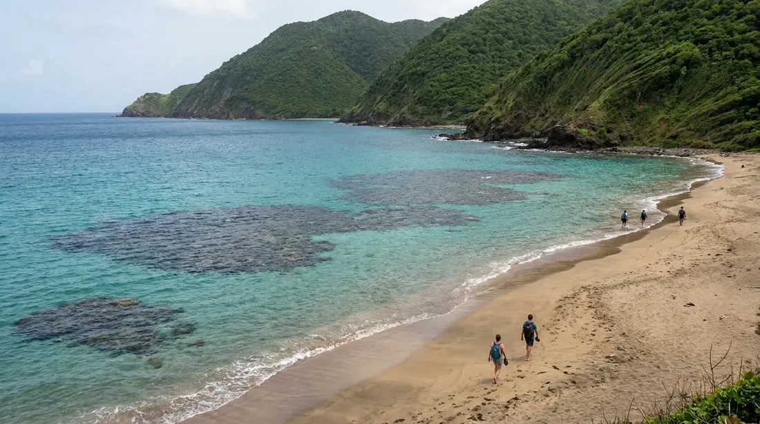
A dramatic north-shore beach by Carambola with two reefs, one shallow and one deep, for snorkelers of different comfort levels.
Davis Bay is the beach at the end of Route 80, where the north shore road runs out of island. Guests and locals also call it Carambola Beach, after the resort behind it. It is the biggest scenery on any St. Croix beach — steep, forested slopes stacked directly over a wide strand of pale sand — and it comes with the biggest waves most visitors will meet here. This page covers the whole picture: the shore break and who it suits, the two-reef snorkel and its limits, the resort next door and its uncertain 2026 status, the gate and parking routine, the golf course up the valley, and the Rockefeller history underneath all of it.
Where Davis Bay sits
The bay occupies the island's northwest corner, at the western terminus of Route 80. Drive the north shore road from the Salt River side, pass Cane Bay, and a few minutes later the pavement finishes at the Carambola resort's entrance; the beach is there. Budget a bit over half an hour from Christiansted along the coast, and roughly the same from Frederiksted by the inland mountain routes. A rental car is effectively the ticket, since the island has no rideshare service and taxis out here need pre-arranging — the car guide covers the practical side, left-side driving included. Davis Bay pairs naturally with the rest of the road behind it: Cane Bay and its bars and dive shops sit a short hop back east, and the whole stretch is walked through in the north shore area guide.
Both approaches earn their minutes. Coming from the Christiansted side, Route 80 rides the water nearly the whole way — Salt River's bay, then the long reef-and-mountain stretch through Cane Bay, with the sea on your right and the surf conditions previewing themselves below the road, so you arrive already knowing what kind of day the bay is having. From Frederiksted the routes climb instead: the inland roads cross the rainforest belt of the northwest, and drivers who take the Mahogany Road way get tunnel-of-trees forest as the opening act of a beach day. Either direction slots neatly into the full-circuit logic of the island loop drive, which treats this coast as its scenic climax.
| Quick facts | Davis Bay |
|---|---|
| Also called | Carambola Beach |
| Coast | North shore, at the west end of Route 80 |
| Entry fee | None |
| Lifeguard | No |
| Public facilities | None; resort amenities are for its guests |
| Parking | Visitor area by the resort entrance gate, at last check |
| Water character | Open-coast; shore break varies from mild to heavy with swell |
| Snorkeling | Inner and outer reef areas; calm mornings only |
| Calmest months | June through September, typically |
The setting
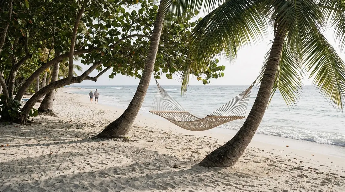
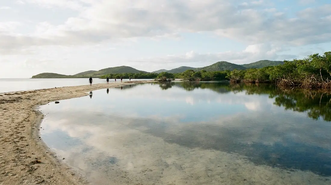
What separates Davis Bay from every other strand on St. Croix is vertical. The island's northwest is its mountain district, and here the high ground gives up almost no coastal plain: green ridgelines climb straight off the back of the beach, close and steep, so the sand feels held inside a bowl of hills. Photographers work this beach constantly for that reason, and the view is equally good in the other direction — headlands run west toward the wild coast, and on a clear day you can pick out Ham's Bluff lighthouse on its ridge to the west. The rocky points flanking the bay take the sea's full energy, throwing spray when a swell is running, and the coastline beyond them hides overhangs and pockets of tidal pool. The land here carries the name Estate Davis Bay, one of the old estate designations that still map the island, and cane country once ran up these valleys; the wider story of the plantations is in the sugar ruins guide.
The sand and the shore break
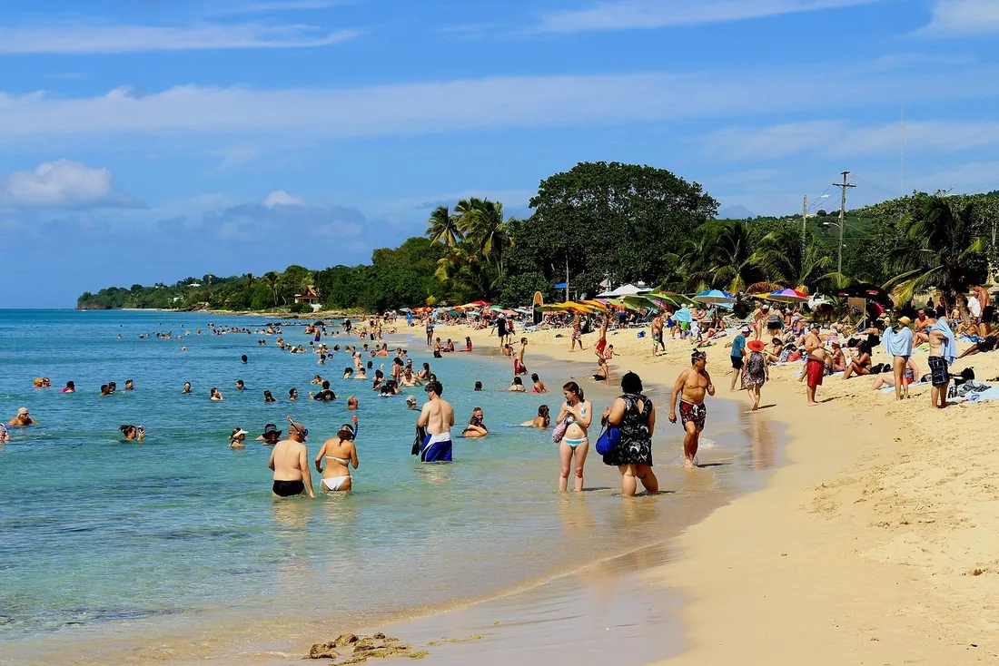
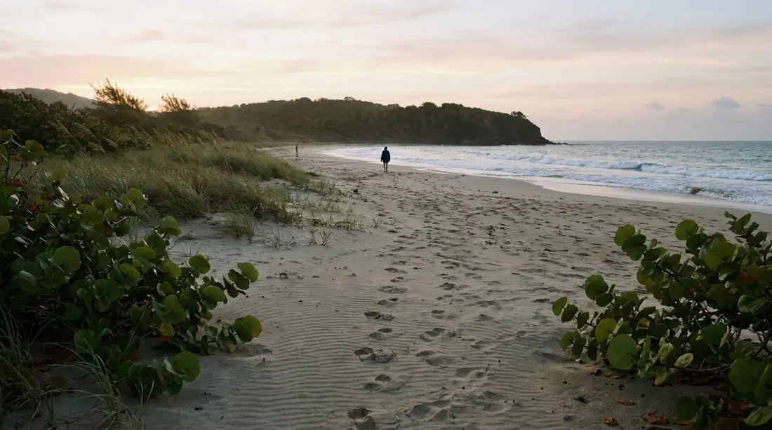
The strand itself is generous: a wide run of light sand with palms and sea grape behind it, and room to spread out even when the resort has guests on its loungers. The defining physical fact of Davis Bay, though, is that it faces the open Atlantic with no barrier reef flattening the swell before it lands. Waves here break on or near the sand. Some days that means a gentle slap you barely notice; on others it means a genuine shore break that picks swimmers up and puts them down hard. The bottom mixes sand with rock in places, and currents can run when the sea is up. None of this makes the beach off-limits. It makes it a beach you read before you enter, the way you would any open-coast strand.
When the surf is up but manageable, Davis Bay turns into the island's casual body-surfing spot. The western end of the beach tends to carry the ride, and on the right day you will see a mix of resort guests and local kids timing the sets. Wave-riding in a shore break rewards experience: go with the wave's shape rather than fighting it, keep your head protected coming down, and get out when the sets outgrow your judgment. Boards and skimboards show up here too when conditions cooperate.
Swimming
For a flat-water swim, timing is everything at Davis Bay. Summer mornings are the reliable window — June through September the north coast routinely goes calm, and the bay can be as easy as any west-end beach. In those conditions the swimming is excellent: clear water, quick depth, that wall of green hills over your shoulder. In winter, or any time a north swell arrives, the equation flips. The break gets heavy, the water moves, and lap-style swimming stops being the point. Households with small children should treat the beach accordingly: on lively days, keep them at the wet-sand line under close watch, because a shore break can knock an adult down, and there is no lifeguard here or on practically any St. Croix beach. The island-wide unguarded-beach rules in the beach overview, linked below, apply in full.
Winter swell days
Between roughly November and March, storm systems in the North Atlantic send long-period swell down to the islands' exposed shores, and Davis Bay is one of the best seats on St. Croix for watching it arrive. The waves stand up tall, detonate on the sand, and hammer the rocky points at either end of the bay hard enough to send spray up the cliffs. On the biggest days the smart move is to stay dry entirely and treat the beach as an amphitheater with a show. These are also the mornings when the coffee-and-a-long-look crowd materializes, and when the drive out along Route 80 — surf visible below the road most of the way — is worth the trip on its own. How swell events work, how long they last, and how to read the marine forecast before committing to a north-shore day is covered in the weather guide, which also handles the storm-season half of the calendar.
Snorkeling
Davis Bay has real snorkeling, and this page will not oversell it. The structure is there: a pair of reef systems, an inner one in comfortable depth and an outer one further off the sand, so the bay serves two ability levels at once. Newer snorkelers can work the shallow coral on a settled morning; confident swimmers with fins can push out to the deeper formations. There is coral to see, fish on it, and enough terrain along the rocky margins to fill a mask session.
The limits are the same open-coast facts that shape the swimming. Any surf stirs sand into the water column and cuts visibility fast, surge makes shallow coral a hazard to you and to it, and the entry through a breaking shore is the hardest part of the exercise. So the working rule for Davis Bay snorkeling reads: calm day, morning hours, or skip it. And when you skip it, the fix is five minutes east — Cane Bay puts protected reef close to shore with an easier entry, and the shore-snorkel rankings place it well ahead of Davis Bay for a reason. Divers have their own version of this geography: the north shore's famous drop-off runs along this whole coast, and the wall diving guide covers the operators who work it, one of which has historically kept a second base at the Carambola resort with rental gear; confirm that desk is staffed before counting on it, given the resort's current chapter.
The resort behind the beach
You cannot write about Davis Bay without writing about the Carambola Beach Resort, because the property owns the land behind the strand and its buildings set the beach's whole backdrop. The resort opened in 1986, designed by architect William Cox on a commission from Laurance Rockefeller, and it was conceived as an architectural tour of Crucian history: 150-odd suites in low, red-roofed buildings that quote the island's Danish rooflines, with louvered windows in the French manner, verandas in the British one, and tropical hardwood detailing throughout. As resort architecture it has aged into one of the more photogenic backdrops in the territory.
The business history has been rockier than the buildings. The property ran under several flags over the decades — a Westin period, a timeshare phase, then years as the Renaissance St. Croix Carambola Beach Resort under Marriott. The territory's public-employee pension fund lent the operation $15 million around 2010, took the resort over after a default in 2012, absorbed hurricane damage in 2017, and sold in 2019. The Renaissance name later came off amid reports of deep deferred maintenance, leaving the hotel bookable through Marriott channels without a brand flag. As of reporting in early 2026, a redevelopment in the $50 million range was taking shape, with a temporary closure floated for the rebuild. What that means for you: the beach is permanent, the hotel's operating status is anything but, and any plan that depends on resort services — food, gear rental, chairs — should be confirmed within days of your visit, without assuming the amenity level the brochures once promised.
Visiting when you are staying elsewhere
You do not need a room key to use this beach. Virgin Islands law has kept the territory's shorelines open to the public since 1971, protecting use of the strip along the water on every coast, resort frontage included; commercial properties like hotels are the category that has historically been expected to let the public through to the sand. The fuller legal picture, including what the statute does and does not say about crossing private land, is laid out in the beach overview.
In practice, arrival at Davis Bay runs through the resort's entrance, and the routine is simple. There is a gatehouse where the road ends; at last check, day visitors could leave the car in a lot on the left before the gate and walk in the short remaining distance, and staff at the gate will point you to the sand if the arrangement has moved. Be pleasant, follow whatever directions you get, and keep the car empty of visible valuables — quiet lots at the edge of the map are where St. Croix's petty theft concentrates, and the safety guide explains the empty-car habit that removes the risk. The walk from parking to water is a matter of minutes.
Food, water, and facilities
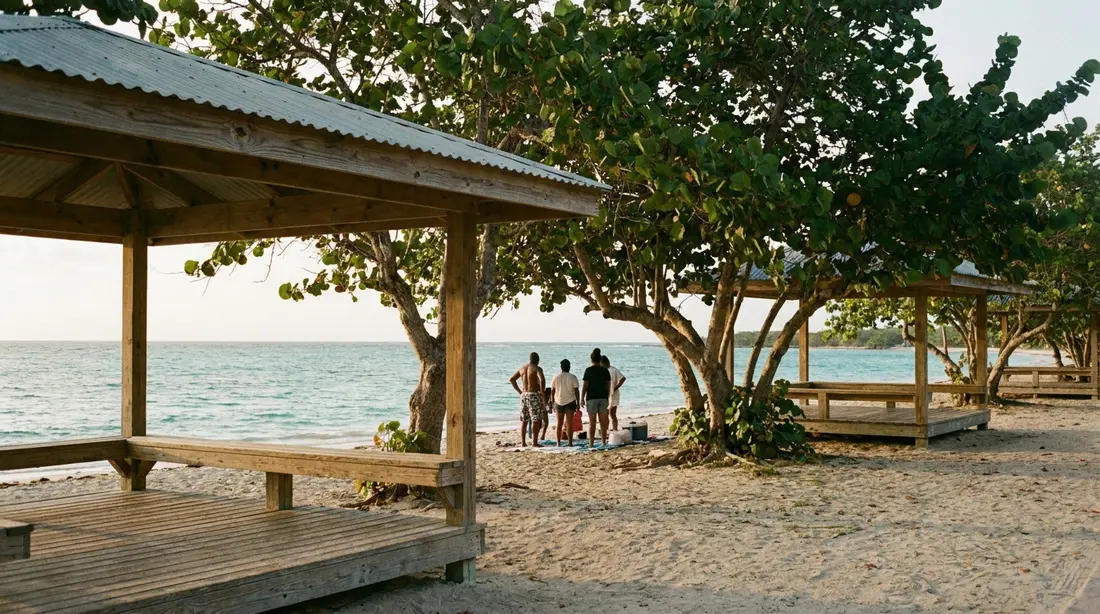
Plan Davis Bay as a bring-your-own beach. There are no public restrooms, no chair rentals, no beach vendors, and no stand-alone bar on this sand; the loungers and hammocks under the trees belong to the resort and its guests. The hotel's restaurants — Saman, the main dining room, and the Flamboyant, the outdoor lounge by the water — served day visitors for years, and on a good day still might. But guest reports through 2026 describe food service running well below full strength while the property waits on its redevelopment, so treat a resort lunch as a possibility to check on arrival rather than a plan. The dependable version of the meal is five minutes away: the Cane Bay strip keeps several kitchens and bars in rotation, detailed in the Cane Bay eats guide. Carry drinking water in any case. Shade exists at the treeline but thins at midday, and the north-shore sun does not negotiate.
The pack list for a no-services beach, specifically tuned to this one:
- More water than feels necessary, plus food if you are not gambling on the resort or driving to Cane Bay.
- Reef-safe mineral sunscreen — the territory restricts oxybenzone formulas — and a real sun shirt for the midday hours.
- Your own shade if you want certain shade; the natural treeline shade moves and fills.
- Reef shoes for the rocky sections and any tide-pool poking along the points.
- Mask and fins on any calm-forecast day, because rentals here cannot be counted on right now.
- A trash bag out — nothing on this beach empties itself.
Carambola Golf Club
The golf course a few minutes up the valley is the other half of the Davis Bay story, and it predates the beach resort by two decades. Robert Trent Jones Sr. laid the course out on former sugar land in the island's northwest interior, and it opened for play in 1966 under its original name, Fountain Valley Golf Course. It remains the U.S. Virgin Islands' only championship-length course: 18 holes, par 72, routed through a green valley with the ruins of an eighteenth-century sugar factory still standing near the clubhouse. Jones spoke of it as one of the designs he was proudest of, and Chi Chi Rodriguez spent years as its director of golf, which tells you the course once sat squarely on the Caribbean golf map. Today it draws a mix of visiting players, cruise-day golfers, and a loyal local membership. Tee times, rates, and current course condition live in the Carambola Golf Club guide.
The Rockefeller chapter
The reason a Trent Jones course and a Cox-designed resort exist out here at all traces to the early 1960s, when Laurance Rockefeller — the family's conservationist and resort-builder, the same figure behind Caneel Bay on St. John — and his brother David assembled roughly 4,000 acres of northwest St. Croix through a venture called the Estate Fountain River Company. The vision was a complete destination: golf first, with the course opening in 1966 as the anchor, and accommodation to follow. The full build-out took longer than the plan, and the beach resort at Davis Bay did not open its doors until 1986, two decades after the first tee shot up the valley. But the footprint the Rockefellers drew — course inland, resort on the sand, the mountains left green between them — is exactly the landscape a visitor walks into today, and it is why this corner of the island feels composed rather than accumulated.
The Annaly Bay trail
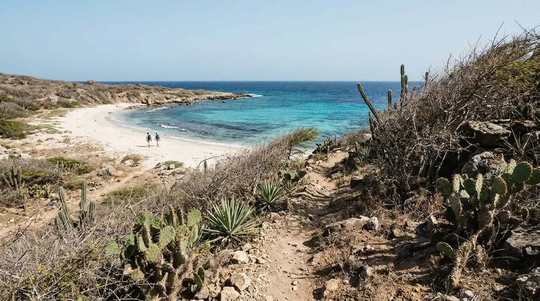
Davis Bay doubles as the staging point for one of the island's signature hikes. The path to the Annaly Bay tide pools leaves from the resort grounds and climbs over the ridge into the roadless coast beyond — real rainforest walking, around three and a half miles round trip, ending at natural rock pools that are only swimmable when the sea is quiet. It is a half-day commitment with real footing and real conditions rules, and the tide pools guide covers the route, the swell judgment, and the trailhead arrangements in detail. For beach-day purposes, the relevant note is the pairing: hikers who start early are back at Davis Bay by early afternoon with the swim already earned, which is about as good as a north-shore day gets.
The coast on either side
Davis Bay marks a boundary. East of it, the shoreline stays reachable: a small mixed sand-and-stone cove sits between here and Cane Bay, used mostly by divers entering the North Star stretch of the drop-off, and then the Cane Bay scene proper takes over. West of Davis Bay, the road ends and the island goes feral. The next several miles of coastline have no pavement at all — cliffs, cobble coves, and forest running to the water, passable only on foot along routes like the Annaly trail. That roadless stretch carries some of St. Croix's heaviest history too: the high ground above it is Maroon Ridge, where Africans who escaped the plantations held out and where a guided history hike now walks the ground. Standing on Davis Bay's sand, you are at the exact seam between the island you can drive and the island you cannot, which explains both the empty horizon to the west and why this beach feels like an ending in the best sense.
The walking on the beach itself rewards the full length. Work the strand end to end and you pass from the resort's groomed center to wilder margins where the rock takes over, with wave-cut overhangs and small pools in the stone along the flanking points on settled days. Photographers get their two different beaches this way — resort-postcard in the middle, raw coast at the edges — inside a fifteen-minute walk.
A Davis Bay day, three ways
The bay supports at least three distinct visit shapes, and picking one in advance beats improvising, because the sea decides which are available.
- The calm-morning water day. Summer pattern, or any flat spell. Arrive by nine with masks in the bag, snorkel the inner reef while the light is high enough to see and before any breeze builds chop, swim the open middle of the bay after, then hold the sand through early afternoon. Lunch either from the cooler or with a five-minute reposition to the Cane Bay strip.
- The hike-then-swim day. Start at the trailhead early, cross to the Annaly tide pools, and be back over the ridge by early afternoon with legs that have earned the water. The swim off Davis Bay's sand is the shower, the cooler is the tailgate, and the drive home along Route 80 is the cooldown. This is the version for travelers who want the whole northwest in one push.
- The swell-day spectacle. Winter special. No swimsuit required: coffee, a long lens if you carry one, waves detonating on the points, and a walk at the dry margin of the sand. Pair it with the lighthouse view, a slow run back through Cane Bay to watch the surf against the wall divers' entry, and lunch somewhere warm. Some of the best Davis Bay visits never touch the water.
Afternoon light and sunset
Davis Bay faces north, with its mountains standing to the south and headlands to the west, and that geometry writes the beach's evening script. Late in the day the light goes long and gold across the water while the hills behind the sand fall into shadow first, which is when the bay photographs best. True sunset over water is a seasonal event here: in summer the sun sets far enough north of west to drop near the sea line, while in winter it slides behind the western high ground before the sky finishes, and the beach loses direct sun earlier than the clock suggests. Photographers should come for the hour before that shadow line arrives. If watching the disc hit the horizon is the goal, the island's west coast does it nightly all year, and the sunset beaches guide ranks those shores.
Season by season
One table covers the planning question most visitors actually have — what the bay is doing when they arrive, and who it suits in that mood. Conditions vary week to week within every season; this is the pattern, and the marine forecast is the day-of answer.
| Season | Typical conditions | Best for | Think twice if |
|---|---|---|---|
| Dec–Mar | North swell events; heavy shore break for days at a time, calm spells between | Wave watching, photography, experienced body surfers, hikers | You want to snorkel or swim laps, or have small kids in the water |
| Apr–May | Swell tapering; more calm mornings, water still moving some days | Swimmers who check the forecast; inner-reef snorkelers on flat days | You need reliably flat water on one fixed date |
| Jun–Sep | Calmest stretch of the year; frequent glassy mornings, storm-watch caveats | Snorkeling both reefs, family swimming, the full beach day | A tropical system is anywhere on the map that week |
| Oct–Nov | Transitional; mixed calm days and early swell pulses | Flexible planners who let the forecast pick the beach | You cannot swap in a west-coast day at short notice |
Davis Bay or Cane Bay
The two beaches sit minutes apart and answer different wants, so most north-shore visitors should simply do both and weight the time by taste. Choose Davis Bay for scenery, space, and surf: it is the grander setting, the wider sand, the beach for a long walk, a wave session, and a camera. Choose Cane Bay for services and sea life: dive shops, food and drink across the road, and the island's best snorkeling straight off the sand. On underwater terms Cane Bay ranks first without much argument; on setting, Davis Bay wins the same way. A practical loop runs snorkel-first at Cane Bay in the morning, lunch on the strip, then the short drive west to finish the afternoon on Davis Bay's sand — or reverse it with an Annaly hike in front. The rest of the coast's stops are mapped in the north shore area guide linked above, with Salt River's kayaking and night paddle waiting on the drive home east.
Questions guests ask
Can we use Davis Bay if we are not resort guests?
Yes. The territory's shoreline law has kept beaches open to the public since 1971, and this one has a long-standing day-visitor routine: park in the visitor area by the entrance gate, at last check on the left before the gatehouse, and walk in. The staff at the gate will redirect you if the parking arrangement has changed. The sand, the water, and the walk are free; what you are not entitled to is the resort's furniture, towels, or facilities, so bring your own setup and leave nothing valuable showing in the car.
Is Davis Bay safe for young children?
It depends entirely on the day. In a calm summer stretch the bay is as friendly as any beach on the island, and kids do fine at the edge with supervision. When any swell is running, the shore break is the specific hazard: waves dumping directly onto the sand can flatten a small child in knee-deep water, and there is no lifeguard. On lively days keep little ones to sandcastle range, and consider trading the swim for Cane Bay or a sheltered northeast bay instead.
Is the snorkeling worth bringing gear for?
On a flat morning, yes — the bay holds two reef areas at different depths, so beginners and stronger swimmers each get something, and the rocky margins add terrain. On an average-to-bumpy day, no: surf kills the visibility and makes the entry the hardest part of the swim. Pack the mask in the car regardless, because Cane Bay is minutes away and its protected reef rescues any Davis Bay snorkel plan the sea cancels.
Is the Carambola resort open right now?
At last check the hotel was operating and taking bookings, without its former Renaissance branding, and reporting in early 2026 described a roughly $50 million redevelopment in the works with a possible closure during the rebuild. That status could change inside a season. The beach itself is unaffected either way — shoreline access does not depend on the hotel's health — but call ahead before relying on the property for anything beyond a parking spot.
Can day visitors get lunch or a drink at the resort?
Historically yes: the Saman dining room and the oceanfront Flamboyant lounge served walk-in visitors alongside guests. Through 2026, however, reviews describe food service running reduced and inconsistent while the property waits on redevelopment. Ask at the gate when you arrive, and hold a backup plan — the Cane Bay bars and kitchens a few minutes east are the reliable meal on this coast.
Are there restrooms, chairs, or rentals on the beach?
Nothing public. The loungers and hammocks belong to the resort, there are no independent vendors, and no public restroom serves the sand. A dive operator has historically kept a station at the resort with snorkel gear for rent, but that depends on the hotel's operating state, so bring what you need: water, shade, reef-safe sunscreen, and a bag to carry everything back out.
Can you walk between Davis Bay and Cane Bay?
Not comfortably, and mostly not on sand. The shoreline between the two bays turns to rock and private frontage, and the connection is Route 80 itself — a narrow two-lane road with minimal shoulder and blind curves, carrying real traffic. A fit walker can cover it, but with children or beach gear it is a poor idea. Drive the few minutes between the bays instead, and save the walking legs for the length of Davis Bay's own strand or the Annaly trail, both of which are better uses of them.
When are the waves biggest?
Winter, broadly December through March, when North Atlantic storms push long-period swell onto the island's exposed shores. Events arrive in pulses that last a few days, with calm windows between, so even a February week usually contains both a wave show and a swimmable morning. Summer is the flat season. The weather guide explains how to read the marine forecast so you can tell which kind of day you are driving into.
Staying near Davis Bay
None of our homes sit on this corner of the island — almost nothing does, which is much of the appeal — so Davis Bay works as a day trip from either coast. Our west end villas near Frederiksted are the closest base, with the mountain roads delivering you to the north shore in well under an hour, and the ocean view collection includes homes on both sides of the island for travelers who want water in the frame at home and at the beach. Browse all of our St. Croix villas and condos and build the north-shore day in from wherever you land.
Sources
Written from official and first-party sources, checked August 2026. Hours, prices and event dates change — confirm before you go.
In this guide
Stay nearby
Private oceanfront on the East End with a sandy, swimmable beach, pool, outdoor kitchen and a separate guest cottage. Sleeps twelve.
 The Cerulean5 bd · 5 ba · sleeps 12 · Christiansted
Sources
12 references, listed in full at the end of this guide — official park, refuge, tourism-board and business sources, checked August 2026.