Maroon Ridge
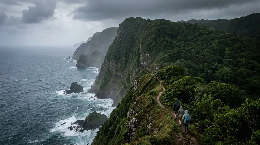
The northwest cliffs where escaped enslaved people built free settlements. A hike through one of the island's most important landscapes.
Maroon Ridge is the high cliff country on St. Croix's north-west corner where escaped enslaved people built free communities — Maroonberg, the Danish maps called the area — beyond the reach of the plantations below. Since August 2025 the ridge has sat inside the largest territorial park in the U.S. Virgin Islands, and it remains one of the most important landscapes on the island. This page covers the history in full, the hike as it exists today, and the conduct the ground asks of anyone who walks it.
Who the Maroons were
Across the Caribbean, enslaved people who escaped and lived free outside the plantation system were called maroons, from the Spanish cimarron. Every sugar island had them; St. Croix had an unusual concentration, and a landscape that let them last.
Denmark bought St. Croix from France in 1733 and turned it, within a generation, into one of the most intensively planted sugar islands in the Caribbean. The labor came from enslaved Africans, who outnumbered the island's white residents by roughly ten to one. From the beginning, some of those people ran. Escape took two main forms. Petit marronage meant short absences — days or weeks away, often to visit family on other estates. Grand marronage meant leaving for good: into the bush of the north-west mountains, or across the water toward Puerto Rico.
The scale is documented. A count in 1791 recorded about 1,385 people listed as runaways out of an enslaved population of roughly 14,400 — close to one in ten. Researchers working on the island today estimate that the ridge community, at its height, held more than a hundred men, women and children. These were settlements, with gardens, shelters and defenses, sustained for decades in the hardest terrain the island offered.
Why they chose the north-west
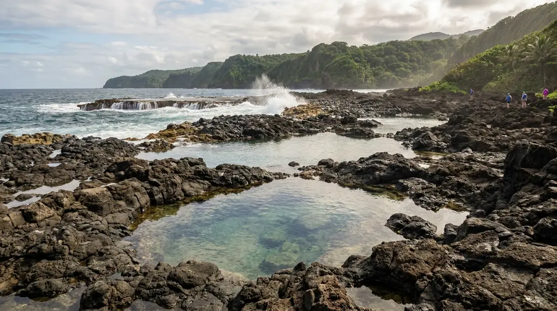
The choice of ground was tactical. The north-west corner is the steepest, wettest, most densely forested part of St. Croix — the island's rain concentrates there, which is why the hills carry closed-canopy forest while the East End grows cactus; the full explanation is in Two Landscapes, One Island. Slopes drop hard to a coast with no harbor. Cliffs meet the sea. For a planter's militia the area was close to unworkable; for people who needed to disappear, it was the best ground within walking distance of every estate on the island.
The Moravian missionary Christian Oldendorp, who toured the Danish islands in 1767 and 1768, described the north-west highlands as an almost impassable Maroon Mountain and wrote that the maroons had held their position on the heights for a long time. His account, published in 1777, records how they defended it: thick bush that swallowed any line of approach, and sharpened wooden stakes — poisoned, he reported — set along the paths. He noted what they ate, including the fruit of the soursop tree, and something more striking: some of the free community walked down to the public markets in daylight to trade for what they needed, then vanished back into the hills. In a market crowd of hundreds, nobody could tell a maroon from an enslaved person on an errand. The colony had codified market rules in 1755 precisely to control that kind of movement, and enforced them poorly — a gap the free community exploited for years.
Maroonberg in the Danish record
The community was never a secret. It was simply out of reach, and the paper trail the Danes left behind proves both points.
The earliest detailed island maps, drawn by Cronenberg and von Jaegersberg in 1750, show the north-west hills as the one region without surveyed estates. Court records from 1752 describe two recaptured runaways, one of whom had lived free in the hills for six years. By the time of Oldendorp's visit, the names Maroonberg — Maroon Mountain — and Maroon Hole, a spot on the coast, were in general use across the Danish West Indies as the known destination for runaways. Peter Oxholm's 1794 map still labels the heights, even as the estates closed in around them. The names outlived the colony: twentieth-century United States topographic maps carry Maroon Ridge and Maroon Hole to this day, which is why the modern park, the hiking calendars and this page all still use them.
A short timeline of the documented record:
| Year | What the record shows |
|---|---|
| 1733 | Denmark purchases St. Croix from France; sugar expansion begins |
| 1750 | Cronenberg map shows the north-west hills unsettled — the maroons' ground |
| 1752 | Two runaways recaptured; one had lived six years at Maroonberg |
| 1758 | Over a hundred enslaved people attempt to seize a vessel for Puerto Rico; the plan fails |
| 1761 | Seventeen people take a boat for Puerto Rico; nine die in the attempt |
| 1767 | Denmark and Spain agree to return each other's runaways; Oldendorp tours the islands |
| 1770 | Royal Danish American Gazette begins publishing; early issues carry frequent runaway notices |
| 1794 | Oxholm's map shows estates covering nearly all formerly unsurveyed land |
| 1848 | Emancipation declared at Frederiksted after a mass uprising |
| 2025 | The V.I. government buys 2,386 acres of the north-west as a territorial park |
The hunts and the laws
Danish colonial law treated marronage as a crime against property, and the penalties were designed to terrify. The slave codes of the era prescribed mutilation for prolonged absence — the loss of a foot for months away, with repeat escape punished on the other — alongside branding and execution for those judged ringleaders. Planters organized armed searches into the hills, sometimes with dogs. Oldendorp's account is telling on this point: he reported that in the late 1760s the hunts were no longer being carried into the high Maroon country at all. The terrain, the traps and the certainty of ambush had priced the mountain out of reach. The free community's defense worked.
What the militia could never win with force, the economy won with acreage. Through the 1750s and 1760s, new animal mills appear in the records at Mount Stewart, Prospect Hill, Oxford, Mount Victory, Rose Hill and Wills Bay — estate names that still hang on the north-west map, several of them now inside the park. Each new estate pushed cleared cane land higher into the hills and shaved territory off the refuge. Modern geographic modeling of the two map generations puts numbers on it: the land suitable for hidden settlement shrank by more than 90 percent in about fifty years. The runaway notices tell the same story from the other side. The island's first newspaper printed ten in its first eight issues in 1770; by the 1790s, the July issues researchers have examined carry none.
Escape by sea
The ridge was one road out. The other was the water, and for much of the eighteenth century it was the better one. From the north-west heights, Vieques is visible on a clear day, roughly 50 miles off, with Puerto Rico beyond it at about 65. Spain, hostile to Denmark's Protestant colonies, offered sanctuary: fugitives who reached Spanish soil and converted to Catholicism were, by royal policy confirmed at mid-century, free. Crucian maroons knew it, and the colonial files record what they did about it — the mass vessel seizure attempted by more than a hundred people in 1758, the seventeen who took a boat in 1761 and lost nine of their number to the sea, and a steady traffic of smaller crossings in canoes and stolen craft. Denmark eventually fought the drain with diplomacy instead of patrols: the 1767 treaty with Spain provided for returning each other's runaways, closing the legal door Puerto Rico had held open.
Recent scholarship has put the sea at the center of the story. The archaeologist Justin Dunnavant, whose research began with the records of the enslaved community at Estate Little Princess, has mapped currents and seasonal winds to reconstruct the crossing routes, arguing that African maritime knowledge — fishermen who understood the channel — guided the traffic. One documented case he cites is a fisherman named Mattadore, who fled captivity by water. The ridge and the crossing were parts of one system: the heights offered concealment, a lookout over the channel, and the shortest open-water line to free soil.
The destination shifted with the politics. After Britain abolished slavery in its colonies, Tortola — visible from St. Croix's east end and free soil from the 1830s — joined Puerto Rico as a goal for escapes by sea, and the record shows crossings in that direction from 1833 onward. Danish St. Croix itself would not reach emancipation until fifteen years later, and it took an uprising to force it.
The cliffs and the oral tradition
Every account of Maroon Ridge eventually arrives at the cliffs, and this is where a careful page has to separate what is documented from what is remembered. Crucian oral history holds that when capture became certain, people leapt from these cliffs into the sea rather than return to slavery. Some tellings frame the act as suicide before re-enslavement; others frame it as a leap toward freedom — an attempted escape by water from the only edge available, or, in the spiritual language some traditions use, a return home. The Virgin Islands ecologist and historian Olasee Davis, who has walked and taught this ground for decades, describes the ridge as sacred ground for exactly this reason.
No Danish document has been produced that records a specific leap, which is unsurprising — the events the tradition describes had no colonial witness, and the colony had no interest in recording them. Scholars treat the tradition with respect as memory carried forward by the community, and this page does the same: it is presented here as oral history, and it is the reason visitors are asked to treat the ridge as memorial ground rather than a viewpoint. Whatever the precise events, the documented record — the hunts, the mutilation statutes, the drownings in the channel — makes the choice the tradition describes entirely credible.
The search for the settlements
Here is a fact that reframes the whole hike: the settlements have never been found. People lived free on this ridge for decades, in numbers, and more than two centuries later archaeology has yet to locate a single confirmed structure.
The search is active. Dunnavant, now at UCLA, works with Steven Wernke of Vanderbilt's spatial analysis laboratory and Lauren Kohut of Winthrop University, building on GIS modeling first attempted by Bo Ejstrud in 2008. The team layers the 1750 and 1799 Danish maps over modern elevation models built from NOAA LiDAR flown in the 2010s, then models where a community needing concealment, water, garden ground and escape routes would have settled — a method sometimes called counter-mapping, reading the landscape from the fugitives' point of view rather than the colonists'. The difficulty is the point. The builders were hiding from professional searchers with every incentive to find them, they favored semipermanent structures they could abandon quickly, and the forest has had 250 years to close over the rest. The absence of ruins is itself the historical evidence: they were that good at disappearing.
So walkers should be clear about expectations. There is no marked ruin, no foundation to photograph, no interpretive sign standing where Maroonberg stood. What the ridge offers is the ground itself, unchanged in its essentials — and that turns out to be enough.
Maroon Sanctuary Territorial Park
In August 2025, after a campaign Olasee Davis had led for decades, the Virgin Islands government purchased 2,386 acres of the north-west — close to four percent of St. Croix — as the Maroon Sanctuary Territorial Park, the largest territorial park in the U.S. Virgin Islands and the largest land purchase in the government's history. The Trust for Public Land and local conservation partners helped assemble the deal. The park takes in the ridge and cliffs, the forested heights above Annaly and Wills Bay, and stretches of the north coast; the St. Croix Hiking Association and the V.I. Trail Alliance are involved in trail work. It is a new park on old ground, and visitor infrastructure is still thin to nonexistent — expect land protection, at this stage, rather than facilities. Rules and access arrangements are likely to develop over the next few years, which is one more argument for going with a local guide who knows the current state of things.
Walking the ridge today
There is no single signed Maroon Ridge trail. What exists is a network of old roads and footpaths across the heights, walked regularly by local groups, with three practical ways in.
From Ham's Bluff
The most common approach extends the lighthouse walk described in our Ham's Bluff guide. That leg is short and steep — well under an hour up at a vacation pace — and ends at the 1915 cast-iron tower on open bluff about 360 feet over the sea. The ridge country runs east from there toward Annaly. Beyond the lighthouse the walking changes character: longer, rougher underfoot, intermittently overgrown, with real exposure to sun and, near the edges, to the cliffs themselves. Turn-around time, water and footwear stop being suggestions on this stretch. Note that the drive to the trailhead is its own subject — the lane past Ham's Bay is rough, and the unpaved forest roads above it are covered in the Scenic Road guide.
From the Carambola side
From the north-shore trailhead by the Renaissance Carambola resort, the route toward Annaly Bay skirts the eastern edge of the park, and a branch climbs toward Wills Bay — hikers report roughly 45 minutes to the Wills Bay overlook at an easy grade, though conditions vary with maintenance. This side gives the forest-and-coast version of the landscape without the cliff-edge walking.
With the hiking association
The St. Croix Hiking Association's Maroon Country outings are the full immersion: recent ones have met at Frederiksted beach at 6:30 a.m. and covered six to seven miles of hills and coastal rock in three to five hours, led by Olasee Davis, who narrates the history on the ground it happened on. This is, in our view, the way to do it the first time.
Routes at a glance
Figures below are hedged from published trail descriptions and recent hike reports; there is no official mileage on this ridge, and conditions move with the seasons.
| Route | Length | Difficulty | Access |
|---|---|---|---|
| Ham's Bluff lighthouse out-and-back | About 1.6 miles round trip, roughly 270 ft of climb | Moderate; steep but short | Rough lane off Rt 63; solo feasible, morning best |
| Ridge extension east of the lighthouse | Variable; add 1–3+ miles | Hard; overgrown stretches, sun, cliff exposure | Unmarked; strongly favor a guide |
| Carambola to Wills Bay overlook | Roughly 45 minutes each way | Easy–moderate | Trailhead near the Carambola resort |
| Carambola to Annaly Bay tide pools | About 3.6 miles round trip, ~550 ft of gain | Moderately strenuous; hot, final scramble | Same trailhead; see the tide pools guide |
| Hiking Association Maroon Country hike | About 6–7 miles, 3–5 hours | Rough; hills and coastal rock | Scheduled group events; $10, $5 members, at last check |
Guided or solo
Our plain recommendation: do the lighthouse leg on your own if you like, and do everything beyond it with a guide. The reasons are practical. The ridge trails are unmarked and unmaintained in stretches, and route-finding mistakes here put you in thorn bush or above cliffs. Land status across the heights has historically been a patchwork of public parcels and private estate land, and while the 2025 park purchase resolved much of it, boundaries on the ground are not signed. Phone coverage is patchy. And the history is the point of the walk — a guide who grew up with it delivers the ridge in a way a map app cannot.
Who was running trips at last check:
- St. Croix Hiking Association — the nonprofit runs monthly public hikes across the island, including Maroon Country and Annaly outings, typically $10 per person ($5 for members; annual dues $30). Schedules post on their site and fill; check the calendar early in your trip planning.
- Olasee Davis eco-hikes — the UVI ecologist leads many of the association's north-west hikes and has taken thousands of people across this ground; if his name is on the event, book it.
- Bush Tribe Eco Adventures — lists Maroon Ridge among the trails it covers and runs a guided Annaly tide pools hike (about $50, 3+ hours, capped at eight people, at last check), plus custom trips; call 340-277-2503 about a ridge-specific outing.
- CHANT (Crucian Heritage and Nature Tourism) — the Frederiksted heritage nonprofit runs walking tours and eco hikes with a culture-first approach; ask what they currently offer in the north-west (340-277-4834).
- U.S. Virgin Islands Adventure Guides — certified local guides sell a half-day Maroon Ridge summit hike through booking platforms, graded beginner-to-intermediate.
Operators, prices and schedules on a small island change without notice; confirm everything when you book.
What you see up there
The walk delivers three things. First, the forest: the wet-side canopy closes over the lower trail — turpentine trees, ferns, vines, hermit crabs underfoot, butterflies where the light gets in, and wild goats on the steep ground. Guides point out medicinal plants the free community would have known and used; the botany here is a living archive, and recent writing about the park treats the plant life as part of the history. Second, the edge: where the trees open, the ground falls away to the sea, and you get the north coast running east past Annaly toward Davis Bay, with the water shading from shelf-turquoise to channel-blue. On the clearest days Vieques sits on the horizon — the sight line the maroons themselves watched, with freedom roughly 50 miles beyond it. Third, the lighthouse ruin on its bluff, rusting since deactivation and unsafe to enter, which most walkers treat as the turnaround.
What you will not see is any built trace of Maroonberg. Hold both facts at once — a hundred-person community lived here, and the ground shows nothing — and the landscape does its work.
Conduct on the ridge
This is memorial ground, and Crucians treat it that way. The asks are simple. Walk quietly; save the drone and the playlist for another beach. Take nothing — no pottery shard, no odd stone, nothing that could be a trace of the very settlements archaeologists are still trying to find; if something looks human-made, photograph it in place, note the location, and report it to your guide or the Department of Planning and Natural Resources. Pack out every wrapper. Stay on the walked paths, both for the land's sake and your own. And if you visit on an association hike, expect moments where the group stops and the history is spoken; that pause is the actual purpose of the trail.
The freedom-history circuit
The ridge is one chapter of the island's freedom story, and it reads best alongside the others. Estate Whim shows the plantation system the maroons escaped — see it first if you can, because the two places explain each other (the great house interior has been closed since 2017; the grounds and mill are open). Fort Frederik in Frederiksted is where the story the maroons started reached its end in 1848, when a mass uprising led by Buddhoe forced emancipation on the spot — that history has its own page, and the annual commemoration is covered in our Emancipation Day guide. A drive through the rainforest on Mahogany Road or past Creque Dam connects the geography; the full loop logic is in Driving the Island in a Day.
Practical notes
- Start early. The forest holds heat by mid-morning and the bluff tops have no shade. Association hikes meet at 6:30 a.m. for a reason.
- Water: a liter per person for the lighthouse leg alone; double or more for anything beyond. There are no taps, no facilities, no vendors anywhere on the route.
- Footwear: closed shoes with grip. The rock is loose, and slick after rain; thorn scrub punishes sandals.
- Tell someone. Leave your plan and turnaround time with someone at the villa. Phone signal drops out in the folds of the ridge.
- The trailhead: vehicle break-ins have been reported where the lighthouse walk starts. Bring nothing valuable and leave nothing visible in the car.
- Weather: the north-west is the island's wet side; after heavy rain, give the trails a day and stay out of the stream ravines.
- The cliffs: edges are undercut and unfenced. Keep a body length back, and keep children in hand on the bluff tops.
Questions guests ask
Can I hike Maroon Ridge without a guide?
The lighthouse out-and-back, yes — it is short, well trodden and hard to lose, though you should still go early, carry water and leave nothing in the car. The ridge country beyond it is a different proposition: unmarked routes, overgrown stretches, unsigned boundaries and cliff exposure. Fit, experienced walkers do it solo, but our standing advice is to take the first trip with the St. Croix Hiking Association or a local guide, learn the ground and the story, and decide afterward whether a return on your own makes sense.
How hard is the hike?
It scales. The lighthouse leg is a steep 30-to-40-minute climb most reasonably fit visitors manage. The Wills Bay overlook from Carambola is easier still. The full Maroon Country outings are rough — six to seven miles over hills and coastal rock in tropical heat, three to five hours — and the association describes them accordingly. Nothing here requires technical skill; everything here punishes too little water, bad shoes and a midday start.
Are there ruins of the maroon settlements to see?
No. The settlements were built to be invisible to armed search parties, favored structures that could be abandoned fast, and have never been located — archaeologists are currently hunting for them with LiDAR elevation data and predictive mapping. What survives above ground is the landscape itself, the place names, and estate-era ruins elsewhere on the island. Treat any human-looking trace you stumble on as potentially important: leave it exactly where it is and report it.
Is the story of people leaping from the cliffs true?
It comes to us as oral history, carried in the Crucian community for generations, and we label it that way. No colonial document records a specific leap — nor would one, given who kept the records. The documented context (mutilation statutes, armed hunts, deaths at sea during escape attempts) makes the tradition entirely plausible, and Virgin Islands historians treat the cliffs as sacred ground. Visitors should carry the story respectfully and skip the urge to stage photos at the edges.
What is the Maroon Sanctuary Territorial Park?
A 2,386-acre territorial park created in August 2025, when the V.I. government bought the forested heights and coast of the north-west after decades of advocacy led by Olasee Davis. It is the largest territorial park in the U.S. Virgin Islands, covering close to four percent of St. Croix. Expect protected land rather than a built-out park: at last check there were no visitor facilities, and trail work by local volunteer groups was ongoing.
When should I go?
First thing in the morning, any time of year. December through April brings the driest footing; September through November is greener, wetter and muddier underfoot. Association hikes run monthly year-round and post their calendar online. Avoid the days right after heavy rain, and avoid starting any leg of this walk after mid-morning — heat, not distance, is what turns people around.
Is Maroon Ridge the same as Ham's Bluff?
Neighbors, not synonyms. Ham's Bluff is the specific headland with the lighthouse, and its short steep trail is the usual gateway walk. Maroon Ridge is the larger cliff-and-forest country running east from there along the north-west coast — the ground the free settlements occupied, now the heart of the territorial park. Casual visitors often do the bluff alone and see the ridge from it; the history walk proper continues beyond.
Staying on St. Croix
Our villas sit on the island's east and north side, around Christiansted and the East End — which works well for this hike, since the west is best taken as a planned early-start day out. Drive over at dawn, walk the ridge in the cool hours, swim it off at Rainbow Beach, and be back on your own gallery by evening. The Cerulean and Sunset Sea-Clusion both make comfortable bases for guests who plan a history-heavy itinerary, and the full portfolio is at our villas page. If the freedom-history circuit matters to your group, tell us when you book and we'll help sequence the days.
Sources
Written from official and first-party sources, checked August 2026. Hours, prices and event dates change — confirm before you go.
In this guide
Stay nearby
On The Shoys beach: six bedrooms, six baths, pool and hot tub, room for twelve, and the beach through the back garden.
 Shoy's Beach House6 bd · 6 ba · sleeps 12 · Christiansted
More in Land & Adventure
Sources
12 references, listed in full at the end of this guide — official park, refuge, tourism-board and business sources, checked August 2026.