The Sugar Mill Ruins
More than 150 mills once turned on St. Croix. Their stone towers still stand in pastures and gardens — here's how to read them.
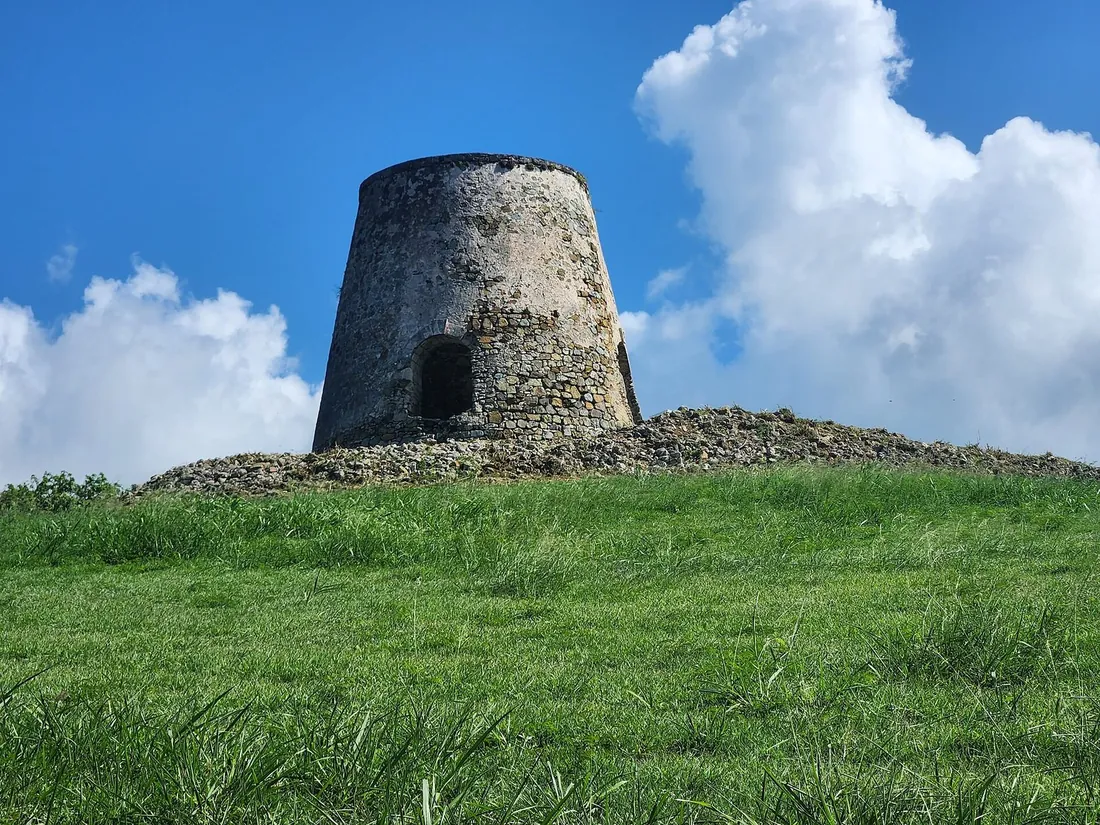
St. Croix is only about 84 square miles, and across two and a half centuries of cane it carried more than 150 windmill towers and dozens of animal-mill rounds, well over 200 sugar mills in all. Their stone stumps still stand in pastures, in gardens, in the yards of ordinary houses, and once you learn the shape you will count them from every road on the island.
This is the site's reference for those ruins as a whole: why one small island is so thickly covered in them, how to recognize the parts of a mill and read what each one did, the enslaved labor the ruins stand for, which ones you can actually walk into, which you only glimpse from the road, and how a visitor engages with them without doing harm. The full step-by-step of how cane turned into sugar and then rum, and the single mill on the island rebuilt to working order, lives at Estate Whim; this page stays with the ruins themselves, the ones scattered across the whole island.
Why the island is covered in them
The short answer is that St. Croix spent roughly the years 1750 to 1820 as one of the richest sugar islands in the Caribbean, and every estate needed a mill. Denmark acquired the island from France in 1733. Its chartered trading concern, the West India and Guinea Company, laid St. Croix out in a grid of plantation parcels through the 1730s. A single Danish officer, Peter Lotharius Oxholm, mapped the whole system near the end of the century; his survey, drawn around 1792 and published in 1799, remains the master document of plantation-era St. Croix. It divided the island into nine administrative Quarters, each a checkerboard of numbered estate plots of a standard size, close to 150 acres apiece.
Those plots filled up fast. Oxholm's own count for 1792 put 231 working estates on the island: 162 of them raising sugar, 33 in cotton, 27 in livestock, and 9 in mixed crops. Later tallies run higher still, past 200 sugar plantations at the height, in the decades when St. Croix went by the nickname the Garden of the West Indies. Cane is a crop that has to be milled within a day or two of cutting or the juice sours, so a plantation could not haul its harvest to a central factory the way later industries would. Each estate crushed and boiled its own cane on site, which is why a mill rose on nearly every parcel, and why their remains are now so evenly sprinkled across the land. The cost of all that cane was the forest: a territorial assessment estimates the island stood about 96 percent cleared by the 1830s. The green hills a visitor sees today are second growth that returned after the estates failed.
How many survive
Nobody can give a single tidy number, because the mills fell at different rates and some were quietly demolished, but a long-running volunteer survey has done the careful work. The Windmills of St. Croix project has pinpointed the locations of roughly 120 of the estimated 150-odd windmill towers ever built, and has added records for 47 more estates that ran animal mills rather than windmills. Add the steam plants that came later and the island's mill total lands somewhere around 200 structures. A handful have been restored; most stand as ruin in every degree, from a nearly whole tower to a ring of stones in the grass.
Three kinds of mill account for what you see. The windmill is the icon, the truncated stone cone that catches the eye from the road; it ran on the steady trade winds and needed them, which is why cane harvest was timed to the strong winter winds Crucians call the Christmas winds. The animal mill was older and cheaper, a mule, ox, or human-powered crusher that left a low circular platform rather than a tower. Steam arrived on the island in 1814 and slowly took over, leaving tall chimneys and iron machinery behind. By the mid-nineteenth century steam had passed wind as the island's main crushing power, and both were fading toward the collapse of the whole industry.
| The island in numbers | Figure |
|---|---|
| Sugar boom | Roughly 1750 to 1820, at its richest |
| Working estates in 1792 | 231 total: 162 sugar, 33 cotton, 27 livestock, 9 mixed |
| Sugar plantations at the height | More than 200 |
| Windmill towers built | Around 150; about 120 located by survey |
| Estates with animal mills | 47 documented |
| Enslaved population at its peak, 1803 | About 26,500 of roughly 30,000 residents |
| Administrative grid | Nine Quarters of numbered plots |
How to read a ruin
An estate was a small factory, and its buildings sat in a fixed relationship to one another, dictated by gravity and wind. Once you know the layout, a jumble of walls in a pasture resolves into a working site you can walk through in your head. Follow the parts in the sequence the cane moved through them.
The windmill tower
This is the shape everyone photographs: a thick-walled stone cone, wider at the base and tapering as it rises, usually twenty to thirty feet tall, almost always missing its top. That open crown is not decay in the ordinary sense; a wooden cap carrying the sails and the drive shaft once sat there and rotated to face the wind, and the timber went first, leaving the masonry ring you see. Look for a doorway at ground level and, often, a stone ramp that climbs to the crushing floor inside, where three upright rollers once stood to squeeze the cane. Low down you may find a second opening, where the crushed stalk, the bagasse, was raked out to dry for fuel. One grim detail belongs to the tower and is worth carrying past it: a turning windmill had no brake. The only way to stop it was to haul the sails clear of the wind, so a cutlass hung ready inside in case a worker's arm was dragged into the rollers.
The animal-mill round
Where an estate never built a tower, or where the tower has vanished, look instead for a low circular platform, sometimes ramped at the edge and sometimes sunk into the ground like a shallow bowl. Guides on the island call the sunken version a cockpit. Here a long beam radiated from a central set of vertical rollers, and mules, oxen, or the enslaved themselves were harnessed to it to walk the circle hour after hour, turning the crushers. A masonry gutter or basin nearby caught the juice. The round is easy to miss because nothing rises from it, but it is often the oldest working structure on the site, predating the windmill that may have replaced it.
The boiling house and copper works
Downhill of the mill, always downhill so the juice could run to it by gravity, lie the long low walls of the boiling house. This is usually the most broken part of a ruin, a footprint rather than a building, but its signature is a row of round sockets set into a masonry bench, where a train of copper kettles once sat over their own fires. Juice was ladled down the line from the largest, coolest copper to the smallest, hottest one and reduced to the point of graining into sugar. When you find the kettle sockets, you have found the heart of the operation.
The chimney
The tallest thing left standing on many estates is a free-standing stack, square or round, often the first mill feature a driver notices. It vented the fires under the boiling coppers and, on estates that modernized, the boiler of the steam engine that replaced the wind. A surviving chimney is a fair sign the estate ran steam power in its later years.
The great house and its yard
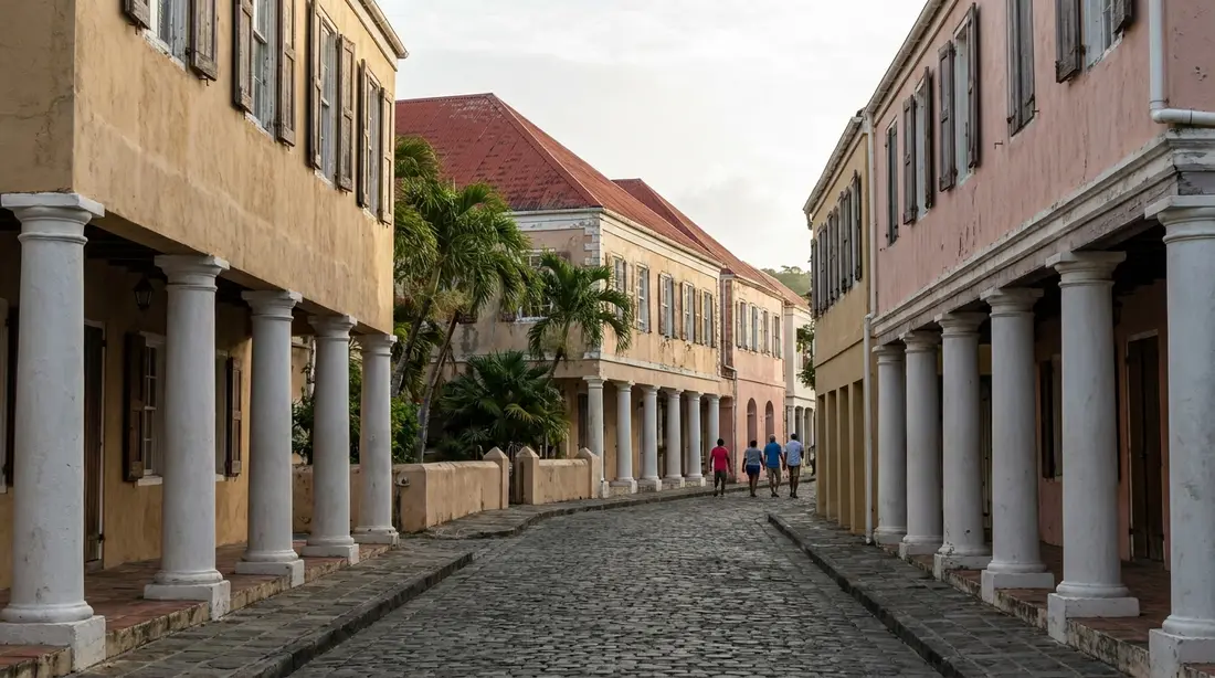
Set apart and usually upslope, to catch the breeze and to keep an eye over the works below, stood the planter's or manager's residence. Where it survives it is generally the best masonry on the site: thick walls of cut coral and local stone bonded with lime mortar, the same material the towns were built from, described in the Danish architecture guide. Around the house yard you may also trace the smaller service buildings, a detached cookhouse kept away from the residence so its fire could not spread, a cistern, a bell post that called the work gangs.
The village
The hardest part to see is the most important. Set at a distance from the great house stood the village, the quarters of the enslaved people who did every scrap of the work. It rarely leaves a standing building; look for regular lines of low stone footings in the grass, the foundations of the row houses. Reading the village against the great house, the two of them on the same ground and built for entirely different lives, is the point of standing in a ruin at all. That story has its own section below.
What each of these did in sequence, cane between the rollers, juice down the copper train, raw muscovado sugar packed into molds while the molasses drained off to the rum still, is walked through in full at the Estate Whim museum, where a windmill has been rebuilt to complete working order and a docent can show you the machinery. Pair that visit with any roadside ruin and the pile of stones starts to make sense.
What each part did
| Part of the ruin | What it did | How to recognize it |
|---|---|---|
| Windmill tower | Crushed cane between rollers, driven by the trade winds | Truncated stone cone, open roofless top, doorway and ramp |
| Animal-mill round | Crushed cane, driven by mules, oxen, or people | Low circular platform or a ring sunk into the ground |
| Boiling house | Reduced the juice to sugar over a train of copper kettles | Long low walls with round kettle sockets, set below the mill |
| Chimney | Vented the boiling fires, later the steam boiler | Tall free-standing stack, often the estate's high point |
| Great house | Owner or manager residence, overseeing the works | Best-preserved masonry, set apart and usually upslope |
| Cookhouse and cistern | Estate kitchen and water storage | Small detached outbuildings near the house yard |
| Village | Homes of the enslaved workforce | Rows of low stone footings, set away from the great house |
The people the ruins stand for
Every one of these mills depended on enslaved Africans and their island-born children for its labor, and the towers are monuments to that work before they are anything else. The scale is plain in the census. By 1803, near the peak of the boom, about 26,500 of the island's roughly 30,000 people were enslaved, close to seven of every eight residents. The Danish crown had formally abolished the transatlantic slave trade in 1792, but the ban did not take effect until 1803, and in the grace years between, planters imported people faster than ever to work the surging cane. The stones stand because those people were made to raise and run them.
The work reached into every hour. The St. Croix Landmarks Society's own account of plantation life records that half an hour before sunrise the driver, the bomba, blew a conch shell or rang the estate bell to turn out the gangs. Men and women worked side by side in the fields cutting cane with curved bills; children and the elderly were set to lighter tasks, clearing trash and loading the cut stalk onto carts and mules. Digging the cane holes by the thousand with hand tools, hauling, feeding the rollers, and tending the coppers were the heaviest jobs, and in crop time the mill and boiling house ran around the clock, because juice cannot wait. The most skilled positions, running the windmill and judging the coppers, carried real knowledge; the master boiler, who called the exact moment the syrup would grain, was among the most valued workers on any estate. The enslaved masons and carpenters also built the walls a visitor now admires, in coral and cut stone.
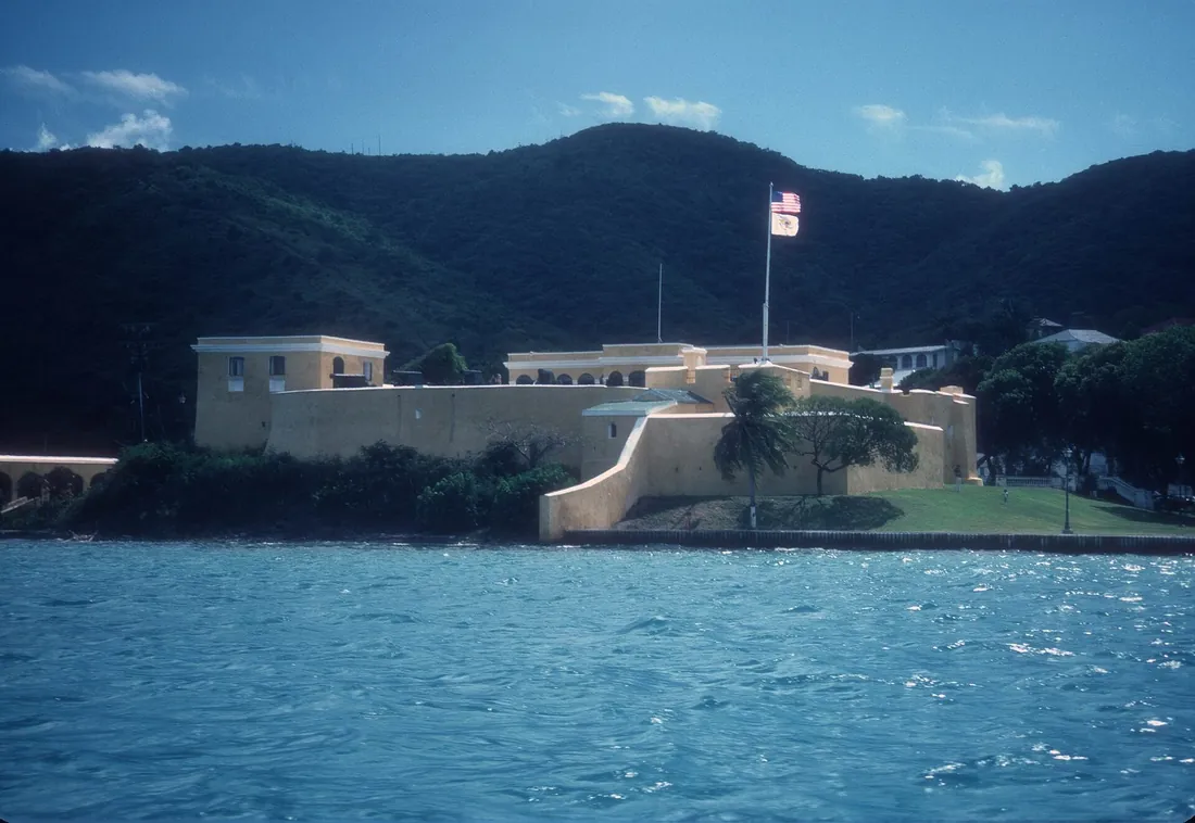
The village where these families lived began as wattle-and-daub huts and, over generations, became rows of two-room stone houses, each with a provision ground where people grew their own food and kept animals, a thin margin of self-sufficiency inside bondage. Conditions were deadly: respiratory disease, malaria, and fevers from bad water killed enslaved workers and planters alike, and the enslaved population could not sustain itself without constant new imports. Freedom came on July 3, 1848, when the enslaved forced the issue at Fort Frederik and the governor-general proclaimed emancipation; that story is told at Fort Frederik and Emancipation Day. What replaced slavery was a harsh contract-labor system that exploded thirty years later in the 1878 Fireburn, when workers burned Frederiksted and roughly fifty estates, covered in the Fireburn guide. Many of the ruins you photograph carry fire scars from that October. To stand in one and see only picturesque stone is to miss what it is.
How the estates got their names
Start looking at a St. Croix map and the estate names take over: Jealousy, Upper Love, Wheel of Fortune, Judith's Fancy, Work and Rest, Golden Rock, Anna's Hope, Hard Labor, Barrenspot, Whim. They are the old plantation names, and most of them still label the neighborhoods, road signs, and villa addresses of the modern island. Naming estates became the fashion in the 1760s, and the names fall into a few clear groups.
Many honor a person. Judith's Fancy took its name from a woman tied to the estate, either an owner's daughter or Judith Aletta Kenney, whose gravestone lies on the ground. Anna's Hope, once simply called Robinson's Plantings, was renamed for a planter's daughter, Anna. William's Delight carries another owner's name. A second group is aspirational, names chosen to summon the wealth an owner hoped for or to ward off the ruin he feared: Golden Rock, Hope, Prosperity, Concordia, alongside the darker Humbug, Retreat, Stoney Ground, and Barrenspot. A third group is frankly emotional, and reads today like a diary of the planters' moods. Upper Love and Lower Love began as Old Love and New Love, both patented to a Frenchman named Lucas de Windt, and the estate that sits in the valley between them was named Jealousy. Work and Rest, Wheel of Fortune, Hard Labor, and the memorable Body Slob all belong here. Even Whim, the island's most-visited estate, wandered through Le Vert, John's Rest, and Wym before the current name stuck. The names outlasted the sugar by a century and a half, which means the road your villa sits on very likely carries the name a planter gave his cane in the 1760s.
Ruins you can visit
Most St. Croix mills stand on private ground, but a good handful are open, restored, or built into places you can enter. These are the ones to plan around.
Estate Whim is the one to see first: the territory's oldest sugar-plantation museum, on Centerline Road near Frederiksted, with an oval great house, a windmill rebuilt cap and all, an animal-mill round, two Glasgow steam engines, and the factory ruins, all interpreted. It is the working key to every other ruin on this list.
St. George Village Botanical Garden, a short drive on, is a different estate whose ruins, the great hall, sugar factory, blacksmith shop, and village foundations, now frame a botanical collection instead. You walk the plantation floor plan through the plantings, self-guided.
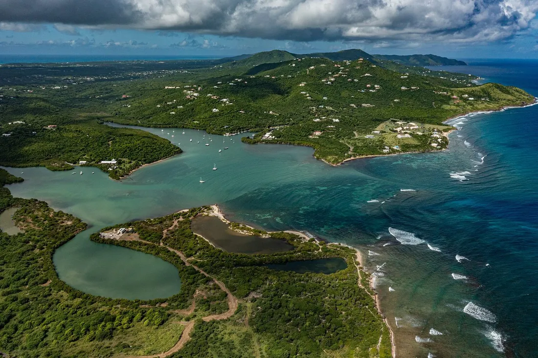
Estate Little Princess, on the north shore just west of Christiansted, is a former sugar and rum plantation held by The Nature Conservancy since 2011. On 24 of its original 200 acres stand a restored great house, a windmill, factory ruins, a laborers' village, and an unusual water-mill tower, linked by walking paths that run down to a quiet beach. Guided tours have run on Tuesdays at 2 p.m. at last check, for small groups; confirm before you go, since a small nonprofit's schedule moves.
Estate Mount Washington, in the hills of the west end, is private land whose owners let visitors take a self-guided stroll of its 13 acres. The draw is a fine animal mill set into the ground, the cockpit type, along with sugar-factory ruins, a rum-distillery footprint, a bell tower, and a cistern, plus a hillside labyrinth laid among the stones. The great house here was found buried in the forest in 1984 and cleared over the following years, which tells you how completely the bush can take an estate back.
Two working rum sites fold ruins into a tour. The Cruzan Rum Distillery at Estate Diamond has distilled on the same ground since 1760 and keeps an old mill on the property; the modern factory side of rum-making shows at the Captain Morgan Visitor Center. And up in the rainforest, Estate Mount Victory, with a factory, animal mill, steam chimney, windmill, and an 1841 schoolhouse, has stood on the National Register since 1978 and sits beside a public road; it is covered with the Creque Dam guide.
Ruins you glimpse from the road
The visitable sites are the exception. The rule is the tower you spot over a fence and cannot reach, and learning to enjoy those is most of the pleasure here. Centerline Road, the island's spine, runs through the old sugar plain and passes mill towers within sight of the pavement, one after another; the drive between Christiansted and Frederiksted is a slow-motion catalog of them. The north-shore and mid-island roads add more. Some sit in cattle pastures, some in cane fields gone to grass, and a surprising number stand in the yards of private homes, a two-hundred-year-old windmill serving as a garden feature behind a modern house. That ubiquity, a mill in an ordinary back yard, is the truest picture of how saturated this small island once was.
A few named estates are known roadside sights. Rust op Twist, on the north-shore road, is a handsome complex visible from the road but privately owned and closed to visitors at last check, exactly the kind of ruin to admire from the car and no closer. The dividing line across the whole island is simple: the museums, the Conservancy site, and Mount Washington welcome you onto the ground, and nearly everything else is someone's private property, to be seen from a public road and left alone. For the full circuit of towers, the island-loop drive is mapped in the drive-around-the-island guide.
Visiting a ruin without harming it
These are fragile, unstabilized structures on land that mostly belongs to other people, so a few plain rules keep both you and the ruin safe. Do not enter or climb ruins on private property without an invitation; as the island's own guidance puts it, common courtesy means you need an owner's say-so to explore a private site. Do not stand on the walls or on loose piles of stone, on any ruin: century-old masonry with no maintenance behind it shifts and drops without warning, and a windmill's crushing floor is a long fall. Take nothing, coral block, brick, or iron, and leave no trash. Photograph freely from public roads, which is where the roadside towers are meant to be enjoyed, and ask before you point a camera at anyone's home or yard. Watch your footing regardless of the site; the ground around a boiling house is uneven and often hides holes where kettles once sat.
The organized way to see many sites in one go is the St. Croix Heritage Trail, a 72-mile self-guided driving route that circles the island from Frederiksted to Point Udall and threads together around 200 historic and cultural stops, the sugar estates prominent among them. The White House Millennium Council named it one of 50 National Millennium Legacy Trails. Following the trail map, or simply keeping its ethic, turns a day of ruin-spotting into something coherent rather than random.
What is protected, and what is falling
Protection is uneven. A handful of estates carry federal protection through National Register listings, Estate Mount Victory since 1978 and Estate Whim among them, and the towns' historic districts protect the mills' urban cousins, the warehouses and great houses in Christiansted and Frederiksted. The St. Croix Landmarks Society maintains Estate Whim and keeps a research archive of estate records, and the Windmills of St. Croix survey has quietly done the essential first task of preservation, finding and documenting where the mills actually are before they disappear. The Nature Conservancy safeguards the Little Princess ruins as part of a protected shoreline.
Most of the island's mills, though, have no such shield. They stand on working farms and private lots, holding up against time on their own thick walls, and the weather is patient. Hurricane Hugo crossed the island directly in 1989 and damaged around ninety percent of its buildings; Irma and Maria did further harm in 2017, closing the Estate Whim great house interior, which remains shut. Each big storm knocks another cap-ring loose, drops another length of boiling-house wall. A tower that looks eternal is one strong season from becoming a mound. Seeing them now, and treating them gently, is not a small thing.
A sugar-history day
The usual plan puts sugar first thing, rum in the afternoon, and salt water to finish, with every stop a few miles from the next across the western half of the island. Open at Estate Whim when the gate does, to get the working mill into your eye first. Add the St. George botanical garden nearby, for the ruins-in-a-garden take on the same subject. Reserve an afternoon tour at Cruzan, where the industry still runs, then close with a beach and dinner in Frederiksted, with the west-coast sunset as the reward. On another day, pair Estate Mount Washington or the Little Princess tour with the rainforest ruins at Mount Victory on the Creque Dam road. If the weather turns, the covered and shaded stops slot into the rainy-day plan. Throughout, keep left the whole way; the habits are in the driving guide, and the wider natural landscape these estates reshaped is mapped in the two-landscapes guide.
Questions guests ask
Why are there so many stone towers on St. Croix?
Because the island spent roughly 1750 to 1820 as one of the Caribbean's top sugar producers, and cane has to be crushed within a day or two of cutting. That made a central factory impossible, so nearly every one of the island's 200-plus estates built its own mill on its own land. More than 150 of those were windmills, the conical towers you see, plus dozens of animal mills and, later, steam plants. When sugar collapsed the mills were simply left where they stood, which is why they now dot pastures, gardens, and back yards evenly across an island of only 84 square miles.
What is the difference between a windmill ruin and an animal-mill ruin?
Height, mostly. A windmill left a tall truncated stone cone, open at the top where its wooden cap and sails have rotted away; it ran on the trade winds. An animal mill left a low circular platform, sometimes sunk into the ground like a bowl, with no tower at all; mules, oxen, or enslaved workers walked a circle to turn its rollers. Windmills were the more powerful and expensive option and became the island icon, but animal mills were older and cheaper, and 47 estates are recorded as having used one. Both fed the same downhill boiling house.
Can I go inside the ruins?
At a few places, yes. Estate Whim, the St. George botanical garden, and Estate Mount Washington all let you walk their grounds, and the Little Princess estate offers a guided tour on Tuesday afternoons at last check. Nearly every other mill on the island stands on private property, where you need the owner's invitation to enter, and many are simply meant to be seen from the road. Never climb on ruins anywhere: the old masonry is unstable, and a windmill's inner floor is a real fall. Look, photograph, and leave the stones as you found them.
Which ruins can I see for free, without a tour?
Drive Centerline Road between Christiansted and Frederiksted and you will pass tower after tower within sight of the car, no fee and no gate needed. The mid-island and north-shore roads add more. Estate Mount Washington's self-guided walk is free at last check, and the roadside towers cost nothing to admire. The paid stops, Whim, the botanical garden, Cruzan, add the interpretation and the machinery, but the sheer density of ruins is something you take in for the price of a rental car and a slow drive.
Why do the estates have such strange names?
Naming plantations became fashionable on St. Croix in the 1760s, and owners drew on people, hopes, and moods. Some names honor a person, like Judith's Fancy or Anna's Hope. Some are wishful or superstitious, like Golden Rock, Prosperity, or the rueful Humbug and Barrenspot. And some are frankly emotional: Upper and Lower Love with Jealousy in the valley between them, plus Work and Rest, Wheel of Fortune, and Hard Labor. The names outlived the sugar and became the island's modern place names, so the neighborhood or road your villa sits on most likely wears a planter's name from 250 years ago.
Who built and worked these mills?
Enslaved Africans and their descendants, who made up close to seven of every eight people on the island at the peak in 1803. They quarried and laid the stone, dug the cane holes, cut and hauled the crop, fed the rollers, and tended the boiling coppers through the night in crop time, when the mills ran around the clock. Skilled enslaved workers ran the windmills and judged the sugar. They lived in villages set apart from the great house, the low stone footings of which still survive on many sites. The ruins are monuments to that labor first; emancipation did not come until 1848.
What were the towers made of, and why do they last?
Local stone and cut coral limestone, bonded with lime mortar burned on the island, the same materials that built the Danish towns. The walls are thick, often several feet at the base, which is why a roofless tower can stand for two centuries with no maintenance while its wooden cap, floors, and machinery vanish. That durability is also fragile in the end: each major hurricane loosens more masonry, and a tower that looks permanent can be reduced to a mound by one bad storm, which is why documenting and respecting them now matters.
Staying on old estate land
Chances are your villa sits on a former plantation. The whole island was carved into estates, and their names survive on the road signs, so an address on St. Croix is usually an old estate name. Our own Shoy's Beach House stands on Estate Shoys, just east of Christiansted, and The Cerulean and the wider East End homes sit on land that grew cane before it grew villas. Wherever you base yourself among our twelve homes, the mill ruins are a short drive away, and after this page the tower you pass on the way to the beach will read as more than scenery.
Sources
Written from official and first-party sources, checked August 2026. Hours, prices and event dates change — confirm before you go.
In this guide
Stay nearby
On The Shoys beach: six bedrooms, six baths, pool and hot tub, room for twelve, and the beach through the back garden.
 Shoy's Beach House6 bd · 6 ba · sleeps 12 · Christiansted
More in History & Culture
Sources
12 references, listed in full at the end of this guide — official park, refuge, tourism-board and business sources, checked August 2026.