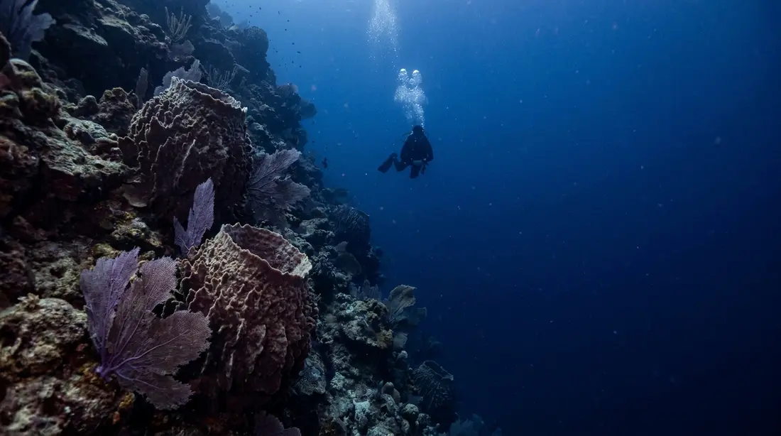
Diving the Cane Bay Wall
The drop-off starts about 40 feet down, roughly 100 yards off the beach, and falls toward the Puerto Rico Trench. A world-famous shore dive.
The Cane Bay Wall is the dive St. Croix is known for: a submarine cliff whose upper edge sits within a surface swim of a public beach on Route 80. You gear up by your car, walk in over sand, cross a few hundred feet of reef, and arrive at a place where the island stops and deep ocean starts. This page is the full site reference — why the drop exists, how the swim and the dive actually run, what lives at each depth, when the north shore lets you in, and the tank, guide and food logistics that make it a one-parking-lot day.
Why there is a wall here
St. Croix sits apart from the rest of the Virgin Islands, and the water that separates it from St. Thomas is some of the deepest in the region. The plate boundary responsible runs north of the islands: along the Puerto Rico Trench, the North American plate is being driven beneath the Caribbean plate, and NOAA's survey work puts the trench floor below 8,400 meters — beyond 27,000 feet, the deepest point in the whole Atlantic. That collision zone stretches past Puerto Rico and the Virgin Islands before curving into open ocean, and the stretching and faulting it generates opened the deep basin on St. Croix's north side, called the Virgin Islands Trough on the charts.
Cane Bay is where that geometry comes closest to a beach towel. The island's north-facing shelf is narrow here, so the edge of the shelf — the top of the wall — sits a short swim off the sand instead of miles out where only boats go. Past the edge, the bottom heads for the trough.
How far down it goes depends on which publication you trust. The island's visitor guide lists the Cane Bay drop at more than 3,200 feet; dive shops and the local press quote five figures, measuring all the way into the trough, whose own charted depths run past 13,000 feet and higher in places. Rather than pick a side, this page says the wall falls for thousands of feet and leaves the precise number to the survey ships. From a diver's perspective the dispute is academic: at recreational depths the view over the edge is the same either way — dark blue, no floor, and the occasional large animal treating the void as a travel lane.
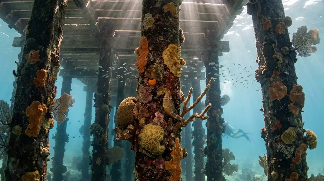
The swim out
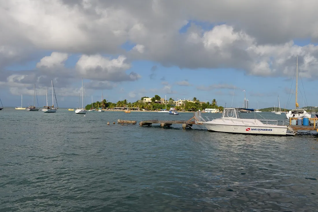
Every shore dive here starts the same way: enter over the sandy lane in front of the boat ramp, the one clear path through the rocky, urchin-holding shallows on either side. From there a sand channel threads between coral heads on a gentle outward slope, and you follow it — on the surface with a snorkel to save gas, or underwater once there is enough depth to make it worth breathing tank air.
The target is the white mooring buoy that marks the top of the site. Published distances for the swim disagree the way the depth figures do: older descriptions say about 100 yards, while the visitor guide's own dive write-up measures 200-plus yards from the ramp to the buoy. Call it a two-to-four-minute kick for a relaxed swimmer with fins, longer in chop, and budget energy accordingly — the standing local advice is to pace the surface swim so you reach the buoy rested rather than winded, because the dive has not started yet.
Guides here use a route locals call 3 Anchor Chute, one of several sand corridors that run between the reef structures toward the lip. The corridors matter twice: outbound they are the low-relief highway that keeps your fins off living coral, and inbound they are the navigation. Divers who note which chute they exited through, and the compass heading back to the ramp, skip the awkward long surface swim home.
The dive profile
Depth at the mooring runs in the high-20s to about 30 feet, and the reef rolls over into the true vertical face by roughly 40. That number is the whole reason this site works for ordinary certified divers: the interesting part begins inside Open Water limits, so nobody needs a deep card to look over the edge.
A standard guided profile is multi-level and shaped like a checkmark. Descend at or near the buoy, cross the rim, and drop down the face to the deepest planned point — commonly somewhere in the 60-to-100-foot range depending on certification, experience and gas plan. Work along the wall at depth for a stretch, then step the dive progressively shallower: back over the rim, across the coral gardens at 30 to 40 feet, and finally a long, slow meander through the 15-to-25-foot shallows toward shore that doubles as the safety stop. Done this way, the shallow return leg is a second dive in its own right rather than a chore, and the profile keeps most of its bottom time out of the deep zone.
The mooring itself is worth a word. The buoy exists so that boats never drop anchor on the reef — the site is moored, and dive boats tie off rather than hook in. For shore divers it serves as the descent reference on the way out and a mid-swim rest stop on the way home. Currents are usually mild, and the face itself gives shelter, though the shallows carry surge whenever swell is running; the days that matter for that are covered below.
Gas planning deserves more respect here than on a boat dive, because the tank has to cover the trip home as well as the dive. The conservative shore-dive convention — a third out, a third back, a third in reserve — maps neatly onto the checkmark profile: spend the first third reaching and working the face, turn the dive with two-thirds still showing, and let the shallow return leg run on the second third without dipping into the reserve. Divers who reach the ramp with ample gas planned it right; divers who hit reserve at the buoy have earned a long surface swim.
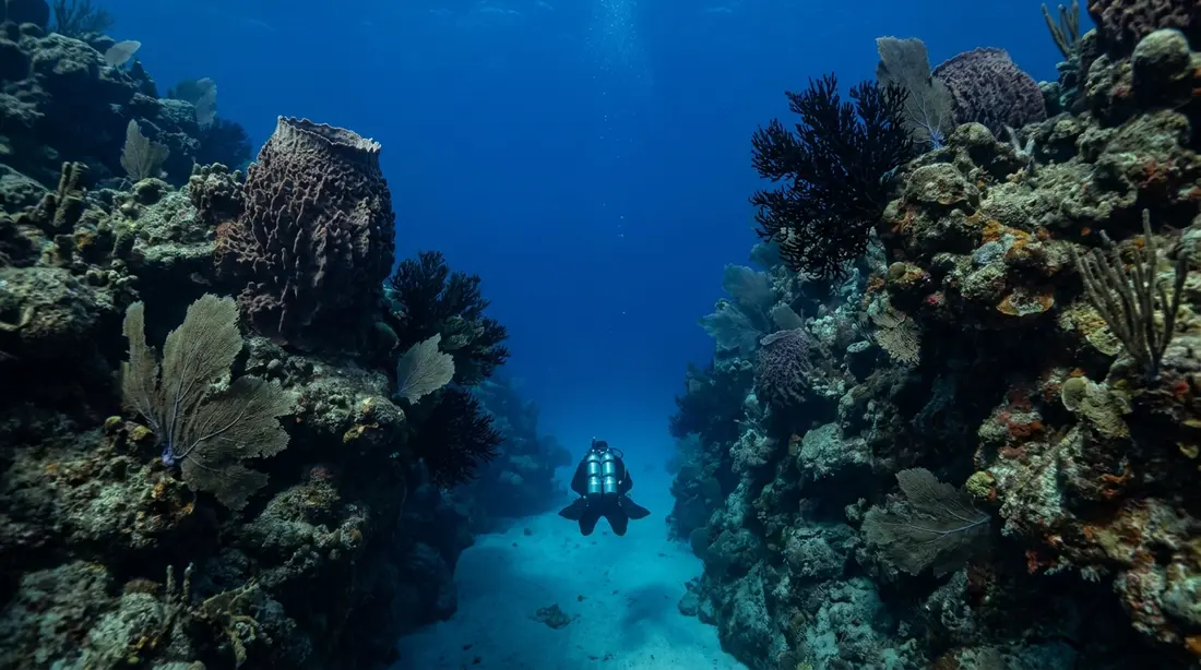
Time at the rim is the part people fly home talking about. With the reef at your back and nothing ahead, the sensation is closer to flight than to swimming — hold position at 50 or 60 feet, look down past your fins into water that returns no floor, and let the schooling fish and the occasional shark put scale on the emptiness. Photographers should commit one dive to wide-angle at the rim and a separate agenda to the small life inshore; the site punishes trying to do both on one tank.
What lives at each depth
The wall rewards divers who treat it as several habitats stacked on top of each other rather than one scenic backdrop. Working from the sand out and down, at last check the reliable cast looks like this.
The entry lane and inner shallows. Bare sand with scattered rock and coral heads. Conch plow the bottom, peacock flounder vanish against it, and the rocks either side of the lane bristle with sea urchins — the reason the clear sandy lane by the ramp is the entry. Small-subject hunters do well here: flamingo tongue snails on the sea fans, banded coral shrimp in crevices, nudibranchs for those who look closely, and an octopus now and then.
The reef flat and chutes, roughly 15 to 40 feet. Coral gardens divided by sand corridors, with sea fans and soft corals over the flats. Parrotfish and blue tangs graze here, trumpetfish hang in the gorgonians, angelfish work the coral heads, turtles and southern stingrays cross the sand, and yellowhead jawfish hover over their burrows in the rubble patches. This band is also where returning divers report the site's oddest resident: real seahorses among the soft-coral beds on the inshore leg — never promised, occasionally delivered.
The rim and upper face, roughly 40 to 100 feet. Sponges and hard corals armor the edge, schools of triggerfish and creole wrasse stack up in the water column, barracuda hold station just off the face, and Caribbean reef sharks patrol the blue side of the boundary. Nurse sharks turn up resting on ledges. This is also the band with the human artifacts, described in the next section.
The open blue. Nothing lives "at" the drop, and that is the point — the wall functions as a coastline for pelagic traffic. Dolphins pass on occasion. From late winter into spring, roughly March and April, humpback whales migrate through the deep water offshore, and divers sometimes hear them before anyone sees anything. The rare-sightings list kept by local shops includes hammerheads, mantas and — a handful of times — whale sharks. Expect none of them; enjoy the odds.
Depth bands at a glance
| Zone | Depth | Typical sightings |
|---|---|---|
| Entry lane and shallows | 0–15 ft | Conch, peacock flounder, urchins, flamingo tongues, banded shrimp, octopus on a good day |
| Reef flat and sand chutes | 15–40 ft | Parrotfish, blue tang, angelfish, trumpetfish, turtles, stingrays, jawfish; seahorses reported on the soft-coral beds |
| Rim and upper face | 40–100 ft | Triggerfish schools, barracuda, reef sharks, nurse sharks, sponges and hard coral, historic anchors |
| The blue beyond the face | bottomless for practical purposes | Occasional dolphins; humpbacks migrating offshore around March–April; rare hammerhead, manta and whale shark reports |
Sightings are habitat odds, never promises, and the roster shifts with season and sea state. The one constant is structure: coral inshore, wall at the rim, open water past it.
Anchors, chutes and the restoration garden
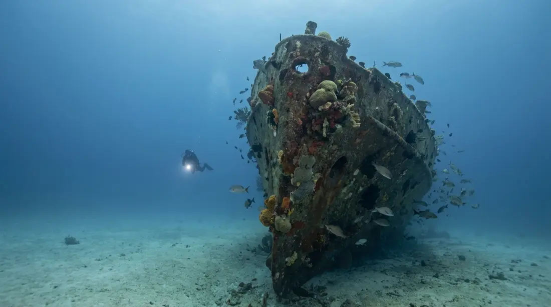
Two features give the site a sense of time. The first is iron: anchors from nineteenth-century ships lie on the reef where they were abandoned or lost, heavy enough that no storm has moved them since. The chute guides use as their outbound highway takes its local name from a group of them. Finding an anchor mid-dive is a reliable thrill precisely because nothing about the reef announces it — a shape too regular for coral resolves, as you close in, into a two-century-old piece of seamanship.
The second feature points forward instead of back. Conservation crews maintain a coral restoration garden in the shallows, marked at last check by an orange buoy north of the main line back to shore, where nursery-grown fragments are planted out to rebuild stands of the branching corals this coast has lost. Staghorn and elkhorn — both federally listed as threatened — still grow wild on the reef flat here as well. The practical takeaway for divers is buoyancy: this reef is part museum and part nursery, and neither category benefits from a dragged gauge or a misplaced fin kick.
When the wall lets you in
Cane Bay faces north, and the calendar of this dive is the calendar of north-facing water in the Caribbean.
Winter, roughly December through March, is when the site gets moody. The trade winds strengthen — the Christmas Winds — and, separately, storms far out in the North Atlantic send long-period swell south. That swell can arrive under blue skies with no local wind at all and still put heavy surge across the reef flat and breakers on the entry, and when it does, the wall is off the menu for a day or several. Local shops watch the forecast and relocate to the island's sheltered west side rather than fight it; the pier and wrecks at Frederiksted are the standing plan B that keeps dive vacations intact. The fix for travelers is scheduling: put the wall early in the trip so a swell event postpones the dive instead of deleting it.
Summer and early fall are the site's glass season — the flattest water, the easiest entries and the best of the visibility, with tropical-weather watching as the trade-off; the hurricane season guide covers how the island actually lives with that. Day to day in any month, the pattern is the classic one: calm mornings, building trade-wind chop after midday. Dive early.
Visibility at Cane Bay runs about 20 to 60 feet depending on season, sea state and runoff after rain — good Caribbean water, though noticeably shy of the 100-foot averages the lee coast posts. Water temperature is warm year-round; a skin or 3mm suit covers nearly everyone.
Conditions windows
| Period | What to expect | Planning move |
|---|---|---|
| Dec–Mar | Christmas Winds; periodic long-period north swell; surge over the reef flat | Schedule the wall early in the trip; hold Frederiksted as the fallback |
| Mar–Apr | Swell events taper; humpbacks migrating in the deep water offshore | Ask the shops what has been passing through |
| May–Oct | Calmest seas and easiest entries of the year | Best window for independent shore dives and the snorkel swim |
| Any month | Calm mornings, trade-wind chop after midday | First tank in the water before noon |
Shore-dive logistics
Few dives of this caliber anywhere run on less infrastructure. The beach is public, on Route 80 about midway along the north shore — plan on 25 to 30 minutes' drive from Christiansted, similar from Frederiksted, and note that rideshare apps do not operate on St. Croix, so this is a rental-car outing (see driving on the left). Parking is roadside along the bay; on weekends the spaces close to the ramp go by mid-morning, and a diver hauling tanks wants one of them.
Tanks and gear are solved across the road. Sweet Bottom Dive Center operates a full-service shop directly opposite the beach — its second location besides the one at the Carambola resort down the coast — with tank rentals and fills including nitrox, rental kit, gear servicing, retail, guided shore and boat dives, and PADI instruction through the professional ratings as a 5 Star Instructor Development Center; at last check the shop was run by owners Mark and Laura Linse. The convenience is hard to overstate: certified divers with their own gear can rent cylinders, cross the road, dive one of the Caribbean's marquee sites, and hand the empties back an hour and a half later.
Food and the after-dive hour are equally close. The Landing Beach Bar operates on the sand itself, with a deep list of local Leatherback beers and plates that cover seafood through vegan. AMA at Cane Bay serves Caribbean-American dinner over the water Tuesday through Saturday at last check. One caution for returning visitors: Eat @ Cane Bay, the longtime lunch stop, has closed, so those two are the current options. Facilities beyond that are minimal — this is a beach with a boat ramp, a road and hills behind it, and shade is whatever sea grape tree you claim. Freshwater gear rinse is best planned for your villa; every home we manage has an outdoor shower that handles salty kit.
The rest of the beach day — sand, the annual Mardi Croix parade, the full eat-and-drink picture — has its own page: Cane Bay beach.
Guided dives and boat options
Two operators were running the wall regularly at last check, and both appear in the island-wide scuba guide with the rest of the verified roster.
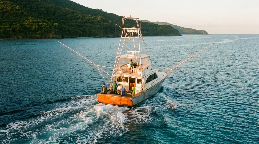
- Cane Bay Dive Shop — based at 2 Strand Street in Frederiksted despite the name, open seven days, PADI 5 Star. At last check its guided Cane Bay Wall shore dives ran Tuesday through Saturday at 1:30 pm with a six-diver cap, and its boat, the 36-foot Newton IBIS, loaded at the Salt River marina around 8:30 am for two-tank north-shore mornings that cover other stretches of the same wall system — the sections no swim reaches.
- Sweet Bottom Dive Center — the shop across the road, running guided shore dives on this site plus boat and guided trips along the Davis Bay and Cane Bay wall stretch from its Carambola base.
A guided first dive is the right call even for experienced divers, and cheap insurance for everyone else: the guide knows the day's surge, the correct chute out and back, where the anchors are, and which coral head hid a seahorse this week. After one orientation, independent shore diving is routine for certified buddy teams — that independence is most of the site's appeal. Prices and schedules move; book direct and confirm times, and in winter book a day or two out.
Divers working on certifications will find the site built into the local training scene — the shallows serve as a skills platform with a wall dive 200 yards away for graduation day. Course options island-wide are covered in learn to dive on St. Croix.
The night dive
After dark the wall trades its scenery for its residents. Coral polyps open to feed, lobsters and crabs come out of the ledges, octopus hunt across the flats, and sleeping parrotfish wedge into the reef in their mucus cocoons. The structure that makes the site easy by day makes it navigable by night — the sand chutes read clearly in a light beam, and depth control is simple with the reef flat as reference. Local shops run night dives on their schedules, and Cane Bay Dive Shop has long advertised the wall after dark as a specialty; conditions permitting, it is one of the two headline night dives on the island. The other, the Frederiksted Pier's macro circus, is a different show entirely — the island-wide night diving guide compares them. Go guided at night here regardless of experience: this is an exposed north-shore site, and the judgment call about surge belongs to someone who saw the water that afternoon.
Snorkeling the wall
Non-divers can visit the top of the drop, with caveats. From the beach, a strong swimmer with fins can cross the reef to the lip and look down into the blue from the surface — a genuine open-ocean moment available for the price of a mask. The inner reef closer to shore is the easier version and an excellent snorkel in its own right, with parrotfish, turtles and the branching corals in comfortable depths. The rules of engagement: calm mornings only, fins and a buddy for the outer swim, and no shame in judging the lip too far — most visitors see the wall itself with a dive shop instead. Spot-by-spot detail, gear notes and the skill ladder live in the snorkeling guide and the shorter best snorkeling beaches list.
Safety on a site with no bottom
The Cane Bay Wall's accident profile is shaped by one fact: past the rim, the reef stops telling you how deep you are. On a flat reef the bottom enforces your limit; on a wall, nothing does, and clear water flattens depth perception enough that 90 feet can look like 50. The countermeasures are unglamorous and completely effective. Set a maximum depth before the dive and treat the computer, its alarm, and your gauge checks as the terrain you no longer have. Watch gas with extra margin, because depth spends it faster and the exit still includes a swim. Keep positive control of buoyancy at the rim — the classic wall error is drifting down while looking down.
Around the dive: fly a surface marker or dive flag on independent shore dives, since small-boat traffic uses this coast; give the DAN flying-after-diving minimums their due when the trip ends — 12 hours after a single dive, 18 after repetitive days, more after decompression exposure, with the full framework in the scuba guide; and skip solo diving here entirely. Territorial law prohibits sunscreens containing oxybenzone, octinoxate or octocrylene — pack mineral-based lotion — and keep hands off everything — the wall's surfaces are alive, some of them sting back, and the anchors are the only antiques that can take the handling.
Questions guests ask
How hard is the swim to the wall?
Manageable for anyone who is comfortable in open water with fins, and tiring for anyone who is not. Published figures put the buoy between 100 and a bit over 200 yards off the ramp depending on the measuring point — a few minutes of steady kicking on a calm morning. Chop and surge change the math quickly, which is why the standing advice is to pace yourself, snorkel rather than breathe tank gas on the surface, and arrive at the descent point rested. If the swim sounds like the hard part, book a guide the first time; if it still sounds hard, take the boat version.
Is the wall suitable for a brand-new Open Water diver?
Yes, with a guide and a conservative plan. The rim sits around 26 to 40 feet — inside entry-level limits — so a new diver can experience the drop without ever going deep. What the site demands is buoyancy control and depth awareness, exactly the skills freshest in a new diver's training. A sensible first profile stays at or above 60 feet, keeps the wall on one shoulder, and spends the back half of the dive in the shallow gardens. The shops here run this dive for new certifications constantly.
Do I need a guide, or can we shore-dive it ourselves?
Certified buddy teams dive it independently every day, and no rule requires a guide. The strong recommendation is one guided orientation first: entries, the correct chute, the navigation home and the local read on surge are all things a guide transfers in one dive that trial and error teaches slowly. After that, rent tanks across the road, fly a flag, plan gas and depth like adults, and enjoy one of the few serious wall dives anywhere that starts at a parking spot.
What is the deepest part, really?
Deeper than the sources agree on. The visitor guide's dive pages say the drop exceeds 3,200 feet; shops and local writers cite figures past 13,000 by measuring into the Virgin Islands Trough, the deep basin between St. Croix and the northern islands, which connects to the Puerto Rico Trench system — the Atlantic's deepest water at more than 27,000 feet, per NOAA. This site splits no hairs: thousands of feet, no bottom a diver will ever see, and the top 100 feet are where the entire dive happens anyway.
Can snorkelers see anything, or is it divers-only?
Snorkelers get two real experiences here. The inner reef is a first-rate shore snorkel on its own — corals, parrotfish and turtles in relaxed depths a short swim out. Strong swimmers on calm mornings can continue to the lip and watch the bottom vanish from the surface, which is as close as anyone gets to the wall without a tank. The drop itself reads as deep blue from above rather than a visible cliff face, so manage expectations, take fins and a buddy, and go early before the wind.
Where do we get tanks and gear at the beach?
Directly across the road. Sweet Bottom Dive Center's Cane Bay shop rents cylinders and full kit, fills air and nitrox, services gear and runs guided dives, at last check open as one of the shop's two locations along this coast. Cane Bay Dive Shop, based in Frederiksted, also runs scheduled guided shore dives at the site and rents tanks from its shop. Nothing about this dive requires bringing gear across an ocean; a mask that fits your face and your own computer are the two items worth packing.
When is the site unusable?
Mostly during winter north-swell events. From roughly December through March, long-period swell from North Atlantic storms periodically arrives — sometimes under windless blue skies — and puts surge and breaking water across the reef flat for a day or several at a time. Local shops simply move operations to the sheltered west coast until it passes. Trade-wind chop also builds most afternoons year-round, which makes mornings the default. Summer and early fall are the reliable flat season. When in doubt, call the shop across the road; they looked at the water an hour ago.
Staying near the wall
Cane Bay sits on Route 80 within a 25-to-30-minute drive of Christiansted, which puts every home in our collection in day-trip range of the wall. The East End villas and beachfront homes reach it by one scenic north-shore road, with the Christiansted boardwalk's boats and restaurants on the way home; the west-end homes trade that for shorter runs to the Frederiksted Pier and the wrecks, the natural pairing on days the north shore is closed. Divers should look for what a dive week actually uses: an outdoor shower, a shaded rail where wetsuits drip, and space to stage gear — standard equipment at our properties. Pair the wall with Davis Bay, ten minutes west, for the after-dive beach.
Sources
Written from official and first-party sources, checked August 2026. Hours, prices and event dates change — confirm before you go.
In this guide
Stay nearby
Private oceanfront on the East End with a sandy, swimmable beach, pool, outdoor kitchen and a separate guest cottage. Sleeps twelve.
 The Cerulean5 bd · 5 ba · sleeps 12 · Christiansted
More in On the Water
Sources
10 references, listed in full at the end of this guide — official park, refuge, tourism-board and business sources, checked August 2026.