The Buck Island Underwater Trail
One of only three underwater trails in the United States, marked through an elkhorn coral reef lagoon. What the swim is actually like.
Off the eastern tip of Buck Island, inside the barrier reef, a line of plaques runs along the sea floor. Follow it with a mask on and you are swimming the Buck Island underwater trail: a marked interpretive route through coral grottoes in water no deeper than 12 feet, led by a guide, read from the surface. Only three marked underwater trails exist in the United States. This page covers that swim from the mooring to the last marker: the route, the depths, the coral, the fish, and what it asks of a swimmer.
What the trail is
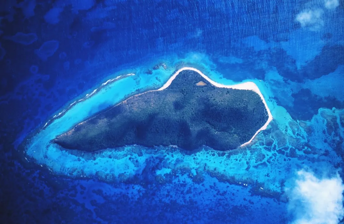
The underwater trail is the National Park Service's oldest idea at Buck Island: treat a reef the way a park treats a canyon rim, with a laid-out route and signs that explain the view. The route sits in the east lagoon, the sheltered water between the island's eastern shore and the elkhorn barrier reef that stands off it. Markers on the bottom trace the path and identify what a swimmer is passing over. A crew member leads each group along it, and the whole thing is designed to be experienced from the surface, face down, without ever diving.
The pedigree is real. Published histories of the monument describe Buck Island Reef as one of the first fully protected marine gardens and underwater trails in the national park system, with the marine-garden designation in place by 1962, months after President Kennedy created the monument. Snorkelers have been reading this reef through a mask for over sixty years, which predates recreational snorkeling as most of the world knows it. The monument around the trail, its 1961 proclamation, the 2001 expansion and the full rulebook, has its own reference: the Buck Island Reef National Monument guide. This page stays in the water.
Two boundaries define everything else here. The trail is snorkel-only; scuba happens elsewhere in the lagoon at two designated dive moorings. And the trail keeps the monument's hours, open with the island from 7 a.m. and shut each evening at 5, so every pass over it happens in daylight.
Getting into the water
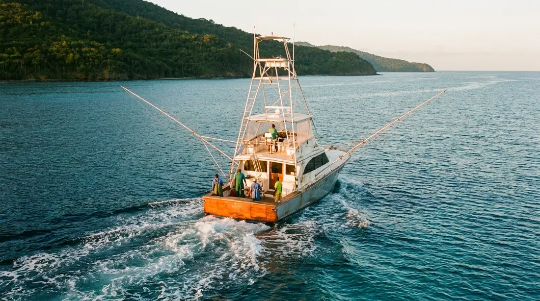
The swim starts before the swim. Boats cross from St. Croix, round the island, and enter the lagoon through a gap in the barrier reef, then tie to park moorings near the trailhead markers. One recent first-person account describes the captain threading a natural break in the coral to reach the mooring, which is the standard approach: the barrier has kept boats out of the east lagoon for ten thousand years except where it allows them in. Inside, the water flattens. Even on a day when the open channel is lively, the lagoon behind the reef is usually swimmable, which is the whole reason the trail could be built where it is.
At the mooring, the crew runs the briefing: how the markers work, where the guide will lead, the no-touch and no-stand rules, and who swims in which group. On most trips this is the second water contact of the day rather than the first. The common trip pattern puts a stop at the island's west end sand before the trail, where beginners get a lesson in knee-deep water, and the park itself notes that first-timers can manage the grottoes after a short lesson from the boat crew. By the time the boat moors at the trail, everyone has already had a mask on.
Flotation is part of the routine. Recent trip accounts describe crews putting swimmers in flotation vests before the trail and treating them as required at the reef, and the logic is conservation as much as safety: a tired swimmer wearing a vest rests on the vest. A tired swimmer without one stands on the nearest solid thing, and here the nearest solid thing is alive.
The guided pass, start to finish
The park's in-water format is small and fixed: a guide takes no more than six snorkelers along the trail at a time. Bigger boatloads simply split, each cluster with its own crew member, entering in waves. The guide swims the route at the front, sets an easy pace, points out what the group is passing, and keeps the line together. Nobody is racing. The route is short enough that speed would be beside the point.
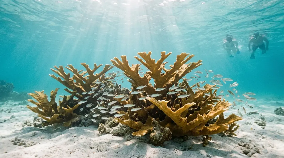
The shape of the route, as the territory's tourism office describes it, runs across shallow coral formations, through a passage walled in coral, and out toward the inside edge of the barrier reef itself. That middle section is the part guests remember: the grottoes, where coral rises around the swimmer on both sides and the trail threads between the formations. The park's published maximum for the grotto water is 12 feet, and much of the route is shallower, so the reef is never far below a swimmer's chest. You do not look down at the coral from a distance here. You travel through its upper storeys.
After the marked route, the leash comes off. Trips generally allow a stretch of unguided snorkeling near the moorings once the guided pass is done; one operator publishes about an hour of free swim after the trail on its standard half-day, and recent visitor accounts put the whole reef stop at roughly an hour. The free swim is where the second look happens: back to the marker you rushed past, a slow hang above a coral head, the patient wait for the parrotfish to come back around. Between the guided line and the free swim, plan on your time at the reef being measured in a generous hour, with the exact clock set by the boat you chose. Trip lengths, boats and booking live in the boat tours guide.
What the markers teach
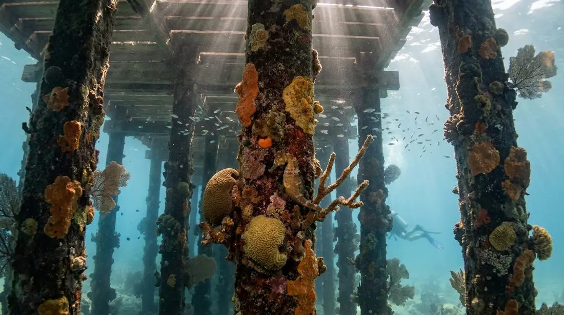
The trail's furniture is a series of plaques set on the sea floor along the route. They do two jobs at once: they mark the way, tracing the most scenic line through the coral, and they interpret it. As local guides describe them, the plaques identify the fish and marine plants common around each stop, so a swimmer hangs above a sign, reads it, lifts their eyes, and finds the thing named on the plaque going about its business a few feet away. The park's own summary is the plainest: signs tell what you see.
That mechanism sounds quaint and works brilliantly, for one underrated reason: it slows people down. An unmarked reef gets swum across. A marked one gets read, plaque by plaque, and the pauses at each marker are when the reef starts producing, because reef fish return to their routines the moment a swimmer stops thrashing forward. The trail turns a crowd of first-timers into a line of slow, stationary observers, which is better snorkeling technique than most people ever get taught.
Do not expect a museum's worth of text. The plaques are brief, the water does the teaching, and the guide fills the gaps between markers. The reading level is a child's; the content, a reef that has been federally protected longer than almost any other in the hemisphere, is its own curriculum.
The route by stages
The park does not publish a numbered stop list, so the table keeps to the stages that are documented: the route's published shape, the one published depth figure, and the species the park and territory name along it.
| Stage | The water | What is there |
|---|---|---|
| Mooring to trailhead | Calm lagoon inside the barrier reef | Vest check, group split, short swim behind the guide to the first marker |
| The shallow formations | Shallow; reef close beneath the surface | First plaques; brain corals, schooling Atlantic blue tangs, parrotfish |
| The grotto passage | The route's deepest water; park maximum 12 feet | A corridor walled in coral; markers naming corals and fish; turtles pass through |
| Toward the barrier's inside edge | Shallow again over the reef's back side | Branching elkhorn structure; the larger fish of a no-take reserve |
| Free swim near the boats | Swimmer's choice, in front of the moored boats | Your own pace; photographs; the second pass at whatever the guided line hurried past |
Everything on the route obeys one design constraint: it is readable from the surface. Nothing on the trail requires a duck-dive, and the guides do not ask for one.
The elkhorn the trail was built to show
The trail exists because of one animal. Elkhorn coral, Acropora palmata, is the big branching architect of Caribbean reefs, throwing out flattened branches up to 15 inches across from a central trunk and, in good health, extending them by as much as 5 inches a year. It grows in exactly the water a snorkeler occupies, the top 15 feet, and where it thrives it builds dense thickets that shelter the fish a reef runs on. NOAA lists it as threatened under the Endangered Species Act. Buck Island's barrier, the 4,554-acre reef formation wrapping two-thirds of the island, is an elkhorn structure, and the Park Service calls this elkhorn barrier reef unique in United States waters.
What the trail shows today is elkhorn at every stage of its story: standing branch structure, old skeletal frames from the reef's mid-century prime, and young colonies growing on the frames. To read that view correctly, it helps to know the numbers, and this reef has better numbers than almost any in the Caribbean, because scientists have been counting here for decades.
Hugo, disease, and the ledger since
The full arc, straight from the published monitoring record. Through the 1970s and 1980s, white band disease moved through the Caribbean's acroporid corals, and at Buck Island the live elkhorn cover that had stood near 85 percent fell to about 5 percent under disease and storm damage. Then, in September 1989, Hurricane Hugo hit St. Croix directly, the most powerful cyclone to strike the area in at least sixty years, and researchers monitoring the monument's reef measured live elkhorn cover at 0.8 percent afterward. Between them, disease and hurricanes had removed over 90 percent of the living elkhorn. The reef a 1970s snorkeler swam and the reef of the early 1990s were different places.
The ledger since then has entries on both sides. In 2006, a USGS census of the monument (Mayor, Rogers and Hillis-Starr) estimated between 97,232 and 134,371 living elkhorn colonies with at least a meter of connected live tissue across 795 hectares of the monument, with white band disease present on only about 3 percent of them, real recovery, though the authors were plain that density remained low against the historical reef. Then came the newest threat: stony coral tissue loss disease, which reached the U.S. Virgin Islands in January 2019 and arrived at Buck Island in early 2021, with an outbreak reported at the underwater trail itself on July 25, 2021. The response was hands-on: park strike teams and volunteers treated infected colonies with amoxicillin paste, syringe by syringe, over 800 corals treated at Buck Island with the treatments stopping lesion progress about 85 percent of the time. Elkhorn was not the disease's main victim, SCTLD prefers brain, pillar and star corals, but those corals line the trail too, and some Caribbean reefs lost over 40 percent of their coral cover to it.
| Years | What happened on this reef |
|---|---|
| 1970s–1980s | White band disease and storms cut live elkhorn cover from about 85 percent to about 5 percent |
| September 1989 | Hurricane Hugo strikes St. Croix directly; live elkhorn cover measured at 0.8 percent after |
| 1989 onward | Long-term reef monitoring runs continuously at the monument |
| 2006 | USGS census estimates 97,232–134,371 living elkhorn colonies across 795 hectares; about 3 percent diseased |
| 2019–2021 | Stony coral tissue loss disease reaches the USVI, then Buck Island; outbreak reported at the trail July 25, 2021 |
| 2021 onward | Park teams treat over 800 corals at Buck Island with amoxicillin paste; lesions halted about 85 percent of the time |
So what does a swimmer actually see in 2026? A protected, patrolled, medicated, closely counted reef that is neither the 85-percent elkhorn forest of 1970 nor a ruin. The branching structure is there, young colonies are visibly growing, the grottoes still stand, and the fish community over it all is the richest a snorkeler will meet anywhere on a St. Croix trip. Guests who want the deep version of the reef-health story can ask the crew, most of whom have watched this water for decades and will give it to you straight.
The fish along the route
Over 250 fish species live on Buck Island's reef, and the trail crosses their densest neighborhood. The park's own trail page singles out the schools of Atlantic blue tangs that move through the grottoes, powder-blue and traveling in loose herds that part around a swimmer. The territory and local guides fill out the regular cast: parrotfish grinding audibly at the coral, trumpetfish hanging vertical among the branches, butterflyfish working in pairs, and sergeant majors everywhere the reef rises. Green and hawksbill turtles cross the route often enough that guides treat a sighting as normal rather than lucky; the hawksbills are here for the sponges on the reef itself, and both species nest on the island's beaches at night. Where turtles fit into the wider island picture, and the manners they are owed in the water, is covered in the sea turtles guide.
The bigger silhouettes turn up on the trail's outer stretch, toward the barrier's edge: a barracuda holding still in open water, a spotted eagle ray passing along the reef line, a southern stingray on the sand between coral heads, and now and then a reef shark, which the guides regard with the enthusiasm of people who know what a healthy reef looks like. None of these animals has been hunted inside this boundary within the lifetime of any fish now alive, the whole monument has been fully no-take since 2001 and protected far longer, and the behavioral result is what first-time visitors notice most: the fish hold their ground. You get long, close looks here that open-coast snorkeling rarely gives, which is exactly what a trail full of identification plaques needs to work.
The skill question
Here is the fair assessment. The trail is beginner-accessible, and it is still an open-water swim, and both facts deserve respect.
The case for the beginner: the water is protected by a barrier reef, the route's deepest point is 12 feet by the park's figure, nothing requires diving down, the group is capped at six per guide, vests are standard, fins and gear come from the boat, and the crew has taught a snorkel lesson on the beach an hour earlier. The park's stated position is that beginners can handle the grottoes after that short lesson, and the operators' economics agree, since most passengers on any given boat are first-timers. Children who swim comfortably do the trail every day of the season.
The realistic caveats: you swim from a moored boat to the trail and back, in water over your head the entire time, wearing fins most beginners have used for under an hour. The lagoon is calm by Caribbean standards, and it is still the sea; a breezy winter afternoon puts texture on the surface, and a swimmer who panics in deep water will not enjoy learning that here. The buddy rule the park sets, always snorkel with a partner and stay in front of the moored boats, is the practical frame. Tell the crew where your swimming stands before the briefing, and they will position you behind the guide, hand you a noodle in addition to the vest, or pair a crew member with you. They do this every single trip.
For the true non-swimmer, the answer at last check is unambiguous, so plan around it: none of the authorized operators publishes a glass-bottom hull, so there is no dry way to see the trail. A non-swimmer's Buck Island day is the deck, the crossing, and the west end sand with wading off the beach, which is a good day, and the trail itself will stay a story other people tell at dinner. Weigh that before spending a seat on the boat, or treat the beach half of the trip as the destination.
Photographing the trail
The trail is the easiest serious underwater photography on St. Croix, for structural reasons. The water is shallow, so natural light reaches the subject; the bottom alternates coral and pale sand, so scenes carry their own reflector; the fish tolerate proximity; and the free-swim window after the guided pass gives you time to work a subject instead of drifting past it. A basic waterproof camera or a phone in a dive housing produces keepers here on an average morning.
Three practical notes. First, shoot on the morning boats when you can: the lagoon is at its calmest before the trade wind builds, and surface chop is the difference between clear frames and murk-streaked ones. The seasonal rhythm behind that, winter wind, summer glass, lives in the weather guide. Second, get the camera low in the water and shoot slightly upward at fish rather than straight down at their backs; the 12-foot ceiling means you can frame coral against surface light without ever leaving the surface yourself. Third, the rules photograph with you: nothing gets touched, nothing gets stood on, no coral gets gripped to steady a shot, and turtles get distance rather than pursuit. The monument bans drones without written permission, so the aerial view belongs to the observation point on the island's ridge, and the reef's best portrait is taken from underneath anyway.
Rules on the trail
The regulations that govern the swim itself, restated fresh and short; the monument's complete rulebook, from anchoring to alcohol, lives in the monument reference.
- Hands off everything, always. Living coral dies where skin presses it, and the trail's entire value is concentrated within arm's reach.
- Feet never touch down. If you tire, roll onto the vest, signal the guide, and rest afloat. Standing anywhere on the route means standing on the reef.
- Nothing leaves the water with you. The reserve's no-take rule reaches down to a single shell or coral fragment, dead or alive.
- Swim with a partner, keep the guide in view, and stay on the boat side of the mooring field, per the park's own snorkeling guidance.
- Snorkel only. Tanks are welcome in the monument solely at the two designated scuba moorings elsewhere in the lagoon, never on the trail.
- Sunscreen must be mineral. The territory's ban on oxybenzone, octinoxate and octocrylene applies to possession, and the coral below you is the reason the law exists.
- Daylight only: the trail closes with the island every evening at 5 and reopens at 7 the next morning, which protects the beaches for nesting turtles and means every swim happens in reading light.
Why the park funnels everyone down one route
A marked trail looks, at first glance, like a concession to tourists. Read the design again and it is a conservation instrument. Buck Island logged 40,079 recorded visitors in 2025, and nearly every one of them who entered the east lagoon swam the same few hundred yards of it, in groups of six behind a trained guide, wearing flotation that keeps feet off the bottom, inside daylight hours, over a route chosen and maintained by the park. The alternative, the same tens of thousands of swimmers scattered at will across the whole lagoon, would spread fin strikes and anchor scars over every coral head in it.
Each rule on this page slots into that logic. The guide ratio puts a rule-enforcer within a few strokes of every swimmer. The vests exist so that nobody's rest stop is a coral colony. The plaques hold swimmers in the sand-bottomed lanes between formations. The evening closure hands the island back to nesting turtles. Even the free-swim area sits in front of the moored boats, where the crews can watch it. The trail concentrates the impact of mass visitation onto the most durable line through the reef and wraps supervision around it, and the proof of concept is sixty-plus years old and still holding schools of blue tangs. It is the rare place where being herded is the point, and where the herding buys the thing you came for.
The trail against the island's other snorkels
St. Croix gives a snorkeler more than one great morning, so place the trail correctly. The full island catalog is in the snorkeling reference and the beach-ranked version in best snorkeling beaches; here is the fair positioning.
Cane Bay beats the trail on three counts: it is free, it starts at the sand with no boat and no schedule, and for a strong swimmer it offers something the lagoon cannot, the lip of a wall that drops toward abyssal water. Choose Cane Bay for independence and drama. The trail beats Cane Bay on everything a first-timer needs: calmer water, a guide, a capped group, shallower coral, denser and tamer fish, and zero navigation. The Frederiksted Pier wins for small strange creatures on its pilings, and the seagrass bays at Chenay Bay and The Shoys win for effortless turtles in waist-deep water. What the trail alone offers is the combination: a federally protected barrier reef, interpreted, guided, and reachable by anyone who can swim a pool length. Most guests who take the boat early in the week snorkel better everywhere else afterward, because the trail is also, quietly, the island's best swimming lesson.
The other half of the boat day
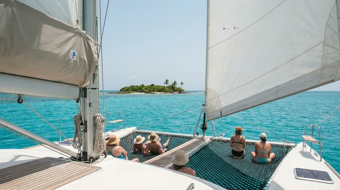
Every trail trip pairs the swim with the island's west end, where the boats put guests ashore on sand that turns up on lists of the Caribbean's best beaches. That half of the day, the beach itself, the picnic setup, the short land trail over the ridge, belongs to the Turtle Beach guide, which covers it properly.
Questions guests ask
How long do you actually spend in the water?
Plan on about an hour at the reef as the working figure. The guided pass over the marked route is the shorter part, an unhurried procession behind the guide, and the free snorkeling afterward fills out the stop; one operator publishes roughly an hour of open swim time after the trail on its standard half-day, and recent visitor accounts describe the reef stop overall as about an hour. Boats and trip formats vary, so the clock belongs to the operator you book. Nobody credible rushes it: the crossing schedules are built so that the trail gets its full allotment even on the shortest trips.
Can you scuba dive the underwater trail?
No. The trail itself is snorkel-only under the monument's rules. Divers are welcome in the monument at exactly two designated scuba moorings elsewhere in the lagoon, where 30-to-40-foot dives pass through haystack-shaped stands of elkhorn coral, a different experience over the same reef system. If your group splits between divers and snorkelers, the practical answer is two outings: the concessionaire boat for the trail, and one of the island's dive operators for tank time, using our scuba guide to pick sites and shops.
What do the underwater signs actually say?
They are identification plaques, brief by design. Set into the bottom along the route, they name and depict the corals, fish and marine plants a swimmer is most likely to see at that point, and they double as waypoints marking the best line through the formations. Treat them as prompts rather than reading material: hover over a plaque, take in the name, then lift your eyes and find the subject a few feet away, usually behaving exactly as advertised. The guide adds the commentary between markers, and the crews are good; most have been narrating this reef for years.
Is the coral still worth seeing after the hurricanes and the disease?
Yes, with a clear-eyed understanding of what you are seeing. This reef lost most of its living elkhorn to white band disease and Hurricane Hugo between the 1970s and 1989; a 2006 census then counted roughly 100,000 or more living elkhorn colonies in the monument, and park teams have been treating the newest disease, SCTLD, coral by coral since 2021 with about an 85 percent success rate. The structure of the grottoes stands, young colonies grow on the old frames, and the fish community is the richest a snorkeler meets on St. Croix. It is a recovering reef under the best protection available, and it still earns the trip.
What happens if you get tired mid-swim?
You rest without touching anything. The vest every snorkeler wears at the reef is built for exactly this: roll onto your back, breathe, raise a hand, and the guide comes to you, on most trips towing a flotation ring or noodle for the trip back to the boat. The group sizes are small enough, six swimmers per guide, that nobody goes unnoticed. What you must never do is put a foot down, because the only footing on the route is living coral. If you suspect in advance that stamina will be the issue, say so at the briefing and the crew will keep you closest to the guide.
Is there current on the trail?
The route sits inside the barrier reef, which takes the ocean's energy before it reaches the lagoon, so on a normal day the trail water is calm to gently textured, with nothing a recreational swimmer would call current. Wind is the variable that matters: winter's trade winds put chop on the surface by afternoon, which tires swimmers faster and stirs visibility, so morning departures are the calm ones in that season. The park's own caution stands, conditions can change and every swimmer should know their limits and keep a buddy, and the captains cancel outright on the days that would test anyone.
Can you swim the trail more than once in a trip?
On a single boat stop, the guided pass runs once, and the free-swim window afterward lets you re-swim as much of the nearby reef as your legs allow, in front of the moored boats. Plenty of guests get their second full trail pass a different way: they book the boat again later in the week, or book a different operator's format for the contrast, a sail out and a powerboat back being a favorite combination. Villa guests with a week on the island have the calendar for it, and the operators see repeat passengers within the same stay all the time.
Villas within sight of the lagoon
The strange luxury of an East End stay is that the trail stays in view after you have swum it. The Cerulean looks straight across the channel at Buck Island, close enough to pick out the day boats crossing to the reef you snorkeled that morning, and the rest of our East End collection shares some version of that sightline, with the East End departure docks a few minutes away. Guests on that coast tend to swim the trail early in the week, then spend the remaining evenings identifying, from the deck with a drink, the exact patch of water where the blue tangs were. Our team on St. Croix arranges the boat as routine, and the East End guide and experiences page frame the rest of the week around it.
Sources
Written from official and first-party sources, checked August 2026. Hours, prices and event dates change — confirm before you go.
In this guide
Stay nearby
Private oceanfront on the East End with a sandy, swimmable beach, pool, outdoor kitchen and a separate guest cottage. Sleeps twelve.
 The Cerulean5 bd · 5 ba · sleeps 12 · Christiansted
More in On the Water
Sources
11 references, listed in full at the end of this guide — official park, refuge, tourism-board and business sources, checked August 2026.